mail_outline sales@mediastorehouse.com
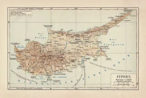
Map of Cyprus, published in 1880Ancient map of Cyprus. Lithograph, published in 1880
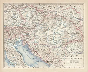
Austro-Hungarian Empire, Habsburg Monarchy, lithograph, published in 1877Ancient map of Austro-Hungarian Empire. Habsburg Monarchy. Lithograph, published in 1877
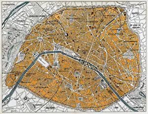
City map of Paris, lithograph, published in 1877City map of Paris, France. Lithograph, published in 1877
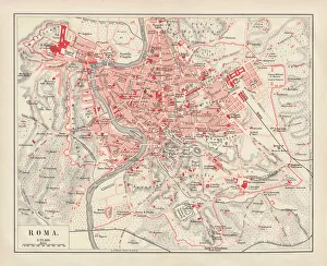
City map of Rome, lithograph, published in 1878City map of Rome, Italy. Lithograph, published in 1878
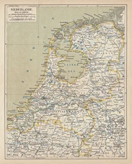
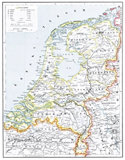
Map of the Netherlands, lithograph, published in 1877Map of the Netherlands. Lithograph, published in 1877
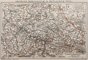
Kingdom of Saxony, Eastern partAntique illustration of a Kingdom of Saxony, Eastern part
City map of ParisAntique illustration of a City map of Paris
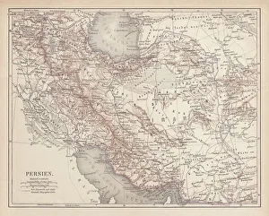
Ancient map of Persia, lithograph, published in 1877Ancient map of Persia. Lithograph, published in 1877
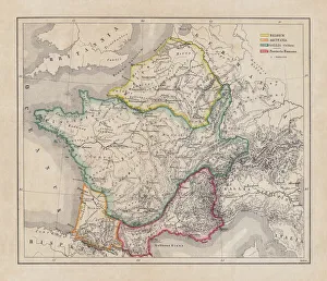
Gaul in the time of Julius Caesar, published in 1867Gaul in the time of Roman politican Gaius Iulius Caesar (100 - 44 BC). Steel engraving with hand-colored borderlines and Latin legend, published in 1867
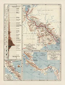
Panama Canal Project, lithograph, published in 1880Ancient map of the Panama Canal Project. Lithograph, published in 1880
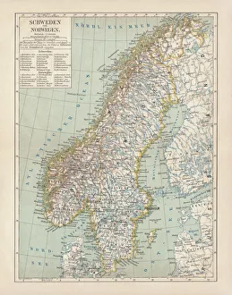
Sweden and Norway, lithograph, published in 1878Ancient map of Sweden and Norway. Lithograph, published in 1878
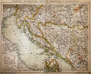
Bosnia, dalmatia, istria, croatia, slavoniaAntique illustration of a Bosnia, dalmatia, istria, croatia, slavonia map
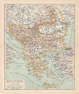
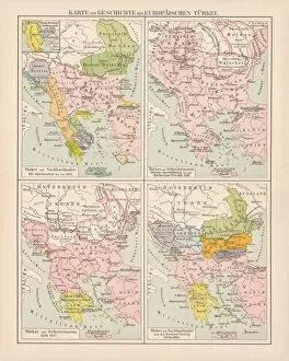
Balkan Peninsula in 1878, lithographAncient map Balkan. The political classification of the Balkan Peninsula after the Treaty of Berlin in 1878. Lithograph, published in 1878
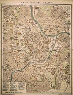
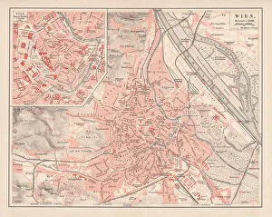
Vienna inner cityAntique map of Vienna from 1898
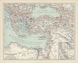
Ottoman Empire, lithograph, published in 1878Ancient map of Ottoman Empire. Lithograph, published in 1878
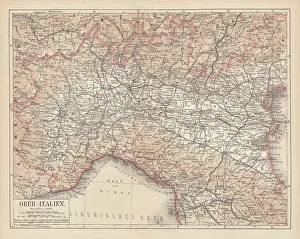
Ancient map of Northern Italy, lithograph, published in 1876Ancient map of Northern Italy. Lithograph, published in 1876
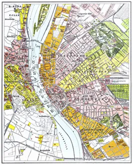
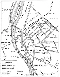
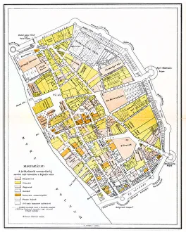
Budapest city mapIllustration of a Budapest city map
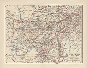
Afghanistan, lithograph, published in 1881Ancient map of Afghanistan. Lithograph, published in 1881
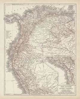
Peru, Ecuador, Colombia, Venezuela, lithograph, published in 1877Ancient map of Peru, Ecuador, Colombia, and Venezuela. Lithograph, published in 1877
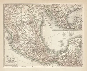
Mexico, ancient map, lithograph, published in 1877Ancient map of Mexico. Lithograph, published in 1877
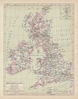
Map of British Isles, lithograph, lithograph, published in 1876Map of British Isles. Lithograph, published in 1876
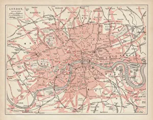
City map of London, lithograph, lithograph, published in 1877City map of London, United Kingdom. Lithograph, published in 1877
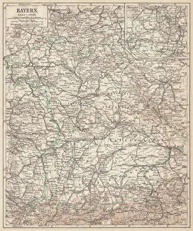
German federal state of Bavaria, lithograph, published in 1874Map of German federal state of Bavaria. Lithograph, published in 1874
Netherlands mapillustration of a Netherlands map
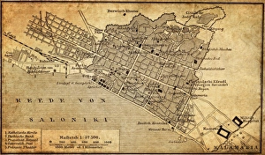
City map of Thessaloniki, GreeceIllustration of a city map of Thessaloniki, Greece
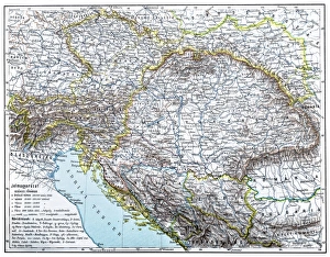
Austro-Hungarian Monarchy map from 1896illustration of a Austro-Hungarian Monarchy map from 1896
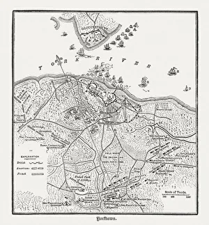
Battle of Yorktown in 1781, wood engraving, published in 1884Plan of the Battle of Yorktown during the American Revolutionary War in 1781. Wood engraving, published in 1884
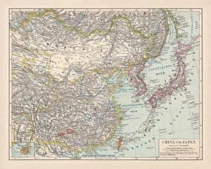
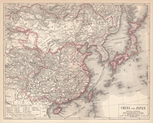
China and Japan, lithograph, published in 1881Antique map of China and Japan. Lithograph, published in 1881
Ottoman Empire, 14th-19th century, lithograph, published in 1878Ancient map of the history of European Turkey, 15th - 19th century. Lithograph, published in 1878
City map of Vienna, Austria, lithograph, published in 1878Ancient map of Vienna, Austria. Lithograph, published in 1878
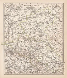
Silesia and Poznan, lithograph, published in 1878Ancient map of Silesia and Poznan, former territories of the German Empire, today Poland. Lithograph, published in 1878
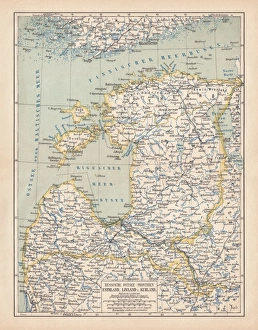
Map of Baltic states, lithograph, published in 1877Historic map of Baltic states: Lithuania, Estonia, Latvia. Lithograph, published in 1877
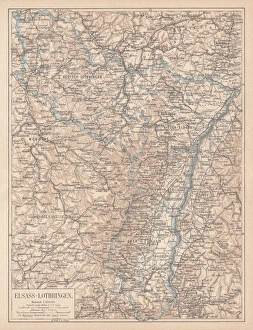
Map of Alsace-Lorraine, lithograph, published in 1875Ancient map of Alsace-Lorraine (German: Elsass-Lothringen). Lithograph, published in 1875
Map of China and Japan, lithograph, published in 1875Map of China and Japan. Lithograph, published in 1875
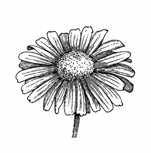
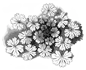
Daisy flowerAntique illustration of a daisy flower
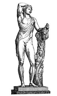
Dionysus god of the vineIllustration of a Dionysus god of the vine, grape harvest, winemaking, wine, ritual madness, religious ecstasy, and theatre
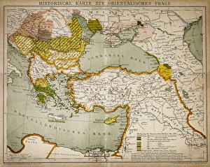
Historical map of the Oriental part of worldAntique illustration of a Historical map of the Oriental part of world
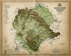
Belovar-koros, Croatio map from 1893Antique illustration of a Belovar-koros, Croatio map from 1893
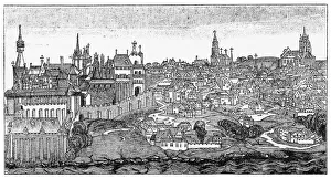
Pest old mapIllustration of a Pest old map
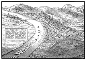
Buda and Pest old mapBudapest, a famously, is the combination of the cities Buda and Pest
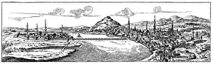
Buda and Pest from 17 century
Buda 1470Illustartion of a Buda 1470
Hedgerow Cranesbill (Geranium pyrenaicum)Illustration of a Hedgerow Cranesbill (Geranium pyrenaicum)
Vienna and surroundingsIllustration of a Vienna and surroundings
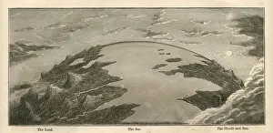
Topographical Land Sea Sky Earth Globe, Antique 1871 IllustrationColor stock photo of an antique illustration of a topographical earth globe showing land, sea and sky examples. Salvaged from an 1871 geography book
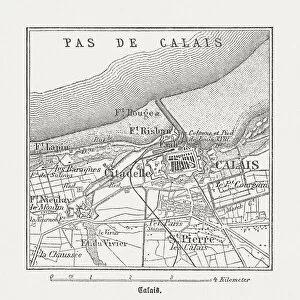
Calais, France, wood engraving, published in 1882City map of Calais, France. Wood engraving, published in 1882
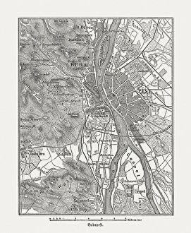
Budapest, wood engraving, published in 1882City map Budapest, capital of Hungary. Wood engraving, published in 1882