mail_outline sales@mediastorehouse.com
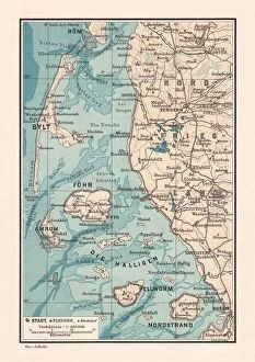
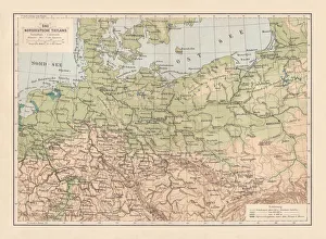
Northern Friesland (Nordfriesland), and islands, Schleswig-Holstein, Germany, lithograph, published 1887North Frisian Islands and Northern Friesland (Nordfriesland), the northernmost district of Germany, part of the state of Schleswig-Holstein. Lithograph, published in 1887
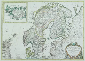
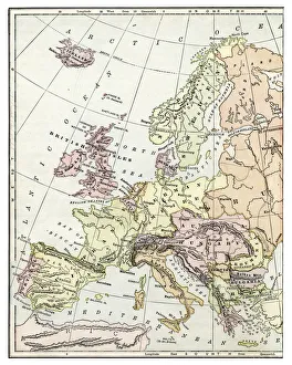
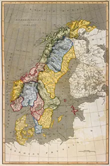
Map of Scandinavia
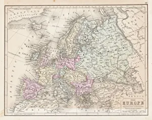
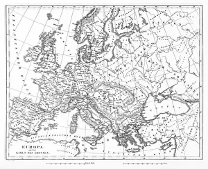
Europe map 1867Mitchellas Modern Atlas - Published by E.H. Butler and Co - Philadelphia 1867
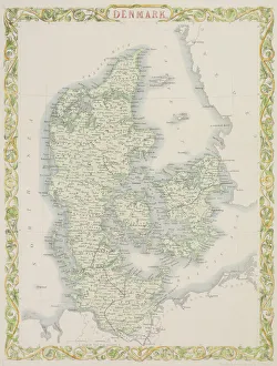
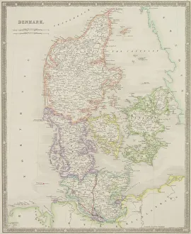
Antique map of Denmark
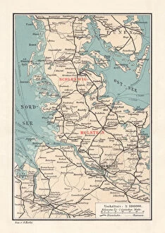
Map of Schleswig-Holstein, northernmost state of Germany, lithograph, published 1887Map of Schleswig-Holstein, northernmost state of Germany. Lithograph, published in 1887
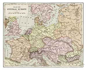
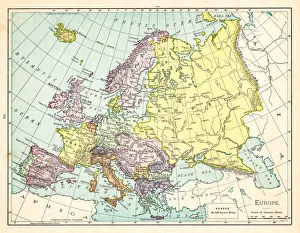
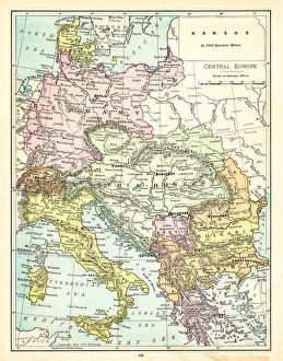
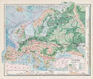
Map of central Europe 1889Indiana Educational Series The Complete Geography - Indianapolis 1889
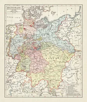
Map of the German Confederation (1815-1866), lithograph, published in 1897Map of the German Confederation between 1815 and 1866. Lithograph, published in 1897
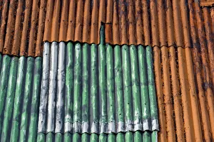
Rusty, green-painted corrugated iron wall, Faroe Islands, Faroe Islands, Denmark
Rusty Corrugated iron roof, Faroe Islands, Faroe Islands, Denmark
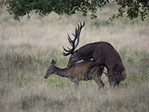
Red Deer -Cervus elaphus-, mating, Jaegersborg, Copenhagen, Denmark
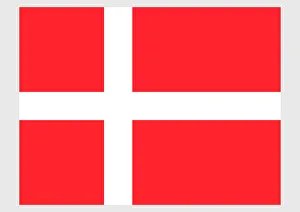
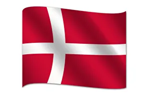
Illustration of national flag of Denmark, with white Scandinavian cross extending to edges of red field
Origami cyclebicycle folded out of paper, origami style
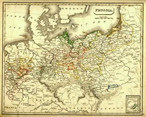
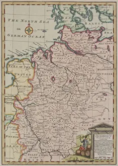
Antquie Map of PrussiaVintage map of Prussia from 1837
Fire GlassCognac glass with fire around the glass - the mood is muted and the background is a dark wallpaper
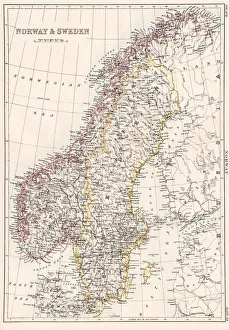
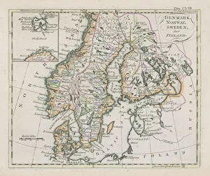
Norway and Sweden map 1884Encyclopedia Britannica 9th Edition New York Charles Scribners and Sonsl 1884 Vol XVII
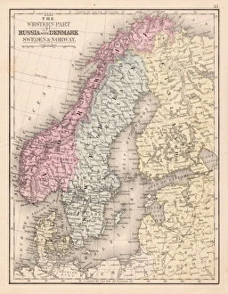
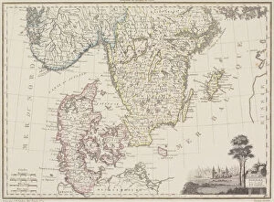
Denmark Sweden Norway map 1867Mitchellas Modern Atlas - Published by E.H. Butler and Co - Philadelphia 1867
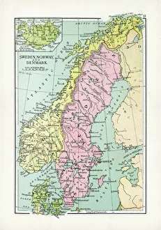
Antique Map of Sweden, Norway and DenmarkVintage map of Sweden, Norway and Denmark, from 1894
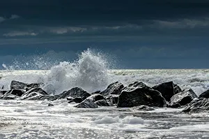
Waves charing on rocks, North Sea Coast, Holmes Country, Jutland, Denmark
Map of Europe 1895The Rand-McNally Grammar School Geography 1895 - Chicago & New York
Antique map of Denmark, Norway, Sweden and FinlandWonderful hand coloured antique map, circa 1780 - 1800
Map of Central Europe 1895The Rand-McNally Grammar School Geography 1895 - Chicago & New York
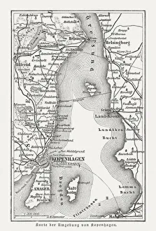
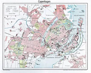
Map of Copenhagen and sourroundings, Denmark, wood engraving, published 1897Map of Copenhagen and sourroundings, Denmark. Wood engraving, published in 1897
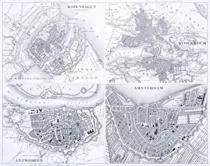
Engraving: Copenhagen, Stockholm, Antwerp and AmsterdamEngraved illustrations of the cities of Copenhagen, Stockholm, Antwerp and Amsterdam from Iconographic Encyclopedia of Science, Literature and Art, Published in 1851
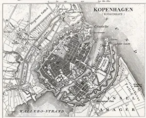
Engraving: Map of CopenhagenEngraved illustrations of the Map of Copenhagen from Iconographic Encyclopedia of Science, Literature and Art, Published in 1851. Copyright has expired on this artwork. Digitally restored
Map of Europe 1897Natural Elementary Geography by Redway and Hinman - NY/Cincinnati/Chicago 1897
Map of Europe 1877Warrens Common School Geography 1877
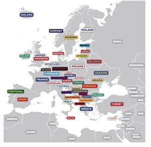
Labeled European MapLabeled European map concept showing countries with labels. EPS 10 file. Transparency effects used on highlight elements
Map of Sweden with Denmark and Norway
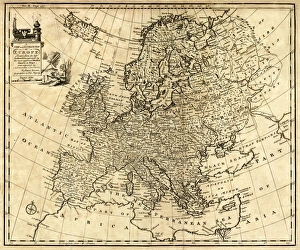
Antique Map of Europe 1744An engraved map of Europe with ornamental cartouche and relief shown pictorially by Emanuel Bowen 1744, London, Geographer to His Majesty
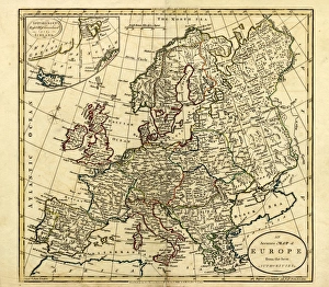
Antique Map of Europe, 1785An accurate map of Europe from the best authorities. London: C. Dilly & G. Robinson: 1785. Original size: 35.7 x 37.4 cm. Coloured, Inset: Spitsbergen, East and West Greenland, and Iceland
Flag of Denmark
Red Deer -Cervus elaphus-, couple mating, Copenhagen, Denmark
Radish with leavesA radish with leaves photographed from a top angle against a red background
Origami magnifying glassmagnifying glass folded out of paper, origami style
Close up of six string acoustic guitar
North German lowland map, 19th century view, lithograph, published 1884Old Topographic map of the North German lowland in German language. Lithograph, published in 1884
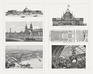
Buildings of the world Exhibitions, 19th centuryExhibition buildings of world exhibitions in the 19th century: 1-3) Buildings for the World Exhibition 1893 in Chicago, USA: 1) Machine exhibition building, 2) Building for horticulture
Map of Europe 1889Indiana Educational Series The Complete Geography - Indianapolis 1889
antique, archival, baltic, border, cartography, denmark, document, europe, european, finland, geography, historic, historical, latitude, longitude, map, nobody, north, norway, region, scale
Engraving: Map of Copenhagen from 1895illustration of a Engraving: Map of Copenhagen from 1895
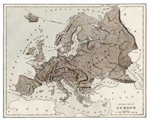
Victorian Map of EuropeEngraved illustrations of Europe in the Time of Charlemagne from Iconographic Encyclopedia of Science, Literature and Art, Published in 1851. Copyright has expired on this artwork. Digitally restored
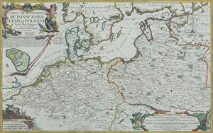
Map of Baltic Sea and Europe
Antique map of Germany
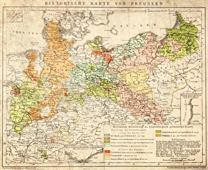
Prussia historical mapIllustration of a Prussia historical development map
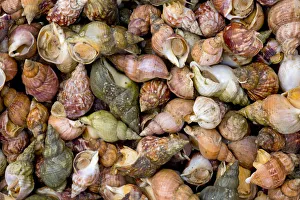
Mussels in shells, Faroe Islands, Denmark
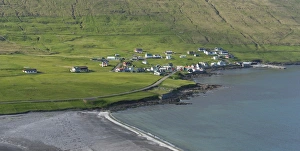
Sandvik, the northernmost village on Suouroy, Faroe Islands, Denmark
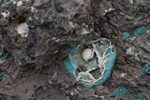
Zeolite geode, minerals, Faroe Islands, Denmark