mail_outline sales@mediastorehouse.com
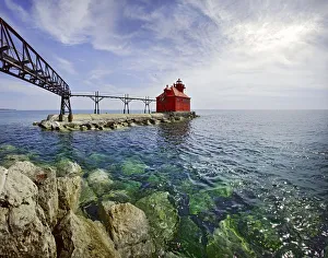
Sturgeon Bay Lighthouse Door County WisconsinUSA Wisconsin Door County Sturgeon Bay North Pierhead Ship Canal Lighthouse. Door County, Wisconsin
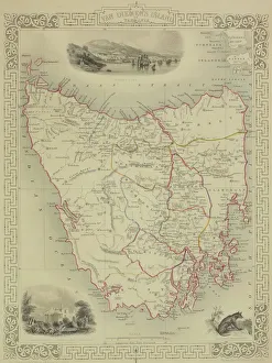
Antique map of Tasmania
Viking ship, sunset, silhouette, 3D graphics
Fanad Head LighthouseFanad is a peninsula that lies between Lough Swilly and Mulroy Bay on the north coast of County Donegal in Ireland
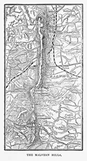
Map of Malvern Hills in Worcestershire, England Victorian Engraving, 1840Very Rare, Beautifully Illustrated Antique Engraving of Map of Malvern Hills in Worcestershire, England Victorian Engraving, 1840. Source: Original edition from my own archives
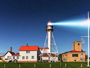
Whitefish Point Lighthouse by MoonlightThe Whitefish Point Lighthouse illumintated by moonlight. Whitefish Point is located at the extreme southeastern end of Lake Superior
Godrevy lighthouseWild flowers in foreground and Godrevy lighthouse in distance at Cornwall
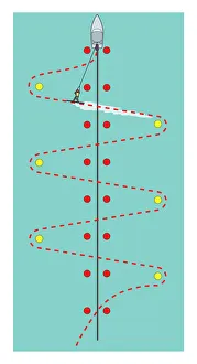
Waterskiing slalom course
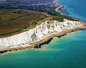
Beachy Head and LighthouseA profile of the Beachy Head Lighthouse. Beachy Head is a series of cliffs along the southdowns coastal path in East Sussex close to Eastbourne and is a renowned suicide hotspot
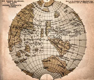
World map from 1520Western hemisphere of the Johannes SchAoner globe from 1520. expedition
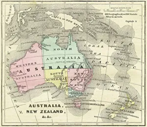
Map of Australia and New Zealand 1856Colton and Fitchs Modern School Geography by George W. Fitch - New York 1856
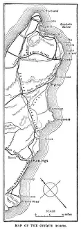
Map of the Cinque Ports (Victorian engraving)An old map of the Cinque Ports, which are five historic ports on the south-eastern corner of Kent, England. The Confederation of Cinque Ports (Cinque is pronounced asinka)
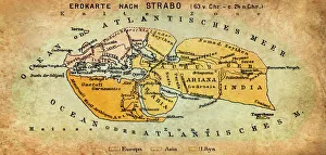
Map of the world according to Strabo 63 B.C
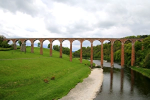
The nineteenth century arched Leaderfoot Viaduct over the River Tweed in the Scottish Borders, ScotlandLeaderfoot Viaduct is a disused railway viaduct over the River Tweed near Melrose in the Scottish Borders, Scotland. The viaduct was completed in 1863
Shrove Lighthouse, Greencastle, Co Donegal, Ireland; View of beach and lighthouse
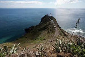
Azores lighthouse, Maia, Santa Maria, Azores, Portugal
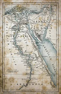
Map of EgyptIllustration of a Map of Egypt
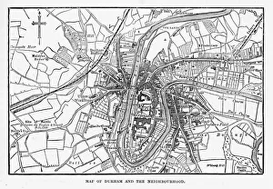
Map of the City of Durham, England Victorian Engraving, 1840Very Rare, Beautifully Illustrated Antique Engraving of Map of the City of Durham, England Victorian Engraving, 1840. Source: Original edition from my own archives
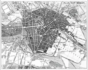
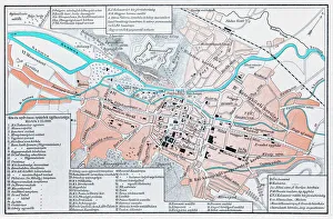
Berlin, Germany MapEngraved illustrations of a Map of the City of Berlin, Germany from Iconographic Encyclopedia of Science, Literature and Art, Published in 1851. Copyright has expired on this artwork
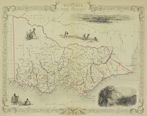
Antique map of Victoria or Port Phillip in Australia with vignettes
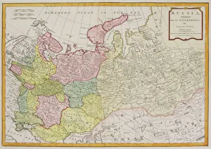
Antique map of Russia
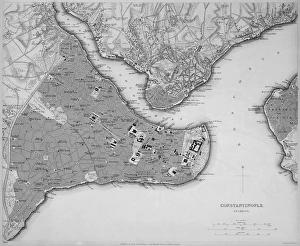
Antique map of Constantinople, present day Istanbul
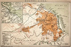
Buenos Aires mapAntique engraving map of Buenos Aires
Dream Falls - Tahquamenon Falls State ParkUpper Tahquamenon Falls in Fall Color. Tahquamenon Falls State Park encompasses close to 50, 000 acres stretching over 13 miles
Halong Bay in Vietnam
Fanad Lighthouse, Donegal, IrelandCumulous cloud at sunset, a huge storm hits Fanad Lighthouse off the coastline of Fanad, Donegal, Ireland
Archer Cupid as a toilet sign, Oktoberfest, Munich, Upper Bavaria, Bavaria, Germany
Beach BalletAugust 1955: A ballet dancer draws circles in the sand with the points of her toes. Original Publication: Picture Post - 8498 - Festival Ballet Dancer - unpub
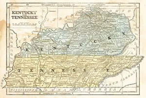
Map of Kentucky and Tennessee 1855System of Geography for the use of schools by Sidney E. Morse - Published by Harper & Brothers - New York 1855
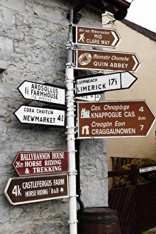
Signpost in Quin, County Clare, Ireland, Europe
Way to toilet, Indic scripts, Tamil Nadu, India
Empress Of Canada17th July 1947: The Canadian Pacific liner Empress of Canada at Liverpool just before she departs on her first post-war voyage to Canada, the first vessel to resume service on this route
St Anthony Lighthouse at sunset in the Roseland Cornwall
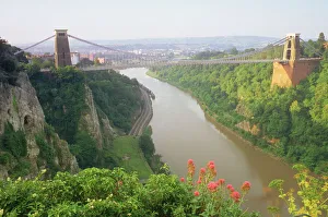
Suspension Bridge in Bristol, Avon, UK
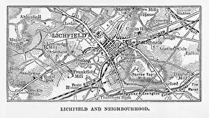
Map of Litchfield in Staffordshire, England Victorian Engraving, 1840Very Rare, Beautifully Illustrated Antique Engraving of Map of Litchfield in Worcestershire, England Victorian Engraving, 1840. Source: Original edition from my own archives
Sunrise on the Crater Rim of Kibo PeakMt. Kilimanjaro, Tanzania
Fanad Lighthouse, Donegal, IrelandLong exposure image of Fanad Lighthouse off the coastline of Fanad, Donegal, Ireland
Four different alpine ski courses, including downhill, giant slalom, super-g and slalom
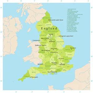
Highly detailed vector map of England. Source data courtesy of NGDC and NASA. Source database: World Data Bank II. The source data is in the public domain. Data updated and improved
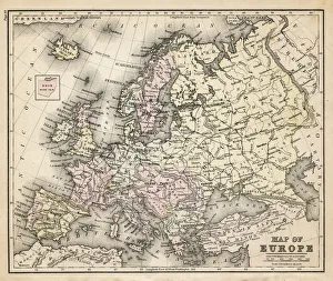
old map of european old map form 1883, showing european countries
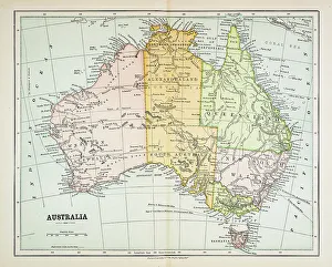
Map of Australia 1883Map of Australia
Beachy Head Aerial ViewAerial view of Beachy Head at low tide in summer with the town of Eastbourne in the background
Waianapanapa SunriseThe Road to Hana is an amazing and probably Mauis most popular drive. One of the must stops on the way is the black sand beach. The water is cold, treacherous and shark infested
Cluj Napoca, romania mapIllustration of a Cluj Napoca, romania map
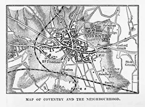
Map of Coventry in Warwickshire, England Victorian Engraving, 1840Very Rare, Beautifully Illustrated Antique Engraving of Map of Coventry in Warwickshire, England Victorian Engraving, 1840. Source: Original edition from my own archives
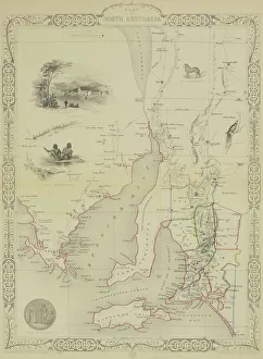
Antique map of South Australia with vignettes
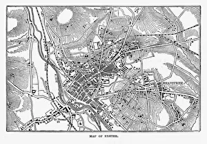
Map of Exeter in Devon, England Victorian Engraving, 1840Very Rare, Beautifully Illustrated Antique Engraving of Map of Exeter in Devon, England Victorian Engraving, 1840. Source: Original edition from my own archives
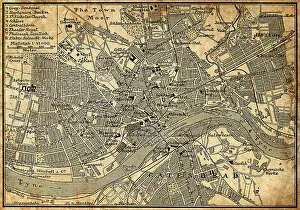
Map of Newcastle Upon TyneAntique illustration of old Newcastle Upon Tyne map