mail_outline sales@mediastorehouse.com
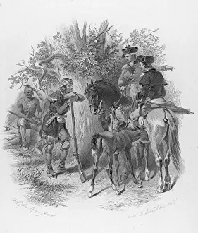
Scene From Last Of The MohicansIllustration of a scene from James Fenimore Coopers 1826 novel Last of the Mohicans: a Narrative of 1757 shows two men on horseback in European clothes
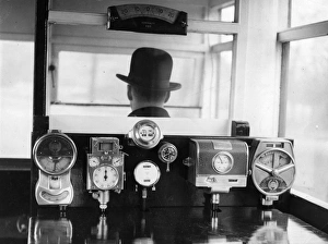
Bus DriverMarch 1929: A set of instruments on a bus route survey vehicle for measuring distance, gradient and camber on roads used by the London General Omnibus Companys fleet of buses
New Golden Arrow LocoThe locomotive William Shakespeare at Victoria Station, London, before entering service on the Golden Arrow route from London to Dover for the channel crossing, 11th October 1951
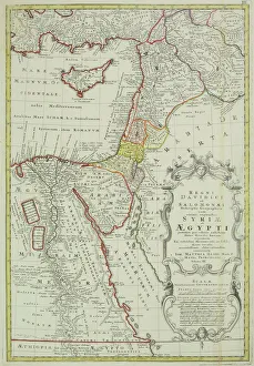
Antique map of the Middle East with Egypt, Syria, and Israel. Date unknown
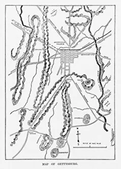
Battle of Gettysburg Map, July 3, 1863 Civil War EngravingEngraving of the Map of the Battle of Gettysburgs, Pennsylvania, July 3, 1863 Civil War Engraving from Famous Leaders and Battle Scenes of the Civil War, Published in 1864
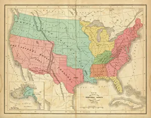
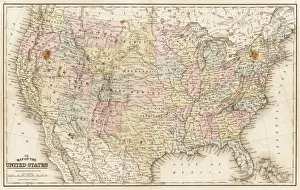
Map of United States 1876Map of United States showing the territorial growth between 1780 and 1876
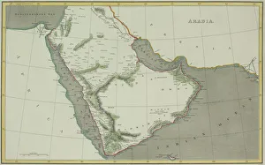
Antique map of Arabian peninsula and Persia
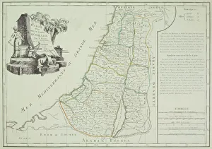
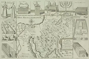
Antique map of Israel
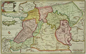
Antique map of the Middle East by Halma
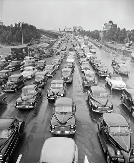
Head-On View Of Traffic JamUNITED STATES - CIRCA 1940s 1950s: Head-On View Of Traffic Jam, Coming Off Ramp On Multi-Lane Highway. (Photo by H. Armstrong Roberts/Retrofile/Getty Images)
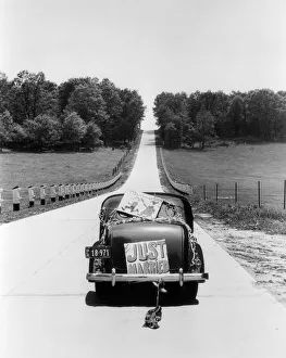
Back View Of Car With Just Married SignUNITED STATES - Circa 1930s: Back View Of Car With Just Married Sign. (Photo by H. Armstrong Roberts/Retrofile/Getty Images)
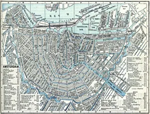
Map of city Amsterdam Netherlands from 1881 Original edition from my own archives Source : Illustriertes Konversations Lexikon 1881
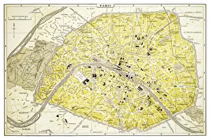
Map of Paris 1894map/plan of the city of Paris, France
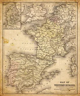
western europe map 1883a map of Western europe from 1883
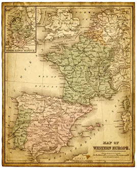
western europe 1867a map of Western europe from 1867, overlay with grunge burnt texture paper
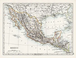
Mexico map 1897The World-Wide Atlas of Modern Geography, Political and Physical W. & A.K. Johnston - London 1897
Map of United States 1869Cornells Grammars-School Geography - S.S. Cornell - New York D. Appleton and Company 1869
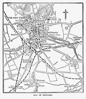
Map of the City of Bedford, England Victorian Engraving, 1840Very Rare, Beautifully Illustrated Antique Engraving of Map of the City of Bedford, England Victorian Engraving, 1840. Source: Original edition from my own archives
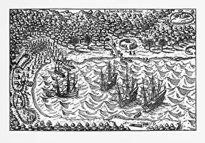
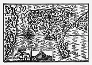
Island of Principe Historical Map by Van Noort, Circa 1598Very Rare, Beautifully Illustrated Antique Engraved Victorian Illustration of Historical Map of Van Noort at the Island of Principe, 1598. Copyright has expired on this artwork. Digitally restored
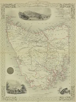
Antique map of Van Diemen Island off Australia with vignettes
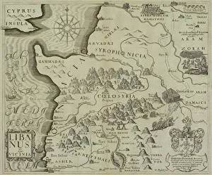
Antique map of holy land including Syria and Lebanon
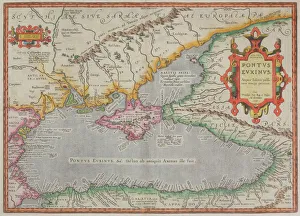
Antique map of the Black Sea and surrounding lands
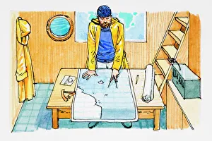
Seaman looking at sea map and holding pair of compasses
Timanfaya National Park, Lanzarote, SpainThe road from the Timanfaya National Park on Lanzarote going back towards Yaiza
Chania lighthouse with the sun right behind, at sunrise, harbour, Chania, Crete, Greece
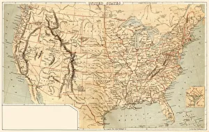
Map of United States 1867Mitchells Modern Atlas - Published by E.H. Buttler & Co - Philadelphia 1867
Antique map of Israel with vignettes
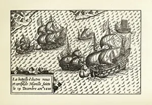
Engraving of Van Noort Landing in Manila Bay, Philippines, 1600Very Rare, Beautifully Illustrated Antique Engraved Victorian Illustration of Historical Engraving of Van Noort Landing in Manila Bay, Philippines, 1600. Copyright has expired on this artwork
Historical Map of Dutch Navigators Island of Bali IllustrationVery Rare, Beautifully Illustrated Antique Engraved Victorian Illustration of Historical Map of Dutch Navigators on the Island of Bali. Copyright has expired on this artwork. Digitally restored
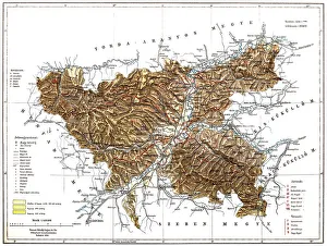
RAOEgenAntique map of RAOEgen
RomaniaAntique map of Romania
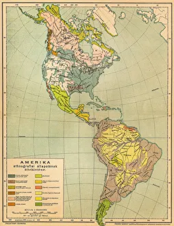
American ethnographic mapIllutration of American ethnographic map
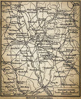
Potteries mapAntique illustration of a Potteries map
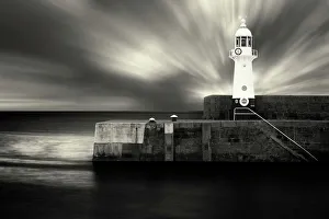
Tells A storyMevagissey Lighthouse cornwall
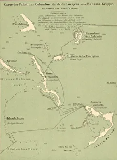
Map Of Columbus Route In BahamasMap tracing Italian explorer Christopher Columbus route upon his arrival in the Bahamas, 1492. (Kean Collection/Getty Images)
Illustration of narrowboat entering, moving up, and leaving lock
Black and white illustration of two Coyote (Canis latrans) paw prints
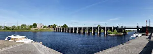
Old bridge over the River Shannon, Shannonbridge, County Offaly and Roscommon, Ireland, Europe
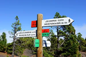
Signpost on the volcano route, Ruta de los Volcanes, La Palma, Canary Islands, Spain, Europe, PublicGround
Passenger ships on the Rhine River, Konstanz, Baden-Wuerttemberg, Germany
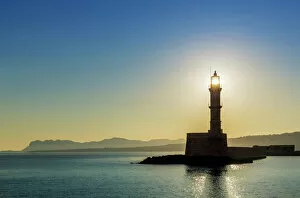
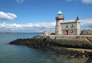
The old lighthouse of Howth, Howth Head peninsula, Leinster, Ireland
Digital illustration showing different areas of wooden floor, and insets of sander and attachment
Illustration showing diaphragm moving down when exhaling and up when inhaling
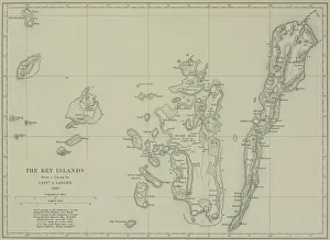
Antique map of the Key Islands
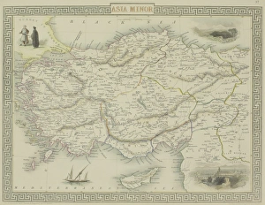
Antique map of Asia Minor
Illustration of triode valve
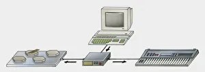
Illustration of MIDI system connected to desktop PC