mail_outline sales@mediastorehouse.com
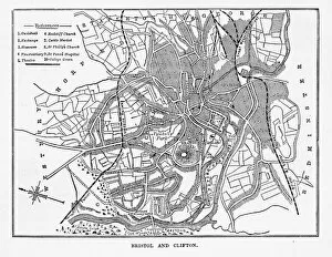
Map of Bristol and Clifton, Yorkshire, England Victorian Engraving, 1840Very Rare, Beautifully Illustrated Antique Engraving of Map of Bristol and Clifton in Yorkshire, England Victorian Engraving, Circa 1840 from Our Own Country, Great Britain, Descriptive, Historical
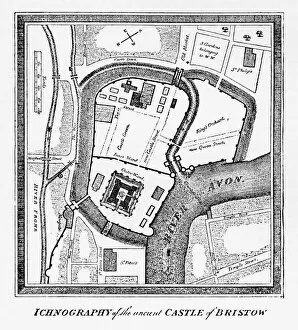
Map of Bristol in Yorkshire, England Victorian Engraving, Circa 1247Very Rare, Beautifully Illustrated Antique Engraving of Map of Bristol in Yorkshire, England Victorian Engraving, Circa 1247 from Our Own Country, Great Britain, Descriptive, Historical, Pictorial
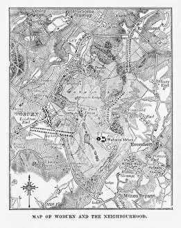
Map of Woburn and Neighborhoods, England Victorian Engraving, Circa 1840Very Rare, Beautifully Illustrated Antique Engraving of Map of Woburn and Neighborhoods, England Victorian Engraving, Circa 1840 from Our Own Country, Great Britain, Descriptive, Historical
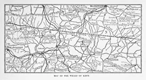
Map of Kent and Neighborhoods, England Victorian Engraving, 1840Very Rare, Beautifully Illustrated Antique Engraving of Map of Kent and Neighborhoods, England Victorian Engraving, 1840 from Our Own Country, Great Britain, Descriptive, Historical, Pictorial
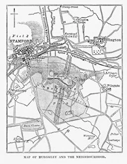
Map of Burghley and Neighborhoods, England Victorian Engraving, 1840Very Rare, Beautifully Illustrated Antique Engraving of Map of Burghley and Neighborhoods, England Victorian Engraving, 1840 from Our Own Country, Great Britain, Descriptive, Historical, Pictorial
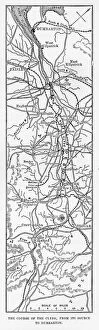
Map of the Course of the River Clyde, England Victorian Engraving, 1840Very Rare, Beautifully Illustrated Antique Engraving of Map of the Course of the River Clyde, England Victorian Engraving, 1840 from Our Own Country, Great Britain, Descriptive, Historical
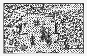
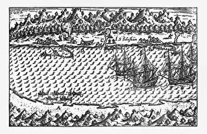
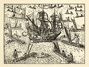
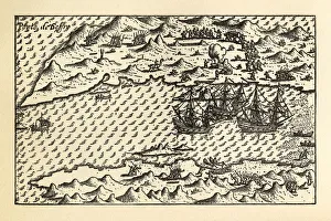
Rio de Janeiro Historical Map by Van Noort, Circa 1598Very Rare, Beautifully Illustrated Antique Engraved Victorian Illustration of Historical Map of Van Noort at Rio de Janeiro, 1598. Copyright has expired on this artwork. Digitally restored
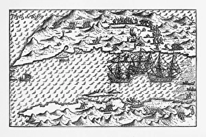
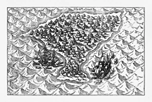
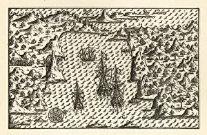
Van Noort at Porto Deseado Historical Map of 1598Very Rare, Beautifully Illustrated Antique Engraved Victorian Illustration of Historical Map of Van Noort at Porto Deseado, 1598. Copyright has expired on this artwork. Digitally restored
Porto Deseado Historical Map by Van Noort, Circa 1598Very Rare, Beautifully Illustrated Antique Engraved Victorian Illustration of Historical Map of Van Noort at Porto Deseado, 1598. Copyright has expired on this artwork. Digitally restored
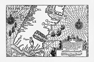
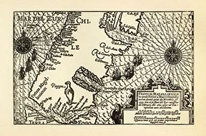
Strait of Magellan Map by Van Noort, Circa 1599Very Rare, Beautifully Illustrated Antique Engraved Victorian Illustration of Historical Map of Van Noort at the Strait of Magellan, 1599. Copyright has expired on this artwork. Digitally restored
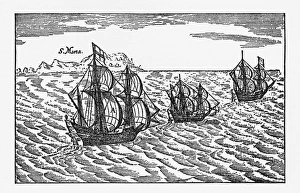
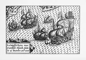
Van Noort Sailing the Strait of Magellan, Engraving of 1600Very Rare, Beautifully Illustrated Antique Engraved Victorian Illustration of Historical Engraving of Van Noort Sailing the Strait of Magellan, 1600. Copyright has expired on this artwork
Van Noort Sailing the Marianne Islands, Engraving 1600Very Rare, Beautifully Illustrated Antique Engraved Victorian Illustration of Historical Engraving of Van Noort Sailing the Marianne Islands, 1600. Copyright has expired on this artwork
Theives Attacking Van Noort on the Marianne Islands, 1600Very Rare, Beautifully Illustrated Antique Engraved Victorian Illustration of Historical Engraving of Van Noort Attacked by Thieives on the Marianne Islands, 1600
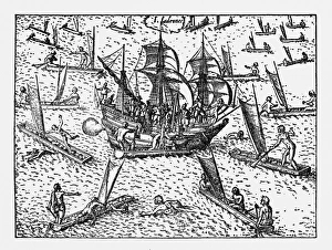
Van Noort Landing in Manila Bay, Philippines Engraving, 1600Very Rare, Beautifully Illustrated Antique Engraved Victorian Illustration of Historical Engraving of Van Noort Landing in Manila Bay, Philippines, 1600. Copyright has expired on this artwork
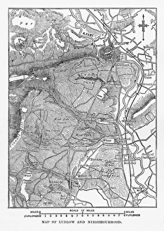
Map of Ludlow, England Victorian Engraving, Circa 1840Very Rare, Beautifully Illustrated Antique Engraving of Map of Ludlow, England Victorian Engraving, Circa 1840 from Our Own Country, Great Britain, Descriptive, Historical, Pictorial
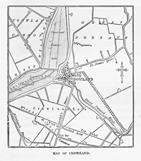
Map of Crowland, England Victorian Engraving, Circa 1840Very Rare, Beautifully Illustrated Antique Engraving of Crowland, The Cut at Peakirk Victorian Engraving from Our Own Country, Great Britain, Descriptive, Historical, Pictorial. Published in 1880
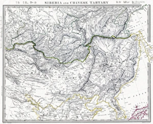
Russian Siberia and Chinese Tartary 1846 MapPhoto of an original map published in the Weekly Dispatch Atlas in 1846 in London
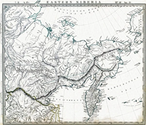
Eastern Russian Siberia 1846 MapPhoto of an original map published in the Weekly Dispatch Atlas in 1846 in London
Van Noort Attacked by Theives on the Marianne Islands, 1600Very Rare, Beautifully Illustrated Antique Engraved Victorian Illustration of Historical Engraving of Van Noort Attacked by Thieives on the Marianne Islands, 1600
Map of Van Noort at the Strait of Magellan, 1599Very Rare, Beautifully Illustrated Antique Engraved Victorian Illustration of Historical Map of Van Noort at the Strait of Magellan, 1599. Copyright has expired on this artwork. Digitally restored
Historical Map of Van Noort at Porto Deseado, 1598Very Rare, Beautifully Illustrated Antique Engraved Victorian Illustration of Historical Map of Van Noort at Porto Deseado, 1598. Copyright has expired on this artwork. Digitally restored
Historical Map of Van Noort at Rio de Janeiro, 1598Very Rare, Beautifully Illustrated Antique Engraved Victorian Illustration of Historical Map of Van Noort at Rio de Janeiro, 1598, from The Golden Book of the Dutch Navigators
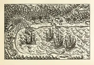
Historical Map of Van Noort at the Island of Principe, 1599Very Rare, Beautifully Illustrated Antique Engraved Victorian Illustration of Historical Map of Van Noort at the Island of Principe, from The Golden Book of the Dutch Navigators
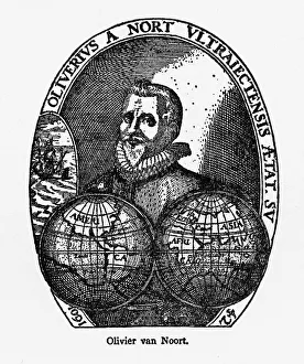
Oliver Van Noort Dutch Navigator, Victorian Illustration, 1558-1622Very Rare, Beautifully Illustrated Antique Engraved Victorian Illustration of Oliver Van Noort Dutch Navigator, Victorian Illustration, 1558-1622. Copyright has expired on this artwork
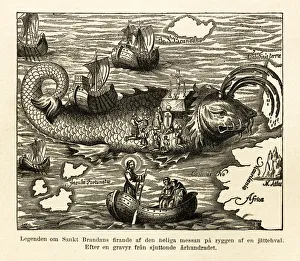
St. Brandans Celebration of the Holy Mass Engraving, Circa 1550Beautifully Illustrated Antique Engraved Victorian Illustration of St. Brandans Celebration of the Holy Mass on the Back of a Whale Engraving, Circa 1550
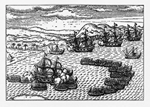
Historical Map of Dutch Navigators Battle in Portugal IllustrationVery Rare, Beautifully Illustrated Antique Engraved Victorian Illustration of Historical Map of Dutch Navigators Battle in Portugal Illustration. Copyright has expired on this artwork
Historical Map of Dutch Navigators Expedition to Sumatra IllustrationVery Rare, Beautifully Illustrated Antique Engraved Victorian Illustration of Historical Map of Dutch Navigators Expedition to Sumatra. Copyright has expired on this artwork. Digitally restored
Historical Map of Dutch Navigators Artic ExpeditionVery Rare, Beautifully Illustrated Antique Engraved Victorian Illustration of Historical Map of Dutch Navigators Arctic Expedition. Copyright has expired on this artwork. Digitally restored
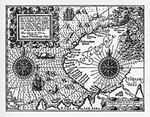
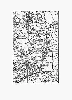
Early Map of Dutch Navigation, Victorian IllustrationVery Rare, Beautifully Illustrated Antique Engraved Victorian Illustration of Early Map of Dutch Navigation. Copyright has expired on this artwork. Digitally restored
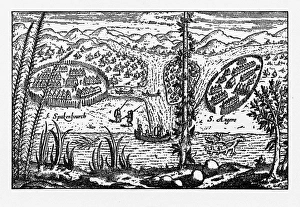
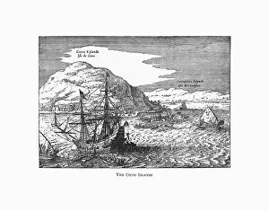
The Cocos Islands Dutch Navigation, Victorian IllustrationVery Rare, Beautifully Illustrated Antique Engraved Victorian Illustration of The Cocos Islands. Copyright has expired on this artwork. Digitally restored
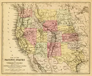
map of the Pacific states (California, Oregon, Washington) an territories with a part of central and souther states - USA (1883)
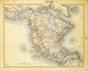
Map of North America 1882Antique Map of North America 1882
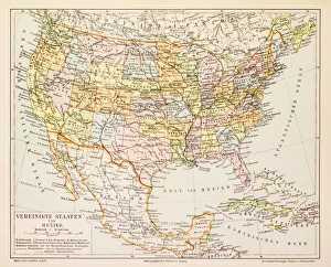
Map of United States and Mexico 1897Map of United States and Mexico
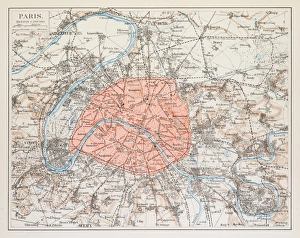
Map of Paris 1895map/plan of the city of Paris, France 1895
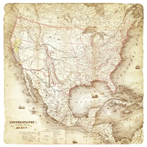
Map of United States and Mexico 1849Map of United States and Mexico
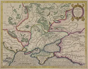
Antique map of Tabula Chersones
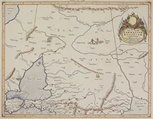
Antique map of Sarmatiam Asiaticam
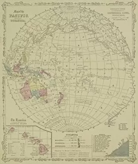
Antique map of Pacific Oceanica with inset of islands
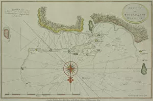
Antique map of Tongataboo in the South Pacific
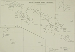
Antique map of British Solomon Islands Protectorate
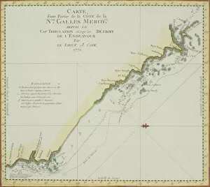
Antique map of coast of southeast Australia
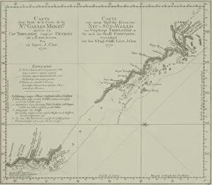
Antique map of New South Wales in Australia
Antique map of northwest Jordan with Sea of Galilee
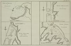
Antique maps of Tahiti and other South Pacific islands
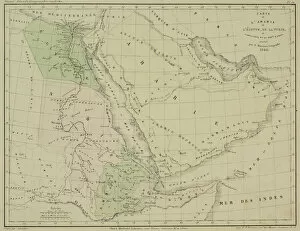
Antique map of Arabia and adjacent Africa and Persia
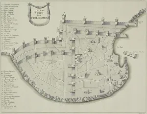
Antique map of fortified city of Ptolemaida
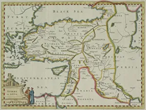
Antique map of Turkey in Asia
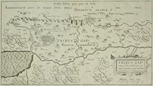
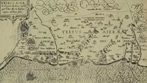
Antique map of tribes of Aser in the holy land