
Earth Collection (page 3)

Background imageEarth Collection: close up, close-up, cropped, detailed, earth, europe, globe, nobody, on black, reversed

close up, close-up, cropped, detailed, earth, europe, globe, nobody, on black, reversed, studio shot, surface, texture, topographic, topography, upside down, Hemera, 87466809

Background imageEarth Collection: background, distant, earth, galaxy, globe, lunar, milky way, milkyway, outer space

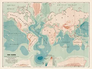
background, distant, earth, galaxy, globe, lunar, milky way, milkyway, outer space, planet, sphere, world, Hemera, 87467861

Background imageEarth Collection: South America Physical map 1897

South America Physical map 1897
The World-Wide Atlas of Modern Geography, Political and Physical W. & A.K. Johnston - London 1897

Background imageEarth Collection: United States NW Central 1897

United States NW Central 1897
The World-Wide Atlas of Modern Geography, Political and Physical W. & A.K. Johnston - London 1897

Background imageEarth Collection: West indies map 1897

West indies map 1897
The World-Wide Atlas of Modern Geography, Political and Physical W. & A.K. Johnston - London 1897

Background imageEarth Collection: Lombardo in the Third Circle of Purgatory engraving 1870

Lombardo in the Third Circle of Purgatory engraving 1870
The Dore Gallery by Edmund Ollier - Cassel, Petter and Galpin (London-New York) 1870

Background imageEarth Collection: Dante and the eagle engraving 1870

Dante and the eagle engraving 1870
The Dore Gallery by Edmund Ollier - Cassel, Petter and Galpin (London-New York) 1870

Background imageEarth Collection: Map of Europe 1869

Map of Europe 1869
Cornells Grammars-School Geography - S.S. Cornell - New York D. Appleton and Company 1869

Background imageEarth Collection: Map of Rome

Map of Rome, Italy

Background imageEarth Collection: Ancient map of the Arctic Region, lithograph, published in 1883

Ancient map of the Arctic Region, lithograph, published in 1883
Ancient map of the Arctic Region. Lithograph, published in 1883

Background imageEarth Collection: map of the world 1823

map of the world 1823
map of the world - 1823 very detailed lithography

Background imageEarth Collection: Map of Abyssinia 1897

Map of Abyssinia 1897

Background imageEarth Collection: Map of Philippines Tasmania Borneo 1897

Map of Philippines Tasmania Borneo 1897
Map of Tasmania Borneo Philippines

Background imageEarth Collection: Armillary sphere engraving 1895

Armillary sphere engraving 1895
Meyers Konversations-Lexikon. Ein Nachschlagewerk des allgemeinen Wissens, 5th edition 17 volumes Bibliographisches Institut - Leipzig 1895-1897

Background imageEarth Collection: Illustration, Crested Porcupine (Hystrix cristata) digging in ground, side view

Illustration, Crested Porcupine (Hystrix cristata) digging in ground, side view

Background imageEarth Collection: Globe of Earth showing African continent, Europe, Middle East, and parts of Asia

Globe of Earth showing African continent, Europe, Middle East, and parts of Asia

Background imageEarth Collection: Cross section illustration of pit mine showing elevators moving up and down in mine shaft

Cross section illustration of pit mine showing elevators moving up and down in mine shaft, and train of coal below

Background imageEarth Collection: Burqin Yadan landform, China, also known as Colorful Beach

Burqin Yadan landform, China, also known as Colorful Beach

Background imageEarth Collection: Potash slag heap near Fulda, Neuhof, Hesse, Germany, Europe

Potash slag heap near Fulda, Neuhof, Hesse, Germany, Europe

Background imageEarth Collection: Internal structure of the Earth, 3D illustration

Internal structure of the Earth, 3D illustration

Background imageEarth Collection: Internal structure of the Earthwith English labels, 3D illustration

Internal structure of the Earthwith English labels, 3D illustration

Background imageEarth Collection: nobody, antique, vintage, archival, cartography, geography, map, history, historical

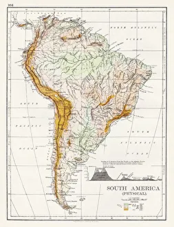
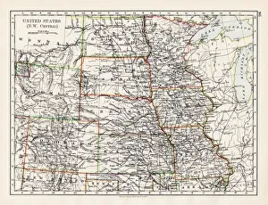
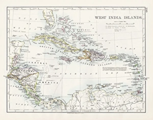
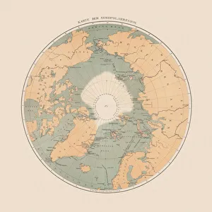
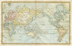
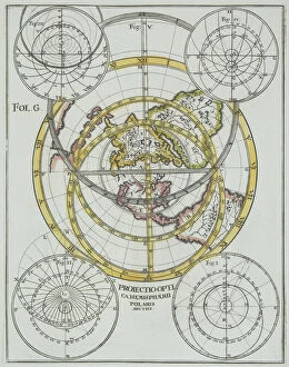
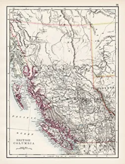
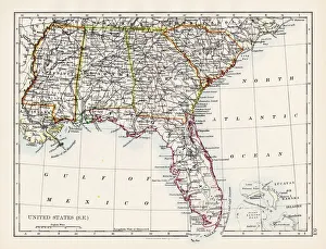
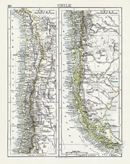
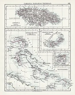
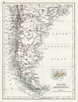
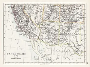
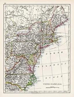
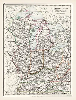
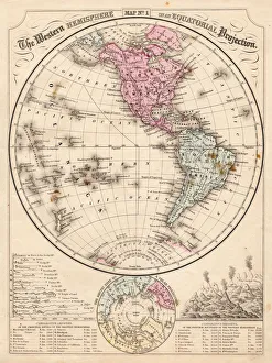
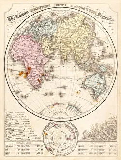
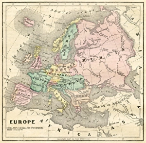
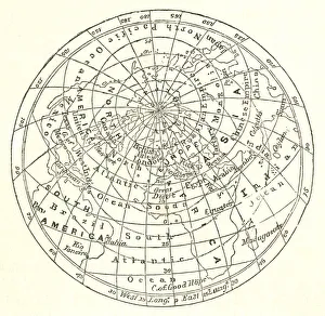
nobody, antique, vintage, archival, cartography, geography, map, history, historical, north pole, south pole, continents, world, earth, north america, south america, europe, africa, asia, australia

Background imageEarth Collection: binary, digital, earth, energy, global, globe, lightning, montage, nobody, numbers

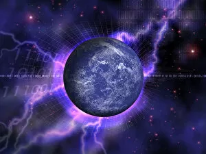
binary, digital, earth, energy, global, globe, lightning, montage, nobody, numbers, orb, outer space, planet, sphere, stars, universe, whole, world, Hemera, 87464649

Background imageEarth Collection: Antique illustration of ornate letter L, with four little angels

Antique illustration of ornate letter L, with four little angels
Antique illustration of capital letter L, illustrated within an ornate frame (decorated with vegetal motifs) and featuring a scene with four naked little angels in the clouds behind the body of

Background imageEarth Collection: Canada map 1883

Canada map 1883
The World-Wide Atlas of Modern Geography, Political and Physical W. & A.K. Johnston - London 1897

Background imageEarth Collection: British North America map 1897

British North America map 1897
The World-Wide Atlas of Modern Geography, Political and Physical W. & A.K. Johnston - London 1897

Background imageEarth Collection: Colombia Ecuador Galapagos map 1897

Colombia Ecuador Galapagos map 1897
The World-Wide Atlas of Modern Geography, Political and Physical W. & A.K. Johnston - London 1897

Background imageEarth Collection: South America map 1897

South America map 1897
The World-Wide Atlas of Modern Geography, Political and Physical W. & A.K. Johnston - London 1897

Background imageEarth Collection: United States North West map 1897

United States North West map 1897
The World-Wide Atlas of Modern Geography, Political and Physical W. & A.K. Johnston - London 1897

Background imageEarth Collection: Manitoba map 1897

Manitoba map 1897
The World-Wide Atlas of Modern Geography, Political and Physical W. & A.K. Johnston - London 1897

Background imageEarth Collection: British Columbia map 1897

British Columbia map 1897
The World-Wide Atlas of Modern Geography, Political and Physical W. & A.K. Johnston - London 1897

Background imageEarth Collection: United States South East map 1897

United States South East map 1897
The World-Wide Atlas of Modern Geography, Political and Physical W. & A.K. Johnston - London 1897

Background imageEarth Collection: Chile map 1897

Chile map 1897
The World-Wide Atlas of Modern Geography, Political and Physical W. & A.K. Johnston - London 1897

Background imageEarth Collection: Jamaica Bahamas Trinidad map 1897

Jamaica Bahamas Trinidad map 1897
The World-Wide Atlas of Modern Geography, Political and Physical W. & A.K. Johnston - London 1897

Background imageEarth Collection: South Argentina map 1897

South Argentina map 1897
The World-Wide Atlas of Modern Geography, Political and Physical W. & A.K. Johnston - London 1897

Background imageEarth Collection: The earth deep and heights map 1893

The earth deep and heights map 1893
Johnsonas Universal Cyclopedia - Charles Kendall - New York 1893 vol 2

Background imageEarth Collection: Africa, Ancient Civilisations, Ancient Egypt, Ancient Greece, Ancient Rome, Antarctica

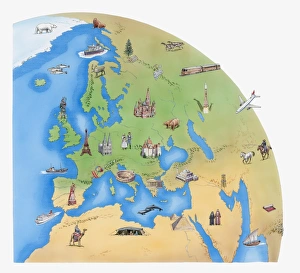
Africa, Ancient Civilisations, Ancient Egypt, Ancient Greece, Ancient Rome, Antarctica, Architecture, Arid, Asia, Building Exterior, Camel, Cold, Commercial Aircraft, Contrasts, Cruise Liner, Day

Background imageEarth Collection: United States South West map 1897

United States South West map 1897
The World-Wide Atlas of Modern Geography, Political and Physical W. & A.K. Johnston - London 1897

Background imageEarth Collection: United States North East map 1897

United States North East map 1897
The World-Wide Atlas of Modern Geography, Political and Physical W. & A.K. Johnston - London 1897

Background imageEarth Collection: United States North East Central map 1897

United States North East Central map 1897
The World-Wide Atlas of Modern Geography, Political and Physical W. & A.K. Johnston - London 1897

Background imageEarth Collection: Businessmen Kicking the Earth

Businessmen Kicking the Earth
Mandy Pritty, dv1233016

Background imageEarth Collection: Pia da Tolomei engraving 1870

Pia da Tolomei engraving 1870
The Dore Gallery by Edmund Ollier - Cassel, Petter and Galpin (London-New York) 1870

Background imageEarth Collection: Dante, Virgil and Cato engraving 1870

Dante, Virgil and Cato engraving 1870
The Dore Gallery by Edmund Ollier - Cassel, Petter and Galpin (London-New York) 1870

Background imageEarth Collection: Beatrice unveiled engraving 1870

Beatrice unveiled engraving 1870
The Dore Gallery by Edmund Ollier - Cassel, Petter and Galpin (London-New York) 1870

Background imageEarth Collection: Western Hemisphere map 1867

Western Hemisphere map 1867
Mitchells Modern Atlas - Published by E.H. Buttler & Co - Philadelphia 1867

Background imageEarth Collection: Eastern Hemisphere map 1856

Eastern Hemisphere map 1856
Mitchells Modern Atlas - Published by E.H. Buttler & Co - Philadelphia 1867

Background imageEarth Collection: Map of Europe 1856

Map of Europe 1856
Colton and Fitchs Modern School Geography by George W. Fitch - New York 1856

Background imageEarth Collection: Victorian map of the Arctic Circle

Victorian map of the Arctic Circle
A Victorian map of the Arctic Circle and beyond. From Peter Parleyas Annual - A Christmas and New Yearas Present for Young Peoplea published in London by Darton & Co in 1851


All Professionally Made to Order for Quick Shipping