mail_outline sales@mediastorehouse.com
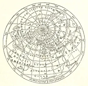
Victorian map of the Arctic CircleA Victorian map of the Arctic Circle and beyond. From Peter Parleyas Annual - A Christmas and New Yearas Present for Young Peoplea published in London by Darton & Co in 1851
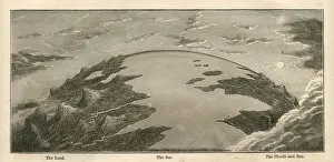
Topographical Land Sea Sky Earth Globe, Antique 1871 IllustrationColor stock photo of an antique illustration of a topographical earth globe showing land, sea and sky examples. Salvaged from an 1871 geography book
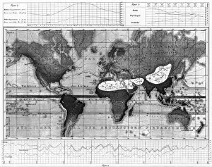
Historical Rainfall and Temperature Charts EngravingEngraved Illustrations of Historical Rainfall and Temperature Map; Temperature Charts of the World from Iconographic Encyclopedia of Science, Literature and Art, Published in 1851
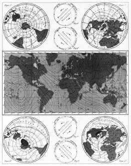
Climate and Weather Charts EngravingEngraved Illustrations of Climate and Weather Charts of the World from Iconographic Encyclopedia of Science, Literature and Art, Published in 1851. Copyright has expired on this artwork
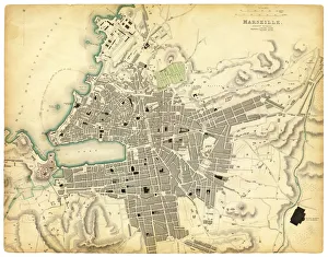
Map of Marseille 1840Map of Marseille - France 1840
The threshold of Purgatory engravingThe threshold of purgatory engraving by Gustave Dore
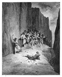
The martyrdom of St. Stephen engraving engraving by Gustave Dore
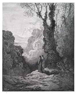
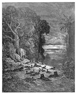
Dante and Virgil engravingDante and Virgil in the Happy Valley engraving by Gustave Dore
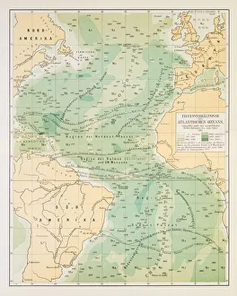
Map of deep Atlantic ocean 1895Different deep zones of the Atlantic ocean Chromolithograph
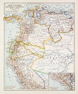
Map of Peru Ecuador Venezuela 1896Map of Peru Ecuador Venezuela
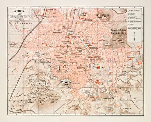
Map of Athens 1895Map of Athens, Greece
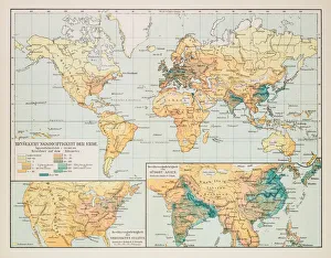
Map of earth population 1895Map of earth population
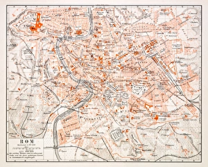
Map of Rome 1896Map of Rome, Italy
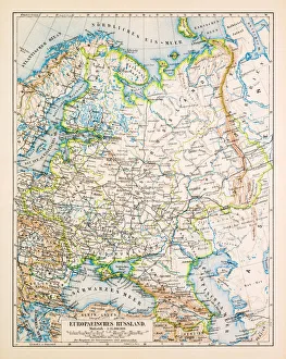
Map of European Russia 1896Map of European Russia
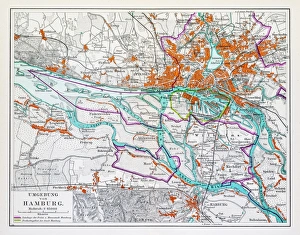
Map of Hamburg 1895Map of Hamburg, Germany
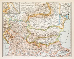
Map of Rumania Bulgaria 1896Map of Rumania, Bulgaria, Serbia, Montenegro
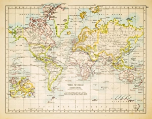
Map of the world 1897Map of the world in Mercator projection
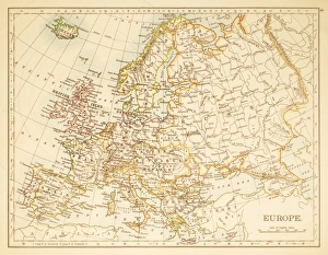
Map of Europe 1897Map of Europe
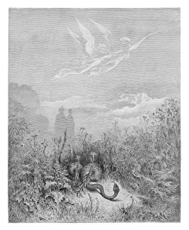
The seven evening on earth engraving 1885Engraving by Gustave Dore
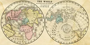
Map of the world horizontal projection 1856Colton and Fitchs Modern School Geography by George W. Fitch - New York 1856
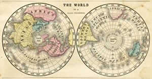
Polar projection of the world map 1856Colton and Fitchs Modern School Geography by George W. Fitch - New York 1856
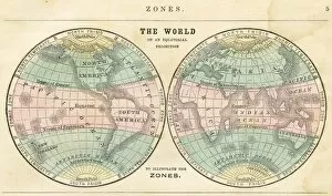
Map of the world in zones 1856Colton and Fitchs Modern School Geography by George W. Fitch - New York 1856
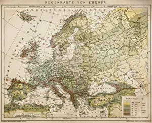
Rain map of EuropeAntique illustration of a rain map of Europe
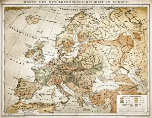
Population tightness map of Europe
Ethnographic map of Europe from 1898
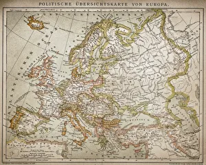
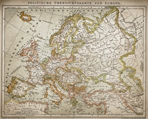
Political outline map of Europe from 1898
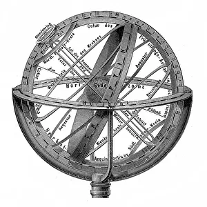
Engraving vintage Planetarium
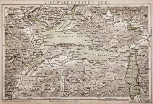
Lake LucerneAntique map of LAKE LUCERNE
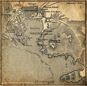
Cartagena, SpainAntique illustration of a Cartagena, Spain map
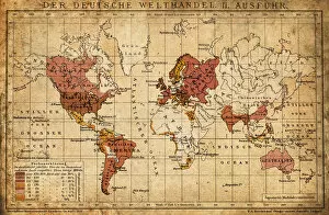
German world trade export map 1898Illustration engraving of the German world trade export map from 1898
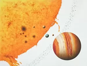
Surface of the sun with an arch of fire, next to the planets Jupiter, Mars, Earth, Venus, Mercury and an Asteroid belt
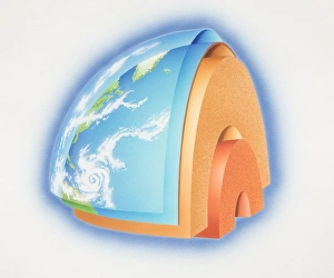
Cross-section diagram of quarter of the earths sphere illustrating subterranean layers of matter, side view
Space shuttle returning Earth through the atmosphere with heat-shield tiles glowing red-hot, low angle view
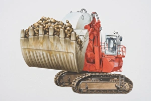
Red mining shovel with bucket full of earth
Green scraper with basin full of earth, side view
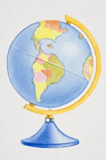
Colourful globe, side view
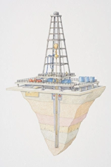
Oil pumping station, cross section
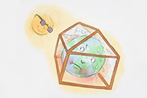
Sun looking down at earth trapped and sweating in greenhouse
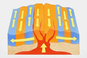
Magnetic crust, forming new mid-oceanic ridges, cross section
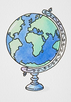
Globe on ornate axis
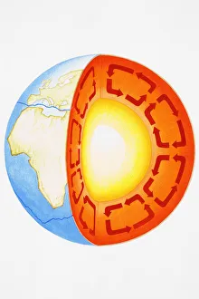
Earth showing Eurasian plate, African, Antarctic plates, and Earths core, cross-section
Igneous rock, weathering and erosion, deposition and metamorphism, and recycled rocks, cross-section
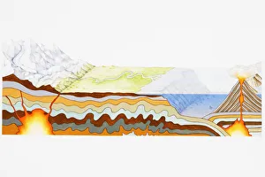
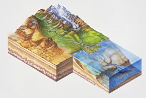
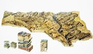
Clastic rock formations showing mountains, glacier, river delta, lake, desert, sea and strata, cross-section, elevated view
Comical depiction of Earth globe with face blowing clouds from mouth
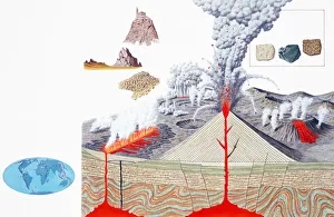
Volcanic eruption, cross-section
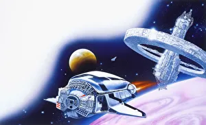
Futuristic space station and space craft
River meandering through canyon, elevated view
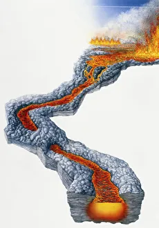
Lava flow, molten rock expelled by volcano during effusive eruption