mail_outline sales@mediastorehouse.com
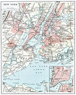
Map of New York city 1896Ilustration of a Map of New York city 1896
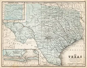
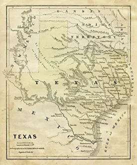
Map of Texas 1867Mitchells Modern Atlas - Published by E.H. Buttler & Co - Philadelphia 1867
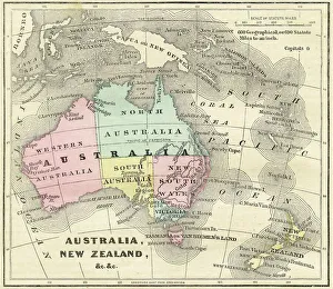
Map of Australia and New Zealand 1856Colton and Fitchs Modern School Geography by George W. Fitch - New York 1856
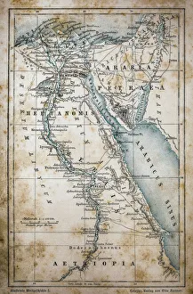
Map of EgyptIllustration of a Map of Egypt
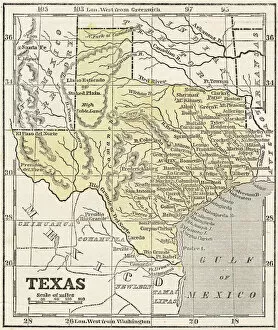
Map of Texas 1856Colton and Fitchs Modern School Geography by George W. Fitch - New York 1856
Map of Texas 1855System of Geography for the use of schools by Sidney E. Morse - Published by Harper & Brothers - New York 1855
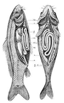
Common carp anatomyillustration engraving of a common carp anatomy
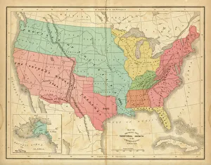
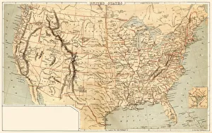
Map of United States 1876Map of United States showing the territorial growth between 1780 and 1876
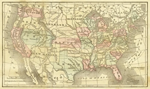
Map of United States 1869Cornells Grammars-School Geography - S.S. Cornell - New York D. Appleton and Company 1869
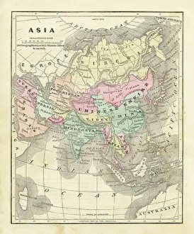
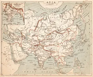
Map of Asia 1856Colton and Fitchs Modern School Geography by George W. Fitch - New York 1856
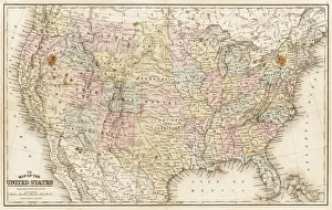
Map of United States 1867Mitchells Modern Atlas - Published by E.H. Buttler & Co - Philadelphia 1867
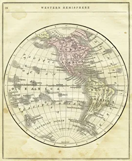
Western Hemisphere map 1856Colton and Fitchs Modern School Geography by George W. Fitch - New York 1856
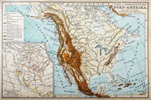
River and mountains map of North AmericaIllustration of a River and mountains map of North America
Abstract PaintingWatercolor Brush Stroke Design Element. Soft Pastel Grunge Texture
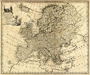
Antique Map of Europe 1744An engraved map of Europe with ornamental cartouche and relief shown pictorially by Emanuel Bowen 1744, London, Geographer to His Majesty
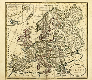
Antique Map of Europe, 1785An accurate map of Europe from the best authorities. London: C. Dilly & G. Robinson: 1785. Original size: 35.7 x 37.4 cm. Coloured, Inset: Spitsbergen, East and West Greenland, and Iceland
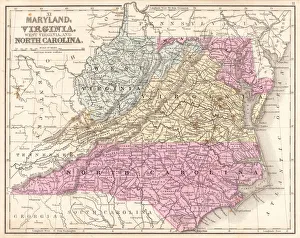
Map of Maryland Virginia North Carolina 1867Mitchells Modern Atlas - Published by E.H. Buttler & Co - Philadelphia 1867
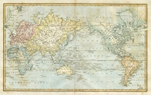
map of the world 1823map of the world - 1823 very detailed lithography
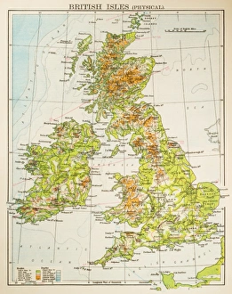
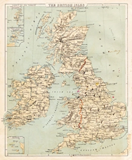
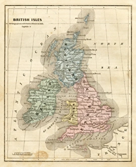
Map of British Isles 1897Map of British Isles
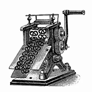
Pretzel makerAntique illustration of a Pretzel maker
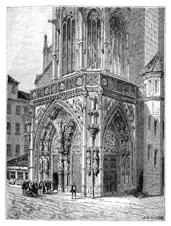
The Frauenkirche ( Church of Our Lady ) in Nuremberg, GermanyIllustration of the Frauenkirche ( Church of Our Lady ) is a church in Nuremberg, Germany
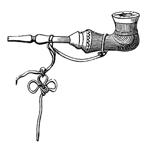
Russian pipeillustration of a Russian pipe
Book endpaper engraving
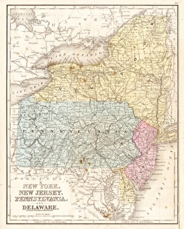
Middle states USA map 1869Cornells Grammars-School Geography - S.S. Cornell - New York D. Appleton and Company 1869
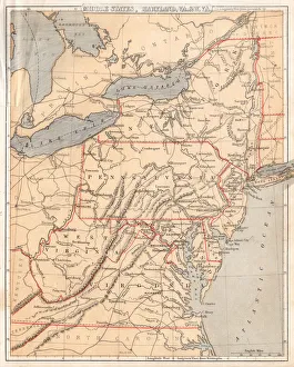
MId-atlantic states usa map 1867Mitchells Modern Atlas - Published by E.H. Buttler & Co - Philadelphia 1867
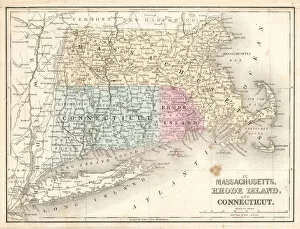
Rhode Island Massachusetts Connecticut 1867Mitchells Modern Atlas - Published by E.H. Buttler & Co - Philadelphia 1867
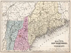
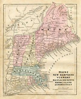
Maine New Hampshire and Vermont 1867Mitchells Modern Atlas - Published by E.H. Buttler & Co - Philadelphia 1867
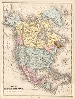
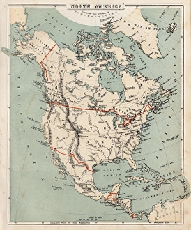
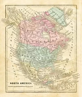
Map of North America 1867Mitchells Modern Atlas - Published by E.H. Buttler & Co - Philadelphia 1867
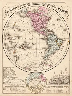
Western Hemisphere map 1867Mitchells Modern Atlas - Published by E.H. Buttler & Co - Philadelphia 1867
Map of Asia 1869Cornells Grammars-School Geography - S.S. Cornell - New York D. Appleton and Company 1869
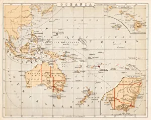
Map of Australia Oceania 1869Cornells Grammars-School Geography - S.S. Cornell - New York D. Appleton and Company 1869
Map of the British isles 1869Cornells Grammars-School Geography - S.S. Cornell - New York D. Appleton and Company 1869
Map of North America 1869Cornells Grammars-School Geography - S.S. Cornell - New York D. Appleton and Company 1869
Maine New Hampshire and Connecticut 1856Colton and Fitchs Modern School Geography by George W. Fitch - New York 1856
map of the British isles 1856Colton and Fitchs Modern School Geography by George W. Fitch - New York 1856
Map of United States 1856Colton and Fitchs Modern School Geography by George W. Fitch - New York 1856
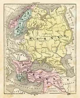
Map of Russia Turkey 1856Colton and Fitchs Modern School Geography by George W. Fitch - New York 1856
Map of North America 1856Colton and Fitchs Modern School Geography by George W. Fitch - New York 1856
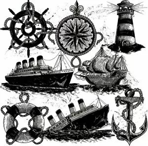
Nautical Elements in classic style
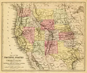
map of the Pacific states (California, Oregon, Washington) an territories with a part of central and souther states - USA (1883)
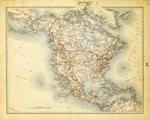
Map of North America 1882Antique Map of North America 1882
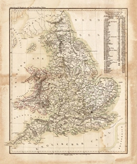
Map of great Britain 1831Antique map of great Britain 1870
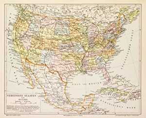
Map of United States and Mexico 1897Map of United States and Mexico
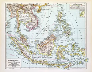
Map of Indochina 1895Map of Indochina and Malay Archipelago
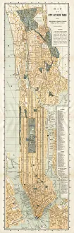
Map of New York City 1894Huge vertical panorama map of New York 1885
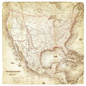
Map of United States and Mexico 1849Map of United States and Mexico
Red antique book
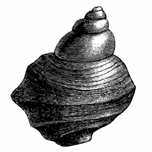
MolluskAntique illustration of a Mollusk