amusement park, architecture, beach, blue sky, brighton, clear sky, color image, copy space, day, dock, england, entertainment, harbor, historical landmark, horizontal, leisure, low angle view
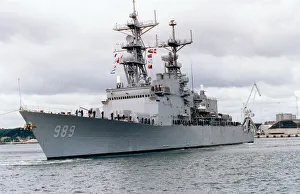
Destroyer USS Deyo arriving in port
1993, Action, Armed Forces, Arrival, Battle, Conflict, Defense Industry, Harbor, Military, Military Exercise, Nautical Vessel, Navy, Ocean, Outdoors, Port, Power, Sea, Shipping, Technology