mail_outline sales@mediastorehouse.com
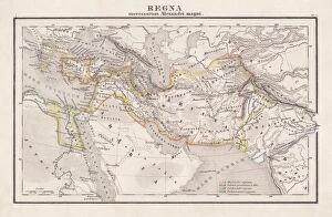
Empire of Alexander the Great, hand-coloured steel engraving, published 1861Antique map from Empire of Alexander the Great 356 - 326 BC) after the battle of Ipsos (301 BC). Legend in Latin language. Steel engraving with hand colored borderlines, published in 1861
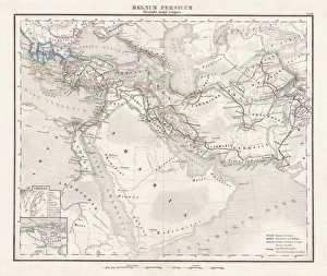
Persian Empire (c. 400 BC), steel engraving, pubolished in 1861Antique map from the Persian Empire (around 400 BC) before the conquest of Alexander the Great (334/335 BC). Legend in Latin language. Steel engraving with hand colored borderlines, published in 1861
Antique map of the Middle East
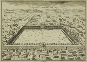
Antique print of plans for town of Isfahan in Iran
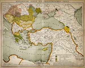
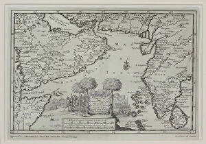
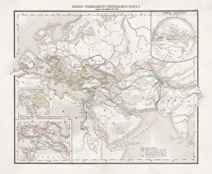
Historical map of the Oriental part of worldAntique illustration of a Historical map of the Oriental part of world
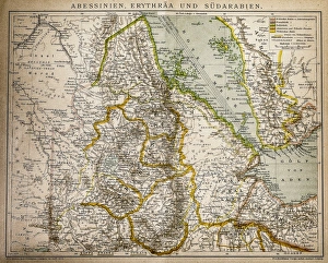
Abyssinia, Eritrea and South ArabiaAntique illustration of a Abyssinia, Eritrea and South Arabia
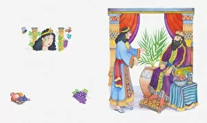
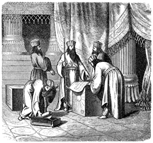
Illustration of a bible scene, Esther 5-8: Queen Esther persuades King Ahasuerus to help the Jews
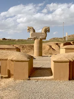
Mysterious ancient stone horses gate of Persepolis - IranAncient and mysterious big stone horses statues carved into large stone blocks, as an entrance gate to one of the 500 BC palaces of the Persepolis or Takhte Jamshid complex
Persepolis ancient ruins in Iran - Simorgh mythical bird stone carvingAncient and mysterious ruins and stone carved column decorated with a twin Simorgh bird, the mythical Iranian equivalent of phoenix or griffin featured in the Persian literature of antiquity
Persepolis, Gate of Xerxes or All Nations gateGate of Xerxes I or All Nations gate, with colossal lamassus (human-headed bulls), Persepolis, the ceremonial capital of the Achaemenid Empire founded by Darius the Great (522-486 B.C)
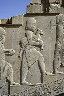
Apadana palace, Persepolis, IranTribute bearers, bas-relief in Apadana palace, Persepolis (Unesco World Heritage List, 1979), Iran, Achaemenid civilization, 6th-5th century BC
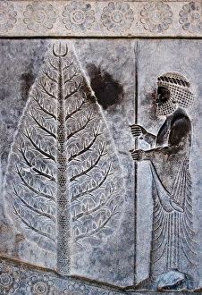
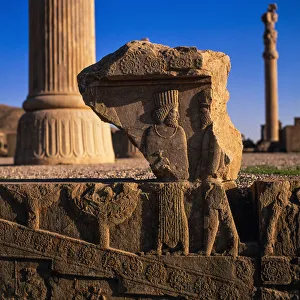
Prsian Heritagecraving on stone at Persepolis
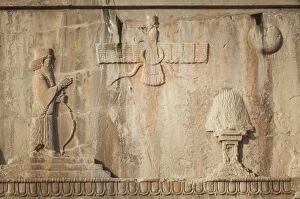
Carvings on the Tomb of Artaxerxes III, PersepolisCarvings on the Tomb of Artaxerxes III (425BC-338BC, the 11th emperor of the Achemenid Empire) in the ancient site of Persepolis
africa, antique, arabian sea, archival, asia, borders, boundaries, cartography, countries, geography, gulf of aden, historic, horn, illustration, india, indian ocean, iran, key, legend, map
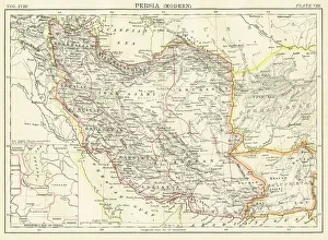
Modern Persia map 1885Encyclopedia Britannica 9th Edition New York Charles Scribners and Sons 1885 Vol XVIII
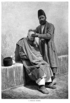
Persian Barber - Scanned 1886 Engraving
Mithridatesillustration of a Mithridates
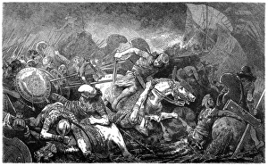
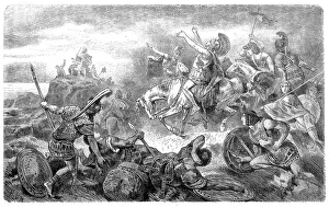
Battle of MarathonBATTLE OF MARATHON Miltiades, with 11, 000 Athenians and Plataeans, defeats the 60, 000-strong Persian army of Darius Hystaspes
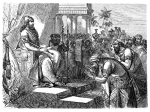
Paying homage to an Assyrian rulerIllustration of a Paying homage to an Assyrian ruler
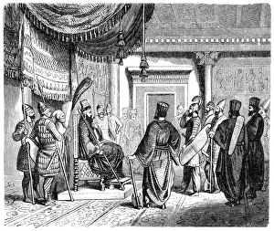
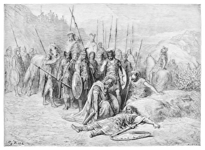
War council with the Persian kingIllustration of a War council with the Persian king
Cyrus II (c. 590 / 580-530 BC), Persian kingillustration of a Cyrus II (c.590/580-530 BC), Persian king
Magus, Persian priests of AntiquityIllustration of a Magus, Persian priests of Antiquity
Persian ambassadors, invaded by the Macedonians in womens clothesIllustration of a Persian ambassadors, invaded by the Macedonians in womens clothes
Xenophon, retreating in Persia, reaches the Black SeaIllustration of a Xenophon, retreating in Persia, reaches the Black Sea
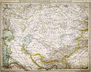
Russia - Central Asia and TurkeyAntique illustration of Russia - Central Asia and Turkey
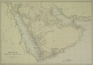
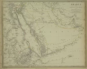
Antique map of Arabia with the Red Sea and Persian Gulf
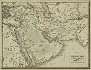
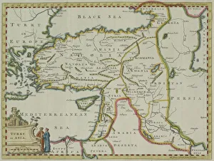
Antique map of Turkey in Asia, Egypt, Arabia, and Persia
Assyria and Phersia Empire c. 500 BC, steel engraving, published 1661Antique map from Assyrian and Persian Empire, c. 500 BC. Legend in Latin language. Steel engraving with hand colored borderlines, published in 1861
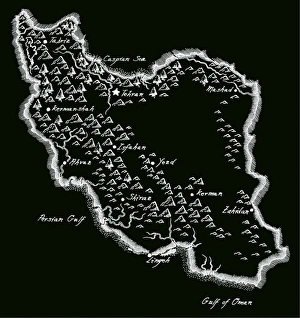
Antique Iran MapIran Map, - Antique style. Includes mountains and water bodies. High detail - vector illustration
Alejandro Magno discover Darius engraving 1894Great Men and Famous Women
Antique map of Turkey in Asia
Antique map of Arabia with Egypt, Nubia, and Abyssinia
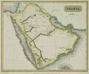
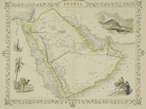
Antique map of Arabia
Antique map of Arabia with vignettes
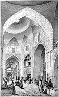
Bazar in Ispahan or IsfahanAntique illustration of a Bazar in Ispahan or Isfahan
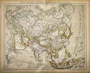
Political Map of AsiaAntique illustration of Political Map of Asia
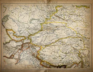
Map of inner AsiaAntique illustration of a inner Asia
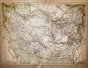
Map of West AsiaAntique illustration of a West Asia
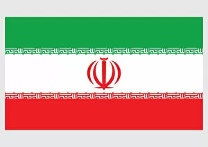
Illustration of flag of Iran, a horizontal tricolour of red, white, and green with red emblem of Iran in centre, and takbir written in white in Kufic script on fringe of both green and red bands
Illustration of Jami Mosque, Zavareh, Iran
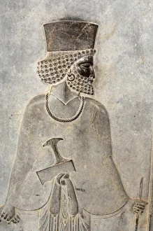
Bas-relief with Persian guard, East staircase, Apadana, Persepolis (Unesco World Heritage List, 1979), Iran, Achaemenid civilization, 6th-5th century BC
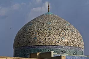
Dome of Sheikh Lotfollah MosqueSheikh Lotf Allah Mosque (Masjed-e Sheikh Lotf-o-llah ) is one of the architectural masterpieces of Safavid Iranian architecture, standing on the eastern side of Naghsh-i Jahan Square, Isfahan
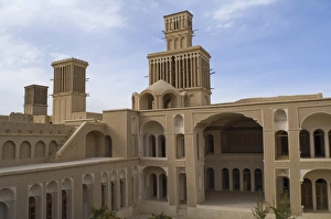
Aghazadehs House in Abarkuh, IranAbarkuh is one of the ancient Iranian cities located about 140 kilometer (87 miles) to the west of the city of Yazd and bordering the province of Fars
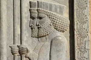
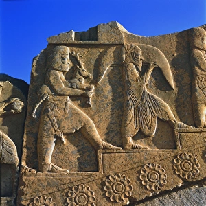
Bas-relief of two Persians guard, PersepolisIran, Persepolis, Bas-relief of two Persians guard. Apadana Palace, Persepolis, (Unesco World Heritage List, 1979), Iran. Achaemenid civilisation
Bas-relief with Persian guard, Persepolis, IranBas-relief with Persian guard, Persepolis in Apadana palace, Persepolis (Unesco World Heritage List, 1979), Iran, Achaemenid civilization, 6th-5th century BC
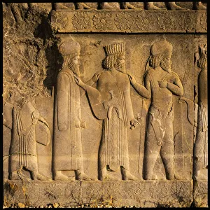
Bas-relief depicting Median dignitariesIRAN, Fars, Bas-relief depicting Mede noblemans, East staircase, Apadana, Persepolis (Unesco World Heritage List, 1979), Iran. Achaemenid civilisation, 6th-5th century BC
Bas-relief in Persepolis, IranTribute bearers, bas-relief in Apadana palace, Persepolis (Unesco World Heritage List, 1979), Iran, Achaemenid civilization, 6th-5th century BC
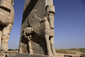
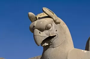
Eagle-head, Persepolis, Fars Province, IranPersepolis, the ceremonial capital of the Achaemenid Empire founded by Darius the Great (522-486 B.C ) Persian king of the Achaemenid dynasty. Relief of Apadana place, destroyed by Alexander