mail_outline sales@mediastorehouse.com
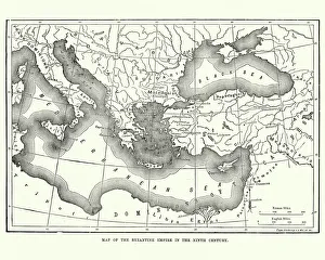
Map of the Byzantine Empire in the 9th CenturyVintage engraving of a Map of the Byzantine Empire in the 9th Century
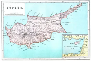
Map of CyprusVintage 19th Century map of Cyprus in the eastern Mediterranean Sea
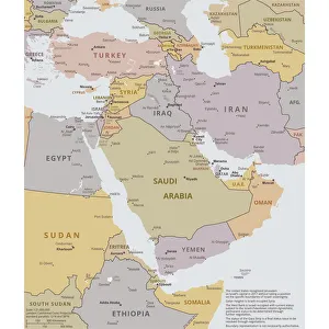
Political map of The Middle EastVector illustration of the policital map of The Middle East Reference map was created by the US Central Intelligence Agency
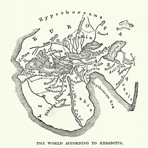
Map of the Ancient World according to HerodotusVintage engraving of a Map of the Ancient World according to Herodotus. Herodotus was a Greek historian who was born in Halicarnassus, Caria and lived in the fifth century BC
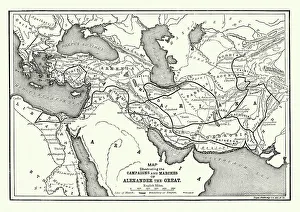
Ancient History - Map of Alexander the Great CampaignsVintage engraving of a map of the campaigns and marches of Alexander the Great
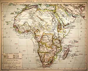
Africa Political MapAntique illustration of a Africa Political Map from 1893
Flamingo flock, Ras al Khor Sanctuary, DubaiRas Al Khor wildlife Sanctuary. Rakws is located at the head of the 14Km long watercourse known as Dubai Creek, and covers an area of 620 hectares featuring sabkhas saline flats
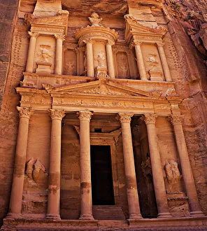
Al Khazneh (The Treasury), Petra, JordanThis little wonder measures 82 feet (25 meters) wide and 128 feet (39 meters) high. Its an absolute stunner and the first thing you see after walking through the canyon
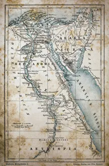
Map of EgyptIllustration of a Map of Egypt
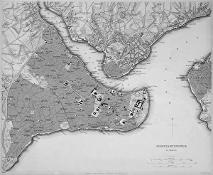
Antique map of Constantinople, present day Istanbul
Excursion boat off the Pigeons Rock, Grotte aux Pigeons, limestone rocks eroded by wind and weather in the Raouche district, Beirut, Lebanon, Middle East, Asia
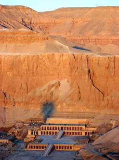
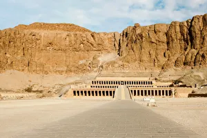
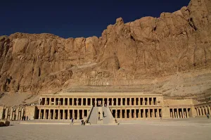
Queen Hatshepsuts Temple, Luxor, EgyptAerial view from hot air balloon of Queen Hatsheputs Temple, Valley of the Queens
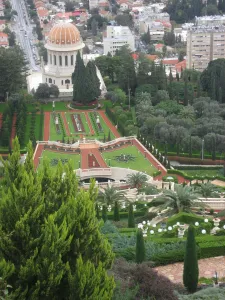
Bahai temple and gardens, Haifa, IsraelBahAa Ai World Centre in Haifa, the spiritual and administrative centre of the BahAa Ai Faith. The Terraces of the BahAa Ai Faith, or Hanging Gardens of Haifa. In the foreground, the Baha i Eagle
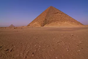
The Red PyramidView of the Red Pyramid at Dahshur necropolis near Cairo, Egypt
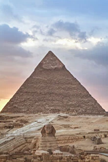
Sunset at the Pyramids, Giza, Cairo, EgyptA sunset from the Pyramids at Giza, Cairo, Egypt
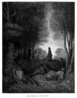
Jesus Praying in the GardenVintage engraving from the 1870 of a scene from the New Testament by Gustave Dore showing Jesus Praying in the Garden
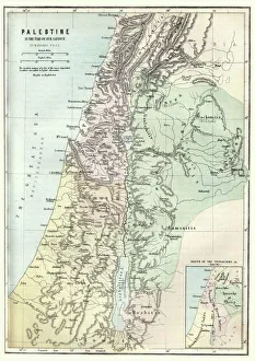
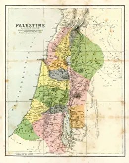
Map of Palestine in the time of Jesus ChristVintage engraving of Map of Palestine in the time of Jesus Christ
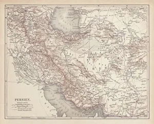
Ancient map of Persia, lithograph, published in 1877Ancient map of Persia. Lithograph, published in 1877
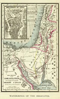
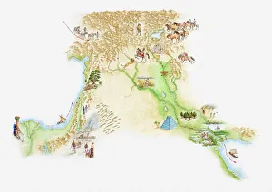
Wanderings of the Israelites Map EngravingEngraved illustration of Wanderings of the Israelites Map Engraving from The Popular Pictorial Bible, Containing the Old and New Testaments, Published in 1862. Copyright has expired on this artwork
Mortuary Temple of Hatshepsut, Luxor, EgyptMortuary Temple of Hatshepsut, Deir el-Bahari, Theban Necropolis (UNESCO World Heritage List, 1979), Luxor, Egypt. Egyptian civilisation, New Kingdom, Dynasty XVIII
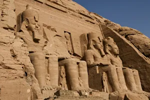
Abu Simbel templeView of the massive rock Sun Temple Of Ramses II at Abu Simbel situated on the western bank of Lake Nasser
Sunset, Sphinx (foreground), The Pyramid of Chephren (background), The Pyramids of GizaGiza, Egypt
Deir al-Bahri, HatshepsutDayr el-Bahari or Dayr el-Bahri is a complex of temples and tombs on the west bank of the Nile. The complex is part of UNESCO World Heritage Sites
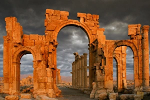
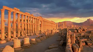
Monumental Arch, Palmyra, SyriaSunset at the Unesco World heritage Site. Before the Syrian conflict started in 2011, more than 150, 000 tourists visited the city of Palmyra every year
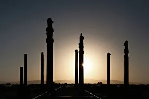
Persepolis ancient columns at sunset, IranPersepolis was the ceremonial capital of the Achaemenid Empire (ca. 550 u2013330 BC). It is situated 60 km northeast of the city of Shiraz in Fars Province, Iran
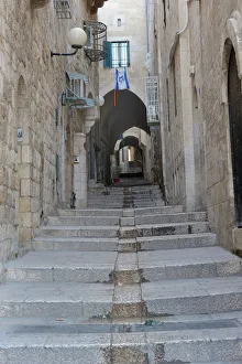
Deserted alleyway with Israeli flag hanging from a window above an archway, Muslim Quarter, Old City, Jerusalem, Middle East
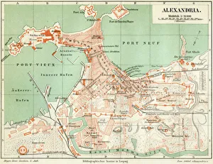
Plan of the old city Alexandria 1895Meyers Konversations-Lexikon. Ein Nachschlagewerk des allgemeinen Wissens, 5th edition 17 volumes Bibliographisches Institut - Leipzig 1895-1897
Antique Map - Biblical PalestineAntique Map from 1864 of Biblical Palestine
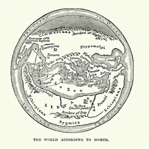
Map of the Ancient World according to HomerVintage engraving of a Map of the Ancient World according to Homer. Homer is best known as the author of the Iliad and the Odyssey
Covered alley in Yazd old town, IranYazd is an ancient desert city in central Iran and the capital of the Yazd province. Since 2017 its listed by UNESCO as a world heritage
Historical map of Palestine with the twelve tribes of Israel. Colored steel engraving, published in 1886
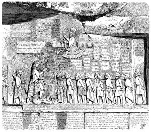
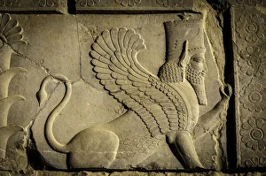
Behistun Inscription, ancient relief, Kermanshah, IranIllustration of a Behistun Inscription, ancient relief, Kermanshah, Iran
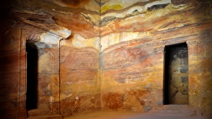
Interior of The Treasury, Petra, JordanThe site is open from 6am to 6pm during the summer and from 6am to 4 pm in winter
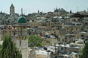
Overlooking the Old City of Jerusalem, Israel, Middle East
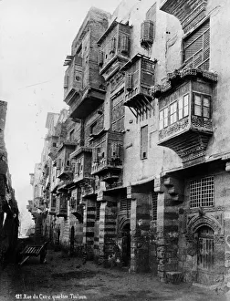
Old Cairocirca 1880: Old buildings in the Touloun quarter of Cairo. Examples of highly decorated mashrubiyeh windows. (Photo by Topical Press Agency/Getty Images)
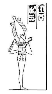
Egyptian God Osirisillustration of a Egyptian God osiis
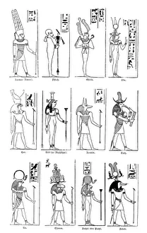
Egyptian godsIllustration of a Egyptian gods
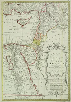
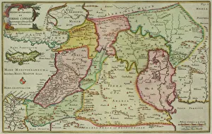
Antique map of the Middle East with Egypt, Syria, and Israel. Date unknown
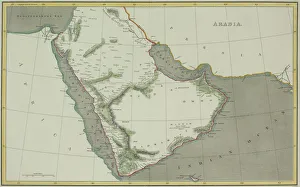
Antique map of Arabian peninsula and Persia
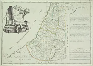
Antique map of Israel
Antique map of the Middle East by Halma
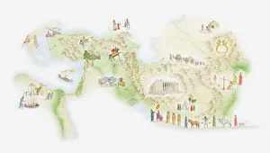
Illustrated map of ancient Persia
Illustrated map of ancient Assyrian empire
Dromedary looking at camera, Bir Shalaten
Sphynx Bas ReliefBas relief showing a sphynx decorating the north wall of the Apadana terrace Persepolis
Palmyra, SyriaThe Colonnade street in Palmyra, Syria
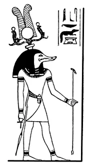
Egyptian God Sobekillustration of a Egyptian God Sobek
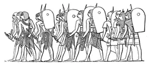
Ancient Egypt warrior armyIllustration of a Ancient Egypt warrior army