mail_outline sales@mediastorehouse.com
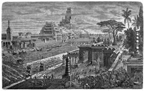
Fall of Babylon by Cyrus II, 539 BCIllustration of a Fall of Babylon by Cyrus II, 539 BC
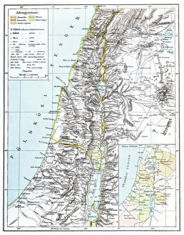
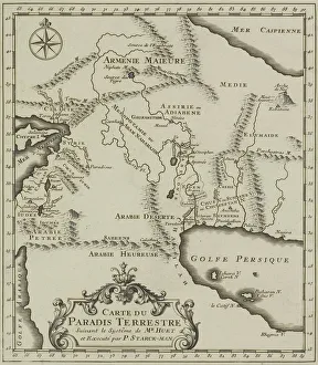
Map of PalestineIllustration of a map of Palestine
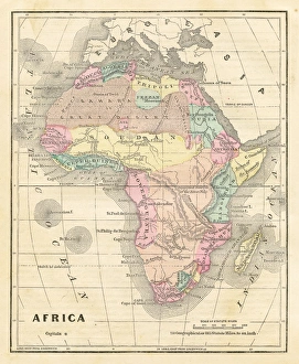
Old map of Africa 1856Colton and Fitchs Modern School Geography by George W. Fitch - New York 1856
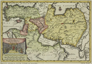
Antique map of Persia and the Middle East
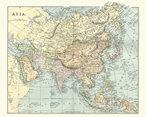
Antique map of asia in late 19th CenturyVintage Antique map of asia in late 19th Century
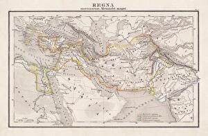
Empire of Alexander the Great, hand-coloured steel engraving, published 1861Antique map from Empire of Alexander the Great 356 - 326 BC) after the battle of Ipsos (301 BC). Legend in Latin language. Steel engraving with hand colored borderlines, published in 1861
Seleucid Empire, 3rd to 2nd century BC, published in 1861The Seleucid Empire was created after the death of Alexander the Great and dominated the Near East from the 3rd to 2nd century BC. Legend in Latin language
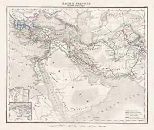
Persian Empire (c. 400 BC), steel engraving, pubolished in 1861Antique map from the Persian Empire (around 400 BC) before the conquest of Alexander the Great (334/335 BC). Legend in Latin language. Steel engraving with hand colored borderlines, published in 1861
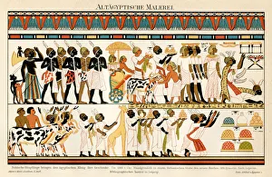
Ancient Egyptian Chromolithograph 1895Meyers Konversations-Lexikon. Ein Nachschlagewerk des allgemeinen Wissens, 5th edition 17 volumes Bibliographisches Institut - Leipzig 1895-1897
Antique map of the Middle East
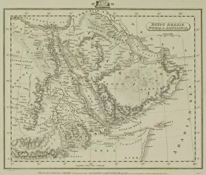
Antique map of Middle East with Arabia, Egypt, Nubia, and Abyssinia
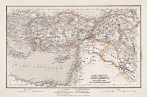
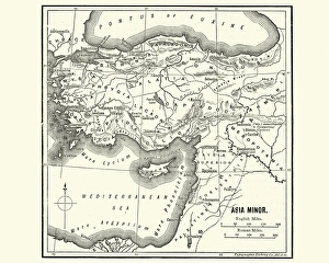
Map of Asia Minor in Ancient TimesVintage engraving of a Map of Asia Minor in Ancient Times
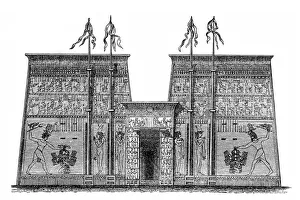
Ancient Egyptian Temple in Edfuillustration of an ancient Egyptian temple in Edfu
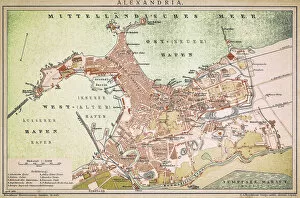
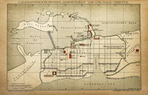
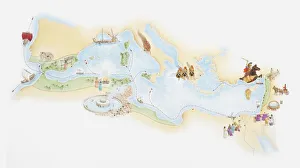
Alexandria mapAntique illustration of a Mediterranean Sea
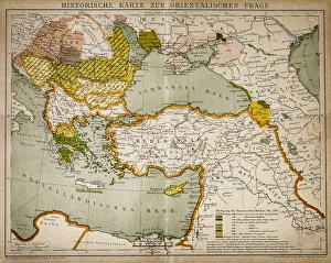
Historical map of the Oriental part of worldAntique illustration of a Historical map of the Oriental part of world
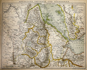
Abyssinia, Eritrea and South ArabiaAntique illustration of a Abyssinia, Eritrea and South Arabia
Alexandria in the first century before and after ChristAntique illustration of a Alexandria in the first century before and after Christ
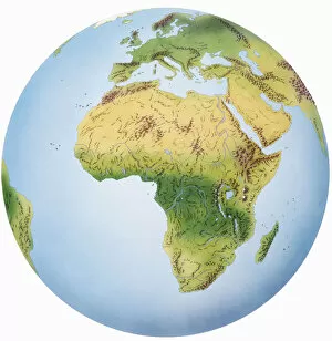
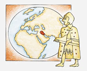
Globe of Earth showing African continent, Europe, Middle East, and parts of Asia
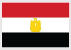
Illustration of flag of Egypt, horizontal bands of red, white and black with yellow Eagle of Saladin in centre
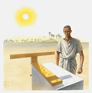
Illustration of man standing next to a t-shaped sundial, Ancient Egypt
Illustrated map of Phoenician empire and trade routes
Illustration of ancient Sumerian next to a map highlighting ancient Sumer
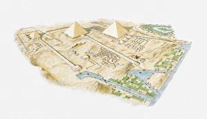
Illustration of Pyramids of Giza, aerial view
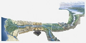
Illustration of Nile river from Lake Victoria to Nile Delta
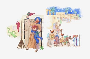
Illustration of a bible scene, Exodus 12, Passover, Moses instructs Gods people how to keep safe and the pharaoh agrees to let them leave Egypt
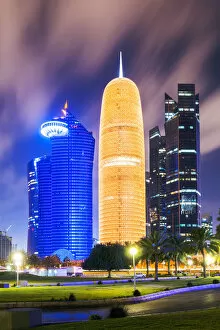
Doha city center illuminated at night, Qatar, Middle EastDoha, Qatar, Persian Gulf countries
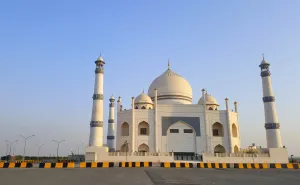
Siddiqa Fatima Zahra Mosque, KuwaitThe work on this mosque was started in February 2008 and was completed in June 2011. The Shia mosque was designed in the style of the Taj Mahal in Agra, India
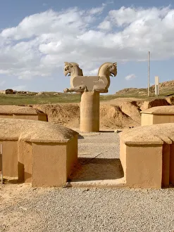
Mysterious ancient stone horses gate of Persepolis - IranAncient and mysterious big stone horses statues carved into large stone blocks, as an entrance gate to one of the 500 BC palaces of the Persepolis or Takhte Jamshid complex
Persepolis ancient ruins in Iran - Simorgh mythical bird stone carvingAncient and mysterious ruins and stone carved column decorated with a twin Simorgh bird, the mythical Iranian equivalent of phoenix or griffin featured in the Persian literature of antiquity
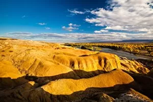
Burqin Yadan landform, China, also known as Colorful Beach
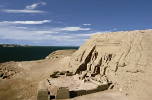
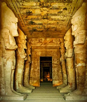
The Great Temple of Ramses II, Abu Simbel, Egypt
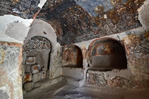
Interior View of Cave Church, CappadociaInterior view of cave church in Soganli valley, Cappadocia, Turkey, Central Anatolia.The historic mural paintings are ruined (vandalized) by some modern graffiti.UNESCO World Heritage Site
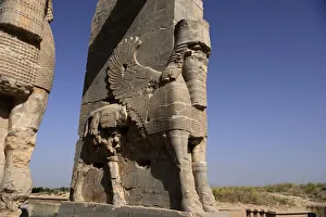
Persepolis, Gate of Xerxes or All Nations gateGate of Xerxes I or All Nations gate, with colossal lamassus (human-headed bulls), Persepolis, the ceremonial capital of the Achaemenid Empire founded by Darius the Great (522-486 B.C)
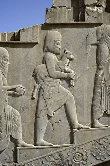
Apadana palace, Persepolis, IranTribute bearers, bas-relief in Apadana palace, Persepolis (Unesco World Heritage List, 1979), Iran, Achaemenid civilization, 6th-5th century BC
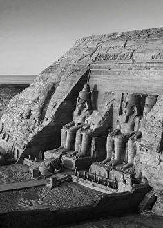
The statues of Rameses II, Abu Simbel, EgyptLocated just 40 km north of the border with Sudan is the temple of Abu Simbel which was constructed by Ramses II around 3000 years old
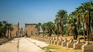
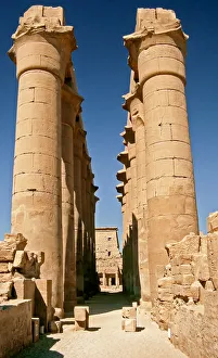
Entrance to the Temple of Luxor, Luxor, EgyptThe Avenue of the Sphinxes towards the ancient Egyptian Colossi at the entrance to Court of Ramses II, Luxor Temple, Luxor, Nile Valley, Egypt
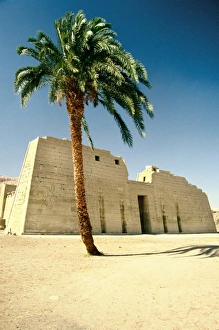
Mortuary temple of Ramesses III, Luxor, EgyptMedinet Habu is the name commonly given to the Mortuary Temple of Ramesses III, an important New Kingdom period structure in the location of the same name on the West Bank of Luxor in Egypt
Luxor Temple, Luxor, EgyptThe Karnak Temple Complex, Luxor, Egypt
Hypostyle hall, Great Temple of Abu SimbelHypostyle hall with colossal statues of Ramesses II depicted as the god Osiris, the Great Temple of Abu Simbel (UNESCO World Heritage List, 1979), dating from the reign of Ramesses II
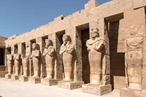
Statues of Ramses II as Osiris in Karnak Temple, Luxor, EgyptThe Karnak temple complex is a vast open-air museum, and the second largest ancient religious site in the world, after the Angkor Wat Temple of Cambodia
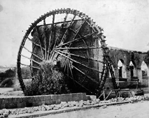
Water Wheel At Hamacirca 1920: One of the worlds largest water wheels at Hama in Syria which has been running continuously for 900 years. (Photo by General Photographic Agency/Getty Images)
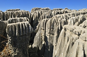
Eroded limestone, karst formation at Qalaat Faqra, Lebanon, Middle East, West Asia
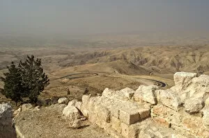
View from Mount Nebo in the Abarim Mountains, Jordan, Western Asia
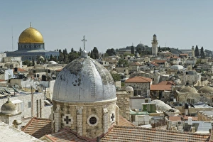
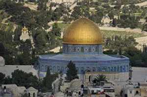
Old City of Jerusalem with Dome of the Rock, Israel, Middle East
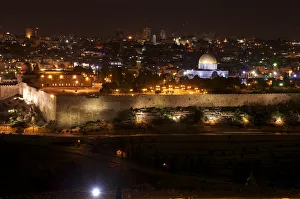
View from the Mount of Olives in Jerusalem by night, with Wailing Wall and Dome of the Rock, Israel, Middle East
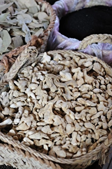
Dried ginger, spice souk, Dubai, United Arab Emirates, Arabia, Middle East, Orient
Dried lemons, spice souk, Dubai, United Arab Emirates, Arabia, Middle East, Orient
Dome of the Rock on the Temple Mount, Arab Quarter, Old City of Jerusalem, Israel, Middle East