
Middle East Collection (page 5)

Background imageMiddle East Collection: Four Iwan yard in the complex of the congregational Mosque in Nain, Isfahan, Iran

Four Iwan yard in the complex of the congregational Mosque in Nain, Isfahan, Iran
Nain is an old town in Isfahan province, central Iran. It has some of the most outstanding monuments of the country and is a popular touristic destination

Background imageMiddle East Collection: Yazd Jameh Mosque minarets, the tallest in Iran

Yazd Jameh Mosque minarets, the tallest in Iran
The Jumeh Mosque is the grand congregational mosque of Yazd city. Built in 14th century, the mosque is crowned by a pair of minarets, the highest in Iran

Background imageMiddle East Collection: Highway restaurant backyard, Shiraz - Isfahan road, Iran

Highway restaurant backyard, Shiraz - Isfahan road, Iran
Service station backyard under a dramatic sky. Shiraz - Isfahan highway, Iran

Background imageMiddle East Collection: Persian Breakfast

Persian Breakfast
31st March 1818: Persian men kneel on the floor to enjoy breakfast served on large round trays. Original Artist - James Morier - The Second Voyage Through Persia - A Persian Breakfast - pub

Background imageMiddle East Collection: Antique map of Greece and Turkey in Europe 19th Century

Antique map of Greece and Turkey in Europe 19th Century
Vintage engraving of a Antique damaged map Greece and Turkey in Europe in the 19th Century, 1873

Background imageMiddle East Collection: Antique map of holy land with Egypt and Israel

Antique map of holy land with Egypt and Israel

Background imageMiddle East Collection: Probable Settlement of the Descendants of Noah (steel engraving)

Probable Settlement of the Descendants of Noah (steel engraving)
A creased and stained steel engraving of a map which shows The Countries of the Ancient World Exhibiting the Probable Settlement of the Descendants of Noaha, from A System of Geography

Background imageMiddle East Collection: Ancient Egypt Map - Thebes

Ancient Egypt Map - Thebes

Background imageMiddle East Collection: Illustration of Thermuthis bathing in River Nile as Jochebed holds baby Moses in basket made of

Illustration of Thermuthis bathing in River Nile as Jochebed holds baby Moses in basket made of bulrushes on riverbank

Background imageMiddle East Collection: Illustration of man and boy standing at an early sundial, using a stick known as gnomon

Illustration of man and boy standing at an early sundial, using a stick known as gnomon, Ancient Egypt

Background imageMiddle East Collection: Illustration of man kneeling next to two tools called merkhets

Illustration of man kneeling next to two tools called merkhets, lined up with the stars to tell the time at night, Ancient Egypt

Background imageMiddle East Collection: Illustrated map of ancient Sumer with rivers Tigris and Euphrates

Illustrated map of ancient Sumer with rivers Tigris and Euphrates

Background imageMiddle East Collection: Doha skyline and harbor at sunset, Qatar, Middle East

Doha skyline and harbor at sunset, Qatar, Middle East
Doha, Qatar, Persian Gulf countries

Background imageMiddle East Collection: Doha skyline at sunset, Qatar

Doha skyline at sunset, Qatar
Qatar, Doha. Cityscape at sunset

Background imageMiddle East Collection: Doha skyline in the evening, Qatar

Doha skyline in the evening, Qatar

Background imageMiddle East Collection: carving of the Egyptian God Horus

carving of the Egyptian God Horus
beautiful carving of the Egyptian God Horus on a wall at the Temple of Philae, Lake Nasser

Background imageMiddle East Collection: Interior of The Triclinium Tomb, Petra, Jordan

Interior of The Triclinium Tomb, Petra, Jordan
The site is open from 6am to 6pm during the summer and from 6am to 4 pm in winter

Background imageMiddle East Collection: The Kuwait water towers, Kuwait

The Kuwait water towers, Kuwait
Kuwaiti water towers, Kuwait. In 1965, the government of Kuwait commissioned a Swedish engineering company to develop and implement a plan for a modern water-supply system for Kuwait City

Background imageMiddle East Collection: Evening mood, view over the Christian Quarter, Old City of Jerusalem, Israel, Middle East

Evening mood, view over the Christian Quarter, Old City of Jerusalem, Israel, Middle East

Background imageMiddle East Collection: The interior of the Great Temple of Ramesses II, Abu Simbel, Egypt

The interior of the Great Temple of Ramesses II, Abu Simbel, Egypt
Interior of the temple of Ramses II, Abu Simbel. The sandstone pillar statues are approx. 32a high or 9 meters tall

Background imageMiddle East Collection: Felucca on the Nile

Felucca on the Nile
EGYPT - CIRCA 1930s: Tradition Egyptian felucca boat on River Nile, Cairo on horizon. (Photo by Charles Phelps Cushing/Retrofile/Getty Images)

Background imageMiddle East Collection: arabia, archival, asia, border, cartography, caspian sea, coordinates, document, geography

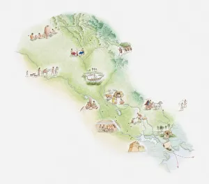
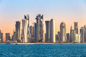
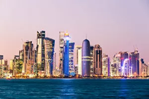
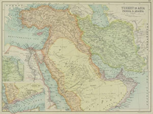
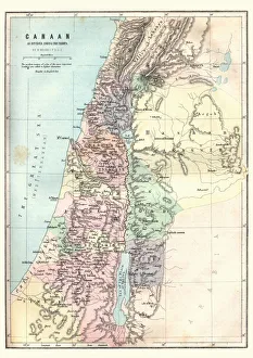
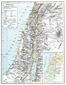
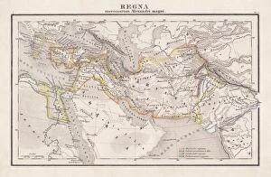
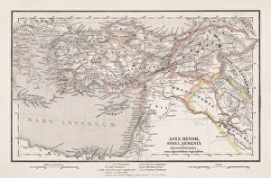
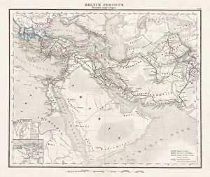
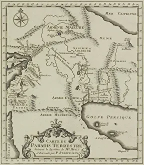
arabia, archival, asia, border, cartography, caspian sea, coordinates, document, geography, historic, historical, insets, iran, iraq, israel, jordan, latitude, legend, longitude, map, mediterranean

Background imageMiddle East Collection: antique, archival, art, crowd, de l europe, engravings, figure lxxl, french, historic

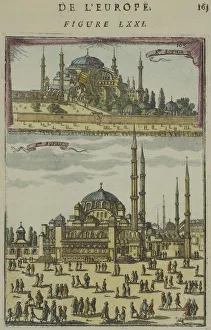
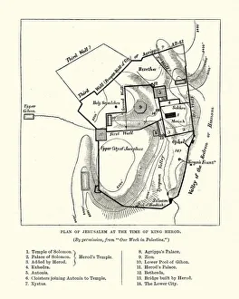
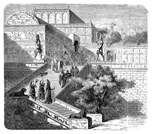
antique, archival, art, crowd, de l europe, engravings, figure lxxl, french, historic, historical, holy land, large group of people, middle east, plaza, print, public square, sophie, spires, temple

Background imageMiddle East Collection: antique, architecture, art, city, clouds, de la cite d acre, engraving, fortified

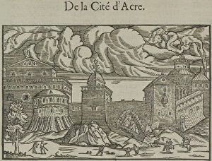
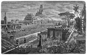
antique, architecture, art, city, clouds, de la cite d acre, engraving, fortified, fortress, french, historic, historical, holy land, large group of people, middle east, print, sky, temple, title

Background imageMiddle East Collection: Map showing the mountain ranges of Palestine

Map showing the mountain ranges of Palestine
Vintage engraving of Map showing the mountain ranges of Palestine, 19th Century

Background imageMiddle East Collection: Map of Canaan as divided amoung the tribes

Map of Canaan as divided amoung the tribes
Vintage engraving of a Map of Canaan as divided amoung the tribes

Background imageMiddle East Collection: Plan of Jerusalem at the Tine of King Herod

Plan of Jerusalem at the Tine of King Herod
Vintage engraving of a Plan of Jerusalem at the Tine of King Herod

Background imageMiddle East Collection: Capital from the Hathor temple in Dendera

Capital from the Hathor temple in Dendera
Illustration of a Capital from the Hathor temple in Dendera

Background imageMiddle East Collection: Egyptian God Thoth

Egyptian God Thoth
illustration of a Egyptian God Thoth

Background imageMiddle East Collection: Egyptian God Khnum

Egyptian God Khnum
illustration of a Egyptian God Khnum

Background imageMiddle East Collection: Egyptian God Ra

Egyptian God Ra
illustration of a Egyptian God Ra

Background imageMiddle East Collection: Egyptian God Horus

Egyptian God Horus
illustration of a Egyptian God Horus

Background imageMiddle East Collection: Egyptian God Tefnut

Egyptian God Tefnut
illustration of a Egyptian God Tefnut

Background imageMiddle East Collection: Royal palace of Assyria, Nineveh (reconstruction)

Royal palace of Assyria, Nineveh (reconstruction)
Illustration of a Royal palace of Assyria, Nineveh (reconstruction)

Background imageMiddle East Collection: Egyptian farm house

Egyptian farm house
Illustration of a Egyptian farm house

Background imageMiddle East Collection: Egyptian God Amun

Egyptian God Amun
illustration of a Egyptian God Amun, Amon, Amen

Background imageMiddle East Collection: Fall of Babylon by Cyrus II, 539 BC

Fall of Babylon by Cyrus II, 539 BC
Illustration of a Fall of Babylon by Cyrus II, 539 BC

Background imageMiddle East Collection: Map of Palestine

Map of Palestine
Illustration of a map of Palestine

Background imageMiddle East Collection: Old map of Africa 1856

Old map of Africa 1856
Colton and Fitchs Modern School Geography by George W. Fitch - New York 1856

Background imageMiddle East Collection: Antique map of Persia and the Middle East

Antique map of Persia and the Middle East

Background imageMiddle East Collection: Antique map of asia in late 19th Century

Antique map of asia in late 19th Century
Vintage Antique map of asia in late 19th Century

Background imageMiddle East Collection: Empire of Alexander the Great, hand-coloured steel engraving, published 1861

Empire of Alexander the Great, hand-coloured steel engraving, published 1861
Antique map from Empire of Alexander the Great 356 - 326 BC) after the battle of Ipsos (301 BC). Legend in Latin language. Steel engraving with hand colored borderlines, published in 1861

Background imageMiddle East Collection: Seleucid Empire, 3rd to 2nd century BC, published in 1861

Seleucid Empire, 3rd to 2nd century BC, published in 1861
The Seleucid Empire was created after the death of Alexander the Great and dominated the Near East from the 3rd to 2nd century BC. Legend in Latin language

Background imageMiddle East Collection: Persian Empire (c. 400 BC), steel engraving, pubolished in 1861

Persian Empire (c. 400 BC), steel engraving, pubolished in 1861
Antique map from the Persian Empire (around 400 BC) before the conquest of Alexander the Great (334/335 BC). Legend in Latin language. Steel engraving with hand colored borderlines, published in 1861

Background imageMiddle East Collection: Ancient Egyptian Chromolithograph 1895

Ancient Egyptian Chromolithograph 1895
Meyers Konversations-Lexikon. Ein Nachschlagewerk des allgemeinen Wissens, 5th edition 17 volumes Bibliographisches Institut - Leipzig 1895-1897

Background imageMiddle East Collection: Antique map of the Middle East

Antique map of the Middle East


All Professionally Made to Order for Quick Shipping