mail_outline sales@mediastorehouse.com
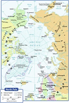
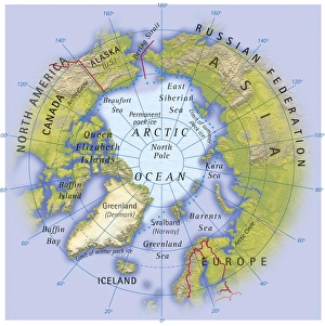
arctic ocean, cartography, map, no people, north pole, polar equal area projection, political map, arctic, Reference Maps, 102270272
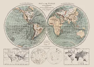
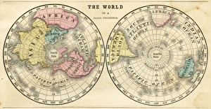
Map of the world 1869Cornells Grammars-School Geography - S.S. Cornell - New York D. Appleton and Company 1869
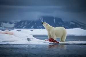
Arctic chillA polar bear looks up towards the sky to smell the air for other approaching bears that would want to take his seal carcass. Taken off the northern coast of the Svalbard Archipelago
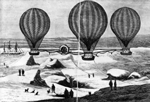
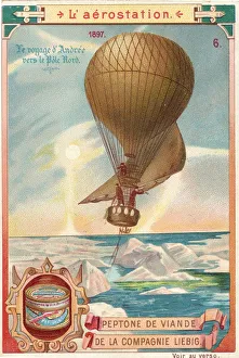
Andree ExpeditionJuly 1897: The ill-fated hot-air balloon expedition to the North Pole, attempted by Swedish explorer Salomon August Andree, Nils Strindberg and Knut Fraenkel in 1897
Digital illustration of map showing position of Arctic Ocean and surrounding continents
Santa with a signhttp://csaimages.com/images/istockprofile/csa_vector_dsp.jpg
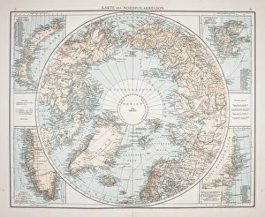
North Polar Chart 1895Meyers Konversations-Lexikon
Hot Air Balloon Andre Over North PoleIllustrated postcard depicting Swedish engineer Solomon Andrees hot air balloon voyage to the North Pole, July 1897. His remains were discovered three years later. (Kean Collection/Getty Images)
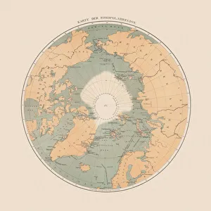
Ancient map of the Arctic Region, lithograph, published in 1883Ancient map of the Arctic Region. Lithograph, published in 1883
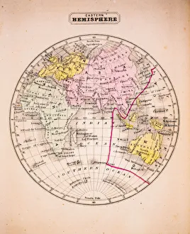
Eastern Hemisphere 1852 Map
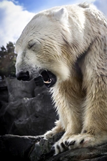
Tired Bear
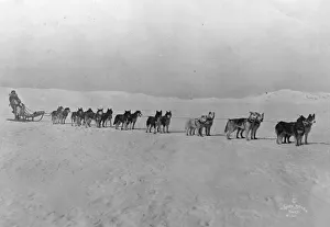
North Pole Huskies27th October 1920: Leionhard Seppala and his Siberian racers, the Inuit sled dogs of the North West, in the first photograph of Amundsens departure for the North Pole
nobody, antique, vintage, archival, cartography, geography, map, history, historical, north pole, south pole, continents, world, earth, north america, south america, europe, africa, asia, australia
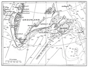
Antique illustration of Greenland and Iceland bathymetry map
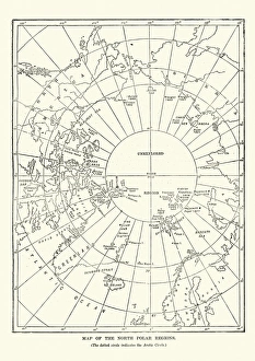
Victorian map of the North Polar RegionsVintage engraving showing a Victorian map of the North Polar Regions
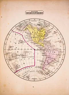
Western Hemisphere 1852 Map
Polar projection of the world map 1856Colton and Fitchs Modern School Geography by George W. Fitch - New York 1856
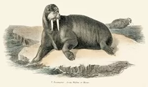
Walrus illustration 1803The Museum of Natural History - the Animal Kingdom (Mammalia) Published by William Mackenzie, 1803 - London
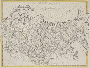
Antique map of Russia and Asiatica
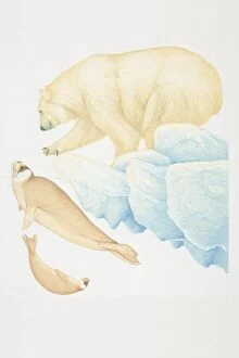
Polar Bear (ursus maritimus), extending out paw and crouching forward, side view
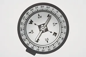
Marine compass
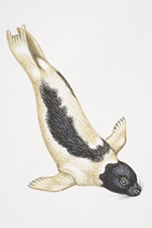
Harp Seal (Phoca groenlandica) diving
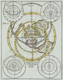
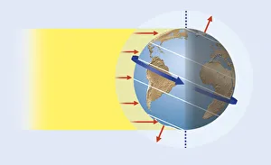
Illustration of suns rays reaching the Earth, creating the greatest heat in the tropics and impinging at oblique angle towards the poles (solar heating)
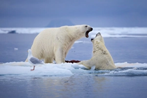
Rights for the IceTwo polar bears fight over a seal carcass in the Svalbard Archipelago
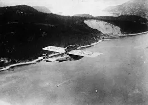
Arctic Aircraftcirca 1925: The Dornier-Wal N25 in which Norwegian explorer Roald Amundsen led an expedition to the North Pole in 1925. (Photo by General Photographic Agency/Getty Images)
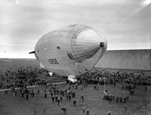
Moored ItaliaGeneral Umberto Nobiles ill-fated airship Italia, moored at Svalbard before an attempt to reach the North Pole. (Photo by Topical Press Agency/Getty Images)
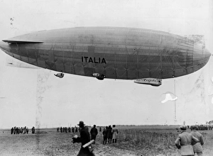
Airship NorgeThe airship Norge, piloted by Italian Umberto Nobile and commissioned by explorer Roald Amundsen for his failed attempt to reach the North Pole
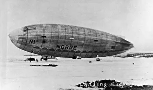
Great 20th Century ExplorersThe semi-rigid N-class airship Norge (Norwegian for Norway ), which was used by the Amundsen-Ellsworth-Nobile Expedition to fly over the North Pole, lands on a snowy field, Teller, Alaska, May 13
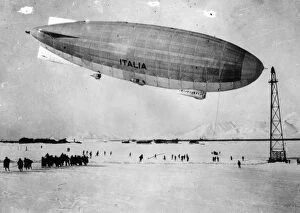
Great 20th Century ExplorersThe ill-fated semi-rigid N-class airship N1 (aka Italia ) makes a stopover at an airfield before continuing on with Italian general Umberto Nobiles second expedition to overfly the North Pole, Stolp