mail_outline sales@mediastorehouse.com
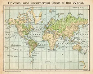
Commercial chart of the world map 1875The Independent Course Comprehensive Geography by James Monteith, A.S. Barnes & Co, New York & Chicago 1875
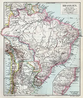
Brazil map 1895Meyers Konversations-Lexikon. Ein Nachschlagewerk des allgemeinen Wissens, 5th edition 17 volumes Bibliographisches Institut - Leipzig 1895-1897
Wroclaw city map 1895Meyers Konversations-Lexikon. Ein Nachschlagewerk des allgemeinen Wissens, 5th edition 17 volumes Bibliographisches Institut - Leipzig 1895-1897
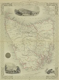
Antique map of Van Diemen Island off Australia with vignettes
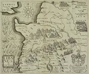
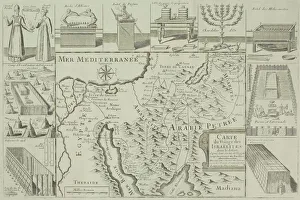
Antique map of holy land including Syria and Lebanon
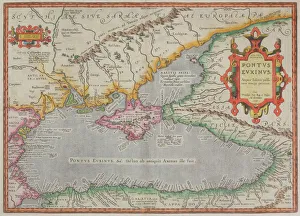
Antique map of the Black Sea and surrounding lands
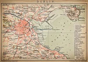
DublinAntique map of Dublin
SingaporeAntique illustration of a Republic of Singapore
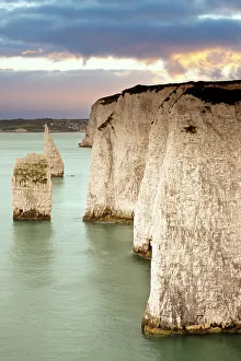
Cliffs at DorsetOld Harry chalk cliffs at Dorset
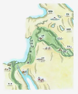
Illustration of strip of land known as the fertile crescent which stretched from Egypt through Canaan and Mesopotamia to Babylonia in the Old Testament
Timanfaya National Park, Lanzarote, SpainThe road from the Timanfaya National Park on Lanzarote going back towards Yaiza
Abandoned house in rural Iceland with a brilliant sunsetIceland
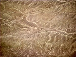
Nazca lines representing monkeyAerial view of Nazca lines representing monkey
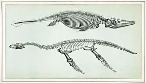
Ichthyosaurus and PlesiosaurusVintage engraving of an Ichthyosaurus and Plesiosaurus. The Ichthyosaurus is a genus of ichthyosaurs from the early Jurassic
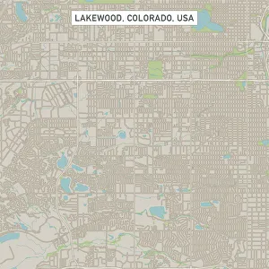
Lakewood Colorado US City Street MapVector Illustration of a City Street Map of Lakewood, Colorado, USA. Scale 1:60, 000. All source data is in the public domain. U.S
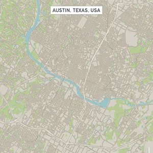
Austin Texas US City Street MapVector Illustration of a City Street Map of Austin, Texas, USA. Scale 1:60, 000. All source data is in the public domain. U.S
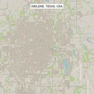
Abilene Texas US City Street MapVector Illustration of a City Street Map of Abilene, Texas, USA. Scale 1:60, 000. All source data is in the public domain. U.S
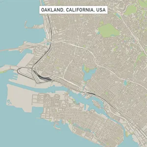
Oakland California US City Street MapVector Illustration of a City Street Map of Oakland, California, USA. Scale 1:60, 000. All source data is in the public domain. U.S
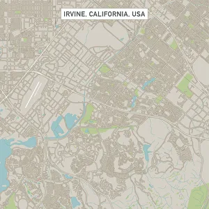
Irvine California US City Street MapVector Illustration of a City Street Map of Irvine, California, USA. Scale 1:60, 000. All source data is in the public domain. U.S
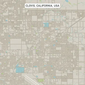
Clovis California US City Street MapVector Illustration of a City Street Map of Clovis, California, USA. Scale 1:60, 000. All source data is in the public domain. U.S
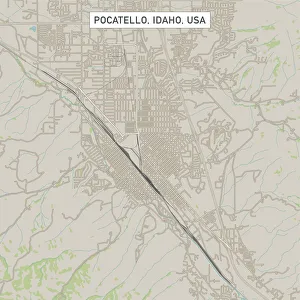
Pocatello Idaho US City Street MapVector Illustration of a City Street Map of Pocatello, Idaho, USA. Scale 1:60, 000. All source data is in the public domain. U.S
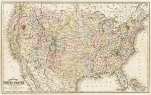
Map of United States 1867Mitchells Modern Atlas - Published by E.H. Buttler & Co - Philadelphia 1867
Antique map of Israel with vignettes
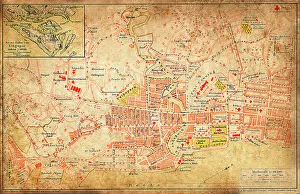
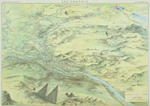
Antique engraving depicting birds eye view of Cairo
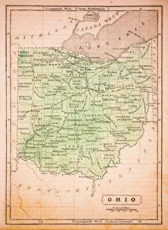
Ohio 1852 Map
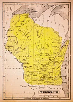
Wisconsin 1852 Map
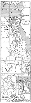
Antique map of Nile River
The Landscape of Zhangjiajie National Forest Park, Hunan, ChinaThe aerial view of Tianzi mountain area in Zhangjiajie National Forest Park
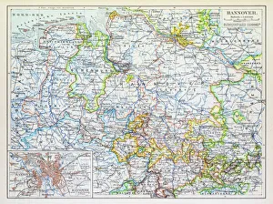
Map of Hannover 1895Map of Hannover, Germany
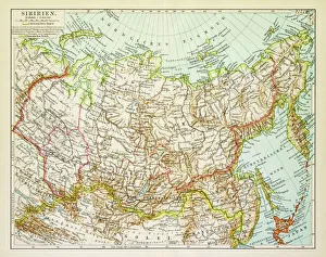
Map of Siberia 1895Map of Siberia
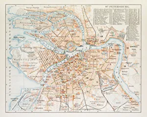
Map of St. Petersburg 1895Map of St. Petersburg, Russia
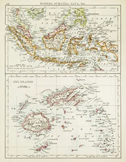
Map of Fiji Sumatra Borneo 1897Map of Fiji, Borneo, Sumatra, java
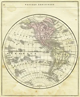
Western Hemisphere map 1856Colton and Fitchs Modern School Geography by George W. Fitch - New York 1856
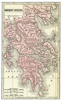
Ancient Greece map 1875The Independent Course Comprehensive Geography by James Monteith, A.S. Barnes & Co, New York & Chicago 1875
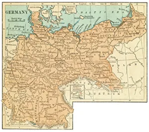
Germany map 1875The Independent Course Comprehensive Geography by James Monteith, A.S. Barnes & Co, New York & Chicago 1875
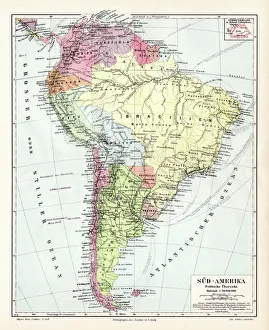
South America political map 1895Meyers Konversations-Lexikon. Ein Nachschlagewerk des allgemeinen Wissens, 5th edition 17 volumes Bibliographisches Institut - Leipzig 1895-1897
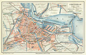
Amsterdam city map 1895Meyers Konversations-Lexikon. Ein Nachschlagewerk des allgemeinen Wissens, 5th edition 17 volumes Bibliographisches Institut - Leipzig 1895-1897
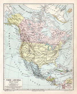
North America political map 1895Meyers Konversations-Lexikon. Ein Nachschlagewerk des allgemeinen Wissens, 5th edition 17 volumes Bibliographisches Institut - Leipzig 1895-1897
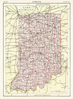
Indiana USA map 1881Encyclopedia Britannica 9th Edition Vol XII Philadelphia j.M. Stoddart & Co 1881
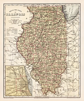
Illinois map 1881Encyclopedia Britannica 9th Edition Vol XII Philadelphia j.M. Stoddart & Co 1881
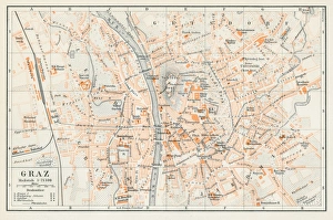
Graz Austria map 1895Encyclopedia Britannica 9th Edition Vol I New York, Samuel Hall 1878
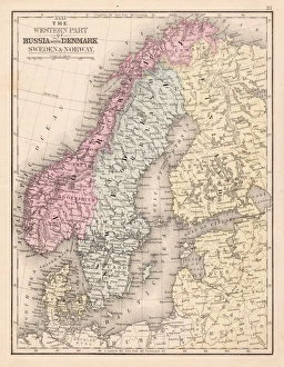
Denmark Sweden Norway map 1867Mitchellas Modern Atlas - Published by E.H. Butler and Co - Philadelphia 1867
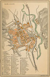
RAOEgenAntique map of RAOEgen
RomaniaAntique map of Romania
Map of KosiceAntique illustration of a map of Kosice
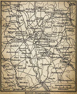
Potteries mapAntique illustration of a Potteries map
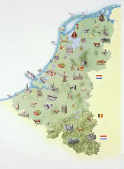
Netherlands, map showing distinguishing features and landmarks
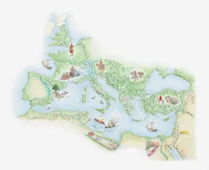
Illustrated map of Roman Empire, BC