mail_outline sales@mediastorehouse.com
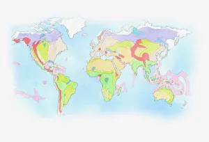
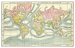
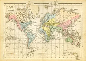
Illustration of Biomes (climatic variation) on world map
Sigiriya Rock, Sri Lanka (Unesco world heritage site)Ancient city of Sigiriya. The ruins of the capital built by King Kassapa I (5th century) lie on the steep slopes and at the summit of a granite peak standing some 180m high (the Lions Rock)
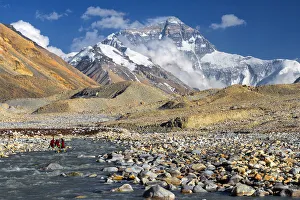
mt. Everest from Everest Base Camp, Tibet, China
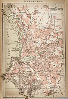
Map of Marseille 1898Antique illustration of Map of Marseille 1898
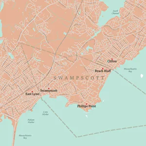
MA Essex Swampscott Vector Road Map. All source data is in the public domain. U.S. Census Bureau Census Tiger. Used Layers: areawater, linearwater, roads, rails, cousub, pointlm, uac10
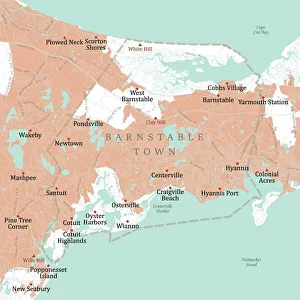
MA Barnstable Town Vector Road Map. All source data is in the public domain. U.S. Census Bureau Census Tiger. Used Layers: areawater, linearwater, roads, rails, cousub, pointlm, uac10
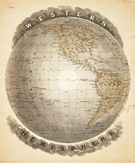
World western hemispheres 1883Warrens Common School Geography
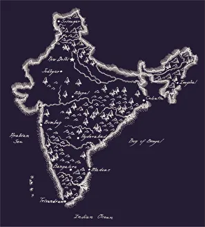
Antique India MapIndia Map, - Antique style. Includes mountains and water bodies. High detail - vector illustration
Ocean currents map 1875The Independent Course Comprehensive Geography by James Monteith, A.S. Barnes & Co, New York & Chicago 1875
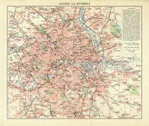
London and Environs Historical Map, Engraving, 1892Very rare, beautifully detailed engraving of London and Environs Historical Map, Engraving, Published in 1892. Original edition from my own archives. Copyright has expired on this artwork
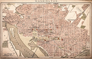
Map of Washington 1898Antique illustration of a Map of Washington 1898
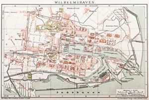
Wilhelmshaven. GermanyAntique illustration of a Wilhelmshaven, Germany map
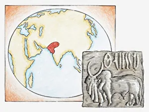
Illustration of map highlighting Indus Valley region and ancient tablet showing water buffalo
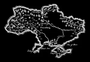
Antique Ukraine MapUkraine Map, - Antique style. Includes mountains and water bodies. High detail - vector illustration
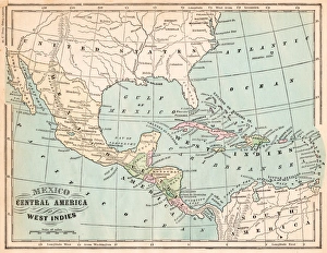
Mexico and West indies map 1875The Independent Course Comprehensive Geography by James Monteith, A.S. Barnes & Co, New York & Chicago 1875
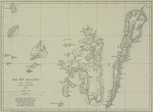
Antique map of the Key Islands
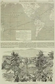
Page from the Illustrated London News with map
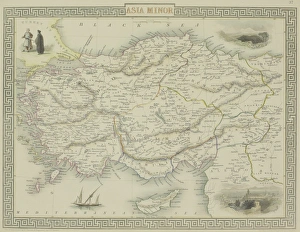
Antique map of Asia Minor
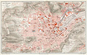
Stuttgart map 1895Meyers Konversations-Lexikon. Ein Nachschlagewerk des allgemeinen Wissens, 5th edition 17 volumes Bibliographisches Institut - Leipzig 1895-1897
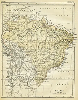
Map of Brazil 1878Encyclopedia Britannica 9th Edition Vol II New York, Samuel Hall 1878
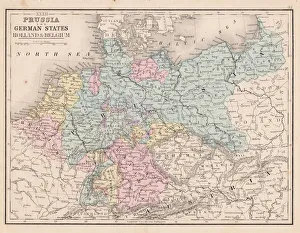
Prussia and german states map 1867Mitchellas Modern Atlas - Published by E.H. Butler and Co - Philadelphia 1867
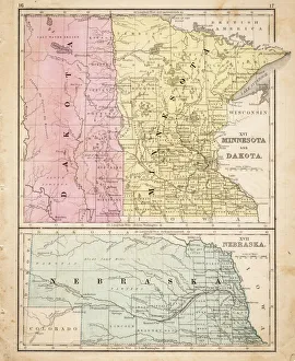
Dakota Missesota Nebraska map 1867Mitchellas Modern Atlas - Published by E.H. Butler and Co - Philadelphia 1867
St. Elias National ParkPark is included in an International Biosphere Reserve and is part of UNESCO World Heritage Site
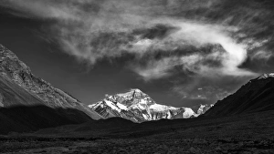
mt. Everest from Everest Base Camp, Tibet
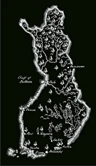
Antique Finland MapFinland Map, - Antique style. Includes mountains and water bodies. High detail - vector illustration
Antique photograph of horserace derby in Chicago
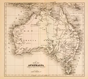
Map of Australia 1874Map of Australia
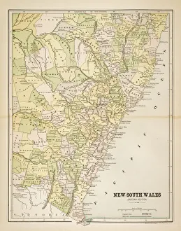
Map of New South Wales 1883Map of the state of New South Wales - Australia
world map 1882french map of the world showing the trajectories of travels and discovery around 1780 and 1822 - map is from 1882
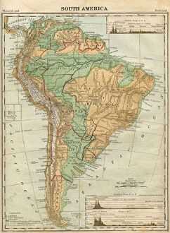
South America Map Illustration, Travel, Exploration, Antique 1871 IllustrationColor stock photo of an antique South America map illustration. Salvaged from an 1871 geography book
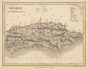
Hand coloured antique map of Sussex EnglandThis detailed map of Sussex is from Dugdales England and Wales Delineated. The map was drawn by G.Cole and engraved by John Roper for publication first in The Beauties Of England And Wales
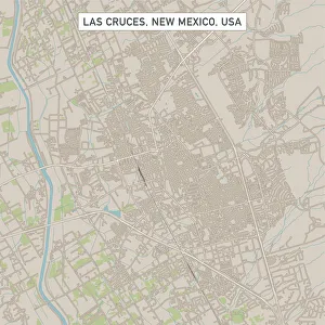
Las Cruces New Mexico US City Street MapVector Illustration of a City Street Map of Las Cruces, New Mexico, USA. Scale 1:60, 000. All source data is in the public domain. U.S
Roswell New Mexico US City Street MapVector Illustration of a City Street Map of Roswell, New Mexico, USA. Scale 1:60, 000. All source data is in the public domain. U.S
Westminster Colorado US City Street MapVector Illustration of a City Street Map of Westminster, Colorado, USA. Scale 1:60, 000. All source data is in the public domain. U.S
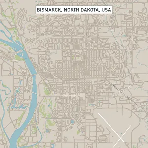
Bismarck North Dakota US City Street MapVector Illustration of a City Street Map of Bismarck, North Dakota, USA. Scale 1:60, 000. All source data is in the public domain. U.S
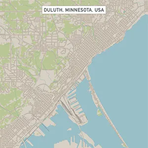
Duluth Minnesota US City Street MapVector Illustration of a City Street Map of Duluth, Minnesota, USA. Scale 1:60, 000. All source data is in the public domain. U.S
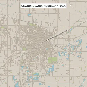
Grand Island Nebraska US City Street MapVector Illustration of a City Street Map of Grand Island, Nebraska, USA. Scale 1:60, 000. All source data is in the public domain. U.S
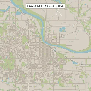
Lawrence Kansas US City Street MapVector Illustration of a City Street Map of Lawrence, Kansas, USA. Scale 1:60, 000. All source data is in the public domain. U.S
old map of central european old map form 1870, showing central europe countries
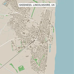
Skegness Lincolnshire UK City Street MapVector Illustration of a City Street Map of Skegness, Lincolnshire, UK. Included files are EPS (v10) and Hi-Res JPG. Data courtesy from Ordnance Survey: VectorMap District https
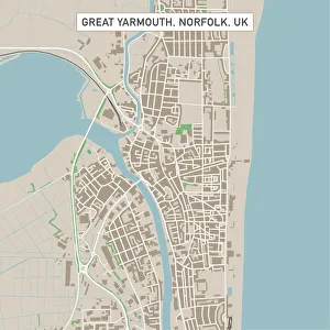
Great Yarmouth Norfolk UK City Street MapVector Illustration of a City Street Map of Great Yarmouth, Norfolk, UK. Included files are EPS (v10) and Hi-Res JPG. Data courtesy from Ordnance Survey: VectorMap District https
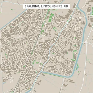
Spalding Lincolnshire UK City Street MapVector Illustration of a City Street Map of Spalding, Lincolnshire, UK. Included files are EPS (v10) and Hi-Res JPG. Data courtesy from Ordnance Survey: VectorMap District https
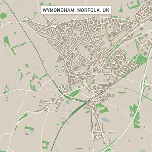
Wymondham Norfolk UK City Street MapVector Illustration of a City Street Map of Wymondham, Norfolk, UK. Included files are EPS (v10) and Hi-Res JPG. Data courtesy from Ordnance Survey: VectorMap District https
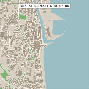
Gorleston-on-Sea Norfolk UK City Street MapVector Illustration of a City Street Map of Gorleston-on-Sea, Norfolk, UK. Included files are EPS (v10) and Hi-Res JPG. Data courtesy from Ordnance Survey: VectorMap District https
Wisbech Cambridgeshire UK City Street MapVector Illustration of a City Street Map of Wisbech, Cambridgeshire, UK. Included files are EPS (v10) and Hi-Res JPG. Data courtesy from Ordnance Survey: VectorMap District https