mail_outline sales@mediastorehouse.com
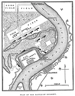
Battle of BelmontVintage engraving from 1863 of a map of the Battle of Belmont which was fought on November 7, 1861, in Mississippi County, Missouri. It was the first combat test in the American Civil War for Brig
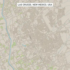
Las Cruces New Mexico US City Street MapVector Illustration of a City Street Map of Las Cruces, New Mexico, USA. Scale 1:60, 000. All source data is in the public domain. U.S
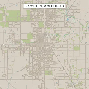
Roswell New Mexico US City Street MapVector Illustration of a City Street Map of Roswell, New Mexico, USA. Scale 1:60, 000. All source data is in the public domain. U.S
Westminster Colorado US City Street MapVector Illustration of a City Street Map of Westminster, Colorado, USA. Scale 1:60, 000. All source data is in the public domain. U.S
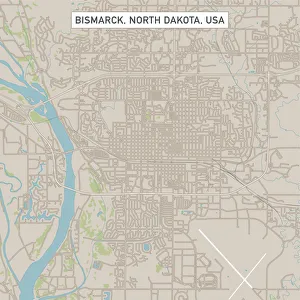
Bismarck North Dakota US City Street MapVector Illustration of a City Street Map of Bismarck, North Dakota, USA. Scale 1:60, 000. All source data is in the public domain. U.S
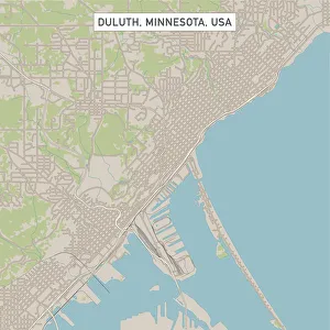
Duluth Minnesota US City Street MapVector Illustration of a City Street Map of Duluth, Minnesota, USA. Scale 1:60, 000. All source data is in the public domain. U.S
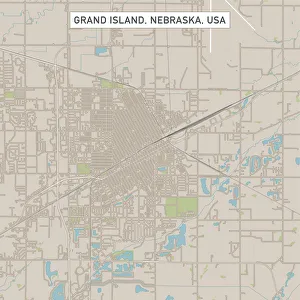
Grand Island Nebraska US City Street MapVector Illustration of a City Street Map of Grand Island, Nebraska, USA. Scale 1:60, 000. All source data is in the public domain. U.S
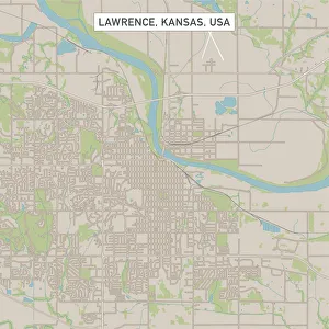
Lawrence Kansas US City Street MapVector Illustration of a City Street Map of Lawrence, Kansas, USA. Scale 1:60, 000. All source data is in the public domain. U.S
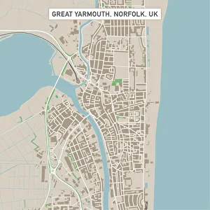
Great Yarmouth Norfolk UK City Street MapVector Illustration of a City Street Map of Great Yarmouth, Norfolk, UK. Included files are EPS (v10) and Hi-Res JPG. Data courtesy from Ordnance Survey: VectorMap District https
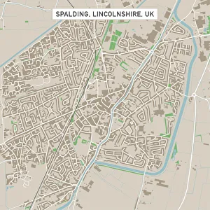
Spalding Lincolnshire UK City Street MapVector Illustration of a City Street Map of Spalding, Lincolnshire, UK. Included files are EPS (v10) and Hi-Res JPG. Data courtesy from Ordnance Survey: VectorMap District https
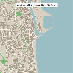
Gorleston-on-Sea Norfolk UK City Street MapVector Illustration of a City Street Map of Gorleston-on-Sea, Norfolk, UK. Included files are EPS (v10) and Hi-Res JPG. Data courtesy from Ordnance Survey: VectorMap District https
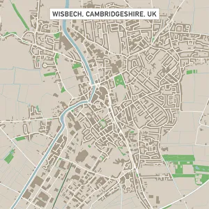
Wisbech Cambridgeshire UK City Street MapVector Illustration of a City Street Map of Wisbech, Cambridgeshire, UK. Included files are EPS (v10) and Hi-Res JPG. Data courtesy from Ordnance Survey: VectorMap District https
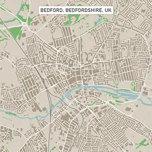
Bedford Bedfordshire UK City Street MapVector Illustration of a City Street Map of Bedford, Bedfordshire, UK. Included files are EPS (v10) and Hi-Res JPG. Data courtesy from Ordnance Survey: VectorMap District https
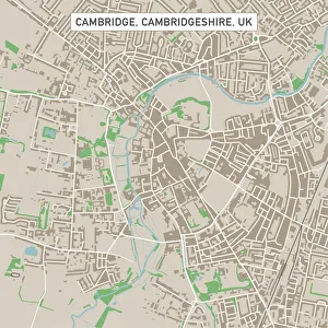
Cambridge Cambridgeshire UK City Street MapVector Illustration of a City Street Map of Cambridge, Cambridgeshire, UK. Included files are EPS (v10) and Hi-Res JPG. Data courtesy from Ordnance Survey: VectorMap District https
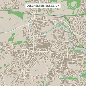
Colchester Essex UK City Street MapVector Illustration of a City Street Map of Colchester, Essex, UK. Included files are EPS (v10) and Hi-Res JPG. Data courtesy from Ordnance Survey: VectorMap District https
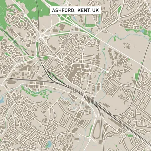
Ashford Kent UK City Street MapVector Illustration of a City Street Map of Ashford, Kent, UK. Included files are EPS (v10) and Hi-Res JPG. Data courtesy from Ordnance Survey: VectorMap District https
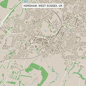
Horsham West Sussex UK City Street MapVector Illustration of a City Street Map of Horsham, West Sussex, UK. Included files are EPS (v10) and Hi-Res JPG. Data courtesy from Ordnance Survey: VectorMap District https
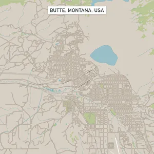
Butte Montana US City Street MapVector Illustration of a City Street Map of Butte, Montana, USA. Scale 1:60, 000. All source data is in the public domain. U.S
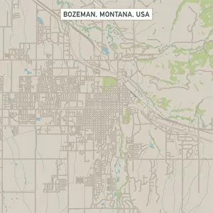
Bozeman Montana US City Street MapVector Illustration of a City Street Map of Bozeman, Montana, USA. Scale 1:60, 000. All source data is in the public domain. U.S
Gullfoss, IcelandView of Icelands iconic and well-known waterfall
Frosty Mossy Colorful Tree TrunkIn Scotland, between The River Garry and Loch Oich, near the Village of Invergarry is a magical unnamed magical mossy forest that looks like its right out of a fairytale
Sligachan River SunsetThe waxing crescent moon rises over the rushing River Sligachan, on the Isle of Skye, Scotland. The distant peaks, left - Beinn Dearg Mhor, middle - Marsco
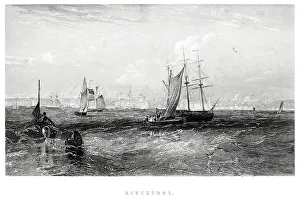
Liverpool from the Sea"Vintage engraving from 1880 of Liverpool a city and metropolitan borough of Merseyside, England, along the eastern side of the Mersey Estuary
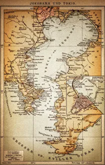
Yokohama and TokyoOld illustration map of Yokohama and Tokyo
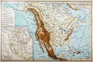
River and mountains map of North AmericaIllustration of a River and mountains map of North America
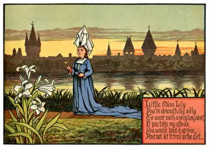
Little Miss Lily, You re Dreadfully Silly - Victorian nursery rhyme illustrationAn elaborately-dressed young medieval lady standing on the riverbank in a blue dress with a long flowing skirt. She is in danger of becoming bogged down in the mud
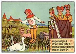
Gray goose and gander, Waft Your Wings Together - Victorian nursery rhyme illustrationA medieval princess and her ladies-in-waiting wish to cross the river, together with her luggage. Their pageboy summons a pair of passing geese
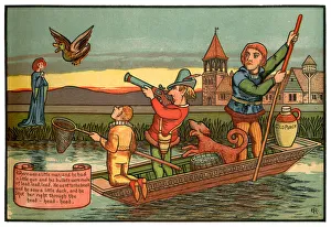
There Was a Little Man and He Had a Little Gun - Victorian nursery rhyme illustrationA man in a punt is aiming his blunderbuss at a flying duck, while a woman stands on the riverbank in line of fire, should the dog in the boat jog the mans arm
Majestic ├×j├│rs├í River Aerial, IcelandThe majestic ├×j├│rs├í is Icelands longest and second-most voluminous river. At 230 kilometres (143 miles) long, it runs through the south of the country
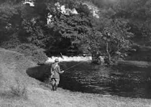
Fishing On Derwentcirca 1915: A man fishing in the River Derwent in the Forge Valley near Scarborough. (Photo by Hulton Archive/Getty Images)
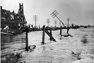
Great Mississippi Flood of 1927Army Corps of Engineers attend the the Great Mississippi Flood, the most destructive river flood in the history of the United States, 1927. (Photo by Fotosearch/Getty Images)
Budapest parliament building, HungaryThe Hungarian Parliament Building from the Danube in Budapest
Ancient, Antique, Beak, Bird, Bird Watching, Damaged, Distressed, Drake, Duck, Feather, Flying, Freshwater Bird, Grass, Greater Scaup Duck, Harlequin Duck, Illustration and Painting, Lithograph
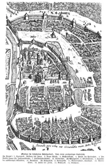
City of Moscow Russia 17th century map illustrationMoscow Russia 17th century Original edition from my own archives Source : Illustrierte Geschichte 1883
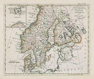
Antique map of Denmark, Norway, Sweden and FinlandWonderful hand coloured antique map, circa 1780 - 1800
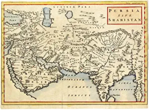
Antique map of Persia and Arabia 1730Original antique copper engraved map by H. Moll, titled Persia Sive Shahistana, published in 1747 for the Universal History (London, T. Osborne & J. Shipton, 8 vols. 1747)
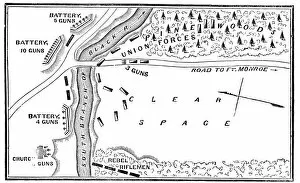
Battle of Big BethelVintage engraving from 1863 of a map of the Battle of Big Bethel also known as the Battle of Bethel Church or Great Bethel was an American Civil War battle that took place on June 10, 1861
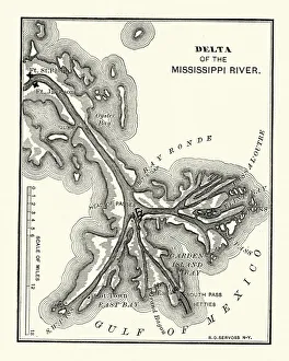
Map of the Delta of the Mississippi river, 19th CenturyVintage engraving of a Map of the Delta of the Mississippi river, 19th Century
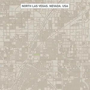
North Las Vegas Nevada US City Street MapVector Illustration of a City Street Map of North Las Vegas, Nevada, USA. Scale 1:60, 000. All source data is in the public domain. U.S
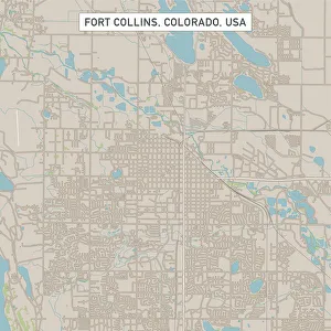
Fort Collins Colorado US City Street MapVector Illustration of a City Street Map of Fort Collins, Colorado, USA. Scale 1:60, 000. All source data is in the public domain. U.S
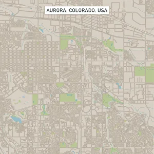
Aurora Colorado US City Street MapVector Illustration of a City Street Map of Aurora, Colorado, USA. Scale 1:60, 000. All source data is in the public domain. U.S
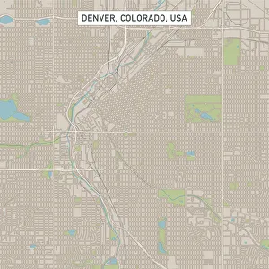
Denver Colorado US City Street MapVector Illustration of a City Street Map of Denver, Colorado, USA. Scale 1:60, 000. All source data is in the public domain. U.S
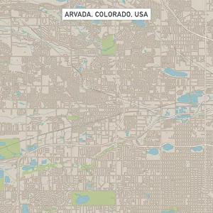
Arvada Colorado US City Street MapVector Illustration of a City Street Map of Arvada, Colorado, USA. Scale 1:60, 000. All source data is in the public domain. U.S
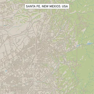
Santa Fe New Mexico US City Street MapVector Illustration of a City Street Map of Santa Fe, New Mexico, USA. Scale 1:60, 000. All source data is in the public domain. U.S
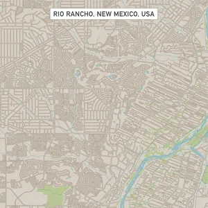
Rio Rancho New Mexico US City Street MapVector Illustration of a City Street Map of Rio Rancho, New Mexico, USA. Scale 1:60, 000. All source data is in the public domain. U.S
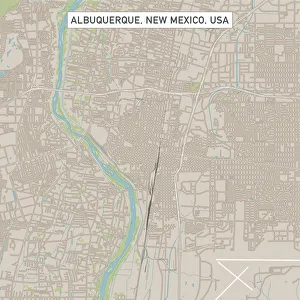
Albuquerque New Mexico US City Street MapVector Illustration of a City Street Map of Albuquerque, New Mexico, USA. Scale 1:60, 000. All source data is in the public domain. U.S
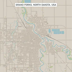
Grand Forks North Dakota US City Street MapVector Illustration of a City Street Map of Grand Forks, North Dakota, USA. Scale 1:60, 000. All source data is in the public domain. U.S
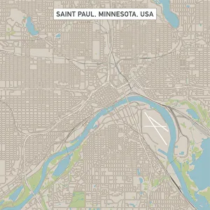
Saint Paul Minnesota US City Street MapVector Illustration of a City Street Map of Saint Paul, Minnesota, USA. Scale 1:60, 000. All source data is in the public domain. U.S