mail_outline sales@mediastorehouse.com
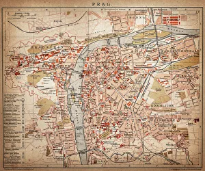
PragueAntique map of Prague from 1898
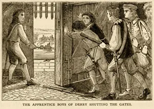
The apprentice boys of Derry shutting the gatesSome of the thirteen apprentice boys of Derry (also known as Londonderry) who shut the gates of the Protestant Irish city against a Jacobite (Catholic) army who then laid siege in 1688-89
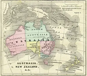
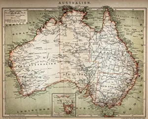
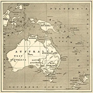
Map of Australia and New Zealand 1856Colton and Fitchs Modern School Geography by George W. Fitch - New York 1856
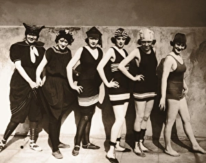
Group of young women wearing bathing suits, portrait (B&W sepia)Bathing suits reflect different eras from Victorian to 1930 s. archival image
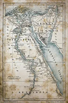
Map of EgyptIllustration of a Map of Egypt
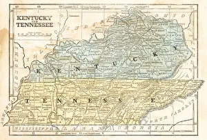
Map of Kentucky and Tennessee 1855System of Geography for the use of schools by Sidney E. Morse - Published by Harper & Brothers - New York 1855
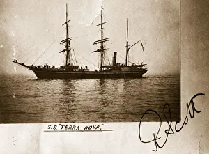
SS Terra Nova11th February 1913: A photgraph of the SS Terra Nova used by Captain Robert Falcon Scott on his ill-fated Antarctic expedtion to the South Pole, and signed by him
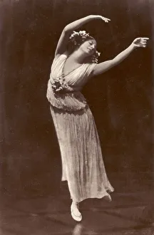
Russian Ballet Dancer Anna PavlovaRussian Ballet dancer Anna Pavlova (1882 - 1931), regarded as the prima ballerina of her era, wearing a pleated dress without a corset for complete freedom of movement
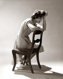
Depressed Sad Moody Woman Leaning Head Onto Arm Slouched Lean Back Of Chair Seated Depression StressUNITED STATES - Circa 1960s: Depressed Sad Moody Woman Leaning Head Onto Arm Slouched Lean Back Of Chair Seated Depression Stress
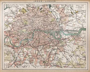
Historic map of London (18th Century)map/plan of the inner city of London from 1898
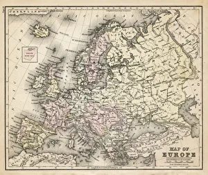
old map of european old map form 1883, showing european countries
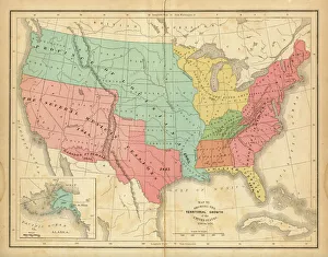
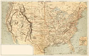
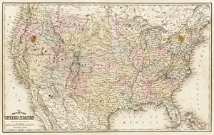
Map of United States 1876Map of United States showing the territorial growth between 1780 and 1876
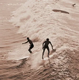
Men surfing wavesUNITED STATES - CIRCA 1960s: Silhouette of two men surfing small waves. (Photo by H. Armstrong Roberts/Retrofile/Getty Images)
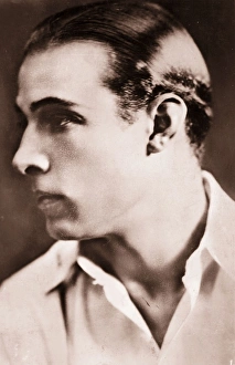
Rudolph Valentinocirca 1924: Rudolph Valentino (1895 - 1926) the screen name of Rodolpho d Antonguolla, the Italian-American leading man and great romantic idol. (Photo by Hulton Archive/Getty Images)
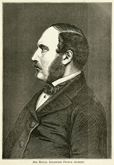
Prince Albert, consort of Queen VictoriaPrince Albert of Saxe-Coburg and Gotha, husband and Prince Consort of Queen Victoria (26 August 1819 - 14 December 1861). From " Albert The Good; Scenes in the Life of The Prince Consort"
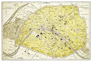
Map of Paris 1894map/plan of the city of Paris, France
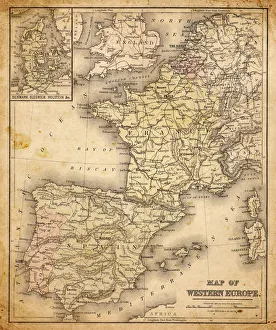
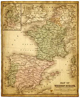
western europe map 1883a map of Western europe from 1883
western europe 1867a map of Western europe from 1867, overlay with grunge burnt texture paper
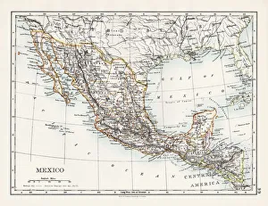
Mexico map 1897The World-Wide Atlas of Modern Geography, Political and Physical W. & A.K. Johnston - London 1897
Map of United States 1869Cornells Grammars-School Geography - S.S. Cornell - New York D. Appleton and Company 1869
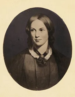
Charlotte Brontecirca 1840: English novelist Charlotte Bronte (1816 - 1855). Original Artwork: Portrait by Thompson. (Photo by Rischgitz/Getty Images)
Map of United States 1867Mitchells Modern Atlas - Published by E.H. Buttler & Co - Philadelphia 1867
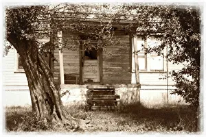
Abandoned Farmhouse in Rural Washington StateLooking past gnarled trees towards the porch and front door of an abandoned farmhouse in rural Washington State, with a faded border
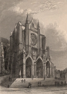
Chartres CathedralThe south transept of Notre Dame Cathedral in Chartres, built in the late 12th and early 13th century in the Gothic style. The rose window depicts the Apocalypse
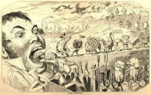
Man thinking of the food he will eat at ChristmasA gluttonous man thinking about the food and drink he will consume at Christmas! From " The Comic Almanack for 1839: An Ephemeris in Jest and Earnest
old map of central european old map form 1870, showing central europe countries
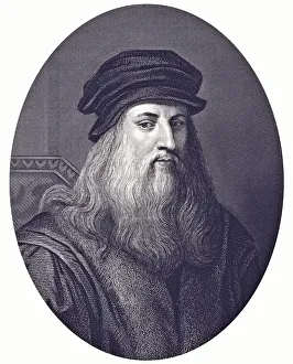
Black and white print portrait of Leonardo da VinciLeonardo da Vinci
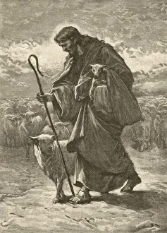
Good ShepherdJesus Christ - The Good Shepherd - tending his metaphorical flock. From " The Childrens Friend - A Monthly Magazine for Boys & Girls" - bound volume XXXIX, Jan-Dec 1899; published by S.W
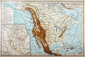
River and mountains map of North AmericaIllustration of a River and mountains map of North America
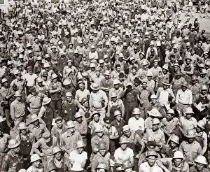
Aerial Of Large Group Of Men Tva Construction Workers Wearing Hard HatsUNITED STATES - Circa 1930s: Aerial Of Large Group Of Men Tva Construction Workers Wearing Hard Hats
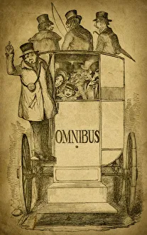
People on a horse drawn omnibus (1843 engraving)The conductor, the driver and a press of passengers aboard a horse drawn omnibus. Woodcut engraving in sepia on aged paper
Map of Australasia (1898 engraving)Old map of Australasia from 1898
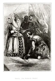
Queen Elizabeth I knighting Sir Francis Drake (1859 engraving)Sir Francis Drake being knighted by Queen Elizabeth I of England in 1581. An engraving from The Heroes of England: Stories of the Lives of Englands Warriors by Land and Sea edited by John G
Map of Australasia (1882 engraving)Old map of Australasia from Royal Geographical Readers no. 5 of Asia, Africa, America and Oceania, publ. T Nelson & Sons, London in 1883
map of new york city 1874very old map showing new york city, new jersey, and hoboken) 1874 - composite with grunge sepia paper
europe map 1829an old map form 1829, showing the whole europe
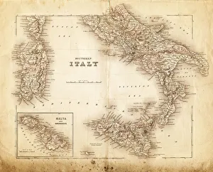
map of italy 1855an old map of southern italy (inset showing malta) - 1855
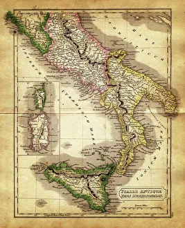
map of italy during the Roman Empiremap of antique italy during the Roman Empire, Meridional parts - Sardinia, Corsica and Sicily
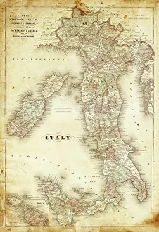
map of italy 1863an old map of italy - 1863
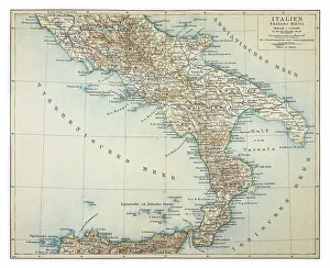
Map of southern Italy 1895
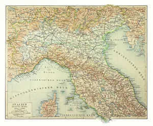
Map of northern Italy 1895
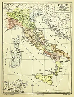
Map of Italy 1895
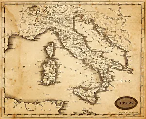
map of italy 1812an old map of italy - 1812
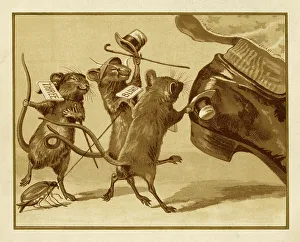
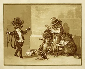
They all ran after the farmer's wife"Three blind mice, Three blind mice, See how they run, See how they run, They all ran after the farmer's wife..." from the nursery rhyme as depicted in "The Diverting History of
Three blind mice painting, sepia"Three blind mice, Three blind mice, See how they run, See how they run, They all ran after the farmer's wife, She cut off their tails with a carving knife
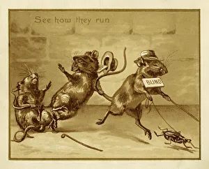
See how they run"Three blind mice, Three blind mice, See how they run, See how they run..." from the nursery rhyme as depicted in "The Diverting History of Three Blind Mice" illustrated by Edmund
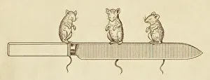
Three blind mice with a carving knifeThree blind mice sitting on a carving knife. Are they mad? From the nursery rhyme as depicted in "The Diverting History of Three Blind Mice" illustrated by Edmund G Caldwell
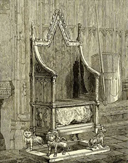
Coronation Chair with the Stone of SconeThe ancient Coronation Chair in Westminster Abbey, London, containing the Stone of Scone. The Chair was made for King Edward I to hold the Stone of Scone which he brought from Scotland in 1296