mail_outline sales@mediastorehouse.com
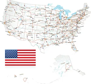
Highly detailed USA Road MapHighly detailed map of United States with roads, states, big cities, rivers and some other objects
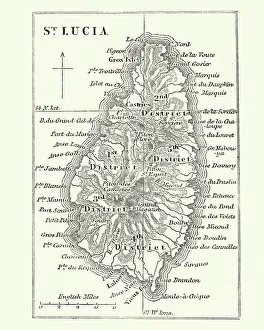
Map of Saint Lucia, 19th CenturyVintage engraving of Map of Saint Lucia, 19th Century
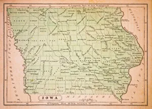
Iowa 1852 Map
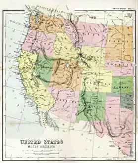
Antique Map of Western USAAntique Map from 1867 of Western United States of America
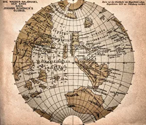
World map from 1520Western hemisphere of the Johannes SchAoner globe from 1520. expedition
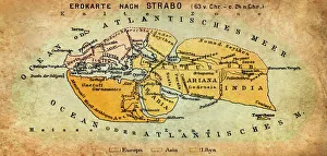
Map of the world according to Strabo 63 B.C
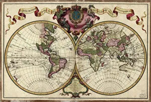
Map of the world, 1720(Original Caption) 18th century map of the world. Published in Paris in 1720, this French map shows the known world, including the new lands that had been discovered in the preceding centuries by
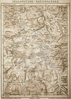
Map of Yellowstone National Park, USA
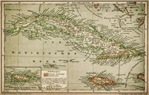
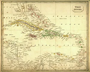
Caribbean mapAntique map of Cuba, Jamaica, Puerto Rico
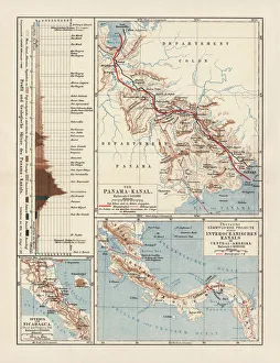
Panama Canal Project, lithograph, published in 1880Ancient map of the Panama Canal Project. Lithograph, published in 1880
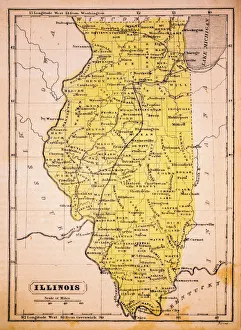
Illinois 1852 Map
Beach PartyA group of surfers on a beach with a Ford Mustang car
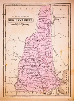
New Hampshire 1852 Map
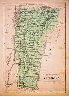
Vermont 1852 Map
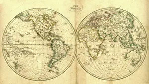
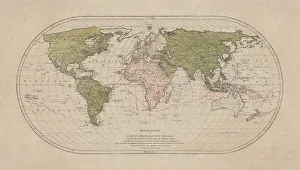
Vintage Map of the WorldVintage map of the world from 1837
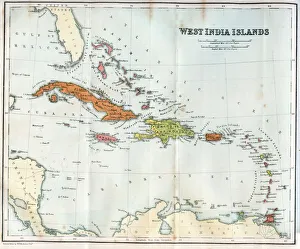
Vintage map of the West India Islands 1860s
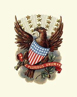
Coat of Arms of USA, 1898
World map by Mathieu Albert Lotter, Augsburg, 1778World map from 1778. Original hand-colored copper engraving by Matthieu Albert Lotter (1741 - 1810, Augsburg) with route of James Cooks First Circumnavigation (1770), through Tahiti
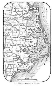
Map of Pamlico and Albemarle SoundsVintage engraving from 1863 of a map of Map of Pamlico and Albemarle Sounds at the time of the American Civil War
Llama overlooking ruins of the ancient city of Machu Picchu, PeruThe Inca citadel in the Andes Mountains and the river valley below
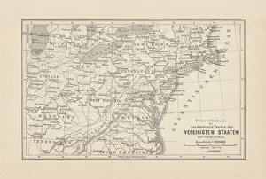
Map of Northeast United States, published in 1882Map of the Northeast United States of America. Wood engraving, published in 1882
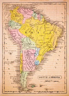
South America 1852 Map
Antquie Map of The West IndiesVintage map of The West Indies from 1837
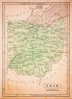
Ohio 1852 Map
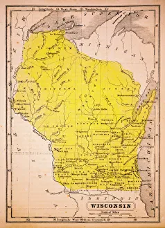
Wisconsin 1852 Map
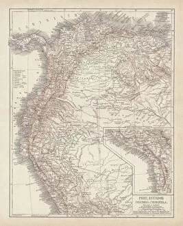
Peru, Ecuador, Colombia, Venezuela, lithograph, published in 1877Ancient map of Peru, Ecuador, Colombia, and Venezuela. Lithograph, published in 1877
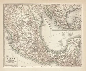
Mexico, ancient map, lithograph, published in 1877Ancient map of Mexico. Lithograph, published in 1877
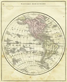
Western Hemisphere map 1856Colton and Fitchs Modern School Geography by George W. Fitch - New York 1856
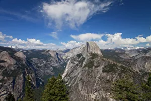
Half Dome Seen From Glacier Point
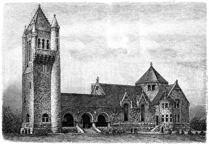
Crematorium in Troy in New York State
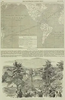
Page from the Illustrated London News with map
World mapthe dissemination of human races by Muller and Peschel
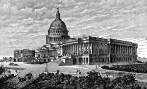
The Capitol Washington
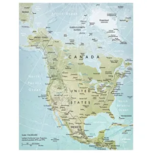
North America mapVector illustration of a detailed map of North America. Reference map was created by the US Central Intelligence Agency and is available as a public domain map at the University of Texas Libraries
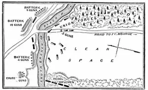
Battle of Big BethelVintage engraving from 1863 of a map of the Battle of Big Bethel also known as the Battle of Bethel Church or Great Bethel was an American Civil War battle that took place on June 10, 1861
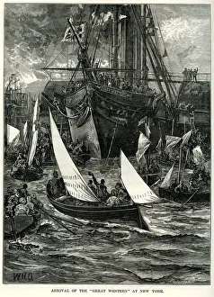
SS Great Western at New YorkVintage engraving showing the arrival of the SS Great Western at New York. SS Great Western of 1838, was an oak-hulled paddle-wheel steamship; the first purpose-built for crossing the Atlantic
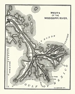
Map of the Delta of the Mississippi river, 19th CenturyVintage engraving of a Map of the Delta of the Mississippi river, 19th Century
Antique illustration of 31 december 1861 eclipse map
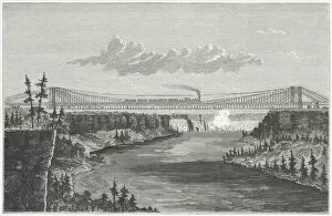
Niagara Falls Suspension Bridge, built 1851-1855, wood engraving, published 1872Niagara Falls Suspension Bridge, built in 1851 to 1855 by John August Roebling (German-American architect, 1806 - 1869). The bridge was replaced in 1896 by the current Whirlpool Rapids Bridge
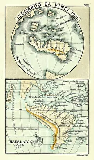
Antique Map by Leonardo Da Vinci 1515 and the Hauslab Globe
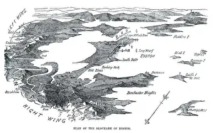
Blockade of BostonVintage engraving from 1861 showing the Plan of the Blockade of Boston during the American Revolutionary War
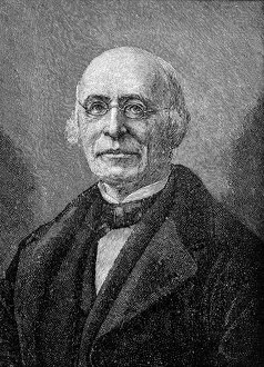
WM. lloyd GarrisonWilliam Lloyd Garrison (December 12, 1805 - May 24, 1879) was a prominent American abolitionist, journalist, suffragist, and social reformer
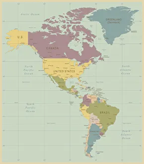
Vintage Map of North and South America534055040
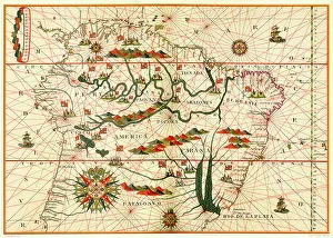
Map of South America, from a Spanish Atlas, 1582
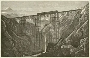
Viaduct of the Lima Oroya Railway (Peru), published in 1872Viaduct of the Lima Oroya Railway (Peru), built by the German architect Albert Fink (1827-1897). Woodcut engraving, published in 1872
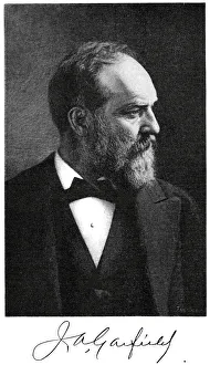
James A. Garfield" Vintage engraving from 1881 showing James A. Garfield the 20th President of the United States, serving from March 4, 1881 until his death on September 19, 1881, a mere 200 days in office
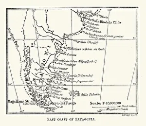
Antique Map of the East Coast of Patagonia in the 16th Century
Vintage photo frame 1900Photo Greeting Card 1900 s