mail_outline sales@mediastorehouse.com
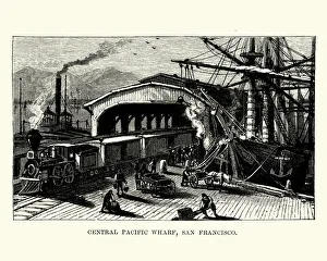
Central Pacific Wharf, San Francisco, 19th CenturyVintage engraving of Central Pacific Wharf, San Francisco, 19th Century
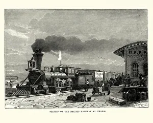
Steam train, station of Pacific Railway at Omaha, 19th CenturyVintage engraving of a station of the Pacific Railway at Omaha, 19th Century
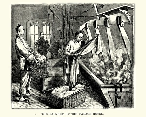
Chinese workers doing laundry in the the Palace hotelVintage engraving of chinese workers doing laundry in the the Palace hotel, San Francisco, 19th Century
Tobacco smoker in 17th Centuryillustration of a Tobacco smoker in 17th Century
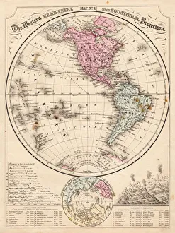
Western Hemisphere map 1867Mitchells Modern Atlas - Published by E.H. Buttler & Co - Philadelphia 1867
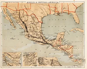
Mexico and Central America map 1869Cornells Grammars-School Geography - S.S. Cornell - New York D. Appleton and Company 1869
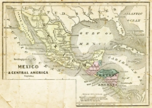
Mexico and Central America map 1856Colton and Fitchs Modern School Geography by George W. Fitch - New York 1856
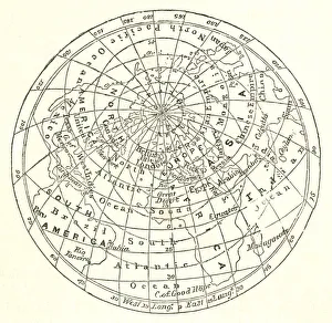
Victorian map of the Arctic CircleA Victorian map of the Arctic Circle and beyond. From Peter Parleyas Annual - A Christmas and New Yearas Present for Young Peoplea published in London by Darton & Co in 1851
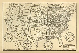
Engraved Chart of United States Time Zones, Circa 1883Beautifully Illustrated Antique Engraved Victorian Illustration of an Engraved Chart of United States Time Zones and Standard Railway Time, Circa 1883. Original edition from my own archives
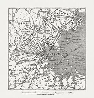
Boston, Massachusetts, USA, wood engraving, published in 1882Map of Boston, Massachusetts, USA. Wood engraving, published in 1882
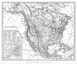
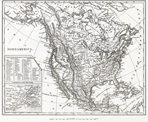
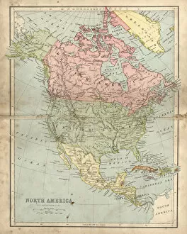
Map of North AmericaEngraved illustrations of a Map of North America from Iconographic Encyclopedia of Science, Literature and Art, Published in 1851. Copyright has expired on this artwork. Digitally restored
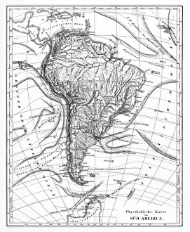
Victorian Map of North AmericaEngraved illustrations of the Physical Map of South America from Iconographic Encyclopedia of Science, Literature and Art, Published in 1851. Copyright has expired on this artwork. Digitally restored
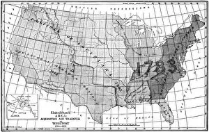
United States area: Acquisition and transfer of territory 1780 to 1870United States area: Acquisition and transfer of territory 1780 to1870
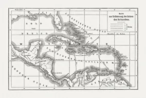
Voyages of Christopher Columbus, wood engraving, published c. 1882Map with the routes of the four voyages of Christopher Columbus in the Caribbean Sea. Wood engraving, published c. 1882
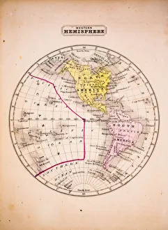
Western Hemisphere 1852 Map
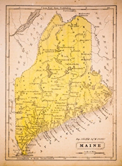
Maine 1852 Map
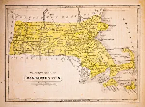
Massachusetts 1852 Map
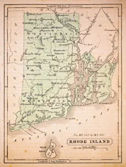
Rhode Island 1852 Map
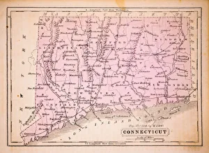
Connecticut 1852 Map
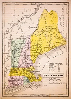
New England 1852 Map
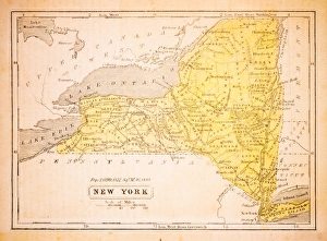
New York 1852 Map
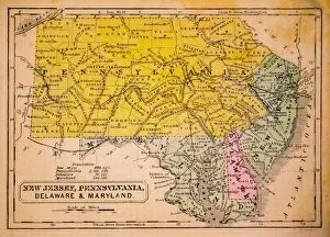
New Jersey, Pennsylvania, Delaware and Maryland 1852 Map
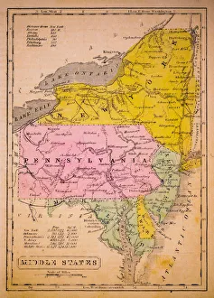
Middle States 1852 Map
Southern States 1852 Map
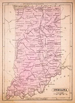
Indiana 1852 Map
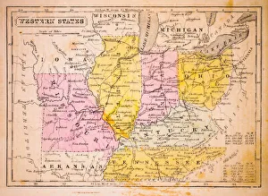
Western States 1852 Map
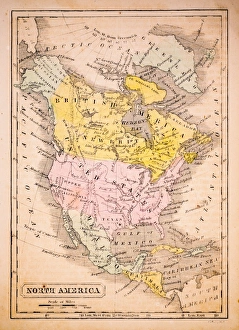
North America 1852 Map
United States 1852 Map
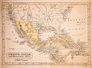
Mexico, Texas, Guatimala and West Indies 1852 Map
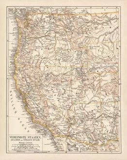
United States of America, West Coast, ithograph, published in 1878United States of America, States on the Pacific Ocean. Lithograph, published in 1878
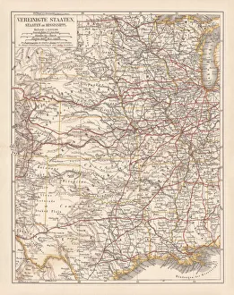
United States of America, States on Mississippi river, lithograph published 1878United States of America, States on the Mississippi river. Lithograph, published in 1878
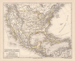
United States of America, Mexico and Central America, published in 1878United States of America, Mexico and Central America. Lithograph, published in 1878
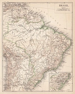
Map of Brazil. Lithograph, lithograph, published in 1874Antique map of Brazil. Lithograph, published in 1874
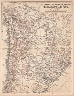
Argentina, Bolivia, Chile, Paraguay and Uruguay, lithograph, published in 1874South American countries: Argentina, Bolivia, Chile, Paraguay and Uruguay. Lithograph, published in 1874
North America 1850 EngravingEngraved illustrations of the Physical Map of North America from Iconographic Encyclopedia of Science, Literature and Art, Published in 1851. Copyright has expired on this artwork. Digitally restored
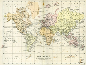
Antique Map of the WorldVintage map of the World from 1884
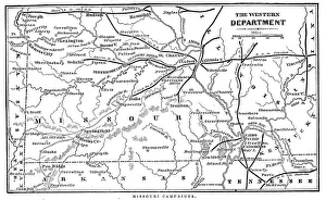
Missouri CampaignsVintage engraving from 1863 of a map of the Missouri Campaigns from the time of the American Civil War
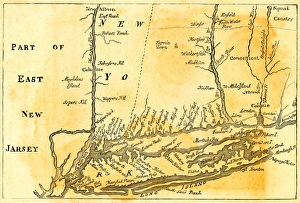
Vintage Map of New York at the beginning of the 18th Century. from 1880
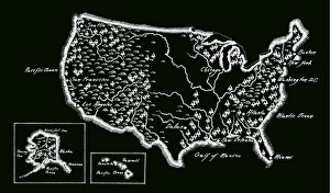
Antique USA MapUSA Map, - Antique style. Includes mountains and water bodies. - vector illustration
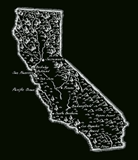
Antique CaliforniaCalifornia Map, - Antique style. Includes mountains and water bodies. High detail - vector illustration
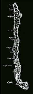
Antique ChileChile Map, - Antique style. Includes mountains and water bodies. High detail - vector illustration
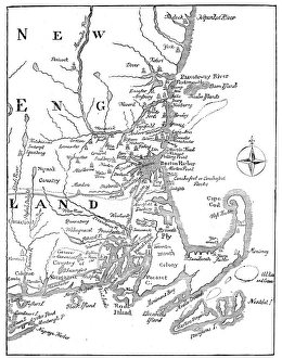
Vintage Map of New England at the beginning of the 18th century
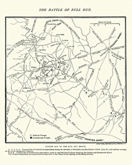
Map of the Battle of Bull RunVintage engraving of a Map of the Battle of Bull Run, The Century Magazine, 1884
Antique damaged map of North America in the 19th CenturyVintage engraving of a Antique map of North America in the 19th Century, 1873
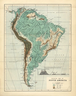
South America Physical Map, Engraving, 1892Very rare, beautifully detailed engraving of South America Physical Map, Engraving, Published in 1892. Original edition from my own archives. Copyright has expired on this artwork. Digitally restored
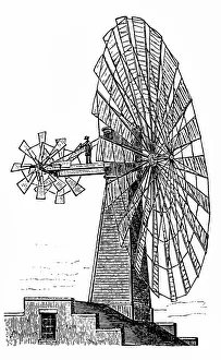
Wind motorlarge wind motor with an auxiliary wheels
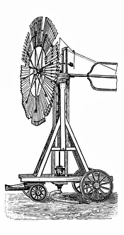
Wheeled Wind motorlarge Wheeled Wind motor