mail_outline sales@mediastorehouse.com
Choose a picture from our Images Dated 11th July 2018 Collection for your Wall Art and Photo Gifts
121 items
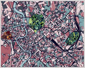
art illustration map of Roma city
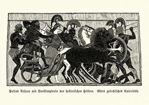
Ancient Greek Mythology, Athena goddess of wisdom and warfareVintage engraving of Athena the ancient Greek goddess of wisdom, handicraft, and warfare, who was later syncretized with the Roman goddess Minerva
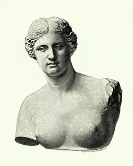
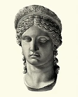
Aphrodite of Milos, Venus de MiloVintage engraving of Aphrodite of Milos better known as the Venus de Milo, is an ancient Greek statue and one of the most famous works of ancient Greek sculpture
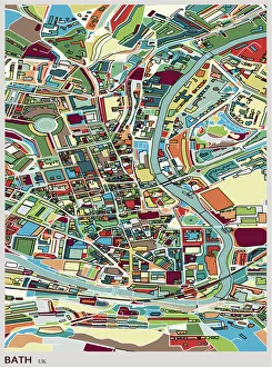
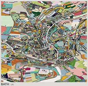
Bath city of England art mapBath city of world cultural heritage
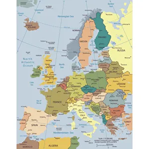
Political map of EuropeVector illustration of the policital map of Europe Reference map was created by the US Central Intelligence Agency and is available as a public domain map at the University of Texas Libraries
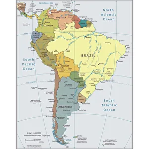
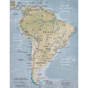
Political map of South AmericaVector illustration of the political map of South America Reference map was created by the US Central Intelligence Agency
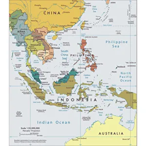
Political map of South East AsiaVector illustration of the political map of South East Asia Reference map was created by the US Central Intelligence Agency
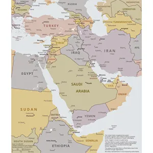
Political map of The Middle EastVector illustration of the policital map of The Middle East Reference map was created by the US Central Intelligence Agency
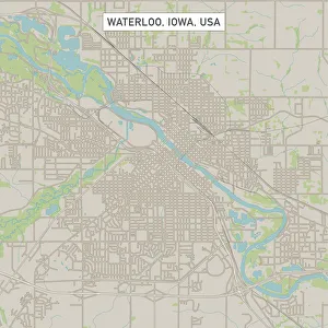
Waterloo Iowa US City Street MapVector Illustration of a City Street Map of Waterloo, Iowa, USA. Scale 1:60, 000. All source data is in the public domain. U.S
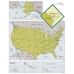
Map of the United States of America with states and major citiesVector illustration of a map of the United States of America with states and major cities Reference map was created by the US Central Intelligence Agency
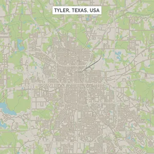
Tyler Texas US City Street MapVector Illustration of a City Street Map of Tyler, Texas, USA. Scale 1:60, 000. All source data is in the public domain. U.S
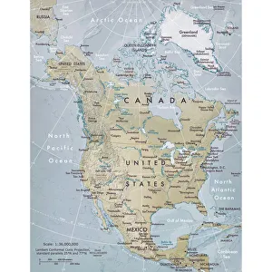
Physical map of North AmericaVector illustration of the physical map of North America Reference map was created by the US Central Intelligence Agency and is available as a public domain map at the University of Texas Libraries
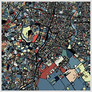
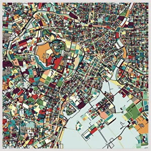
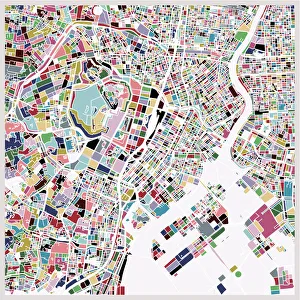
colorful Tokyo art map background
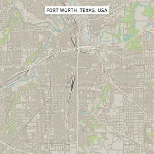
Fort Worth Texas US City Street MapVector Illustration of a City Street Map of Fort Worth, Texas, USA. Scale 1:60, 000. All source data is in the public domain. U.S
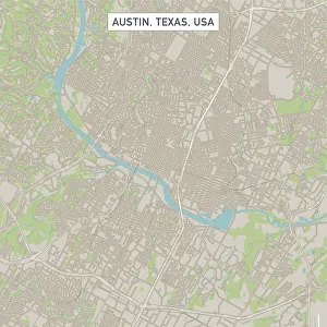
Austin Texas US City Street MapVector Illustration of a City Street Map of Austin, Texas, USA. Scale 1:60, 000. All source data is in the public domain. U.S
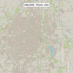
Abilene Texas US City Street MapVector Illustration of a City Street Map of Abilene, Texas, USA. Scale 1:60, 000. All source data is in the public domain. U.S
Arctiinae (tiger moths), lithograph, published around 1895Arctiinae (tiger moths): 1) Purple Tiger (Diacrisia purpurata), male caterpillar (1a), female caterpillar (1b), pupa (1c), male moth (1d)
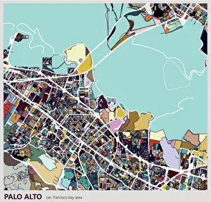
digital art map background, Palo alto city
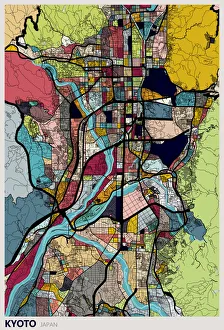
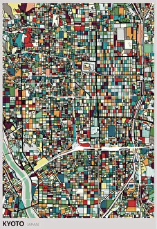
Illustration style Kyoto city mapKyoto city of world cultural heritage
Ancient Greek Mythology, Goddess HeraVintage engraving of Hera, the goddess of women, marriage, family, and childbirth in Ancient Greek religion and myth, one of the Twelve Olympians and the sister-wife of Zeus
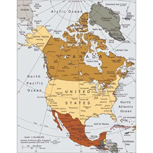
Political map of North AmericaVector illustration of the political map of North America. Reference map was created by the US Central Intelligence Agency
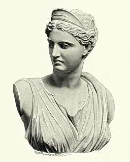
Ancient Greek Mythology, Artemis, goddess of the huntVintage engraving of Artemis, In the classical period of Greek mythology, Artemis was often described as the daughter of Zeus and Leto, and the twin sister of Apollo
Bath city of UK, art mapBath city of world cultural heritage
Physical map of South AmericaVector illustration of the physical map of South America Reference map was created by the US Central Intelligence Agency and is available as a public domain map at the University of Texas Libraries
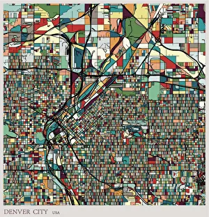
Denver city art deco map
art illustration style Kyoto city map
Tokyo art map for travel
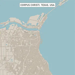
Corpus Christi Texas US City Street MapVector Illustration of a City Street Map of Corpus Christi, Texas, USA. Scale 1:60, 000. All source data is in the public domain. U.S
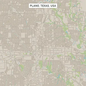
Plano Texas US City Street MapVector Illustration of a City Street Map of Plano, Texas, USA. Scale 1:60, 000. All source data is in the public domain. U.S
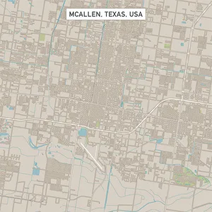
McAllen Texas US City Street MapVector Illustration of a City Street Map of McAllen, Texas, USA. Scale 1:60, 000. All source data is in the public domain. U.S
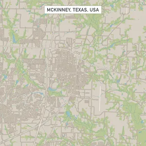
McKinney Texas US City Street MapVector Illustration of a City Street Map of McKinney, Texas, USA. Scale 1:60, 000. All source data is in the public domain. U.S
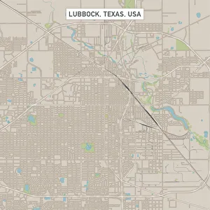
Lubbock Texas US City Street MapVector Illustration of a City Street Map of Lubbock, Texas, USA. Scale 1:60, 000. All source data is in the public domain. U.S
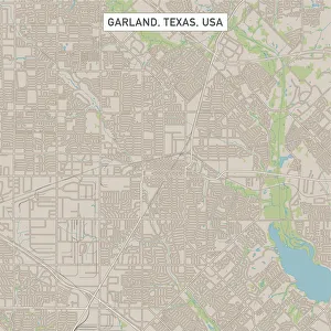
Garland Texas US City Street MapVector Illustration of a City Street Map of Garland, Texas, USA. Scale 1:60, 000. All source data is in the public domain. U.S
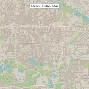
Irving Texas US City Street MapVector Illustration of a City Street Map of Irving, Texas, USA. Scale 1:60, 000. All source data is in the public domain. U.S
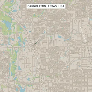
Carrollton Texas US City Street MapVector Illustration of a City Street Map of Carrollton, Texas, USA. Scale 1:60, 000. All source data is in the public domain. U.S
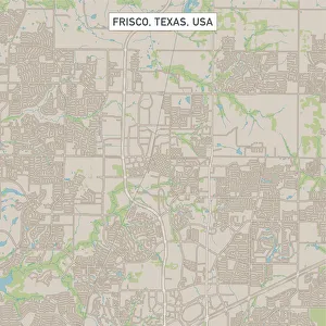
Frisco Texas US City Street MapVector Illustration of a City Street Map of Frisco, Texas, USA. Scale 1:60, 000. All source data is in the public domain. U.S
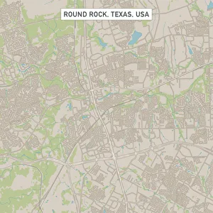
Round Rock Texas US City Street MapVector Illustration of a City Street Map of Round Rock, Texas, USA. Scale 1:60, 000. All source data is in the public domain. U.S
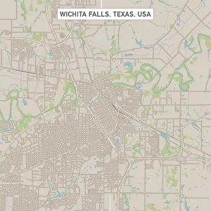
Wichita Falls Texas US City Street MapVector Illustration of a City Street Map of Wichita Falls, Texas, USA. Scale 1:60, 000. All source data is in the public domain. U.S
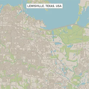
Lewisville Texas US City Street MapVector Illustration of a City Street Map of Lewisville, Texas, USA. Scale 1:60, 000. All source data is in the public domain. U.S
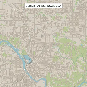
Cedar Rapids Iowa US City Street MapVector Illustration of a City Street Map of Cedar Rapids, Iowa, USA. Scale 1:60, 000. All source data is in the public domain. U.S
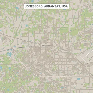
Jonesboro Arkansas US City Street MapVector Illustration of a City Street Map of Jonesboro, Arkansas, USA. Scale 1:60, 000. All source data is in the public domain. U.S
Sunset on Poros island in Aegean sea, GreecePoros town and harbour viewed from the top, Poros island, Attica, Peloponnese, Greece
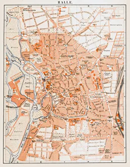
Halle (Saale) is a city in the southern part of the German state Saxony-AnhaltIllustration of a Halle (Saale) is a city in the southern part of the German state Saxony-Anhalt
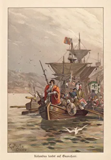
Columbus discovers America, lithograph, published around 1895Landing of Christopher Columbus at the Island of Guanahani, West Indies (area of todays Bahamas), on October, 12, 1492, where he first entered the soil of America
European goldfinches (Carduelis carduelis), lithograph, published around 1895European goldfinches (Carduelis carduelis). Lithograph after a drawing by Christian Votteler (German painter, 1840 - 1916), published around 1895
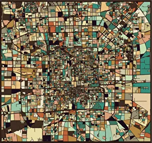
colorful Beijing art map background
colorful Tokyo art map background 2colorful Tokyo art map background
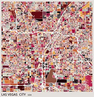
Las vegas city art map background