Jigsaw Puzzle > History > Battles & Wars > Historcal Battle Maps and Plans
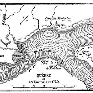
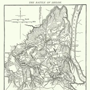
Jigsaw Puzzle : Map of the Siege of Quebec, Canada 1759


![]()
Jigsaw Puzzles from Fine Art Storehouse
Map of the Siege of Quebec, Canada 1759
Vintage engraving of a Map of the Siege of Quebec, Canada 1759. The Battle of the Plains of Abraham, also known as the Battle of Quebec was a pivotal battle in the Seven Years War (referred to as the French and Indian War to describe the North American theatre). The battle, which began on 13 September 1759, was fought on a plateau by the British Army and Navy against the French Army, just outside the walls of Quebec City
duncan1890
Media ID 19990313
© of Duncan P Walker
18th Century 18th Century Style Battle
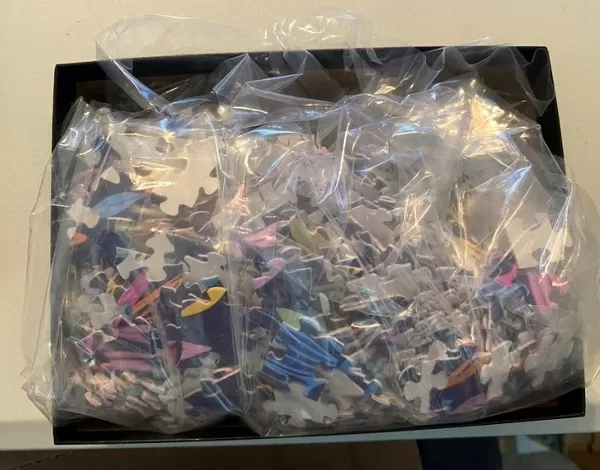
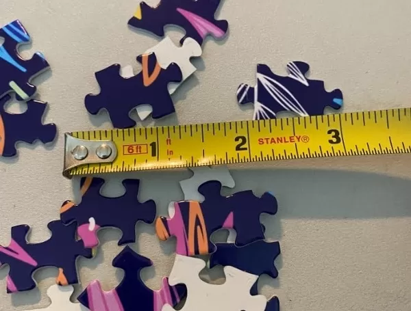
Jigsaw Puzzle (520 Pieces)
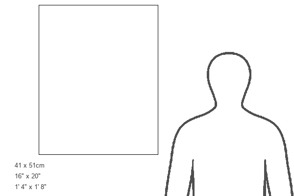
Made in the USA, 520-piece puzzles measure 16" x 20" (40.6 x 50.8 cm). Every puzzle is meticulously printed on glossy photo paper, which has a strong 1.33 mm thickness. Delivered in a black storage cardboard box, these puzzles are both stylish and practical. (Note: puzzles contain small parts and are not suitable for children under 3 years of age.)
Jigsaw Puzzles are an ideal gift for any occasion
Estimated Product Size is 40.5cm x 50.8cm (15.9" x 20")
These are individually made so all sizes are approximate
Artwork printed orientated as per the preview above, with landscape (horizontal) or portrait (vertical) orientation to match the source image.
FEATURES IN THESE COLLECTIONS
> History
> Battles & Wars
> Historcal Battle Maps and Plans
> Map
> Historical Maps
> Map
MADE IN THE USA
Safe Shipping with 30 Day Money Back Guarantee
FREE PERSONALISATION*
We are proud to offer a range of customisation features including Personalised Captions, Color Filters and Picture Zoom Tools
SECURE PAYMENTS
We happily accept a wide range of payment options so you can pay for the things you need in the way that is most convenient for you
* Options may vary by product and licensing agreement. Zoomed Pictures can be adjusted in the Cart.