Home > Map > Historical Maps
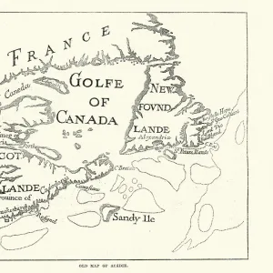
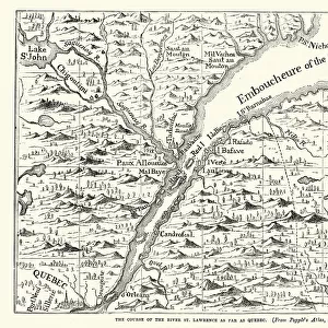
Victorian Map of Eastern Canada Circa 1850

![]()
Wall Art and Photo Gifts from Fine Art Storehouse
Victorian Map of Eastern Canada Circa 1850
Engraved illustration of a Map of Eastern Canada in counties from Iconographic Encyclopedia of Science, Literature and Art, Published in 1851. Copyright has expired on this artwork. Digitally restored
bauhaus1000
Media ID 13666961
© Craig McCausland
1850 1859 66864 78279 Canada Canadian Culture Chart Copperplate Engraving Country Geographic Area Diagram French Culture Image Created 1850 1859 Isolated Journey Montreal North America Ornate Plan Quebec World Map
FEATURES IN THESE COLLECTIONS
> Map
> Historical Maps
> Map
MADE IN THE UK
Safe Shipping with 30 Day Money Back Guarantee
FREE PERSONALISATION*
We are proud to offer a range of customisation features including Personalised Captions, Color Filters and Picture Zoom Tools
SECURE PAYMENTS
We happily accept a wide range of payment options so you can pay for the things you need in the way that is most convenient for you
* Options may vary by product and licensing agreement. Zoomed Pictures can be adjusted in the Basket.