mail_outline sales@mediastorehouse.com
3,678 items
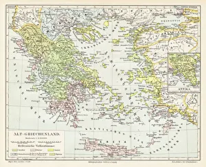
Antique Greece empire map 1895Encyclopedia Britannica 9th Edition Vol I New York, Samuel Hall 1878
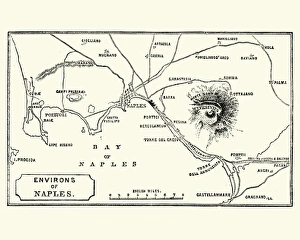
Map of Environs of Naples and Mount Vesuvius 1872Vintage engraving of Map of Environs of Naples and Mount Vesuvius 1872
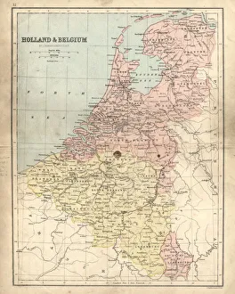
Antique damaged map of Holland & Belgium 19th CenturyVintage engraving of a Antique damaged map of Holland & Belgium in the 19th Century, 1873
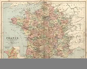
Antique damaged map of France in the 19th CenturyVintage engraving of a Antique damaged map of France in the 19th Century, 1873
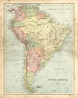
Antique damaged map of South America in the 19th CenturyVintage engraving of a Antique map of South America in the 19th Century, 1873
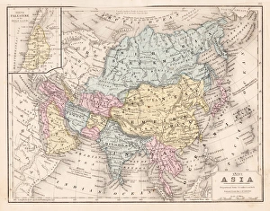
Asia map 1867Mitchellas Modern Atlas - Published by E.H. Butler and Co - Philadelphia 1867
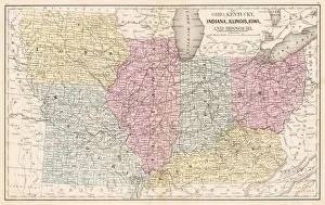
Ohio Indiana Illinois map 1867Mitchellas Modern Atlas - Published by E.H. Butler and Co - Philadelphia 1867
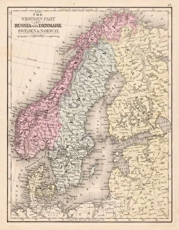
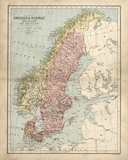
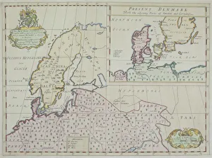
Denmark Sweden Norway map 1867Mitchellas Modern Atlas - Published by E.H. Butler and Co - Philadelphia 1867
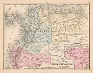
Colombia Ecuador Venezuela map 1867Mitchellas Modern Atlas - Published by E.H. Butler and Co - Philadelphia 1867
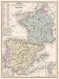
Spain France Portugal map 1867Mitchellas Modern Atlas - Published by E.H. Butler and Co - Philadelphia 1867
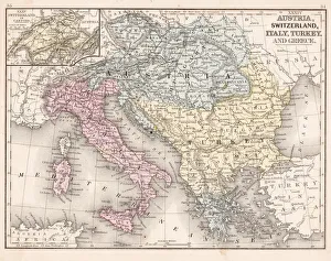
Austria Switzerland Italy map 1867Mitchellas Modern Atlas - Published by E.H. Butler and Co - Philadelphia 1867
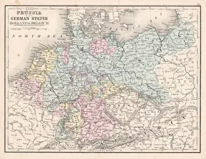
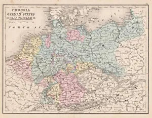
Prussia and German states map 1867Mitchellas Modern Atlas - Published by E.H. Butler and Co - Philadelphia 1867
Prussia and german states map 1867Mitchellas Modern Atlas - Published by E.H. Butler and Co - Philadelphia 1867
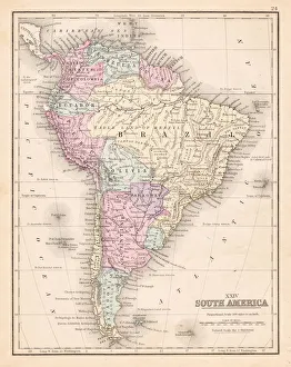
South America map 1867Mitchellas Modern Atlas - Published by E.H. Butler and Co - Philadelphia 1867
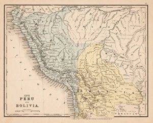
Peru Bolivia map 1867Mitchellas Modern Atlas - Published by E.H. Butler and Co - Philadelphia 1867
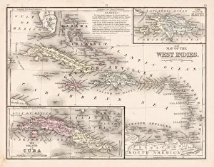
West Indies map 1867Mitchellas Modern Atlas - Published by E.H. Butler and Co - Philadelphia 1867
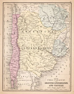
Argentina Chile Urugay map 1867Mitchellas Modern Atlas - Published by E.H. Butler and Co - Philadelphia 1867
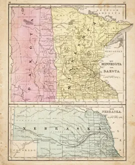
Dakota Missesota Nebraska map 1867Mitchellas Modern Atlas - Published by E.H. Butler and Co - Philadelphia 1867
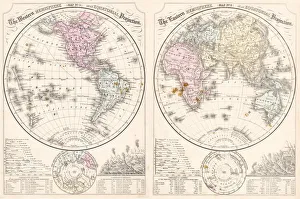
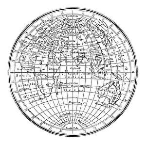
Easter hemisphere map 1867Mitchellas Modern Atlas - Published by E.H. Butler and Co - Philadelphia 1867
Antique damaged map of Swden Norway Denmark 19th Century
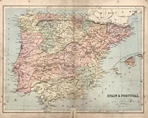
Antique damaged map of Spain and Portugal19th Century
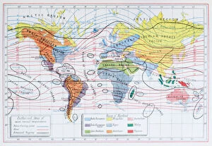
Antique colored illustrations: Isothermal lines and ethnicities of the World
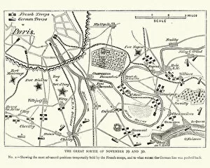
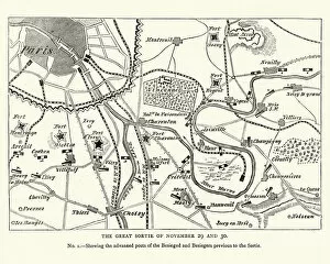
Franco Prussian War Battle plan of Siege of ParisVintage engraving of a scene from the Franco Prussian War. Battle plan of Siege of Paris
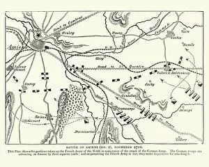
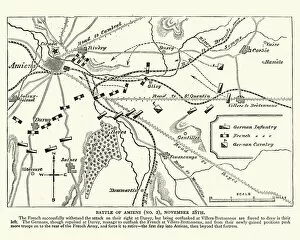
Franco Prussian War plan of the Battle of AmiensVintage engraving of a scene from the Franco Prussian War. plan of the Battle of Amiens
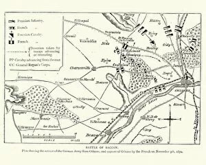
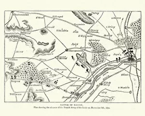
Franco Prussian War Plan of the Battle of CoulmiersVintage engraving of a scene from the Franco Prussian War. Plan of the Battle of Coulmiers (Baccon), The Battle of Coulmiers was fought on November 9
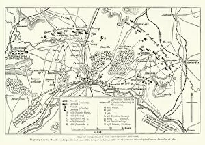
Franco Prussian War Battle plan of Siege of OrleansVintage engraving of a scene from the Franco Prussian War. Battle plan of Siege of Orleans
Antique engraving illustration: World map
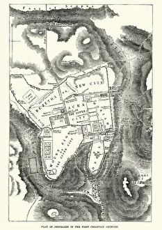
Plan of Jerusalem in the 1st CenturyVintage engraving of a Plan of Jerusalem in the 1st Century
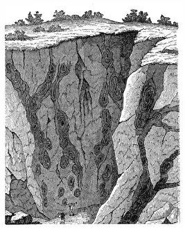
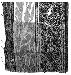
Veins in limestone on Monte CalviIllustration of a Veins in limestone on
Section of a terrain, double vein
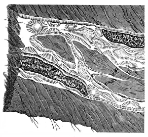
Part of a Freiberg ore mine: sulphur, quartz, gneissIllustration of a Freiberg ore mine: sulphur, quartz, gneiss
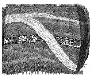
Section of a terrain, ramification and enforcement
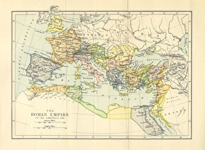
Roman Empire in the Apostolic Age Map, Engraving, 1892Very rare, beautifully detailed engraving of Roman Empire in the Apostolic Age Map, Engraving, Published in 1892. Original edition from my own archives. Copyright has expired on this artwork
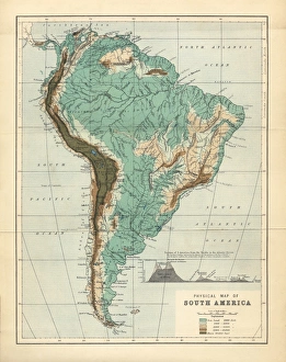
South America Physical Map, Engraving, 1892Very rare, beautifully detailed engraving of South America Physical Map, Engraving, Published in 1892. Original edition from my own archives. Copyright has expired on this artwork. Digitally restored
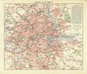
London and Environs Historical Map, Engraving, 1892Very rare, beautifully detailed engraving of London and Environs Historical Map, Engraving, Published in 1892. Original edition from my own archives. Copyright has expired on this artwork
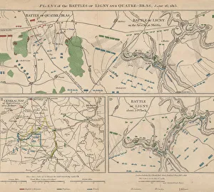
Napoleonic WarsPlans of the battle of Ligny and Quatre-Bras in Belgium during the Napoleonic Wars, 16th June 1815. Here Napoleon Bonaparte defeated the Prussian Army under Gebhard von Blucher
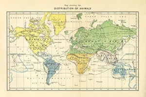
Distribution of Animals Map, Engraving, 1892Very rare, beautifully detailed engraving of North America Physical Map, Engraving, Published in 1892. Original edition from my own archives. Copyright has expired on this artwork. Digitally restored
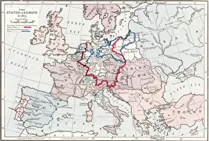
Napoleonic EuropeA map of Europe at the end of the Napoleonic Wars, 1815. The boundary of the German Confederation is marked in red, and boundary of Prussia in blue. (Photo by Hulton Archive/Getty Images)
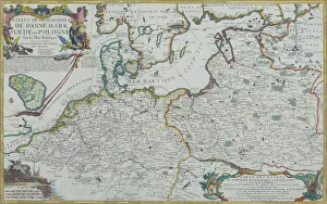
Map of Baltic Sea and Europe
Map of Denmark
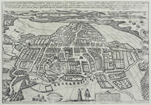
Map of Odense, Denmark
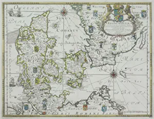
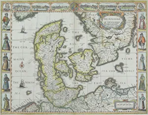
Map of Denmark with Germaine Ocean
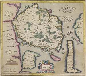
Antique map of island of Fionia in Denmark
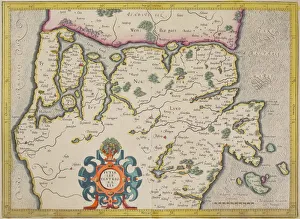
Antique map of Denmark and vicinity