mail_outline sales@mediastorehouse.com
3,669 items
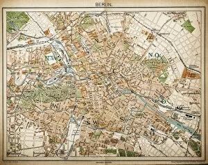
Map of Berlin 1893Illustration of a Map of Berlin 1893
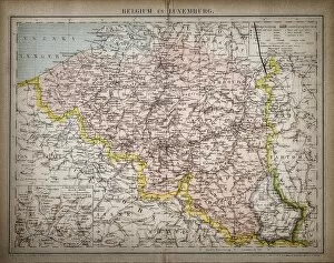
Belgium and LuxembourgAntique illustration map of Belgium and Luxembourg
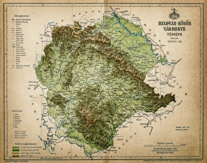
Belovar-koros, Croatio map from 1893Antique illustration of a Belovar-koros, Croatio map from 1893
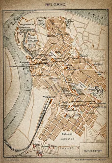
Belgrade map 1893Antique illustration of a Belgrade map 1893
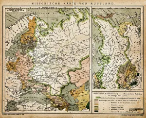
Historic map of RussiaIllustration of a historic map of Russia
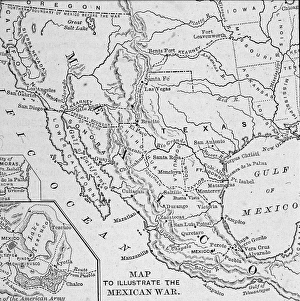
Map Illustrating Mexican-American WarA map of the Western United States and Mexico, illustrating the Mexican-American War (1845-1847). (Engraving by Kean Collection/Getty Images)
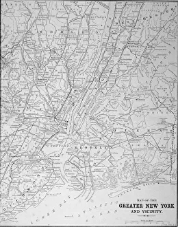
Map Of Greater New York In 1890sMap of the greater New York area, late 1890s. Engraving by E. F. Fisk. (Photo by Kean Collection/Getty Images)
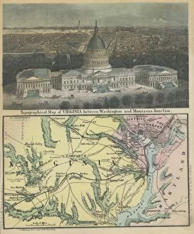
Washington D. CAn engraving of the White House and a topographical map of Virginia between Washington and Manassas Junction, circa 1860s. (Photo by Archive Photos/Getty Images)
South West AmericaMap of the South Western part of the United States constructed and engraved to illustrate The War with the South, circa 1860s. (Photo by Archive Photos/Getty Images)
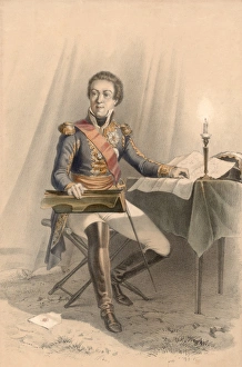
Marshal BerthierFrench cartographer and military leader Louis-Alexander Berthier (1753 - 1815), Napoleon Bonapartes Chief-of-staff, circa 1798. (Photo by Hulton Archive/Getty Images)
Golden State Fruit Box LabelColor lithograph fruit box label for Golden State lemons shows a map of California with a circle around Lemon Cove in Tulare County, the map is surrounded by lemons
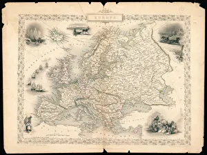
Europe In 1851A political map of Europe, drawn and engraved by J. Rapkin, with illustrations by J. Marchant, engraved by J. Rogers, 1851. The map was published by J & F Tallis of New York
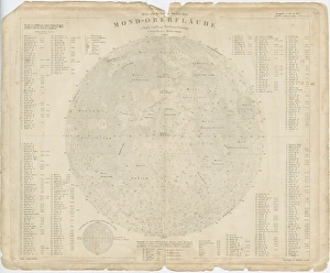
Perthes MoonA map of the Earths moon, circa 1800. Engraved by Justus Perthes and published in Stielers Hand-Atlas. (Photo by Hulton Archive/Getty Images)
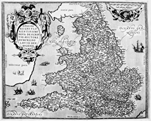
Sixteenth Century EnglandA map of England from Humphrey Lloyds Maps of England, published 1573. (Photo by Hulton Archive/Getty Images)
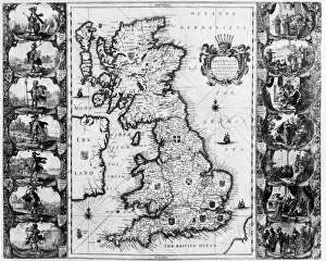
Map Of BritainA map of the British Isles from Theatrum Orbis Terrarum, by J Blaen, published 1645. (Photo by Hulton Archive/Getty Images)
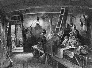
Australia BoundEmigrants plot their progress on board a ship bound for Australia, 1849. (Photo by Hulton Archive/Getty Images)
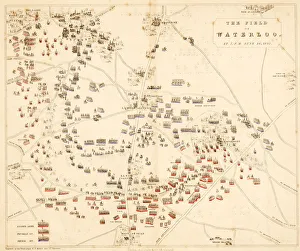
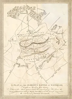
Battle Of WaterlooA plan of the Battle of Waterloo in Belgium, which saw the defeat of Napoleon Bonaparte by an allied force led by the Duke of Wellington and Prince Gebhard von Blucher, 18th June 1815
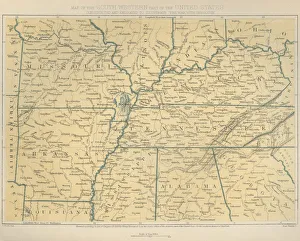
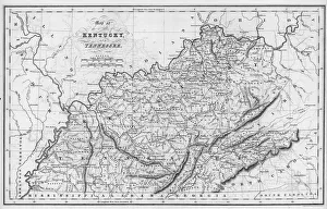
Kentucky And TennesseeAn engraved map of Kentucky and Tennessee by Isaac Taylor Hinton, published by Simpkin & Marshall and printed by Fenner Sears & Co. 1832. (Photo by Hulton Archive/Getty Images)
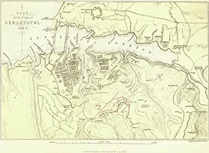
Siege Of SevastopolA plan of the Seige of Sevastopol, during the Crimean War, circa 1855. Engraved by Robert Walker. (Photo by Hulton Archive/Getty Images)
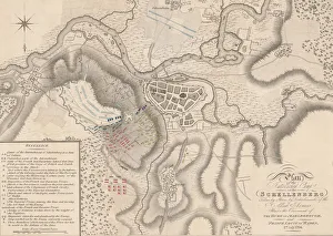
Battle Of SchellenbergA plan of the entrenched camp during the Battle of Schellenberg (or Battle of Donauworth) in Bavaria, part of the War of the Spanish Succession, 2nd July 1704
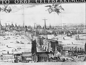
Old London BridgeA detail from Vischers Panorama of London (1616), showing London Bridge. The north bank of the river is in the background, and Southwark in the foreground. (Photo by Hulton Archive/Getty Images)
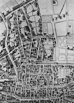
Old City Of LondonA map of the City of London, showing Bunhill Fields, Moorfields and the Old Artillery Yard, 1658. From Richard Newcourts Plan of London (Photo by Hulton Archive/Getty Images)