mail_outline sales@mediastorehouse.com
221 items
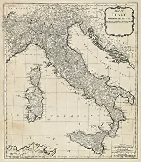
Antique Map of Italy - 18th CenturyVintage map of Italy. Vintage etching circa late 18th century
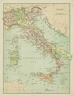
Map of ItalyMarcus Ward's Home Atlas - London, 1894
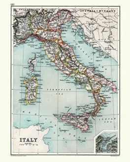
Old chromolithograph map of Italy and IslandsAntique Illustration. Copyright has expired on this artwork. From my own archives, digitally restored
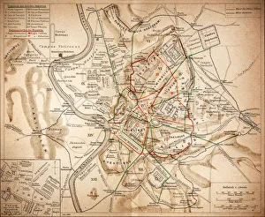
Ancient Rome Italy Map illustration 1898 Original edition from my own archives Source : Brockhaus 1898
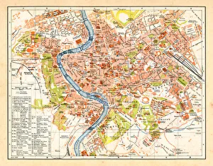
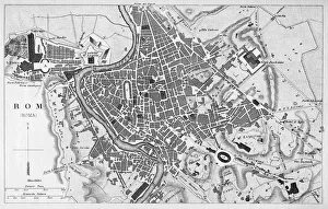
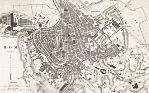
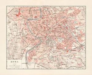
Vintage map of Rome Italy 1898 Original edition from my own archives Source : Brockhaus 1898
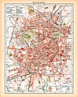
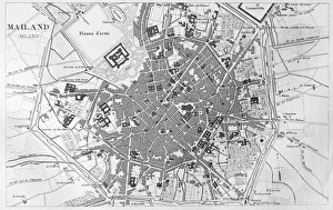
Antique map of Milan Italy 1896Map of Milan Italy 1896 Original edition from my own archives Source : Brockhaus 1896
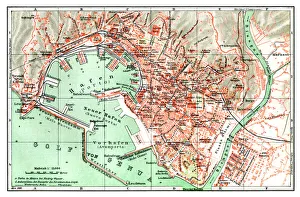
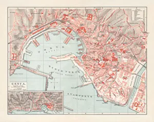
Map of city Genoa Italy 1896 Original edition from my own archives Source : Brockhaus 1896
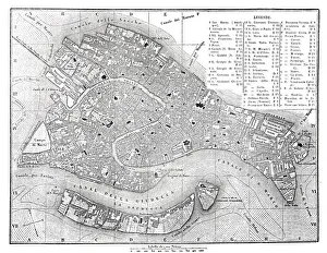
Antique map of Venice Italy 1862Map of Venice Italy 1862 Original edition from my own archives Source : Tour du monde 1862
Antique Map of Italy, with detail of straits of Messina, 19th Century
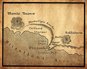
Bay of Baiae, Italy, old map from 1888illustration of a Bay of Baiae, Italy, old map from 1888
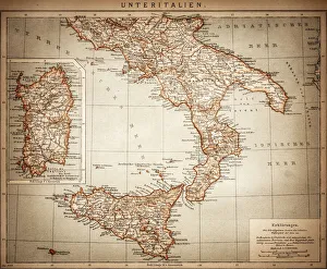
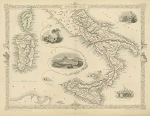
Antique Map of Lower Italy
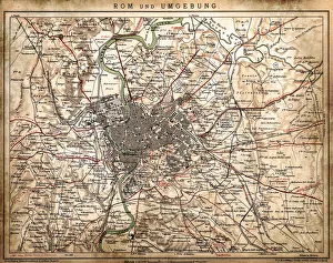
Rome and surroundingsAntique illustration of Rome and surroundings
Ancient RomeAntique illustration Map of Ancient Rome from 1898
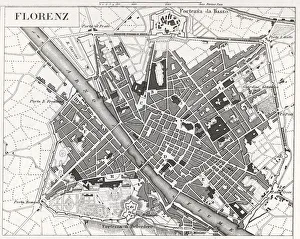
engraved illustrations of the city of FlorenceEngraved illustrations of the City of Florence from Iconographic Encyclopedia of Science, Literature and Art, Published in 1851. Copyright has expired on this artwork. Digitally restored
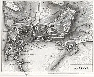
Engraving: Ancona, ItalyEngraved illustrations of the City of Ancona, Italy from Iconographic Encyclopedia of Science, Literature and Art, Published in 1851. Copyright has expired on this artwork. Digitally restored
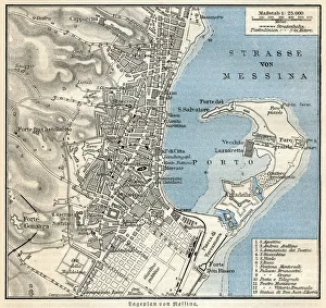
Port of Messina, Sicily - Italy 1897Meyers Konversations-Lexikon. Ein Nachschlagewerk des allgemeinen Wissens, 5th edition 17 volumes Bibliographisches Institut - Leipzig 1895-1897
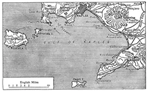
Antique map of Gulf of Naples
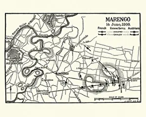
Map of Battle of Marengo, Evening 14 June1800Vintage engraving of Map of Battle of Marengo, Evening 14 June1800. The Battle of Marengo was fought on 14 June 1800 between French forces under Napoleon Bonaparte
Engraving city map of Milano Italy from 1851" 18th Century Style, Cartography, Travel, Antique, Engraved Image, Il, Antique Maps, 186830412
Engraving antique map of Milano Italy from 1851" 18th Century Style, Painted Image, Engraved Image, Woodcut, Illustr, Antique Maps, 174797018
Engraving antique city map of Roma Italy from 1851" 18th Century Style, Cartography, Travel, Painted Image, Antique, Eng, Antique Maps, 183344277
City map of Turin (Torino), Italy, lithograph, published in 1897Historical city map of Turin (Torino), Piedmont, Italy. Lithograph, published in 1897
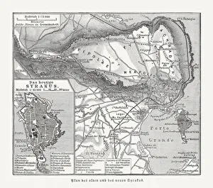
Maps of the ancient and new Syracuse, Italy, published 1897Historical maps of the ancient and new (left) Syracuse, Sicily, Italy. Wood engraving, published in 1897
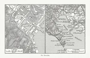
City map of La Spezia, Italy, and surroundings, published 1897City map of La Spezia, Italy, and surroundings. La Spezia is one of the main Italian military and commercial harbours and a major Italian Navy base. Wood engraving, published in 1897
Engraving antique map of Roma Italy from 1851" 18th Century Style, Painted Image, Engraved Image, Woodcut, Illustr, Antique Maps, 174794783
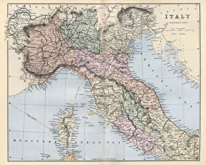
Antique map of Northern and central Italy, Corsica, 19th CenturyVintage engraving of Antique map of Northern and central Italy, Corsica, 19th Century
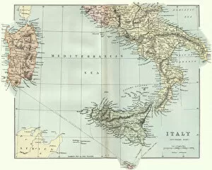
Antique map of Southern Italy, Sardinia, Sicily, 19th CenturyVintage engraving of a Antique map of Southern Italy, Sardinia, Sicily, 19th Century
Southern Italy fine engravingSouthern Italy, 1851, Wonderful engraved map In outline color of Southern Italy with inset drawings of Naples and Vesuvius. The Carnival and Festival of the Vintage also depicted
Map of Italy in 1500Antique Maps, TR001715
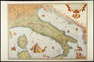
Italy, Vatican Church State, Tuscany, Elba Island, and Marche RegionPlate from renaissance cartography treatment created in XVI century, Artist unknown
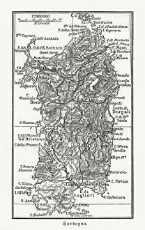
Topographic map of Sardinia, Italy, wood engraving, published 1897Topographic map of Sardinia, Italy - second-largest island in the Mediterranean Sea. Wood engraving, published in 1897
Map of Livorno (Leghorn), Tuscany, Italy, 19th CenturyVintage engraving of Map of Livorno (Leghorn), Tuscany, Italy, 19th Century
Map of Center Italy 1896Andres Allgemeiner Handatlas - Bielefeld und Leipzig 1896
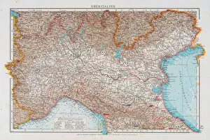
Map of North Italy 1896Andres Allgemeiner Handatlas - Bielefeld und Leipzig 1896
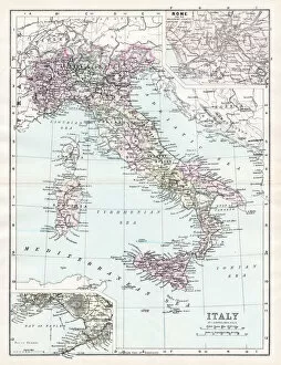
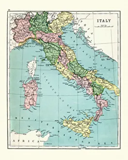
Map of Italy 1894Johnsons Universal Cyclopedia - Volume IV New York - A. J. Johnson Company 1894
Antique engraving illustration: Italy
Genoa, Liguria, Italy, lithograph, published in 1897Genoa - capital of the Italian region of Liguria. Lithograph, published in 1897
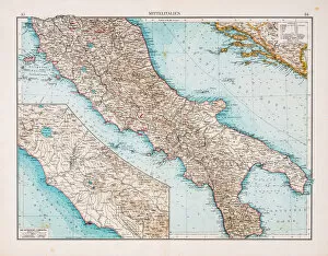
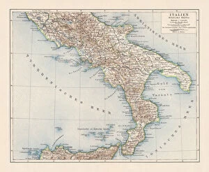
Topographic map of Southern Italy, lithograph, published 1897Topographic map of Southern Italy. Lithograph, published in 1897
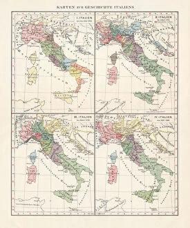
Map of the history of Italy, c. 1000-1866, lithograph, published 1897Map of the historical development of Italy from about 1000 to 1866. Lithograph, published in 1897
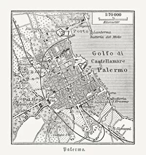
City map of Palermo, Sicily, Italy, wood engraving, published 1897Historical city map of Palermo, Sicily, Italy. Wood engraving, published in 1897
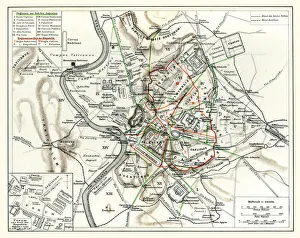
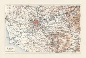
Topographic map of Rome, Italy and surroundings, lithograph, published 1897Topographic map of Rome, Italy and surroundings. Lithograph, published in 1897
Map of Rome, capital city of Italy, lithograph, published 1897Historical city map of Rome, capital city of Italy. Lithograph, published in 1897
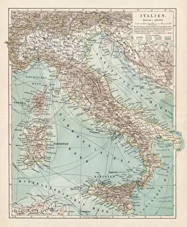
Antique map of Italy, 1897, late 19th CenturyVintage engraving of a Antique map of Italy, 1897, late 19th Century
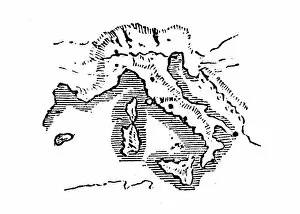
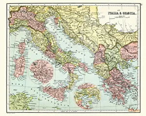
Antique map of Ancient Italy and GreeceVintage engraving of a Antique map of Ancient Italy and Greece
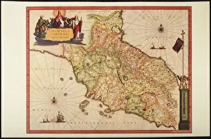
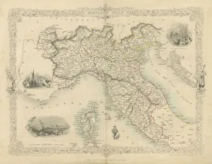
Northern Italy mapA highly decorative and finely engraved map of Northern Italy which appeared in John Tallis & co.s The Illustrated Atlas 1851
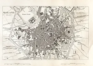
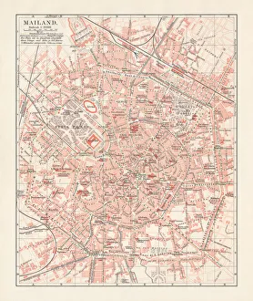
City map of Milan, Italy, lithograph, published in 1897City map of Milan, capital of Lombardy, Italy. Lithograph, published in 1897
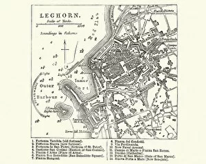
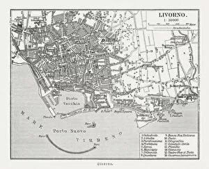
Historical city map of Livorno, Tuscany, Italy, woodcut, published 1897Historical city map of Livorno, Tuscany, Italy. Wood engraving, published in 1897
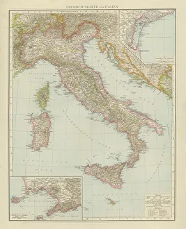
Map of Italy 1900Meyers hand-Atlas Leipzig und Wien Verlag des Bibliographischen Instituts 1900