mail_outline sales@mediastorehouse.com
221 items
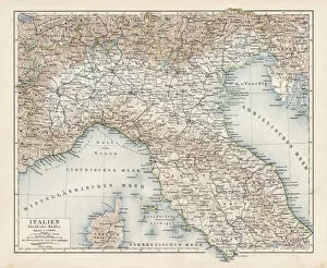
Map of North Italy 1900Meyers hand-Atlas Leipzig und Wien Verlag des Bibliographischen Instituts 1900
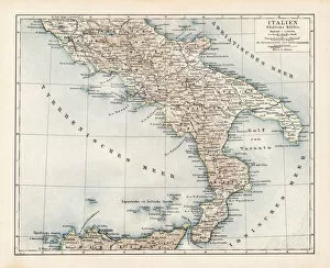
Map of South Italy 1900Meyers hand-Atlas Leipzig und Wien Verlag des Bibliographischen Instituts 1900
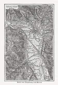
Map of the surroundings of Merano, wood engraving, published 1897Map of the surroundings of Merano, South Tyrol, Italy. Wood engraving, published in 1897
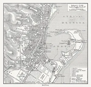
Historical city map of Messina, Italy, wood engraving, published 1897Historical city map of Messina, Italy. Wood engraving, published in 1897
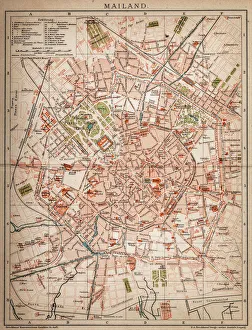
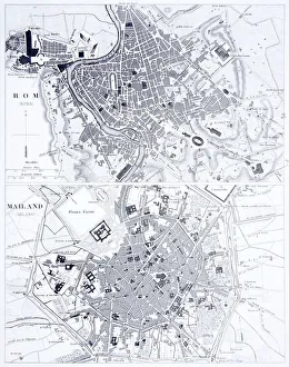
Milan, Italy antique map from 1898
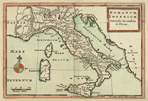
Italy until the time of Emperor Augustus, lithograph, published 1897Map of Italy until the time of Emperor Augustus (63 BC a AD 14). Lithograph, published in 1897
Old map showing Rome arround 1st century BCOld map showing Rome circa 1st century bc Original edition from my own archives Source : Illustriertes Konversations Lexikon 1878
Antique Map of Italy 1732Mediterranean Countries, Antique Maps, 91822666
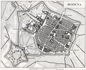
Engraving: ModenaEngraved illustrations of the Provence of Modena from Iconographic Encyclopedia of Science, Literature and Art, Published in 1851. Copyright has expired on this artwork. Digitally restored
18th Century Style, Painted Image, Engraved Image, Woodcut, Illustration and Painting[url=/file_closeup.php?id=11192953 t=_blank][img]/file_thumbview_approve.php?size=1&id=11192953[/img][/url] [url=/file_closeup.php?id=11193877 t=_blank][img]/file_thumbview_approve.php
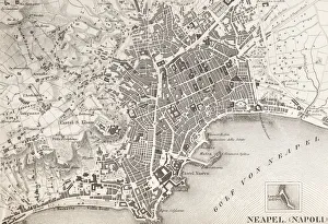
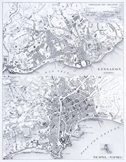
Engraving: Lisbon and NaplesEngraved illustrations of the Cities of Lisbon and Naples from Iconographic Encyclopedia of Science, Literature and Art, Published in 1851. Copyright has expired on this artwork. Digitally restored
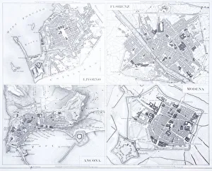
Engraving: Leghorn, Florence, Ancona and ModenaEngraved illustrations of the cities of Leghorn, Florence, Ancona and Modena from Iconographic Encyclopedia of Science, Literature and Art, Published in 1851. Copyright has expired on this artwork
Engraving: Rome and MilanEngraved illustrations of the cities of Rome and Milan from Iconographic Encyclopedia of Science, Literature and Art, Published in 1851. Copyright has expired on this artwork. Digitally restored
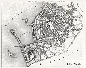
Engraving: Livorno, ItalyEngraved illustrations of the city of Livorno, Italy from Iconographic Encyclopedia of Science, Literature and Art, Published in 1851. Copyright has expired on this artwork. Digitally restored
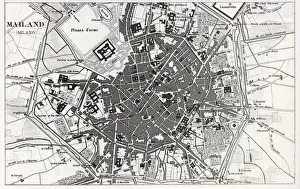
Engraving: Milan, ItalyEngraved illustrations of the city of Milan, Italy from Iconographic Encyclopedia of Science, Literature and Art, Published in 1851. Copyright has expired on this artwork. Digitally restored
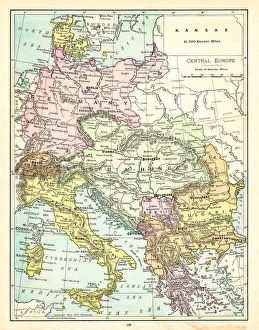
old map of central european old map form 1870, showing central europe countries
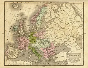
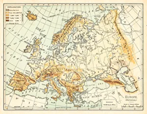
europe map 1829an old map form 1829, showing the whole europe
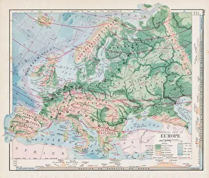
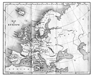
Map of Europe 1897Natural Elementary Geography by Redway and Hinman - NY/Cincinnati/Chicago 1897
Map of Central Europe 1895The Rand-McNally Grammar School Geography 1895 - Chicago & New York
Map of Europe 1877Warrens Common School Geography 1877
Map of Europe at the Napoleonic Wars of Liberty (1813)Map of Central Europe at the beginning of the Napoleonic Wars of Liberty in 1813. Lithograph, published in 1897
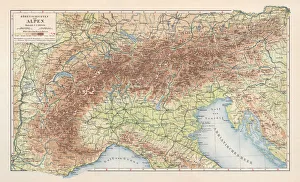
Topographic map of the European Alps, lithograph, published in 1897Topographic map of the European Alps. Lithograph, published in 1897
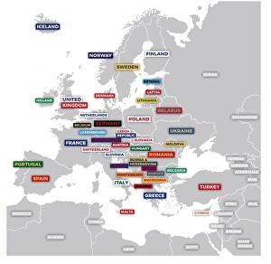
Labeled European MapLabeled European map concept showing countries with labels. EPS 10 file. Transparency effects used on highlight elements
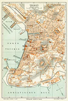
Trieste Italy map 1895Meyers Konversations-Lexikon. Ein Nachschlagewerk des allgemeinen Wissens, 5th edition 17 volumes Bibliographisches Institut - Leipzig 1895-1897
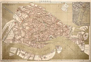
Map of Venice 1898Antique illustration of a Map of Venice 1898
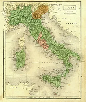
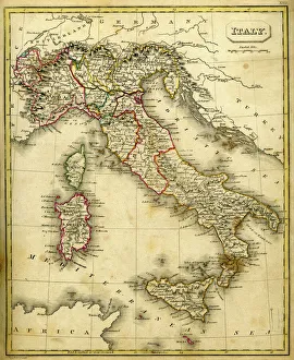
Antique map of ItalyVintage map of Italy in 1861
Antique map of Italy
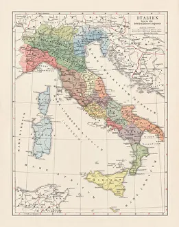
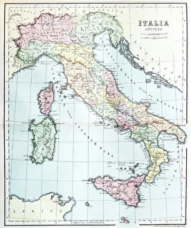
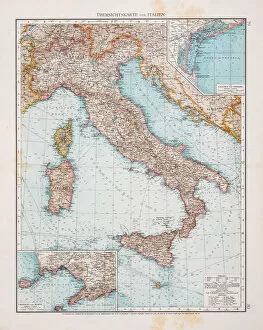
Map of Italy 1896Andres Allgemeiner Handatlas - Bielefeld und Leipzig 1896
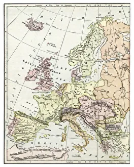
old map of european old map from 1865, europe countries
Map of Europe 1895The Rand-McNally Grammar School Geography 1895 - Chicago & New York
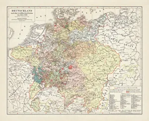
Map of Germany, after the Peace of Westphalia in 1648. Lithograph, published in 1897
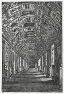
Gallery of Maps, Vatican, published in 1878The Gallery of Maps (Latin: Galleria delle carte geografiche) in the Vatican. Wood engraving, published in 1878
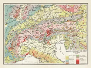
Geological map of the European Alps, lithograph, published in 1897Geological map of the European Alps. Lithograph, published in 1897
Map of Europe 1889Indiana Educational Series The Complete Geography - Indianapolis 1889
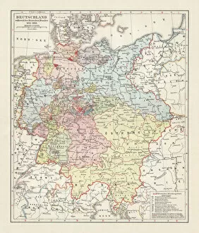
Map of the German Confederation (1815-1866), lithograph, published in 1897Map of the German Confederation between 1815 and 1866. Lithograph, published in 1897
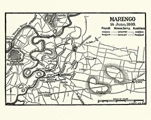
Map of Battle of Marengo, Morning 14 June1800Vintage engraving of Map of Battle of Marengo, Morning 14 June1800. The Battle of Marengo was fought on 14 June 1800 between French forces under Napoleon Bonaparte
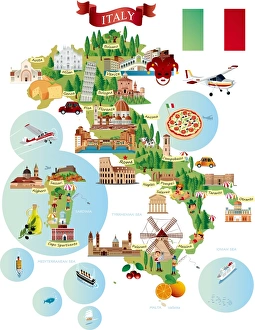
Cartoon map of ITALY
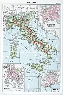
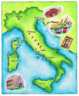
Map of Italywov035.jpg
Antquie Map of ItalyVintage map of Italy fron 1837
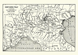
Map of Northern Italy illustrating the campaigns of 1796-1797Vintage engraving of a Map of Northern Italy illustrating the campaigns of 1796-1797 during the French Revolutionary Wars
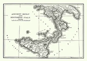
Map of Ancient Sicily and Southern ItalyVintage engraving of a Map of Ancient Sicily and Southern Italy
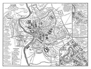
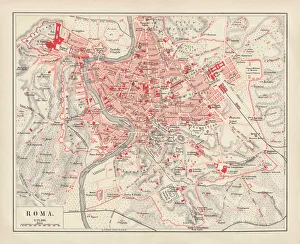
City map of Rome, lithograph, published in 1878City map of Rome, Italy. Lithograph, published in 1878
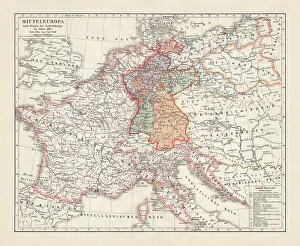
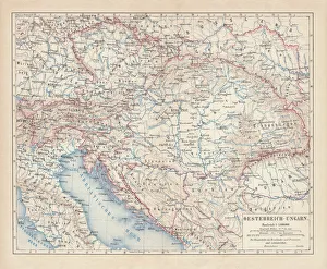
Austro-Hungarian Empire, Habsburg Monarchy, lithograph, published in 1877Ancient map of Austro-Hungarian Empire. Habsburg Monarchy. Lithograph, published in 1877
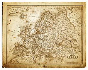
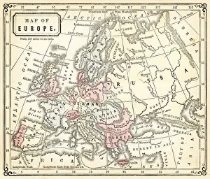
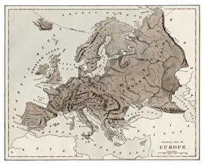
Vintage Map of Europe Mid 19th CenturyVinateg Map of Europe Mid 19th Century, circa 1850
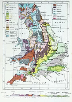
Antique colored illustrations: Geological map of England and Wales
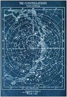
Antique colored illustrations: The constellations visible in Britain
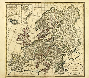
Antique Map of Europe, 1785An accurate map of Europe from the best authorities. London: C. Dilly & G. Robinson: 1785. Original size: 35.7 x 37.4 cm. Coloured, Inset: Spitsbergen, East and West Greenland, and Iceland