mail_outline sales@mediastorehouse.com
1,517 Items
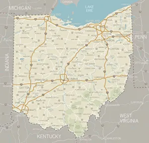
Ohio MapA detailed map of Ohio state with cities, roads, major rivers, and lakes plus National Forests. Includes neighboring states and surrounding water
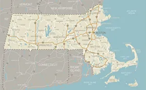
Map of Massachusetts with highwaysA detailed map of Massachusetts state with cities, roads, major rivers, and lakes. Includes neighboring states and surrounding water
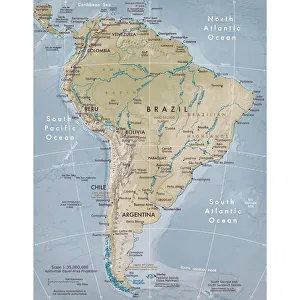
Physical map of South AmericaVector illustration of the physical map of South America Reference map was created by the US Central Intelligence Agency and is available as a public domain map at the University of Texas Libraries
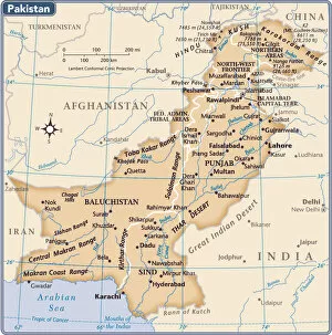
Pakistan country map2011 edition
103745801Reference Maps, 103745801
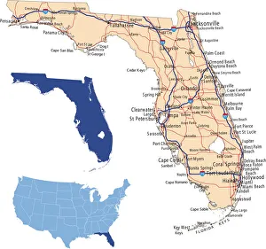
Florida road mapillustration of Florida state road map for your design and products
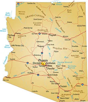
Map of Arizona, USA highways, major roads, and riversVector illustration of map fo Arizona with major roads, rivers and lakes
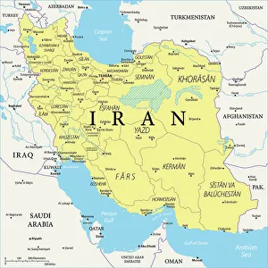
Map of IranThe map shows Iran, an Islamic state between the Caspian Sea in the north and the Persian Gulf in the south. The country is officially named the Islamic Republic of Iran
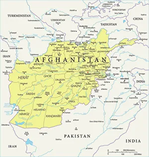
Afghanistan Reference MapA details map of Afghanistan, a landlocked country located in the heart of south-central Asia
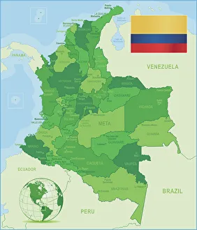
Green Map of Colombia - states, cities and flagColombia, country of northwestern South America. Its 1, 000 miles (1, 600 km) of coast to the north are bathed by the waters of the Caribbean Sea, and its 800 miles (1)
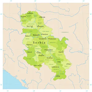
Serbia Reference Map165920930
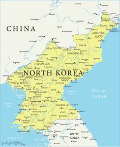
North Korea Reference Map
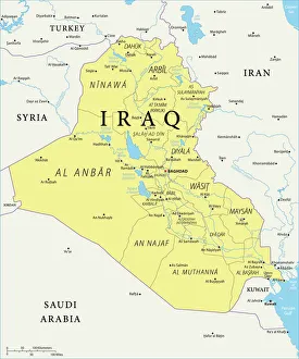
Iraq Reference Map
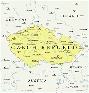
Czech Republic Reference Map
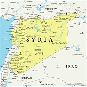
Syria Reference Map
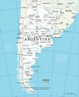
Agentina Refernce MapOfficially the Argentine Republic, Agentina is a country of South America, which covers most of the southern portion of the continent. It is the second largest country in South America after Brazil
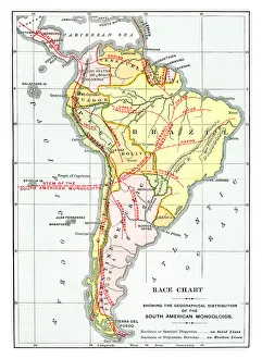
Old map of Race Chart showing the geographical distribution of the South AmericanAntique Illustration, Copyright has expired on this artwork. From my own archives, digitally restored
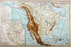
River and mountains map of North AmericaIllustration of a River and mountains map of North America
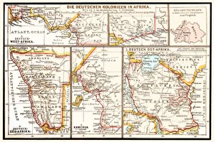
The six principal colonies of German AfricaIllustration of a The six principal colonies of German Africa
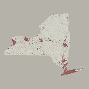
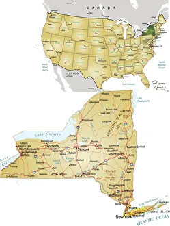
New York State US State Road MapVector Illustration of a Road Map of New York State State, USA. All source data is in the public domain. U.S. Geological Survey
Reference Maps, 164549882164549882
Reference Maps, 163116018163116018
Reference Maps, 131896726131896726
Reference Maps, 455397785455397785
Reference Maps, 455337151455337151
Reference Maps, 163219136163219136
Reference Maps, 165787290165787290
Reference Maps, 164549959164549959
Reference Maps, 167923380167923380
Reference Maps, 163116020163116020
Reference Maps, 164552464164552464
Reference Maps, 163219137163219137
Reference Maps, 154156325154156325
Reference Maps, 134435482134435482
Reference Maps, 164550386164550386
Reference Maps, 167923939167923939
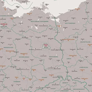
Berlin Brandenburg Area Vector Map. All source data is in the public domain. Made with Natural Earth.
Reference Maps, 158448208158448208
Reference Maps, 164552294164552294
Reference Maps, 667165114667165114
Reference Maps, 163219138163219138
Reference Maps, 164550720164550720
Reference Maps, 135519165135519165
Reference Maps, 154156368154156368
Reference Maps, 164552043164552043
Reference Maps, 164552085164552085
Reference Maps, 164550721164550721
Reference Maps, 154156363154156363