mail_outline sales@mediastorehouse.com
799 Items
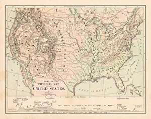
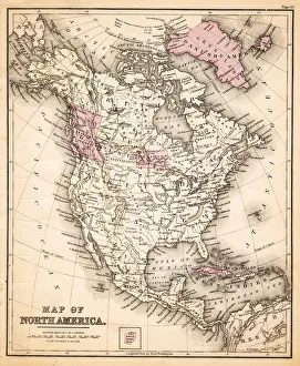
United States map 1881Harpers School Geography, New York, Harpers and Brothers, 1881
USA West Central states map 1881Harpers School Geography, New York, Harpers and Brothers, 1881
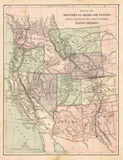
Pacific States USA map 1881Harpers School Geography, New York, Harpers and Brothers, 1881
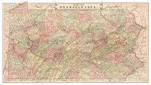
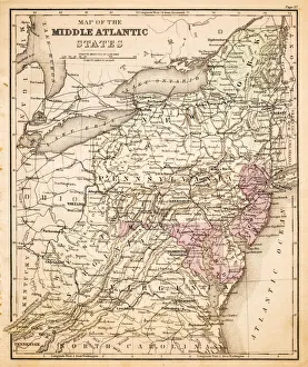
Pennsylvania state USA map 1881Harpers School Geography, New York, Harpers and Brothers, 1881
Map EngravingsFine Art Storehouse Maps: Map Engravings
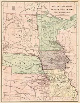
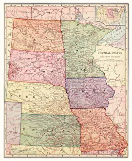
Central states USA map 1892Frye Grammar School Geography - 1892
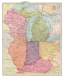
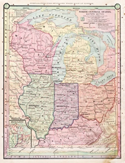
Central states eastern section USA map 1892Frye Grammar School Geography - 1892
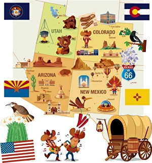
Cartoon Map of USA
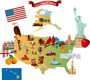
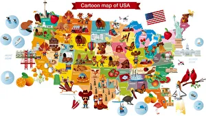
Cartoon map of USA
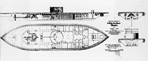
American Civil WarUSS Monitor, general plan published in 1862, showing the ships inboard profile, plan view below the upper deck and hull cross sections through the engine and boiler spaces
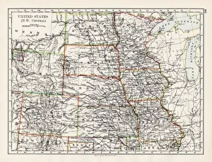
United States NW Central 1897The World-Wide Atlas of Modern Geography, Political and Physical W. & A.K. Johnston - London 1897
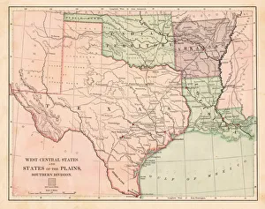
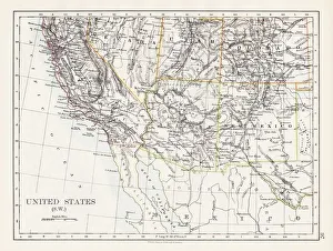
United States South West map 1897The World-Wide Atlas of Modern Geography, Political and Physical W. & A.K. Johnston - London 1897
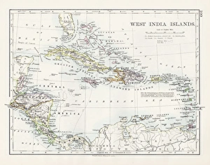
West indies map 1897The World-Wide Atlas of Modern Geography, Political and Physical W. & A.K. Johnston - London 1897
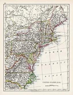
United States North East map 1897The World-Wide Atlas of Modern Geography, Political and Physical W. & A.K. Johnston - London 1897
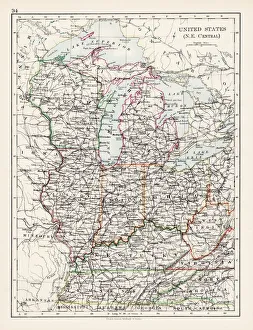
United States North East Central map 1897The World-Wide Atlas of Modern Geography, Political and Physical W. & A.K. Johnston - London 1897
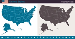
USA Map - Infographic SetVector maps of the United States with variable specification and icons
USA, New York, Niagara Falls, satellite imagea014085
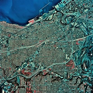
USA, Ohio, Cleveland and Lake Erie, satellite imagea014087
USA, Florida, Jacksonville, satellite imagea014092
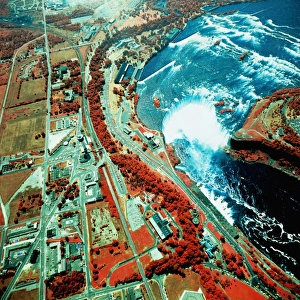
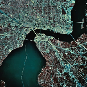
USA, New York, Buffalo, satellite imagea014430
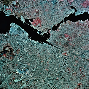
USA, Pennsylvania, Providence, satellite imagea014088
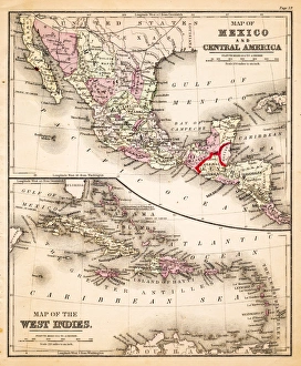
Map of Mexico and West Indies 1883Warrens Common School Geography
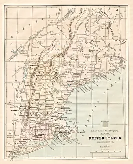
Map of Maine and Vermont1883Warrens Common School Geography
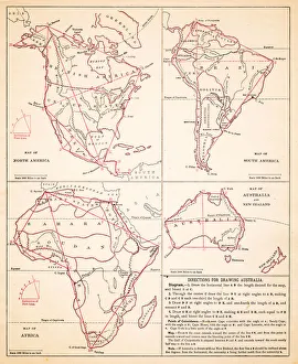
Map drawing Africa North America Australia hemispheres 1881Warrens Common School Geography
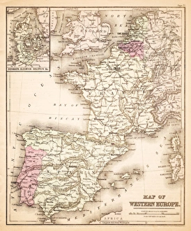
Map of Western Europe 1883Warrens Common School Geography
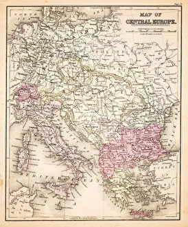
Map of Central Europe 1883Warrens Common School Geography
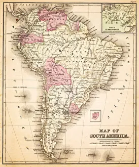
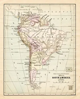
Map of South America 1883Warrens Common School Geography
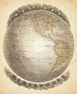
World western hemispheres 1883Warrens Common School Geography
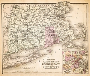
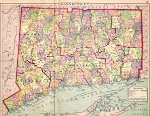
Map of Connecticut 1883Warrens Common School Geography
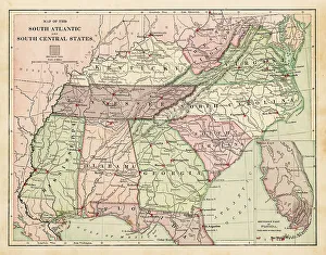
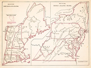
Map of Middle states USA 1883Warrens Common School Geography
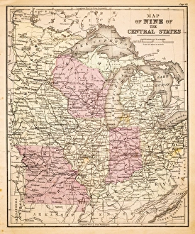
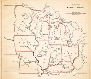
Map of Central States USA 1883Warrens Common School Geography
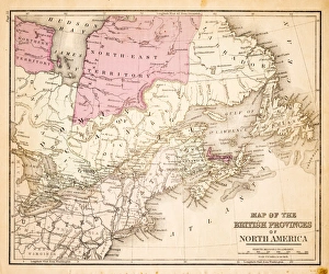
Map of British provinces of North America 1883Warrens Common School Geography
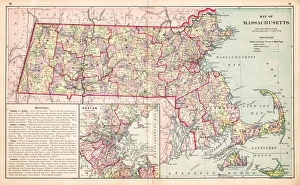
Map of Massachusetts USA 1883Warrens Common School Geography
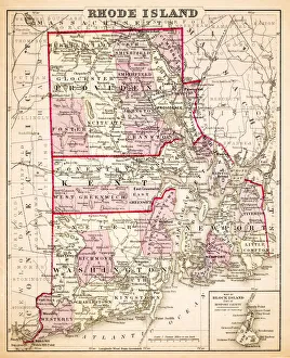
Map of Rhode Island USA 1883Warrens Common School Geography
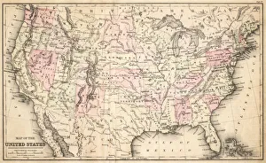
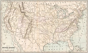
Map of United States 1883Warrens Common School Geography
North Central states map 1886North Central states map Maps Monteith Physical Geography 1886
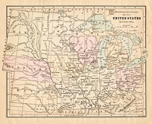
United States map 1881Coltons Common School Geography 1881 New York Sheldon and Co
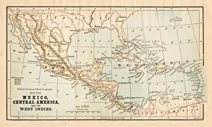
Mexico and Central America map 1881Coltons Common School Geography 1881 New York Sheldon and Co
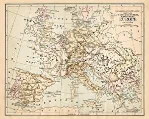
Europe map 1881Coltons Common School Geography 1881 New York Sheldon and Co
South America map 1881Coltons Common School Geography 1881 New York Sheldon and Co
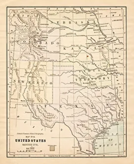
North Eastern States USA map 1881Coltons Common School Geography 1881 New York Sheldon and Co