mail_outline sales@mediastorehouse.com
799 Items
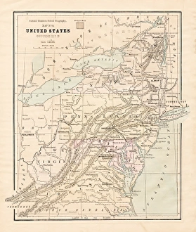
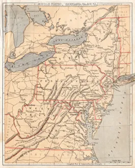
New England States USA map 1881Coltons Common School Geography 1881 New York Sheldon and Co
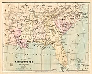
Souther States USA map 1881Coltons Common School Geography 1881 New York Sheldon and Co
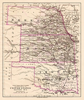
Kansas and Nebraska map 1881Coltons Common School Geography 1881 New York Sheldon and Co
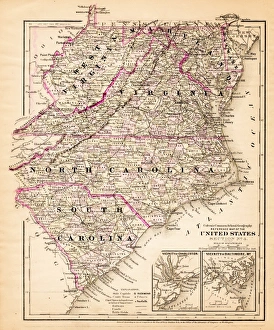
Virginia North Carolina map 1881Coltons Common School Geography 1881 New York Sheldon and Co
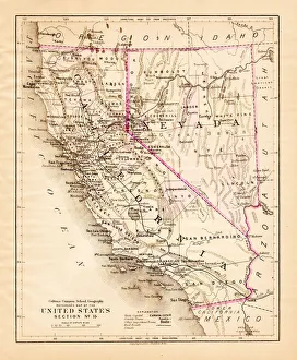
California Nevada map 1881Coltons Common School Geography 1881 New York Sheldon and Co
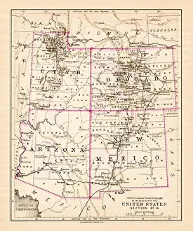
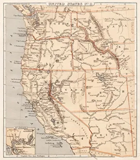
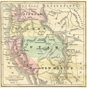
Utah Arizona New Mexico Colorado map 1881Coltons Common School Geography 1881 New York Sheldon and Co
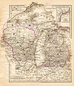
Wisconsin Michigan map 1881Coltons Common School Geography 1881 New York Sheldon and Co
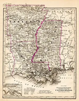
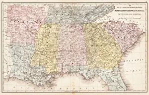
Arkansas Louisiana Pississippi map 1881Coltons Common School Geography 1881 New York Sheldon and Co
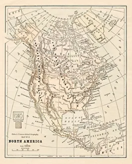
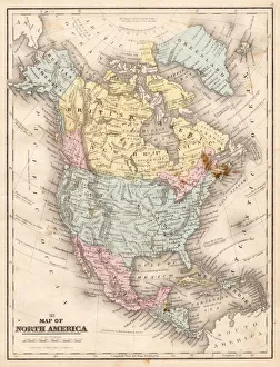
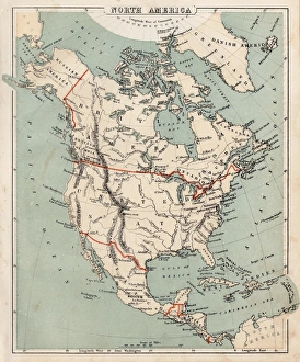
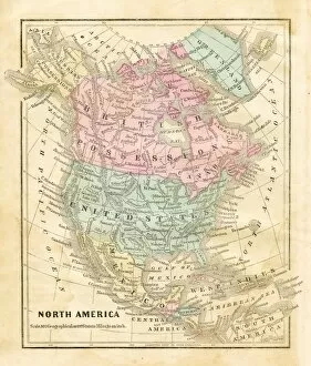
North America map 1881Coltons Common School Geography 1881 New York Sheldon and Co
Middle states USA map 1869Cornells Grammars-School Geography - S.S. Cornell - New York D. Appleton and Company 1869
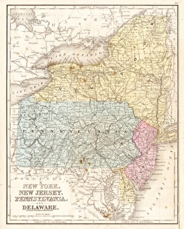
MId-atlantic states usa map 1867Mitchells Modern Atlas - Published by E.H. Buttler & Co - Philadelphia 1867
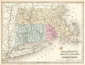
Rhode Island Massachusetts Connecticut 1867Mitchells Modern Atlas - Published by E.H. Buttler & Co - Philadelphia 1867
USA Southern States 1867Mitchells Modern Atlas - Published by E.H. Buttler & Co - Philadelphia 1867
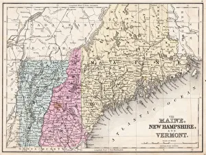
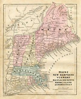
Maine New Hampshire and Vermont 1867Mitchells Modern Atlas - Published by E.H. Buttler & Co - Philadelphia 1867
Map of North America 1867Mitchells Modern Atlas - Published by E.H. Buttler & Co - Philadelphia 1867
Pacific USA states map 1869Cornells Grammars-School Geography - S.S. Cornell - New York D. Appleton and Company 1869
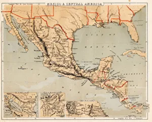
Mexico and Central America map 1869Cornells Grammars-School Geography - S.S. Cornell - New York D. Appleton and Company 1869
Map of North America 1869Cornells Grammars-School Geography - S.S. Cornell - New York D. Appleton and Company 1869
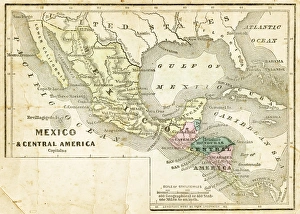
Mexico and Central America map 1856Colton and Fitchs Modern School Geography by George W. Fitch - New York 1856
Western Pacific USA states map 1856Colton and Fitchs Modern School Geography by George W. Fitch - New York 1856
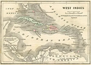
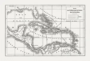
West Indies map 1856Colton and Fitchs Modern School Geography by George W. Fitch - New York 1856
Maine New Hampshire and Connecticut 1856Colton and Fitchs Modern School Geography by George W. Fitch - New York 1856
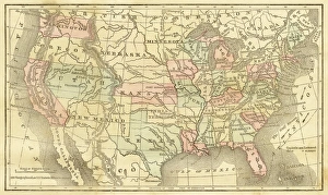
Map of United States 1856Colton and Fitchs Modern School Geography by George W. Fitch - New York 1856
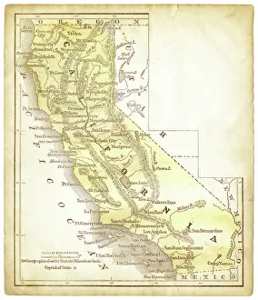
Old map of California 1856Colton and Fitchs Modern School Geography by George W. Fitch - New York 1856
Map of North America 1856Colton and Fitchs Modern School Geography by George W. Fitch - New York 1856
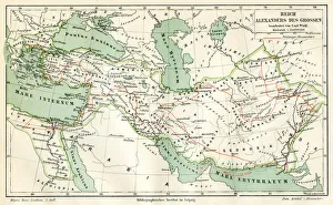
Map of the reign of Alexandre the Great 1895Meyers Konversations-Lexikon. Ein Nachschlagewerk des allgemeinen Wissens, 5th edition 17 volumes Bibliographisches Institut - Leipzig 1895-1897
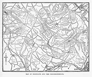
Map of the City of Bradgate, England Victorian Engraving, 1840Very Rare, Beautifully Illustrated Antique Engraving of Map of the Map of the City of Bradgate, England Victorian Engraving, 1840. Source: Original edition from my own archives
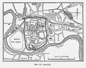
Map of the City of Chester, England Victorian Engraving, 1840Very Rare, Beautifully Illustrated Antique Engraving of Map of the City of Chester, England Victorian Engraving, 1840. Source: Original edition from my own archives
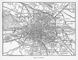
Map of the City of Dublin, Ireland Victorian Engraving, 1840Very Rare, Beautifully Illustrated Antique Engraving of Map of the City of Map of the City of Dublin, Ireland Victorian Engraving, 1840. Source: Original edition from my own archives
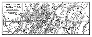
Vicinity of Chattanooga - 1886 scanned engraving
Map of Kentucky and Tennessee - 1886 scanned engraving
Map of New England by Explorer John Smith, Circa 1624Beautifully Illustrated Antique Engraved Victorian Illustration of Historical Map of New England from Explorer Captain John Smith, Circa 1624. Source: Original edition from my own archives
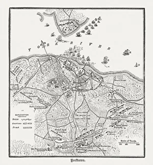
Battle of Yorktown in 1781, wood engraving, published in 1884Plan of the Battle of Yorktown during the American Revolutionary War in 1781. Wood engraving, published in 1884
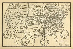
Engraved Chart of United States Time Zones, Circa 1883Beautifully Illustrated Antique Engraved Victorian Illustration of an Engraved Chart of United States Time Zones and Standard Railway Time, Circa 1883. Original edition from my own archives
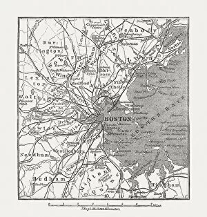
Boston, Massachusetts, USA, wood engraving, published in 1882Map of Boston, Massachusetts, USA. Wood engraving, published in 1882
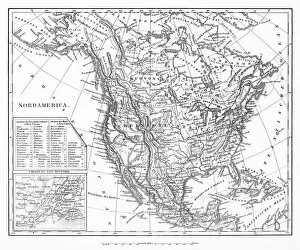
Map of North AmericaEngraved illustrations of a Map of North America from Iconographic Encyclopedia of Science, Literature and Art, Published in 1851. Copyright has expired on this artwork. Digitally restored
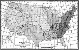
United States area: Acquisition and transfer of territory 1780 to 1870United States area: Acquisition and transfer of territory 1780 to1870
Voyages of Christopher Columbus, wood engraving, published c. 1882Map with the routes of the four voyages of Christopher Columbus in the Caribbean Sea. Wood engraving, published c. 1882
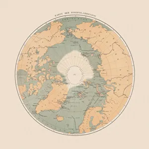
Ancient map of the Arctic Region, lithograph, published in 1883Ancient map of the Arctic Region. Lithograph, published in 1883
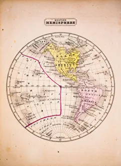
Western Hemisphere 1852 Map
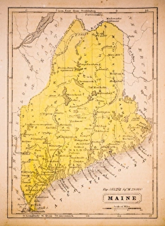
Maine 1852 Map
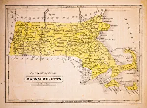
Massachusetts 1852 Map
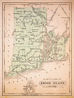
Rhode Island 1852 Map
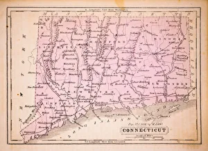
Connecticut 1852 Map
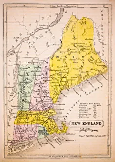
New England 1852 Map
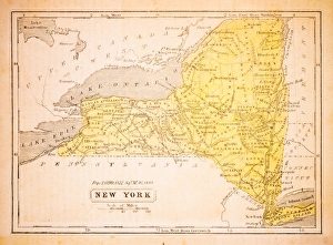
New York 1852 Map
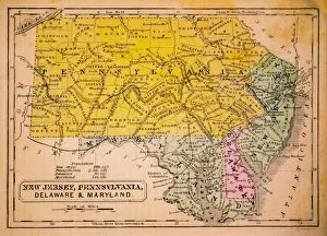
New Jersey, Pennsylvania, Delaware and Maryland 1852 Map
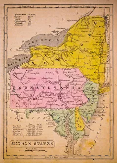
Middle States 1852 Map