mail_outline sales@mediastorehouse.com
799 Items
Southern States 1852 Map
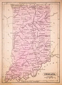
Indiana 1852 Map
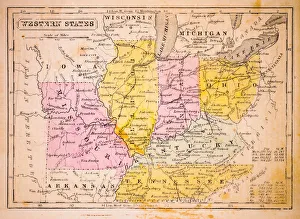
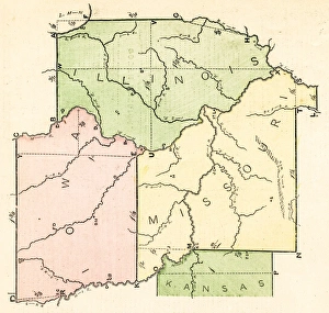
Western States 1852 Map
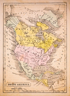
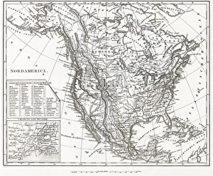
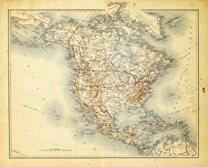
North America 1852 Map
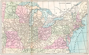
United States 1852 Map
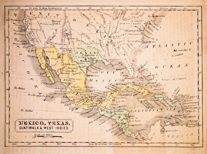
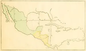
Mexico, Texas, Guatimala and West Indies 1852 Map
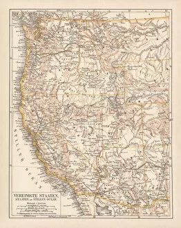
United States of America, West Coast, ithograph, published in 1878United States of America, States on the Pacific Ocean. Lithograph, published in 1878
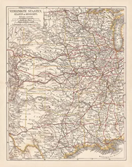
United States of America, States on Mississippi river, lithograph published 1878United States of America, States on the Mississippi river. Lithograph, published in 1878
United States of America, Atlantic coast, lithograph, published in 1878United States of America, Atlantic coast. Lithograph, published in 1878
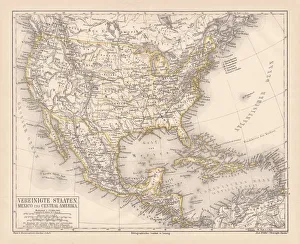
United States of America, Mexico and Central America, published in 1878United States of America, Mexico and Central America. Lithograph, published in 1878
North America 1850 EngravingEngraved illustrations of the Theory of the Art of Drawing from Iconographic Encyclopedia of Science, Literature and Art, Published in 1851. Copyright has expired on this artwork. Digitally restored
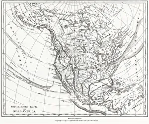
North America 1850 EngravingEngraved illustrations of the Physical Map of North America from Iconographic Encyclopedia of Science, Literature and Art, Published in 1851. Copyright has expired on this artwork. Digitally restored
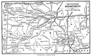
Missouri CampaignsVintage engraving from 1863 of a map of the Missouri Campaigns from the time of the American Civil War
Antquie Map of the United StatesVintage map of the United States of America from 1837
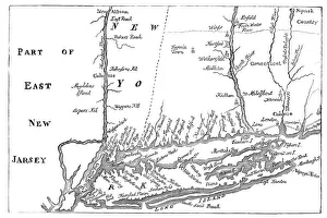
Vintage Map of New YorkVintage Map from 1880 of New York at the beginning of the 18th Century
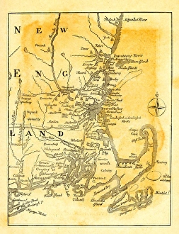
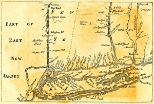
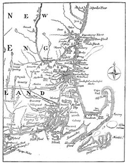
Vintage map of New EnglandVintage map of NEw England around 1700
Vintage Map of New York at the beginning of the 18th Century. from 1880
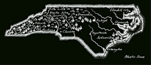
Antique North Carolina
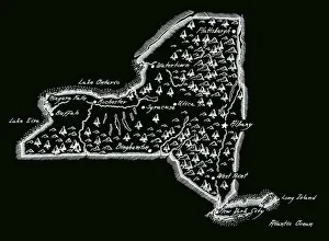
Antique New York StateNew York State Map, - Antique style. Includes mountains and water bodies. High detail - vector illustration
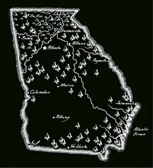
Antique Georgia MapGeorgia Map, - Antique style. Includes mountains and water bodies. High detail - vector illustration
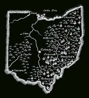
Antique OhioOhio Map, - Antique style. Includes mountains and water bodies. High detail - vector illustration
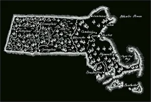
Antique Massachusetts
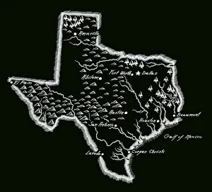
Antique Texas MapTexas Map, - Antique style. Includes mountains and water bodies. High detail - vector illustration
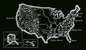
Antique USA MapUSA Map, - Antique style. Includes mountains and water bodies. - vector illustration
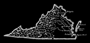
Antique Virginia MapVirginia Map, - Antique style. Includes mountains and water bodies. - vector illustration
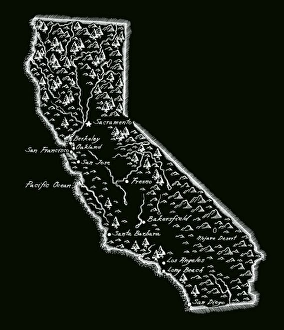
Antique CaliforniaCalifornia Map, - Antique style. Includes mountains and water bodies. High detail - vector illustration
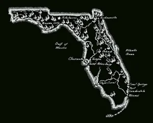
Antique Florida MapFlorida Map, - Antique style. Includes mountains and water bodies. High detail - vector illustration
Vintage Map of New England at the beginning of the 18th century
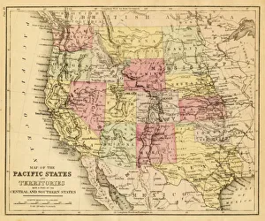
map of the Pacific states (California, Oregon, Washington) an territories with a part of central and souther states - USA (1883)
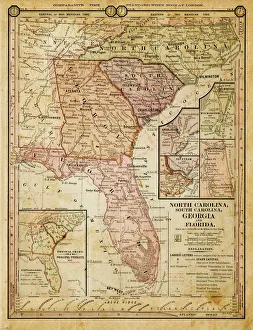
usa - southern states 1884map of north carolina, south carolina, georgia and florida 1884
Map of North America 1882Antique Map of North America 1882
Map of United States and Mexico 1897Map of United States and Mexico
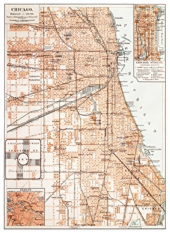
Map of Chicago 1895Map of the city of Chicago, USA
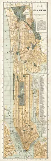
Map of New York City 1894Huge vertical panorama map of New York 1885
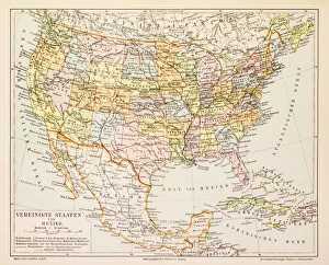
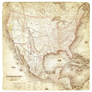
Map of United States and Mexico 1849Map of United States and Mexico
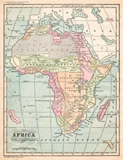
Africa map 1875The Independent Course Comprehensive Geography by James Monteith, A.S. Barnes & Co, New York & Chicago 1875
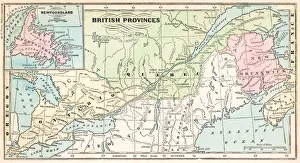
British provinces Canada map 1875The Independent Course Comprehensive Geography by James Monteith, A.S. Barnes & Co, New York & Chicago 1875
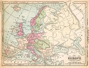
Europe map 1875The Independent Course Comprehensive Geography by James Monteith, A.S. Barnes & Co, New York & Chicago 1875
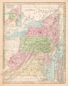
USA middle states map 1875The Independent Course Comprehensive Geography by James Monteith, A.S. Barnes & Co, New York & Chicago 1875
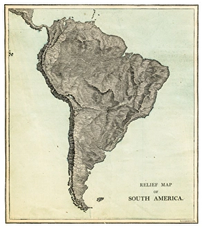
South America relief map 1875The Independent Course Comprehensive Geography by James Monteith, A.S. Barnes & Co, New York & Chicago 1875
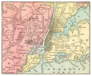
New York and Jersey map 1875The Independent Course Comprehensive Geography by James Monteith, A.S. Barnes & Co, New York & Chicago 1875
North America relief map 1875The Independent Course Comprehensive Geography by James Monteith, A.S. Barnes & Co, New York & Chicago 1875
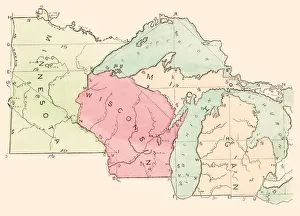
USA states map 1875The Independent Course Comprehensive Geography by James Monteith, A.S. Barnes & Co, New York & Chicago 1875
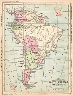
South America map 1875The Independent Course Comprehensive Geography by James Monteith, A.S. Barnes & Co, New York & Chicago 1875
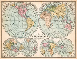
The world in hemispheres map 1875The Independent Course Comprehensive Geography by James Monteith, A.S. Barnes & Co, New York & Chicago 1875
States USA map 1875The Independent Course Comprehensive Geography by James Monteith, A.S. Barnes & Co, New York & Chicago 1875
Routes of travel in the United States map 1875The Independent Course Comprehensive Geography by James Monteith, A.S. Barnes & Co, New York & Chicago 1875
Central America and West Indies map 1875The Independent Course Comprehensive Geography by James Monteith, A.S. Barnes & Co, New York & Chicago 1875