mail_outline sales@mediastorehouse.com
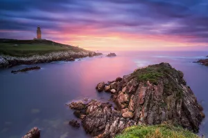
Tower of Hercules, CoruAna, Galicia, SpainThe Tower of Hercules (Torre de Hercules) is an ancient Roman lighthouse. Since June 27, 2009, has been a UNESCO World Heritage Site
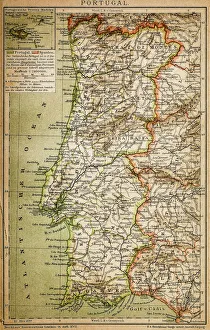
Map of PortugalAntique illustration engraving map og Portugal
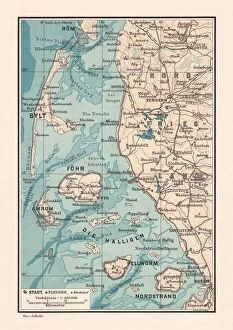
Northern Friesland (Nordfriesland), and islands, Schleswig-Holstein, Germany, lithograph, published 1887North Frisian Islands and Northern Friesland (Nordfriesland), the northernmost district of Germany, part of the state of Schleswig-Holstein. Lithograph, published in 1887
People playing football on Ipanema beach in Rio
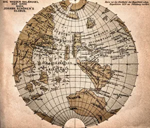
World map from 1520Western hemisphere of the Johannes SchAoner globe from 1520. expedition
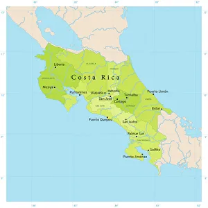
Costa Rica Vector Map+++
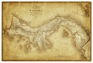
Map of Panama 1864Map of Panama - combined with 2 different texture overlays
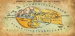
Map of the world according to Strabo 63 B.C
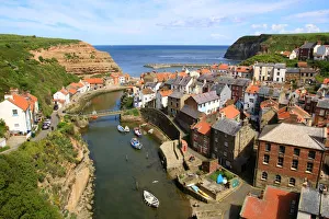
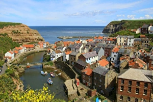
An elevated view of the fishing village of Staithes, North Yorkshire, EnglandLooking seawards over cottage rooftops of the fishing village of Staithes, North Yorkshire, England
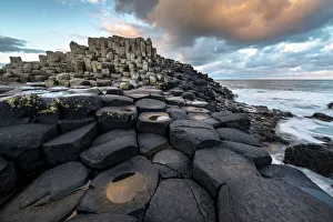
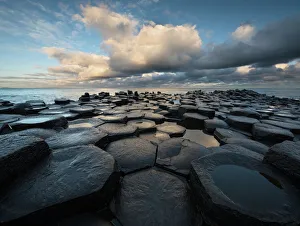
Giants Causeway early morningFresh weather above the basalt columns of the Giants Causeway in Northern Ireland
Couple Puffin on cliff in summer
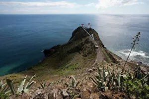
Azores lighthouse, Maia, Santa Maria, Azores, Portugal
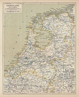
Map of the Netherlands, lithograph, published in 1877Map of the Netherlands. Lithograph, published in 1877
Chapel porth beach, CornwallCornish Atlantic ocean beach and reflections of evening sun and isolated foreground rocks
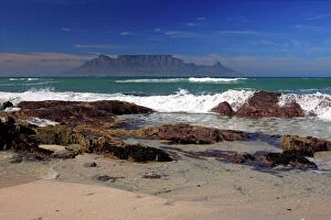
Bloubergstrand, Table Mountain at back, Cape Town, Western Cape, South Africa
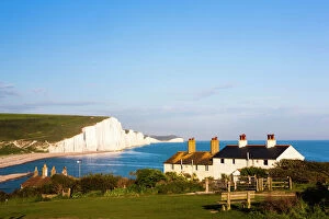
Houses in front of the Seven Sisters chalk cliffs, Seaford, Sussex, England, United Kingdom
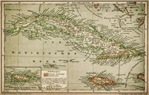
Caribbean mapAntique map of Cuba, Jamaica, Puerto Rico
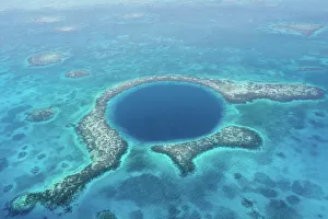
Great Blue Hole, BelizeThe Great Blue Hole is a large submarine sinkhole off the coast of Belize
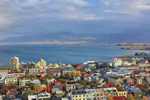
Aerial view over downtown Reykjavik with ocean and mountain at back, IcelandAerial view over downtown Reykjavik from the top of Hallgrimskirkja church with ocean and mountain at back, capital city of Iceland
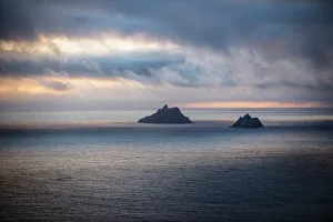
The skellig islands viewed from bolus headIveragh peninsula, county kerry, ireland
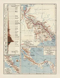
Panama Canal Project, lithograph, published in 1880Ancient map of the Panama Canal Project. Lithograph, published in 1880
Silhouette of Hercules Tower at orange sunsetAn Unesco World Heritage site, Hercules Tower at night in A Coruna, a lighthouse in the north of Spain
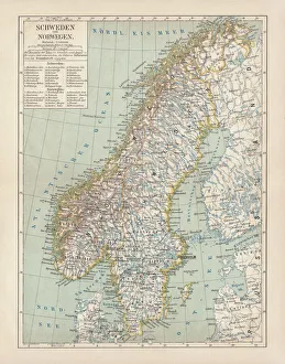
Sweden and Norway, lithograph, published in 1878Ancient map of Sweden and Norway. Lithograph, published in 1878
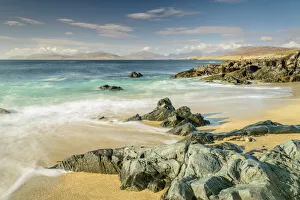
Beach at Scarasta, Isle of HarrisAquamarine seas off the West coast of Harris in the outer Hebrides. In the distance is the Isle of Taransay & the mainland of Lewis
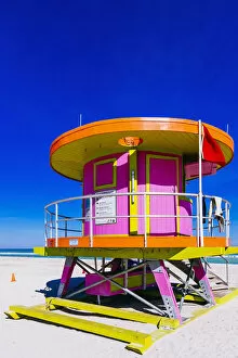
Pink lifeguard tower at South Beach, Miami, Florida, USA
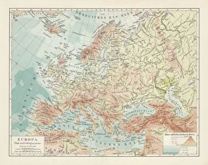
Topographic map of Europe, lithograph, published in 1897Topographic map of Europe. Lithograph, published in 1897
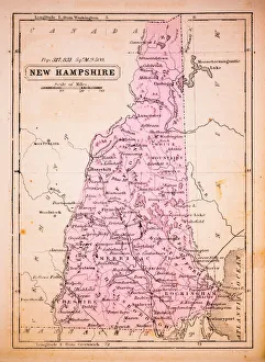
New Hampshire 1852 Map
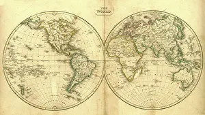
Vintage Map of the WorldVintage map of the world from 1837
Myrtle Beach Boardwalk at dusk
Cliff Baths at Beach of Enniscrone of County Sligo in IrelandAbandoned building which used to have a seaweed bath inside at beach of Enniscrone in County Sligo of Connacht province in Ireland
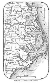
Map of Pamlico and Albemarle SoundsVintage engraving from 1863 of a map of Map of Pamlico and Albemarle Sounds at the time of the American Civil War
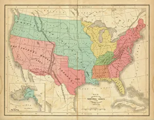
Map of United States 1876Map of United States showing the territorial growth between 1780 and 1876
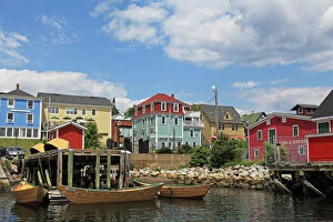
Lunenburg in Nova Scotia, Canada - colorful buildings and dories in the harbor frontLunenburg is a colorful port town in Nova Scotia, Canada. Being the best example of a planned British colonial settlement in Canada and to protect its unique architecture and civic design
Bundoran, Donegal, IrelandScenery along the coastline of Bundoran in County Donegal, Ireland
Marsh Daisy (Armeria maritima), coast at Doolin, County Clare, Ireland, Europe
Shipwreck, Bere Haven Harbour, Dunboy near Castletownbere, Beara Peninsula, County Cork, Ireland, British Isles, Europe
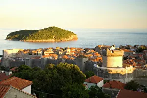
Walled City of Dubrovnik, Southeastern Tip of Croatia, Dalmation Coast, Adriatic Sea, Croatia, Eastern Europe
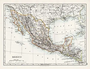
Mexico map 1897The World-Wide Atlas of Modern Geography, Political and Physical W. & A.K. Johnston - London 1897
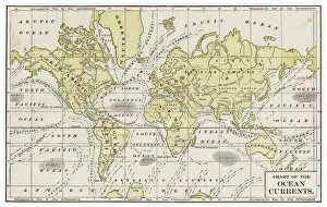
Chart of ocean currents 1889Indiana Educational Series The Complete Geography - Indianapolis 1889
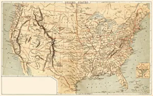
Map of United States 1869Cornells Grammars-School Geography - S.S. Cornell - New York D. Appleton and Company 1869
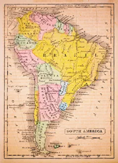
South America 1852 Map
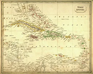
Antquie Map of The West IndiesVintage map of The West Indies from 1837
Looking seawards over cottage rooftops of the fishing village of Staithes, North Yorkshire, EnglandAn elevated view of the fishing village of Staithes, North Yorkshire, England
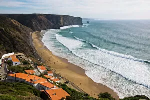
Arrifana beach, Aljezur Municipality, Algarve, PortugalPraia da Arrifana, Aljezur, Portugal
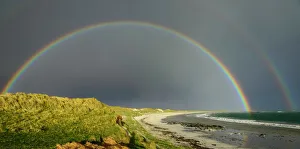
Stormy weather at beach in North UistA double rainbow arches over a North Uist beach & sand dunes in the Outer Hebrides
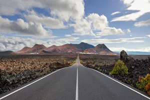
Timanfaya National Park, Lanzarote, SpainThe road from the Timanfaya National Park on Lanzarote going back towards Yaiza
Giants Causeway basalt columns with Atlantic Ocean in the distanceFresh weather above the basalt columns of the Giants Causeway in Northern Ireland
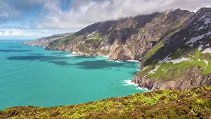
Irelands tallest sea cliffs at Slieve League, DonSlieve league is a mountain on the Atlantic coast of County Donegal, Ireland. At 601 metres (1, 972 ft), it has some of the highest sea cliffs on the island of Ireland