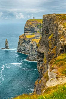
Cliffs of Moher in Ireland
cliffs of moher, landscape - scenery, republic of ireland, beach, cliff, irish culture, coastline, sea, nature, coastal feature, scenics - nature, the burren, majestic, atlantic ocean
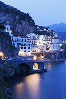
Italy, Campania, Atrani, Town on coastline at dusk
No People, Vertical, Outdoors, Dusk, Sky, Illuminated, Building Exterior, Town, Townhouse, Scenics, Coastline, Water, Reflection, Cliff, Amalfi, Coast, Atrani, Campania, Europe, Italy, Santa Maria
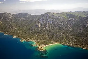
An aerial view of Sand Harbor on the east shore of Lake Tahoe in the summer, Nevada
no people, horizontal, outdoors, day, elevated view, summer, landscape, mountain range, tranquil scene, scenics, lake, coastline, usa, nevada, lake tahoe, sand harbor, lake tahoe, 145057718
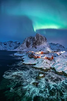
Northern lights over snowcapped mountain, village and dramatic sea in Hamnoy
nature, beach, sea, wave - water, water, landscape - scenery, coastline, no people, rock - object, travel, seascape, scenics - nature, sky, cloud - sky, beauty in nature, environment, tranquil scene