mail_outline sales@mediastorehouse.com
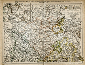
Westphalia, Hesse-nassau and Grand Duchy of Hesse Rhine ProvinceIllustration of a Westphalia, Hesse-nassau and Grand Duchy of Hesse Rhine Province
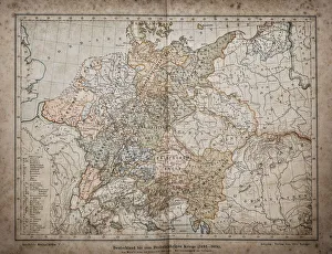
Germany until the Thirty Years War. (1493-1618)Illustration of a Germany until the Thirty Years War. (1493-1618)
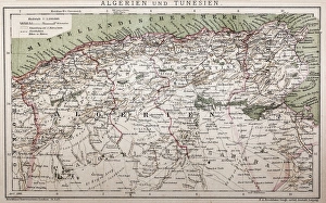
Antique map of Algeria and TunisiaIllustration of a Antique map of Algeria and Tunisia
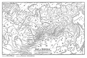
Map of Siberia - scanned 1888 map
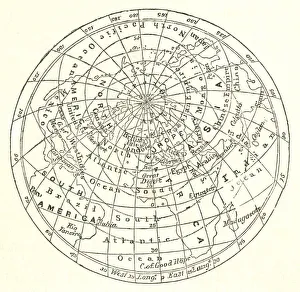
Victorian map of the Arctic CircleA Victorian map of the Arctic Circle and beyond. From Peter Parleyas Annual - A Christmas and New Yearas Present for Young Peoplea published in London by Darton & Co in 1851
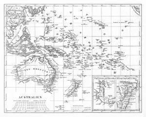
Victorian Map of AustraliaEngraved illustrations of the Map of Australia from Iconographic Encyclopedia of Science, Literature and Art, Published in 1851. Copyright has expired on this artwork. Digitally restored
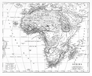
Victorian Map of AfricaEngraved illustrations of a Map of Africa from Iconographic Encyclopedia of Science, Literature and Art, Published in 1851. Copyright has expired on this artwork. Digitally restored
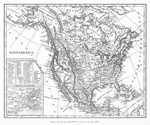
Map of North AmericaEngraved illustrations of a Map of North America from Iconographic Encyclopedia of Science, Literature and Art, Published in 1851. Copyright has expired on this artwork. Digitally restored
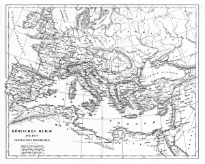
Victorian Map of The Roman EmpireEngraved illustrations of the Roman Empire Under Constantine the Great from Iconographic Encyclopedia of Science, Literature and Art, Published in 1851. Copyright has expired on this artwork
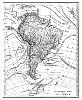
Victorian Map of North AmericaEngraved illustrations of the Physical Map of South America from Iconographic Encyclopedia of Science, Literature and Art, Published in 1851. Copyright has expired on this artwork. Digitally restored
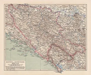
Bosnia and Montenegro, lithograph, published in 1881Ancient map of Bosnia and Montenegro. Lithograph, published in 1881
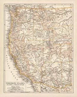
United States of America, West Coast, ithograph, published in 1878United States of America, States on the Pacific Ocean. Lithograph, published in 1878
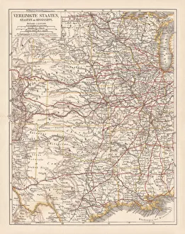
United States of America, States on Mississippi river, lithograph published 1878United States of America, States on the Mississippi river. Lithograph, published in 1878
United States of America, Atlantic coast, lithograph, published in 1878United States of America, Atlantic coast. Lithograph, published in 1878
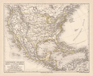
United States of America, Mexico and Central America, published in 1878United States of America, Mexico and Central America. Lithograph, published in 1878
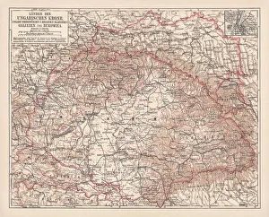
Hungary, lithograph, published in 1878Ancient map of Hungarian Monarchy, Galicia and Bukovina. Lithograph, published in 1878
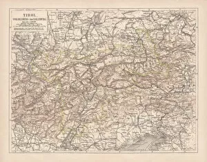
Tirol, Vorarlberg and Salzburg in Austria, lithograph, published in 1878Ancient map of Tirol, Vorarlberg and Salzburg in Austria. Lithograph, published in 1878
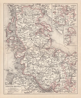
Schleswig-Holstein, lithograph, published in 1878Map of Schleswig-Holstein. Lithograph, published in 1878
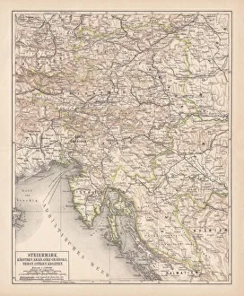
Styria, lithograph, published in 1878Ancient map of Styria: Carinthia, Carniola, GradiAaka, Croatia, Istria, Triest. Lithograph, published in 1878
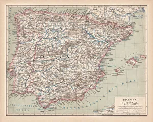
Spain and Portugal, lithograph, published in 1878Ancient map of Spain and Portugal. Lithograph, published in 1878
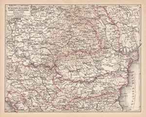
Balkan States, lithograph, published in 1878Ancient map of the Balkan States: Romania, Bulgaria, Serbia and Montenegro. Lithograph, published in 1878
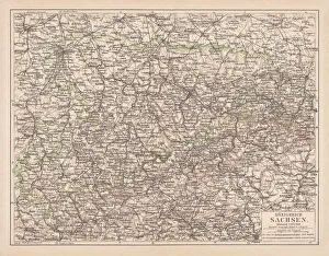
Kingdom of Saxony, lithograph, published in 1878Kingdom of Saxony. Lithograph, published in 1878
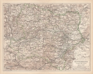
Upper Austria, lithograph, published in 1877Upper Austria (Austria above the Enns, A-sterreich ob der Enns). Lithograph, published in 1877
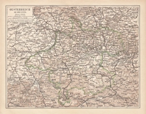
Lower Austria, lithograph, published in 1877Lower Austria (Austria below the Enns, A-sterreich unter der Enns). Lithograph, published in 1877
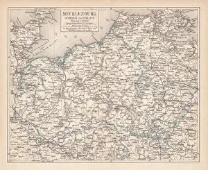
Ancient map of Mecklenburg, lithograph, published in 1877Ancient map of Mecklenburg, Germany. Lithograph, published in 1877
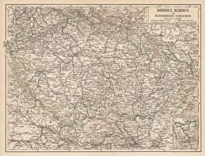
Bohemia, Moravia, Austria and Silesia, lithograph, published in 1874Bohemia, Moravia, Austria and Silesia. Lithograph, published in 1874
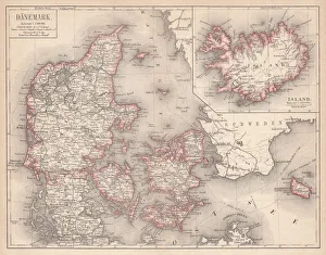
Map of Denmark and Iceland, lithograph, published in 1875Map of Denmark and Iceland. Lithograph, published in 1875
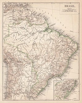
Map of Brazil. Lithograph, lithograph, published in 1874Antique map of Brazil. Lithograph, published in 1874
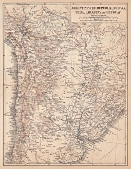
Argentina, Bolivia, Chile, Paraguay and Uruguay, lithograph, published in 1874South American countries: Argentina, Bolivia, Chile, Paraguay and Uruguay. Lithograph, published in 1874
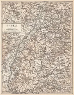
Historical German territory of Baden, lithograph, published in 1874Map of Baden - a historical German territory (today Baden-Wurttemberg). Lithograph, published in 1874
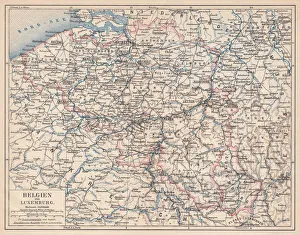
Belgium and Luxembourg, lithograph, published in 1874Antique map of Belgium and Luxembourg. Lithograph, published in 1874
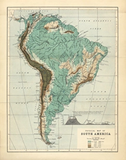
South America Physical Map, Engraving, 1892Very rare, beautifully detailed engraving of South America Physical Map, Engraving, Published in 1892. Original edition from my own archives. Copyright has expired on this artwork. Digitally restored
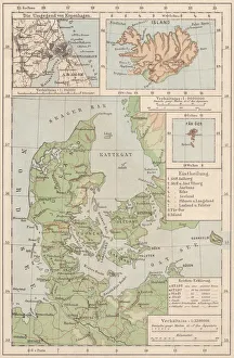
Map of Denmark and Iceland, lithograph, published in 1881Topographic map of Denmark and Iceland. Facsimile, published in 1881
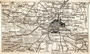
KonigsbergAntique map of Konigsberg
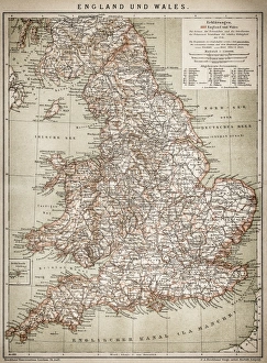
England and WalesAntique map of England and Wales
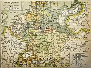
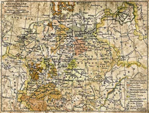
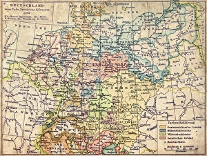
Antique map of Germany from 1815
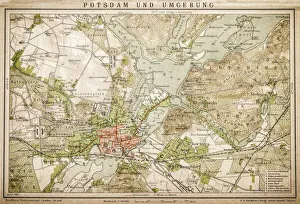
Potsdam and environmentAntique illustration of a Potsdam and environment
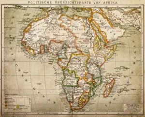
Political outline map of Africa from 1898
Germany 1547Antique map of Germany from 1547
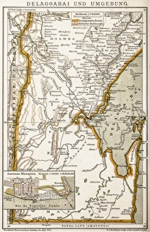
Maputo BayAntique map of Maputo Bay (BaAia de Maputo), formerly Delagoa Bay, BaAia da Lagoa (in Portuguese) is an inlet of the Indian Ocean on the coast of Mozambique
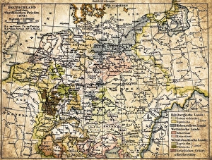
GermanyAntique map of Germany from 1648
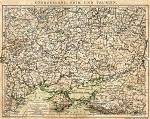
South Russia, Crimea and TauriAntique map of South Russia, Crimea and Tauri
Germany map from 1786Antique map of Germany from 1786
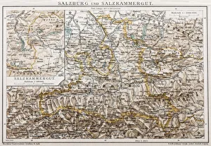
Salzburg and Lake DistrictAntique illustration of a Salzburg and Lake District
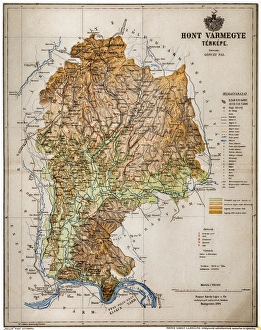
Hont CountyHont, Honthum, Honth was an administrative county (comitatus) of the Kingdom of Hungary and then shortly of Czechoslovakia
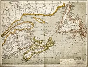
Eastern Canada and NewfoundlandIllustration of a Eastern Canada and Newfoundland
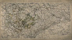
Kingdom of Saxony, province of Saxony (southern part) and Thuringian states
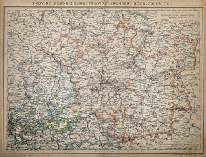
Province of Brandenburg, province of Saxony, northern partAntique illustration of a Province of Brandenburg, province of Saxony, northern part