mail_outline sales@mediastorehouse.com
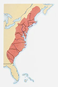
Illustration of states on East Coast of the USA
Shape and national flag of South Korea, 3D computer graphics
Shape and national flag of Azerbaijan, 3D computer graphics
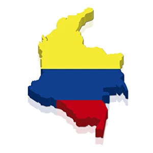
Shape and national flag of Colombia, 3D computer graphics
Shape and national flag of the Republic of Chad, 3D computer graphics
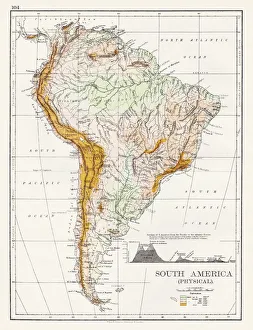
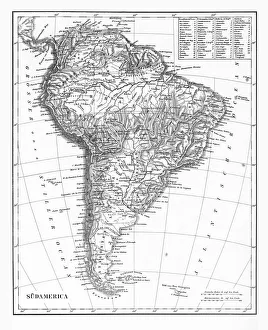
South America Physical map 1897The World-Wide Atlas of Modern Geography, Political and Physical W. & A.K. Johnston - London 1897
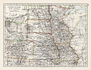
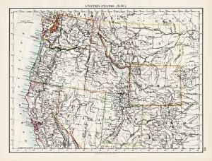
United States NW Central 1897The World-Wide Atlas of Modern Geography, Political and Physical W. & A.K. Johnston - London 1897
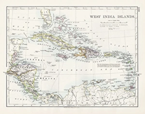
West indies map 1897The World-Wide Atlas of Modern Geography, Political and Physical W. & A.K. Johnston - London 1897
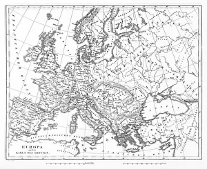
Victorian Map of EuropeEngraved illustrations of Europe in the Time of Charlemagne from Iconographic Encyclopedia of Science, Literature and Art, Published in 1851. Copyright has expired on this artwork. Digitally restored
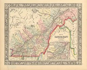
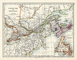
Victorian Map of Eastern Canada Circa 1850Engraved illustration of a Map of Eastern Canada in counties from Iconographic Encyclopedia of Science, Literature and Art, Published in 1851. Copyright has expired on this artwork. Digitally restored
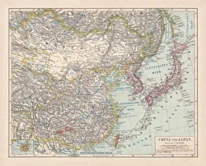
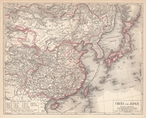
China and Japan, lithograph, published in 1881Antique map of China and Japan. Lithograph, published in 1881
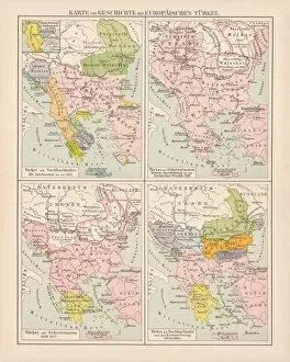
Ottoman Empire, 14th-19th century, lithograph, published in 1878Ancient map of the history of European Turkey, 15th - 19th century. Lithograph, published in 1878
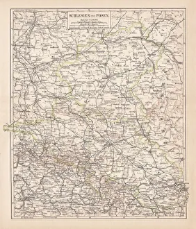
Silesia and Poznan, lithograph, published in 1878Ancient map of Silesia and Poznan, former territories of the German Empire, today Poland. Lithograph, published in 1878
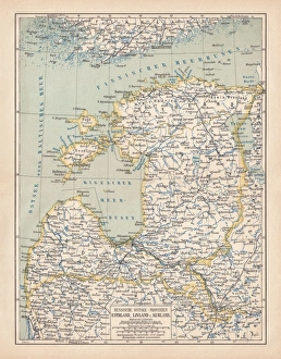
Map of Baltic states, lithograph, published in 1877Historic map of Baltic states: Lithuania, Estonia, Latvia. Lithograph, published in 1877
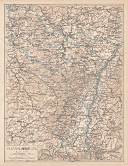
Map of Alsace-Lorraine, lithograph, published in 1875Ancient map of Alsace-Lorraine (German: Elsass-Lothringen). Lithograph, published in 1875
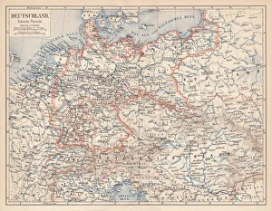
German Empire of 1871-1918, lithograph, published in 1875German Empire within the borders of 1871 - 1918. Lithograph, published in 1875
Map of China and Japan, lithograph, published in 1875Map of China and Japan. Lithograph, published in 1875
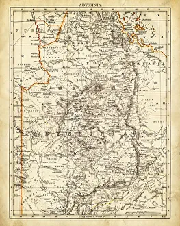
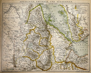
Map of Abyssinia 1897
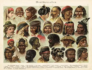
Ethnicity and Race 1888Illustrated Natural History of the Three Kingdoms
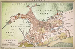
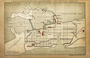
Alexandria mapAntique illustration of a Mediterranean Sea
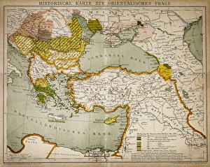
Historical map of the Oriental part of worldAntique illustration of a Historical map of the Oriental part of world
Abyssinia, Eritrea and South ArabiaAntique illustration of a Abyssinia, Eritrea and South Arabia
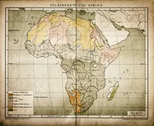
Ethnic map of AfricaAntique illustration of a ethnic map of Africa
Alexandria in the first century before and after ChristAntique illustration of a Alexandria in the first century before and after Christ
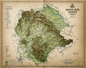
Belovar-koros, Croatio map from 1893Antique illustration of a Belovar-koros, Croatio map from 1893
Actual entrance to the American sector in BerlinThis is the entry point to the american sector, today is a mayor tourist atraction and is on the border to the american sector of Berlin
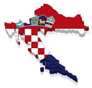
Shape and national flag of Croatia, 3D computer graphics
Shape and national flag of Senegal, levitating, 3D computer graphics
The Continent of South America, Circa 1850Engraved illustrations of the Map of South America from Iconographic Encyclopedia of Science, Literature and Art, Published in 1851. Copyright has expired on this artwork. Digitally restored
Canada map 1883The World-Wide Atlas of Modern Geography, Political and Physical W. & A.K. Johnston - London 1897
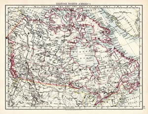
British North America map 1897The World-Wide Atlas of Modern Geography, Political and Physical W. & A.K. Johnston - London 1897
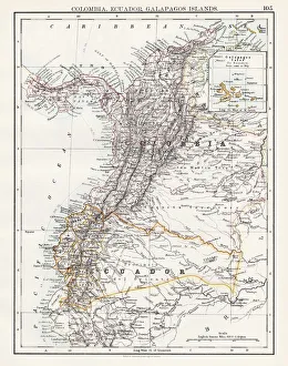
Colombia Ecuador Galapagos map 1897The World-Wide Atlas of Modern Geography, Political and Physical W. & A.K. Johnston - London 1897
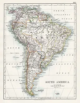
South America map 1897The World-Wide Atlas of Modern Geography, Political and Physical W. & A.K. Johnston - London 1897
United States North West map 1897The World-Wide Atlas of Modern Geography, Political and Physical W. & A.K. Johnston - London 1897
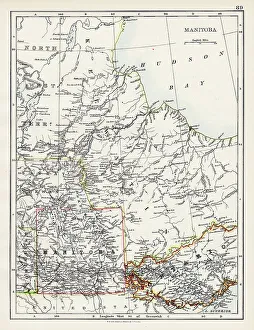
Manitoba map 1897The World-Wide Atlas of Modern Geography, Political and Physical W. & A.K. Johnston - London 1897
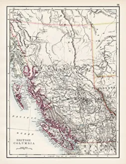
British Columbia map 1897The World-Wide Atlas of Modern Geography, Political and Physical W. & A.K. Johnston - London 1897
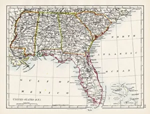
United States South East map 1897The World-Wide Atlas of Modern Geography, Political and Physical W. & A.K. Johnston - London 1897
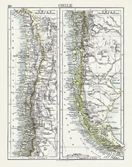
Chile map 1897The World-Wide Atlas of Modern Geography, Political and Physical W. & A.K. Johnston - London 1897
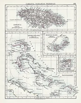
Jamaica Bahamas Trinidad map 1897The World-Wide Atlas of Modern Geography, Political and Physical W. & A.K. Johnston - London 1897
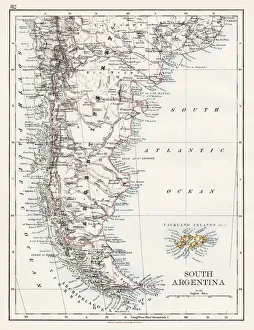
South Argentina map 1897The World-Wide Atlas of Modern Geography, Political and Physical W. & A.K. Johnston - London 1897
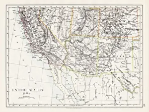
United States South West map 1897The World-Wide Atlas of Modern Geography, Political and Physical W. & A.K. Johnston - London 1897
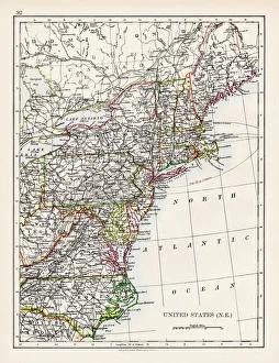
United States North East map 1897The World-Wide Atlas of Modern Geography, Political and Physical W. & A.K. Johnston - London 1897
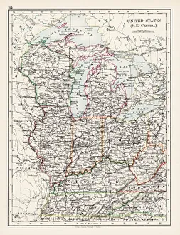
United States North East Central map 1897The World-Wide Atlas of Modern Geography, Political and Physical W. & A.K. Johnston - London 1897
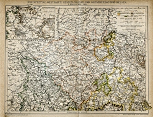
Westphalia, Hesse-nassau and Grand Duchy of Hesse Rhine ProvinceIllustration of a Westphalia, Hesse-nassau and Grand Duchy of Hesse Rhine Province
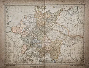
Germany until the Thirty Years War. (1493-1618)Illustration of a Germany until the Thirty Years War. (1493-1618)
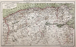
Antique map of Algeria and TunisiaIllustration of a Antique map of Algeria and Tunisia
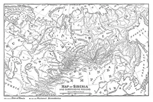
Map of Siberia - scanned 1888 map