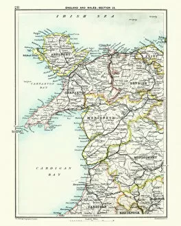
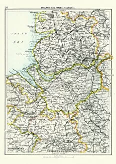
Antique map, North Wales, Anglesey, Carnarvon, 19th Century
Vintage engraving of a Antique map, North Wales, Anglesey, Carnarvon, Denbigh, Merionete, Montgomery19th Century
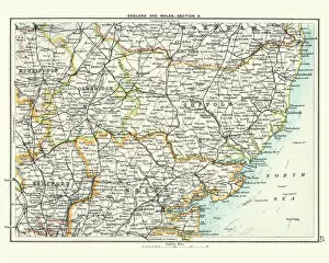
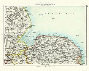
Antique map, Cambridge, Hertford, Essex, Suffolk, England 19th Century
Vintage engraving of a Antique map, Cambridge, Hertford, Essex, Suffolk, England 19th Century
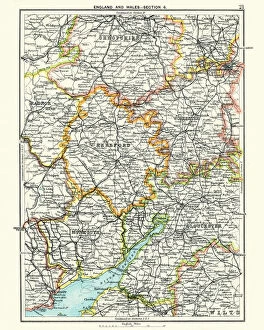
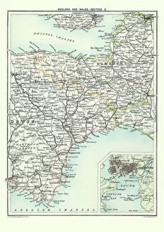
Antique map, Hereford, Worester, Monmouth, Gloucester, Shropshire, 19th Century
Antique map, Hereford, Worester, Monmouth, Gloucester, Shropshire, England and Wales 19th Century
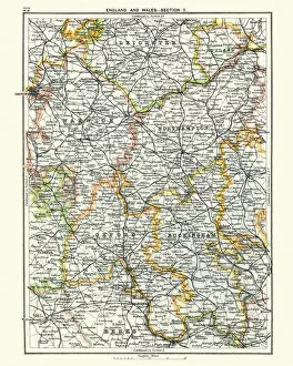
Antique map, Leicester, Warwick, Northampton, Oxford, Buckingham 19th Century
Vintage engraving of a Antique map, Leicester, Warwick, Northampton, Oxford, Buckingham. England 19th Century
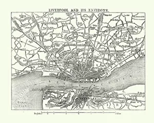
Antique map, Lancashire, Cheshire, Stafford, Liverpool, 19th Century
Vintage engraving of a Antique map, Lancashire, Cheshire, Stafford, Liverpool, Shropshire, Derby, England 19th Century