mail_outline sales@mediastorehouse.com
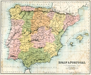
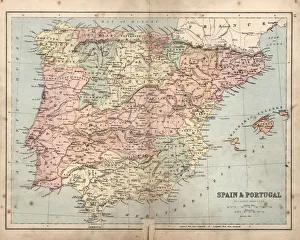
Antique map of Spain and Portugal from 1867
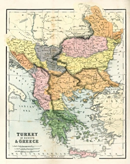
Antique Map of GreeceAntique map of Greece from 1867
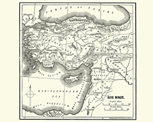
Map of Asia Minor in Ancient TimesVintage engraving of a Map of Asia Minor in Ancient Times
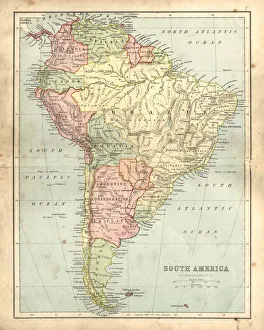
Antique damaged map of South America in the 19th CenturyVintage engraving of a Antique map of South America in the 19th Century, 1873
Antique damaged map of Spain and Portugal19th Century
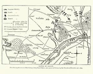
Franco Prussian War Plan of the Battle of CoulmiersVintage engraving of a scene from the Franco Prussian War. Plan of the Battle of Coulmiers (Baccon), The Battle of Coulmiers was fought on November 9
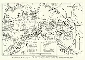
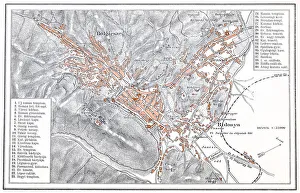
Franco Prussian War Battle plan of Siege of OrleansVintage engraving of a scene from the Franco Prussian War. Battle plan of Siege of Orleans
Ships wheel
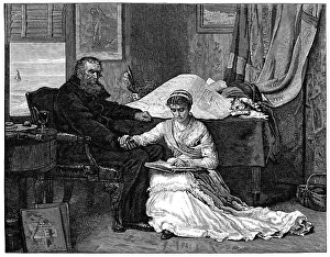
The North-West PassageVintage engraving from 1879 after the painting by John Everett Millais. An old sea captain planning to sail the North-West Passage
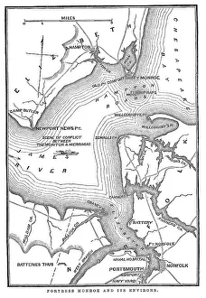
Fort Monroe and its environsVintage engraving from 1863 of a map of Fort Monroe and its environs. Fort Monroe played an important role in the American Civil War
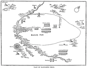
Battle of Bosworth FieldVintage engraving showing a plan of the Battle of Bosworth Field. The Battle of Bosworth (or Bosworth Field) was the last significant battle of the Wars of the Roses
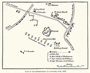
Plan of the Entrenchment at Cawnpore, June, 1857, during the Indian Rebellion of 1857
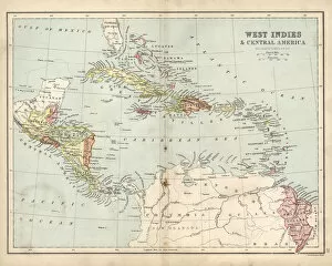
Antique map of West Indies and Central America, 19th Century, 1873
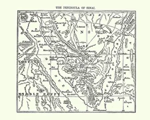
Map of the Sinai Penninsula, 1870Vintage engraving of a Map of the Sinai Penninsula, 1870
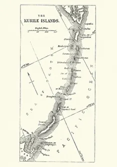
Map of Kuril Islands, 19th CenturyVintage engraving of a Map of Kuril Islands, 19th Century. The Kuril Islands or Kurile Islands in Russias Sakhalin Oblast region, form a volcanic archipelago that stretches approximately 1, 300 km
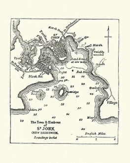
Map of Saint John, New Brunswick, Canada 19th CenturyVintage engraving of Map of Saint John, New Brunswick, 19th Century, 19th Century. 1878
Map of Central America, 19th CenturyVintage engraving of a Map of Central America, 19th Century
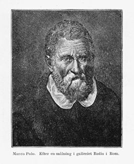
Portrait of Marco Polo Engraving, 1254-1324Beautifully Illustrated Antique Engraved Victorian Illustration of a Portrait of Marco Polo Engraving, 1254-1324. Source: Kristofer Columbus, Lefnad Och Resor (Christopher Columbus)
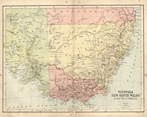
Antique damaged map of Victoria, New South Wales, 19th CenturyVintage engraving of a Antique damaged map of Victoria, New South Wales, and South Australia in the 19th Century, 1873
Brasov manIllustration of a Brasov map
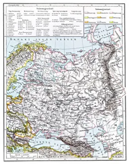
Map of Russia from 1896Illustration of a Map of Russia from 1896
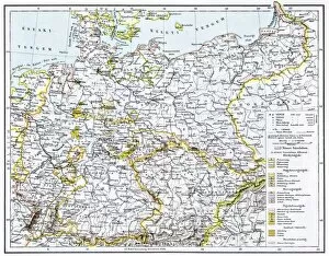
German Reich mapIllustration of a German Reich map
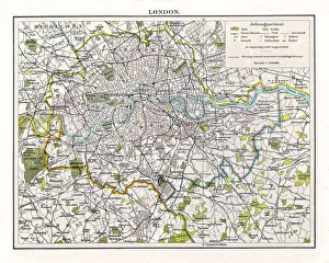
Antquie Map of London, 1895illustration of Antquie Map of London, 1895
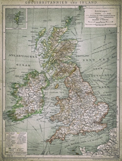
UK and IrelandAntique illustration of UK and Ireland
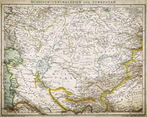
Russia - Central Asia and TurkeyAntique illustration of Russia - Central Asia and Turkey
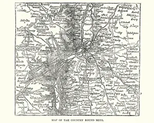
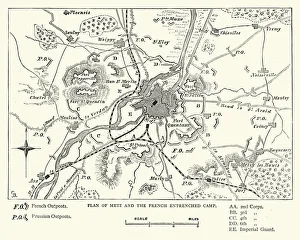
Map of the country around Metz, France, 1870Vintage engraving of a Map of the country around Metz, France, 1870
Franco Prussian War - Plan of Metz and French campVintage engraving of a scene fro the Franco Prussian War. Plan of Metz and French entrenched camp
Victorian map of the Arctic CircleA Victorian map of the Arctic Circle and beyond. From Peter Parleyas Annual - A Christmas and New Yearas Present for Young Peoplea published in London by Darton & Co in 1851
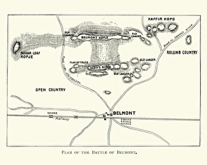
Second Boer War - Battle of BelmontVintage engraving of a plan of the Battle of Belmont an engagement of the Second Boer War on 23 November 1899, where the British under Lord Methuen assaulted a Boer position on Belmont kopje
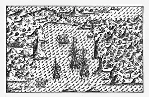
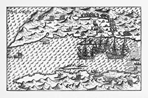
Rio de Janeiro Historical Map by Van Noort, Circa 1598Very Rare, Beautifully Illustrated Antique Engraved Victorian Illustration of Historical Map of Van Noort at Rio de Janeiro, 1598. Copyright has expired on this artwork. Digitally restored
Van Noort at Porto Deseado Historical Map of 1598Very Rare, Beautifully Illustrated Antique Engraved Victorian Illustration of Historical Map of Van Noort at Porto Deseado, 1598. Copyright has expired on this artwork. Digitally restored
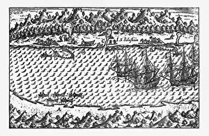
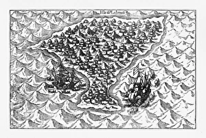
Porto Deseado Historical Map by Van Noort, Circa 1598Very Rare, Beautifully Illustrated Antique Engraved Victorian Illustration of Historical Map of Van Noort at Porto Deseado, 1598. Copyright has expired on this artwork. Digitally restored
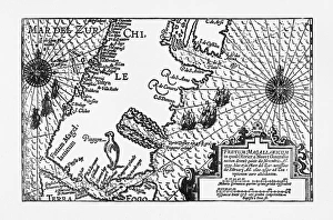
Strait of Magellan Map by Van Noort, Circa 1599Very Rare, Beautifully Illustrated Antique Engraved Victorian Illustration of Historical Map of Van Noort at the Strait of Magellan, 1599. Copyright has expired on this artwork. Digitally restored
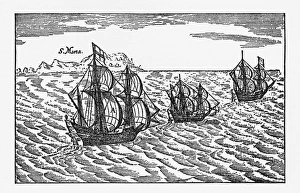
Van Noort Sailing the Strait of Magellan, Engraving of 1600Very Rare, Beautifully Illustrated Antique Engraved Victorian Illustration of Historical Engraving of Van Noort Sailing the Strait of Magellan, 1600. Copyright has expired on this artwork
Van Noort Sailing the Marianne Islands, Engraving 1600Very Rare, Beautifully Illustrated Antique Engraved Victorian Illustration of Historical Engraving of Van Noort Sailing the Marianne Islands, 1600. Copyright has expired on this artwork
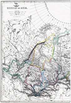
Russia Map, Asian PartPhoto of an original map published in the Weekly Dispatch Atlas in 1846 in London
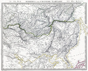
Russian Siberia and Chinese Tartary 1846 MapPhoto of an original map published in the Weekly Dispatch Atlas in 1846 in London
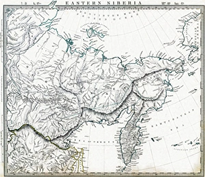
Eastern Russian Siberia 1846 MapPhoto of an original map published in the Weekly Dispatch Atlas in 1846 in London
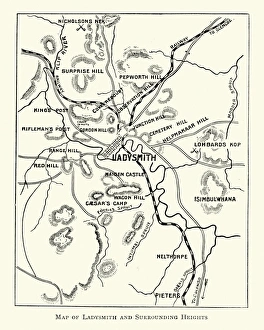
Second Boer War - Plan Ladysmith and surrounding heightsVintage engraving of a Plan Ladysmith and surrounding heights. 1899
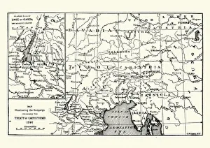
Map of the Campaign preceding the Treaty of Camp-formioVintage engraving of a Map of the Campaign preceding the Treaty of Camp-formio, 1797
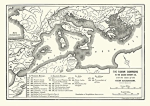
Map of Roman dominions in the Second Century BCVintage engraving of Map of Ancient Roman dominions in the Second Century BC
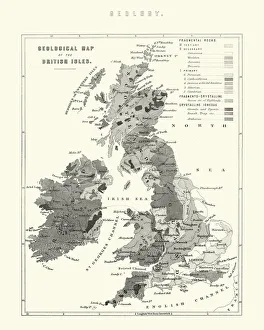
Victorian Geological Map of the British IslesVintage engraving of a Victorian Geological Map of the British Isles
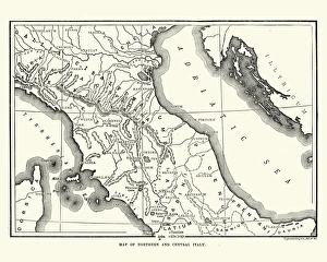
Map of Ancient Northern and Central ItalyVintage engraving of a Map of Ancient Northern and Central Italy
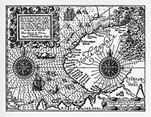
Historical Map of Dutch Navigators Artic ExpeditionVery Rare, Beautifully Illustrated Antique Engraved Victorian Illustration of Historical Map of Dutch Navigators Arctic Expedition. Copyright has expired on this artwork. Digitally restored
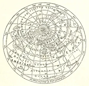
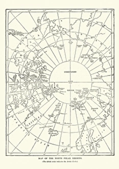
Victorian map of the North Polar RegionsVintage engraving showing a Victorian map of the North Polar Regions
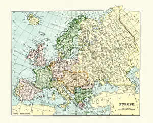
Antique Map of Europe 1880s
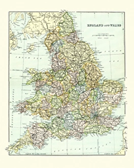
Antique Map of England and Wales 1880sVintage 19th Century map of England and Wales
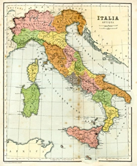
Antique Map of Ancient ItalyVintage engraving showing a Antique Map of Ancient Italy, 1864