mail_outline sales@mediastorehouse.com
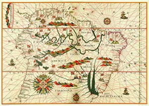
Map of South America, from a Spanish Atlas, 1582
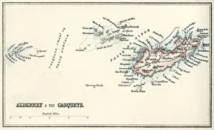
Map of Alderney and the Casquets" Vintage map from 1880 of Alderney and the Casquets. Alderney is the most northerly of the Channel Islands. It is part of the Bailiwick of Guernsey, a British Crown dependency
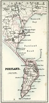
Map of Portland" Vintage map from 1880 of Portland a limestone tombolo or tied island, 6 kilometres long by 2.4 kilometres wide, in the English Channel."
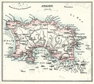
Map of Jersey" Vintage engraving from 1880 of Jersey a British Crown Dependency off the coast of Normandy, France. As well as the island of Jersey itself
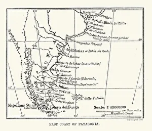
Antique Map of the East Coast of Patagonia in the 16th Century
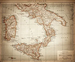
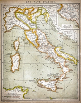
Antique Map of Lower Italy
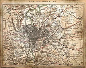
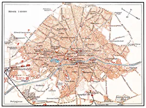
Rome and surroundingsAntique illustration of Rome and surroundings
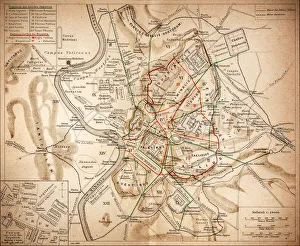
Ancient RomeAntique illustration Map of Ancient Rome from 1898
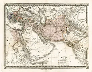
Antique Map of Alexander the Greats EmpireAntique Map from 1862 of the kingdoms of the successors of Alexander the Great. Maps text is written in Latin. [b]View More:[/b] [url=http://www.istockphoto.com/file_search.php
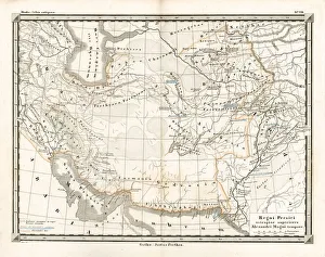
Antique Map of the Persian EmpireAntique Map from 1862 of the Persian Empire, the time of Alexander the Great. Maps text is written in Latin
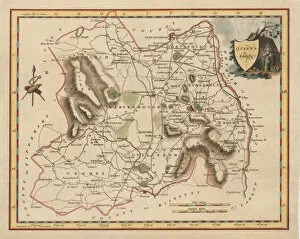
Antique map of Queens County IrelandThis map was made in 1837, just 10 years before the disaster of the Great Famine in 1847. 1837 is a particularly significant time in Irelands history at the period of the historically highest
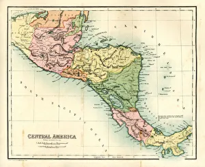
Antique map - Central AmericaAntique map of Central America, 1864
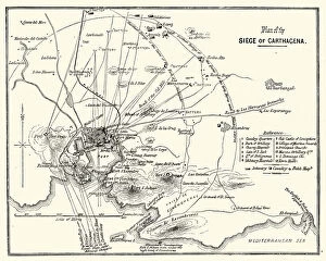
Third Carlist War - Siege of CarthagenaVintage engraving showing a plan of the Siege of Carthagena (Cartagena), Spain, during the Third Carlist War. The Carlist Wars were a series of civil wars that took place in Spain during the 19th
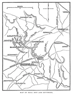
Battle of Bull RunVintage engraving from 1863 of a map of Bull Run and its environs at the time of the American Civil War. The First Battle of Bull Run
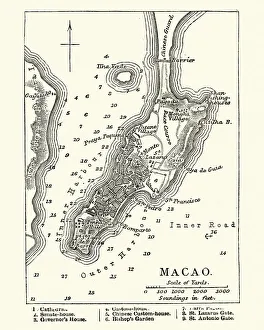
Map of Macau, 19th CenturyVintage engraving of a Map of Macau, 19th Century
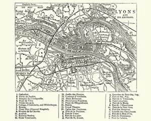
Map of Lyons, France, 19th CenturyVintage engraving of a Map of Lyons, France, 19th Century
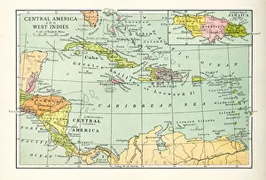
Antique Map of Central America and West IndesVintage map of Central America and West Indes, from 1894
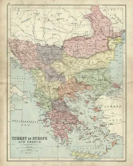
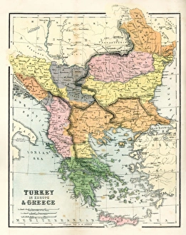
Antique map of Greece and Turkey in Europe 19th CenturyVintage engraving of a Antique damaged map Greece and Turkey in Europe in the 19th Century, 1873
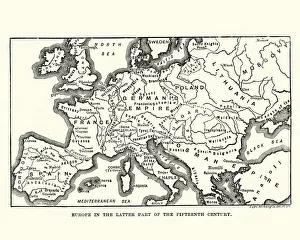
Map of Europe in late 15th CenturyVintage engraving of a Map of Europe in late 15th Century
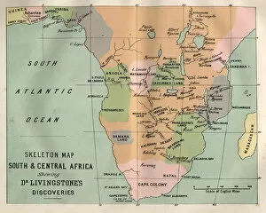
Map South and Central Africa, Livingstones discoveriesVintage engraving of Map South and Central Africa, Livingstones discoveries
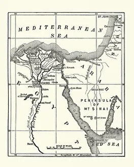
Map of Eygpt, 19th CenturyVintage engraving of a Map of Eygpt, 19th Century
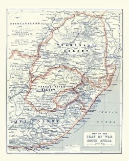
Map of South Africa during the Second Boer WarVintage Map of South Africa during the Second Boer War
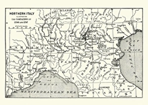
Map of Northern Italy illustrating the campaigns of 1796-1797Vintage engraving of a Map of Northern Italy illustrating the campaigns of 1796-1797 during the French Revolutionary Wars
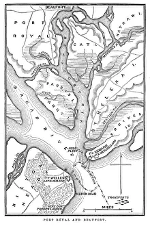
Battle of Port RoyalVintage engraving from 1863 of a map of the Battle of Port Royal which was one of the earliest amphibious operations of the American Civil War
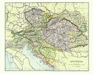
Antique Map of Austria Empire Late 19th CenturyAntique Map of Austria Empire in the Late 19th Century
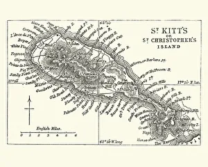
Map of Saint Kitts, 19th CenturyVintage engraving of a Map of Saint Kitts, 19th Century. Saint Kitts and Nevis, also known as the Federation of Saint Christopher and Nevis, [4] is an island country in the West Indies
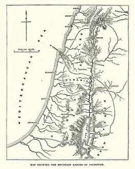
Map showing the mountain ranges of PalestineVintage engraving of Map showing the mountain ranges of Palestine, 19th Century
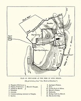
Plan of Jerusalem at the Tine of King HerodVintage engraving of a Plan of Jerusalem at the Tine of King Herod
Bucharest mapIllustration of a Bucharest map
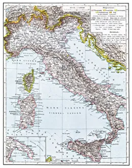
Map of Italy from 1896illustratoion of a Map of Italy from 1896
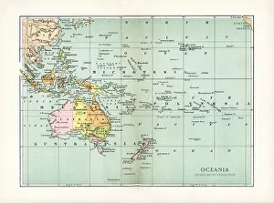
Antique Map of OceaniaVintage map of North Oceania, from 1894
Map of old ItalyVintage map of Italy
Map of New England by Explorer John Smith, Circa 1624Beautifully Illustrated Antique Engraved Victorian Illustration of Historical Map of New England from Explorer Captain John Smith, Circa 1624. Source: Original edition from my own archives
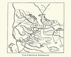
Second Boer War - Plan of the Battle of ElandslaagteVintage engraving of The Battle of Elandslaagte was a battle of the Second Boer War, and one of the few clear-cut tactical victories won by the British during that conflict
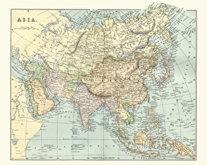
Antique map of asia in late 19th CenturyVintage Antique map of asia in late 19th Century
Antquie Map of the United StatesVintage map of the United States of America from 1837
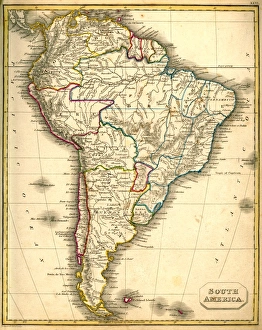
Antquie Map of South AmericaVintage map of South America from 1837
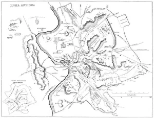
Map of Ancient RomeVintage engraving showing a plan of Ancient Rome
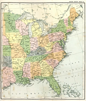
Antique Map of Eastern USAAntique Map from 1867 of Eastern United States of America
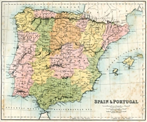
Antique map of Spain and Portugal from 1867
Antique Map of GreeceAntique map of Greece from 1867
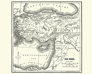
Map of Asia Minor in Ancient TimesVintage engraving of a Map of Asia Minor in Ancient Times
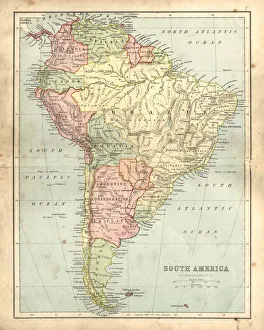
Antique damaged map of South America in the 19th CenturyVintage engraving of a Antique map of South America in the 19th Century, 1873
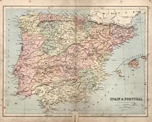
Antique damaged map of Spain and Portugal19th Century
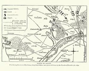
Franco Prussian War Plan of the Battle of CoulmiersVintage engraving of a scene from the Franco Prussian War. Plan of the Battle of Coulmiers (Baccon), The Battle of Coulmiers was fought on November 9
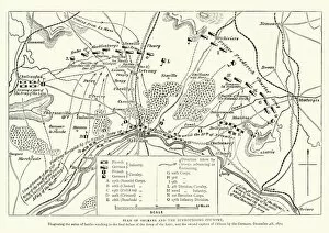
Franco Prussian War Battle plan of Siege of OrleansVintage engraving of a scene from the Franco Prussian War. Battle plan of Siege of Orleans
Ships wheel
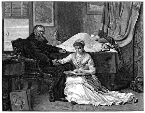
The North-West PassageVintage engraving from 1879 after the painting by John Everett Millais. An old sea captain planning to sail the North-West Passage