mail_outline sales@mediastorehouse.com
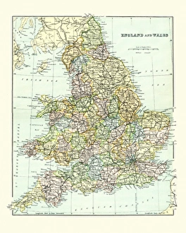
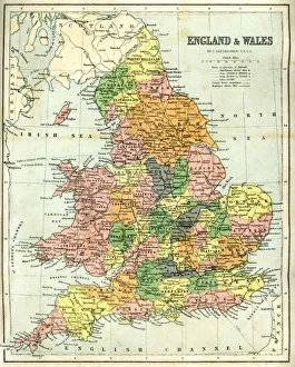
Antique Map of England and Wales 1880sVintage 19th Century map of England and Wales
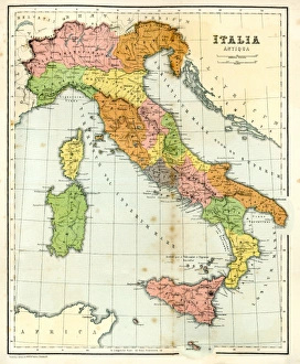
Antique Map of Ancient ItalyVintage engraving showing a Antique Map of Ancient Italy, 1864
Antique map of England and Wales, 1864
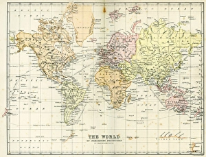
Antique Map of the WorldVintage map of the World from 1884
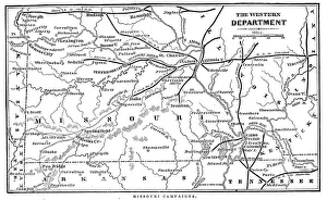
Missouri CampaignsVintage engraving from 1863 of a map of the Missouri Campaigns from the time of the American Civil War
Vintage Map of New York at the beginning of the 18th Century. from 1880
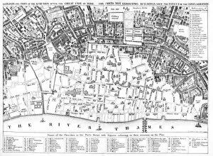
London after the Great FirePlan of London of the Great fire of 1666 showing which parts had been burnt down. The Great Fire of London was a major conflagration that swept through the central parts of the English city of
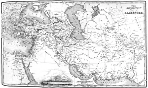
Alexander the Greats EmpireVintage map showing the ruot eof Alexander the Great as he conqured the Middle East
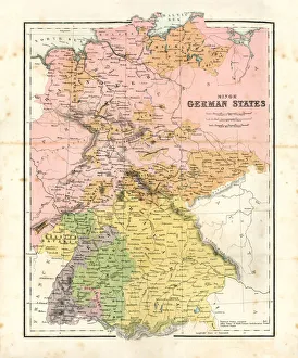
Antique map of Minor German StatesAntique map of the Minor German States from 1864
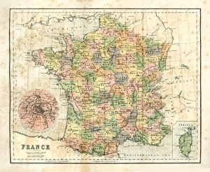
Antique map of France from 1864
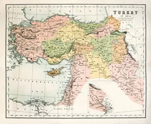
Antique Map of TurkeyAntique map of Turkey from 1867
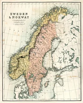
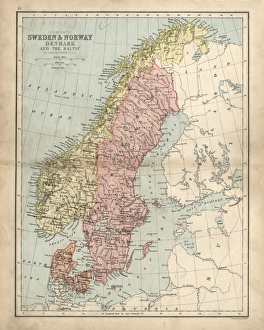
Antique Map of Sweden and NorwayAntique map of Sweden and Norway from 1867
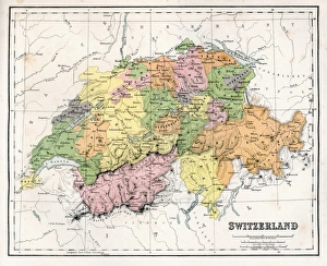
Antique Map of SwitzerlandAntique map of Switzerland from 1867
Nautical Elements in classic style
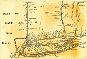
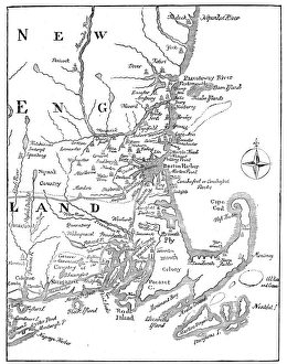
Vintage Map of New England at the beginning of the 18th century
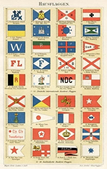
Navigation Company flags illustration 1896Meyers Konversations-Lexikon
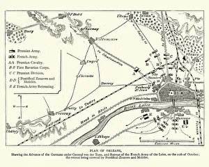
Franco Prussian War - Plan of Second Battle of OrleansVintage engraving of a scene from the Franco Prussian War. Plan of the Second Battle of Orleans, 1870
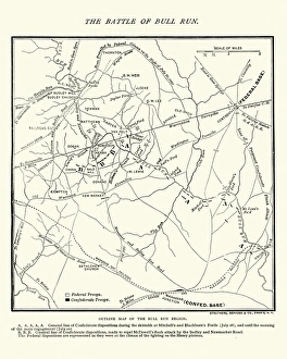
Map of the Battle of Bull RunVintage engraving of a Map of the Battle of Bull Run, The Century Magazine, 1884
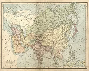
Antique map of Asia in the 19th Century, 1873Vintage engraving of a Victorian Antique map of Asia in the 19th Century, 1873
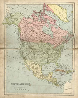
Antique damaged map of North America in the 19th CenturyVintage engraving of a Antique map of North America in the 19th Century, 1873
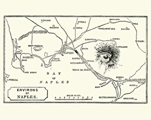
Map of Environs of Naples and Mount Vesuvius 1872Vintage engraving of Map of Environs of Naples and Mount Vesuvius 1872
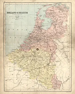
Antique damaged map of Holland & Belgium 19th CenturyVintage engraving of a Antique damaged map of Holland & Belgium in the 19th Century, 1873
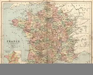
Antique damaged map of France in the 19th CenturyVintage engraving of a Antique damaged map of France in the 19th Century, 1873
Antique damaged map of Swden Norway Denmark 19th Century
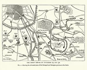
Franco Prussian War Battle plan of Siege of ParisVintage engraving of a scene from the Franco Prussian War. Battle plan of Siege of Paris
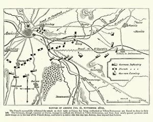
Franco Prussian War plan of the Battle of AmiensVintage engraving of a scene from the Franco Prussian War. plan of the Battle of Amiens
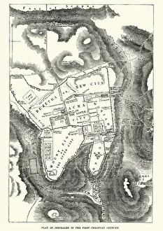
Plan of Jerusalem in the 1st CenturyVintage engraving of a Plan of Jerusalem in the 1st Century
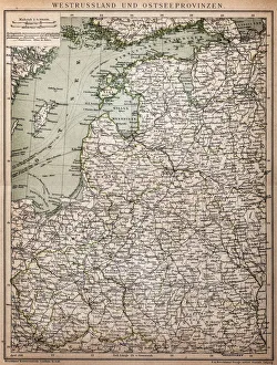
West Russia and Baltic provinces
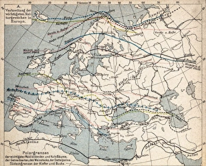
Map of plant geography
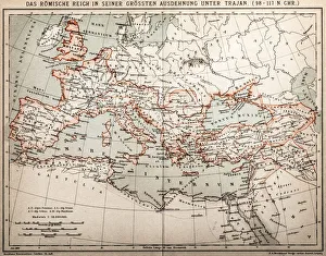
Roman empire under Trajan
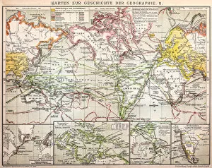
Maps for history of geography
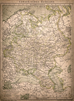
European RussiaAntique illustration of a European Russia
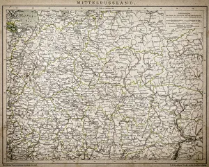
Central Russia
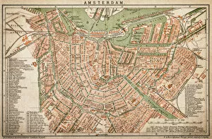
AmsterdamAntquie Map of Amsterdam
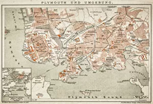
Plymouth and the surrounding area
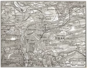
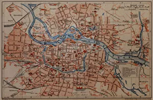
PragueAntique map of Prague
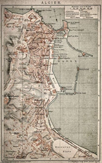
Algiers mapAntique illustration of a Algiers map
Wroclaw City map
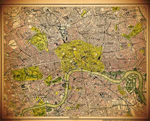
Historic map of LondonAntique illustration map map/plan of the inner city of London from 1898
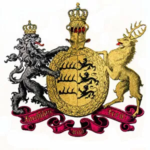
Kingdom of Wurttemberg, GermanyIllustration of Kingdom of Wurttemberg, Germany
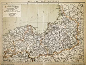
PrussiaAntique illustration of a East-West West Prussia
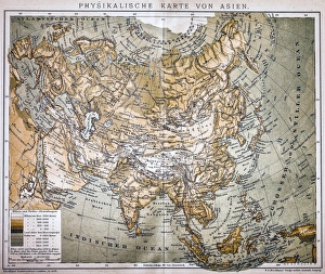
Map of AsiaAntique map of Asia
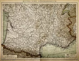
Central and Southern FranceAntique illustration of a Central and Southern France map
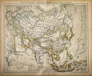
Political Map of AsiaAntique illustration of Political Map of Asia
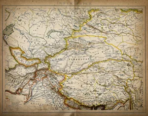
Map of inner AsiaAntique illustration of a inner Asia
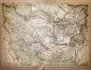
Map of West AsiaAntique illustration of a West Asia
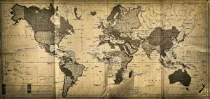
The World mapAntique illustration of a map of the World
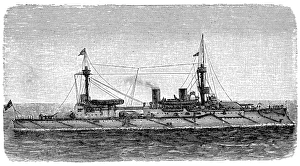
Modern chestnut tower shipIllustration of Modern chestnut tower ship