mail_outline sales@mediastorehouse.com
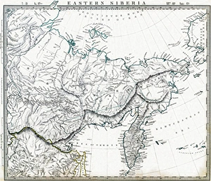
Eastern Russian Siberia 1846 MapPhoto of an original map published in the Weekly Dispatch Atlas in 1846 in London
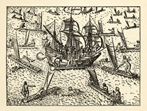
Van Noort Attacked by Theives on the Marianne Islands, 1600Very Rare, Beautifully Illustrated Antique Engraved Victorian Illustration of Historical Engraving of Van Noort Attacked by Thieives on the Marianne Islands, 1600
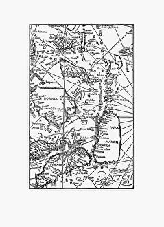
Early Map of Dutch Navigation, Victorian IllustrationVery Rare, Beautifully Illustrated Antique Engraved Victorian Illustration of Early Map of Dutch Navigation. Copyright has expired on this artwork. Digitally restored
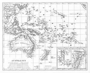
Victorian Map of AustraliaEngraved illustrations of the Map of Australia from Iconographic Encyclopedia of Science, Literature and Art, Published in 1851. Copyright has expired on this artwork. Digitally restored
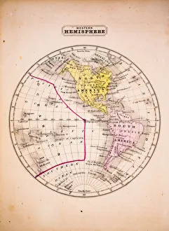
Western Hemisphere 1852 Map
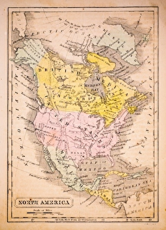
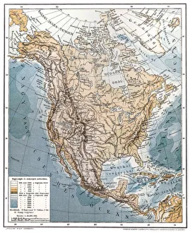
North America 1852 Map
United States 1852 Map
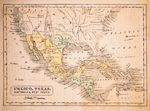
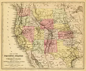
Mexico, Texas, Guatimala and West Indies 1852 Map
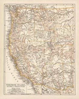
United States of America, West Coast, ithograph, published in 1878United States of America, States on the Pacific Ocean. Lithograph, published in 1878
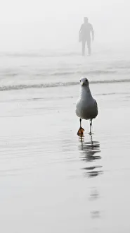
Gull and surferGull on beach with silhouette of male surfer in background fog
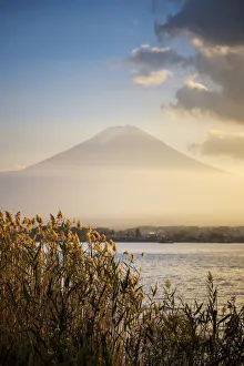
Mount Fuji is located on Honshu Island, is the highest mountain in Japan at 3, 776.24 m (12, 389 ft)
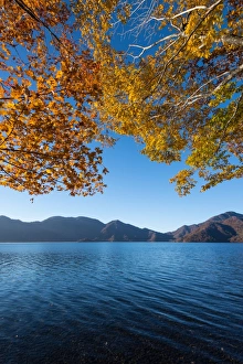
Nikko in autumn seasonTonnaja Travel Photography, 497400269
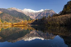
Kamikochi in autumn seasonTonnaja Travel Photography, 497400323
Jiufen Village, TaiwanJiufen is a mountain area in the Ruifang District of New Taipei City near Keelung, Taiwan. It is the tourist attraction place for sightseeing and shopping
map of the Pacific states (California, Oregon, Washington) an territories with a part of central and souther states - USA (1883)
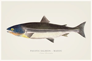
Pacific salmon illustration 1856Narrative of the expedition of an American Squadron to the China Seas and Japan : performed in the years 1852, 1853, and 1854, under the command of Commodore M.C. Perry
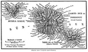
Tahiti island map 1895Meyers Konversations-Lexikon. Ein Nachschlagewerk des allgemeinen Wissens, 5th edition 17 volumes Bibliographisches Institut - Leipzig 1895-1897
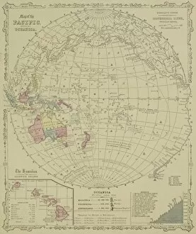
Antique map of Pacific Oceanica with inset of islands
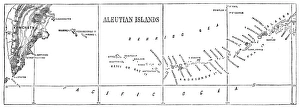
Aleutian islands map 1878Encyclopedia Britannica 9th Edition Vol I New York, Samuel Hall 1878
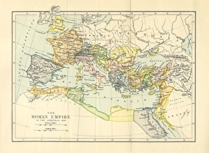
Roman Empire in the Apostolic Age Map, Engraving, 1892Very rare, beautifully detailed engraving of Roman Empire in the Apostolic Age Map, Engraving, Published in 1892. Original edition from my own archives. Copyright has expired on this artwork
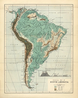
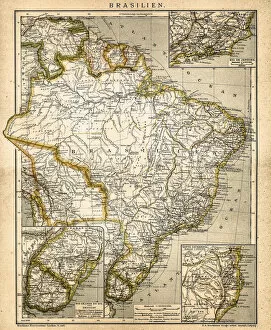
South America Physical Map, Engraving, 1892Very rare, beautifully detailed engraving of South America Physical Map, Engraving, Published in 1892. Original edition from my own archives. Copyright has expired on this artwork. Digitally restored
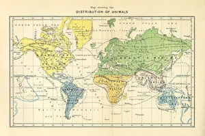
Distribution of Animals Map, Engraving, 1892Very rare, beautifully detailed engraving of North America Physical Map, Engraving, Published in 1892. Original edition from my own archives. Copyright has expired on this artwork. Digitally restored
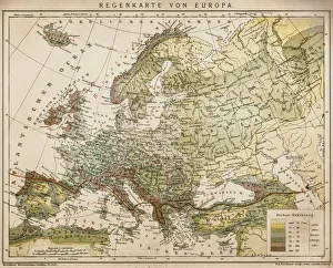
Rain map of EuropeAntique illustration of a rain map of Europe
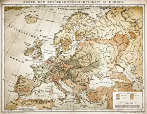
Population tightness map of Europe
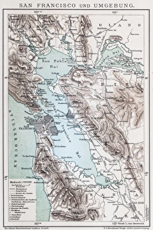
Map of San FranciscoAntique illustration of a Map of San Francisco
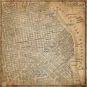
San Francisco, California, USAAntique illustration of a San Francisco, California, USA
North AmericaAntique illustration of a North America
South America mapAntique illustration of a South America map
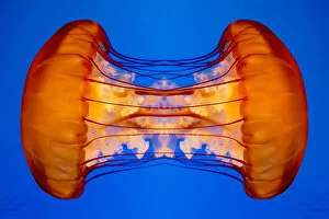
Joined Jellyfish MirrorJelly fish mirror from the oceanic coast of California
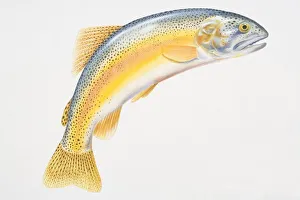
Illustration, Rainbow Trout (Oncorhynchus mykiss) with its tail curved downwards, side view
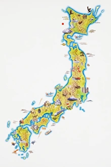
Map of Japan
Digitally generated image of Strait of Juan de Fuca forming international boundary between the United States and Canada
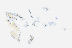
Illustration of scattered group of islands in Pacific Ocean
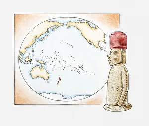
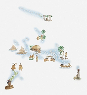
Illustration of Easter Island stone statue in front of a map highlighting Polynesian islands and New Zealand
Illustrated map of New Zealand, Hawaiian Islands, Polynesian Islands and native population
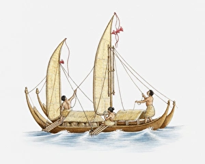
Illustration of Polynesians on a boat
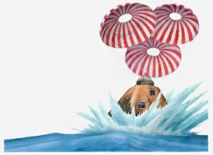
Illustration of Appollo 11 command module landing in Pacific ocean
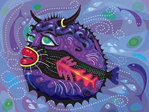
Tropical Blowfish Illustration with Humor. Vivid colors in Blues, Purples and Reds with bull horns and earring. Red kissing lips and big eyes on vector style illustration of fish in foreground
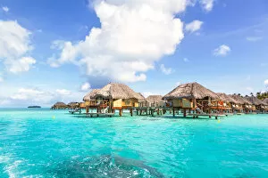
Overwater bungalows in the lagoon of Bora BoraOverwater bungalows of luxury tourist resort, in the lagoon of Bora Bora, French Polynesia, Oceania
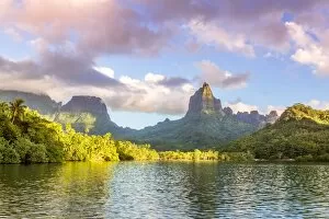
Sunset over Opunohu bay, Moorea, PolynesiaMt Rotui and Opunohu bay at sunset, Moorea, French Polynesia
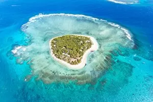
Aerial view of heart shaped island Tavarua, FijiAerial view of Tavarua, heart shaped island, Mamanucas islands, Fiji
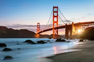
Dawn at the Golden gate bridge, San Francisco, USADawn at the Golden gate bridge from Baker beach, San Francisco, California, USA
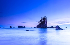
Olympic National Park coastlineThe beautiful 2nd beach near La Push within the Olympic National Park, Washington on a calm tranquil evening
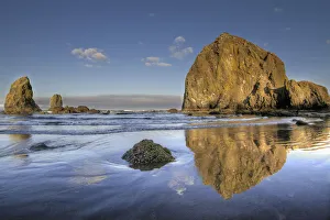
Reflection of Haystack Rock at Cannon BeachReflection of Haystack Rock and the Needles at Cannon Beach Oregon with Blue Sky at Low Tide in the Morning
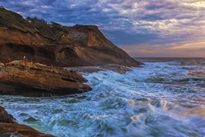
Cape Kiwanda at SunsetWaves at Cape Kiwanda on the Oregon Coast at Sunset
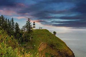
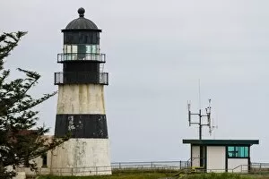
Cape Disappointment Lighthouse after SunsetCape Disappointment Lighthouse in Washington State after sunset
Cape Disappointment CloseupCape Disappointment Lighthouse in Washington State closeup