mail_outline sales@mediastorehouse.com
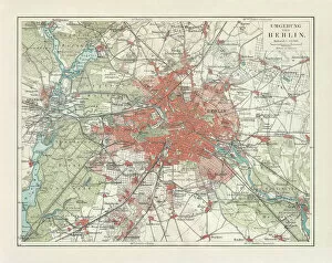
City map of Berlin and surrounding, Germany, lithograph, published 1897City map of Berlin and surrounding, capital of Germany. Lithograph, published in 1897
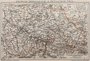
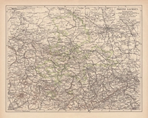
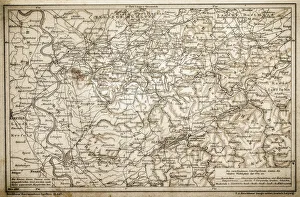
Kingdom of Saxony, Eastern partAntique illustration of a Kingdom of Saxony, Eastern part
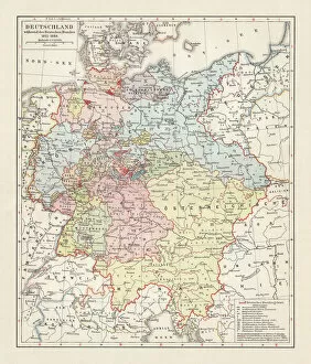
Map of the German Confederation (1815-1866), lithograph, published in 1897Map of the German Confederation between 1815 and 1866. Lithograph, published in 1897
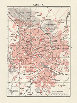
City map of Aachen, Germany, lithograph, published in 1897City map of Aachen, Germany. Lithograph, published in 1897
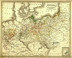
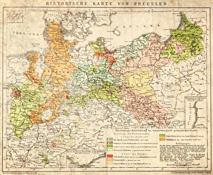
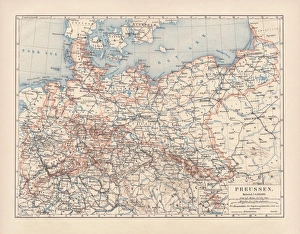
Antquie Map of PrussiaVintage map of Prussia from 1837
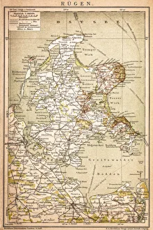
RAOEgenAntique map of RAOEgen
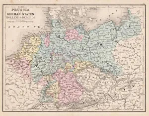
Prussia and german states map 1867Mitchellas Modern Atlas - Published by E.H. Butler and Co - Philadelphia 1867
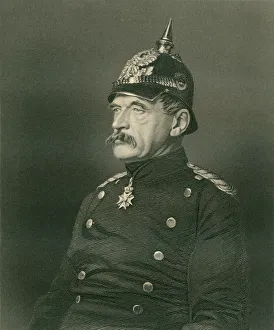
By Roon (XXXL)Comte Albrecht Theodor Emil Von Roon.Engraved by Holl (Around 1860) from a photograph
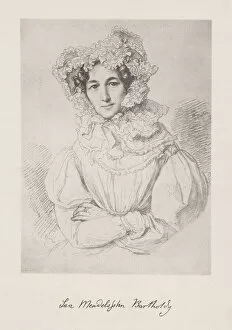
Lea Mendelssohn Bartholdy (1777-1842), collotype, published in 1882Lea Mendelssohn Bartholdy (1777 - 1842), wife of Abraham Mendelsohn Bartholdy, a German Jewish banker and philanthropist. She was the mother of Felix Mendelssohn and Fanny Mendelssohn
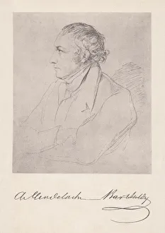
Abraham Mendelssohn Bartholdy (1776-1835, German banker, collotype, published in 1882Abraham Mendelssohn Bartholdy (1776 - 1835(), German Jewish banker and philanthropist. He was the father of Felix Mendelssohn and Fanny Mendelssohn
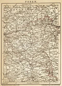
PoznanAncient map of Poznan from 1898
Germania in 2 century after Christ
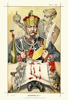
Vanity Fair Print - William I, German EmperorVictorian caricature of William I (Wilhelm I), German Emperor and King of Prussia. Under the leadership of William and his Minister President Otto von Bismarck
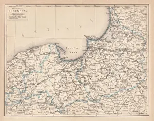
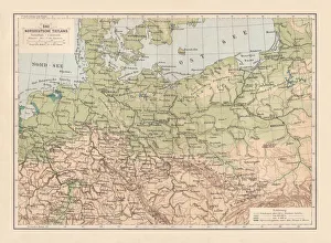
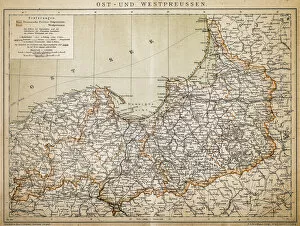
East and West Prussia, lithograph, published in 1877East and West Prussia, former territories of the German Empire. Lithograph, published in 1877
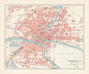
City map of KAonigsberg, Germany (Kaliningrad, Russia), lithograph, published 1897City map of the former Prussian city KAonigsberg, Germany (today Kaliningrad, Russia). Lithograph, published in 1897
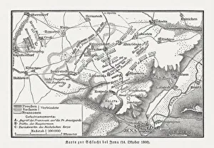
Battle of Jena and Auerstedt, 1806, wood engraving, published 1897Map of the Battle of Jena and Auerstedt on 14 October 1806 on the plateau west of the River Saale, Germany, between the forces of Napoleon I of France and Frederick William III of Prussia
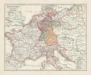
Map of Europe at the Napoleonic Wars of Liberty (1813)Map of Central Europe at the beginning of the Napoleonic Wars of Liberty in 1813. Lithograph, published in 1897
North German lowland map, 19th century view, lithograph, published 1884Old Topographic map of the North German lowland in German language. Lithograph, published in 1884
Teutonic Order state (1525), the country of origin of PrussiaTeutonic Order state in 1525 - the country of origin of Prussia. Lithograph, published in 1884
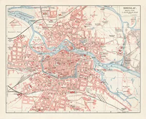
City map of Breslau, (today Wroclaw, Poland), lithograph, published 1897City map of Breslau, Prussia, Germany (today Wroclaw, Poland). Lithograph, published in 1897
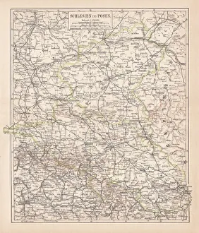
Silesia and Poznan, lithograph, published in 1878Ancient map of Silesia and Poznan, former territories of the German Empire, today Poland. Lithograph, published in 1878
Prussia historical mapIllustration of a Prussia historical development map
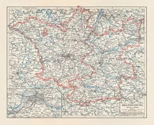
Brandenburg in Germany, mainland, province, and Berlin, lithograph, published 1897The state of Brandenburg in Germany, mainland, province, and Berlin. Lithograph, published in 1897
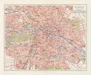
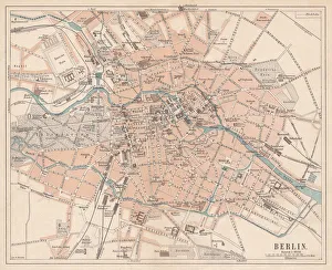
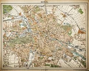
City map of Berlin, Germany, lithograph, published in 1897City map of Berlin, capital of Germany. Lithograph, published in 1897
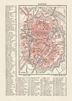
City map of Danzig (now Gdsk, Poland), lithograph, published 1897City map of Danzig with street directory, Prussia, Germany (now Gdsk, Poland). Lithograph, published in 1897
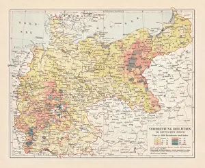
Distribution of the Jews in Germany, lithograph, published in 1897Map of the distribution of the Jews in Germany at the end of the 19th century. Lithograph, published in 1897
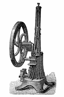
The Bisschop engineIllustration of the Bisschop engine was first patented in 1871 by Alexis De Bisschop of Prussia
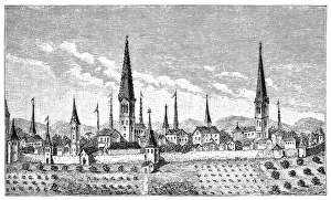
Cityscape of Dortmund, North Rhine-Westphalia, Germany, 16th centuryIllustration of a Cityscape of Dortmund, North Rhine-Westphalia, Germany, 16th century
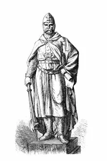
Hermann BalkIllustration of a Hermann Balk
Province of Saxony, lithograph, published in 1878Province of Saxony, former territory of Prussia from 1816 to 1945. Lithograph, published in 1878
Prussia, lithograph, lithograph, published in 1878The Kingdom of Prussia at its greatest extent, after 1866. Lithograph, published in 1878
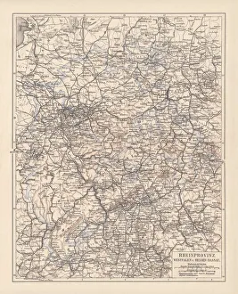
Prussian provinces, lithograph, published in 1878Prussian provinces: Rhineland, Westphalia, and Hesse-Nassau. Lithograph, published in 1878
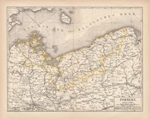
Pomerania, lithograph, lithograph, published in 1878Pomerania, former territory of the German Empire. Lithograph, published in 1878
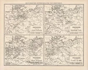
Historical development of Prussia, lithograph, published in 1878Ancient maps of the historical development of Prussia, 17th - 19th century. Lithograph, published in 1878
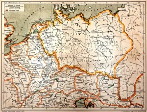
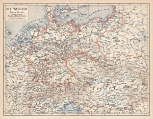
German Empire of 1871-1918, lithograph, published in 1875German Empire within the borders of 1871 - 1918. Lithograph, published in 1875
Berlin, city map, lithograph, published in 1874Historic city map of Berlin, Germany. Lithograph, published in 1874
Siege of Paris by the prussians engraving 1881Le Monde Physique par Amedee Guillemin - Paris / Librairie Hachette et Cie 1881
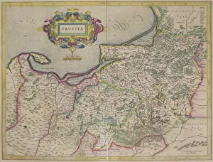
Antique map of Prussia
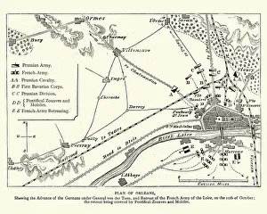
Franco Prussian War - Plan of Second Battle of OrleansVintage engraving of a scene from the Franco Prussian War. Plan of the Second Battle of Orleans, 1870
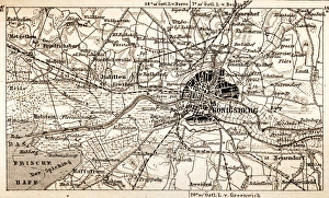
KonigsbergAntique map of Konigsberg
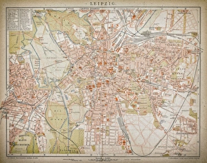
LeipzigAntique illustration of a Leipzig from 1898
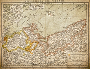
Mecklenburg and PomeraniaAncient map of Mecklenburg and Pomerania
Rhenish-Westphalia coals and industrial map
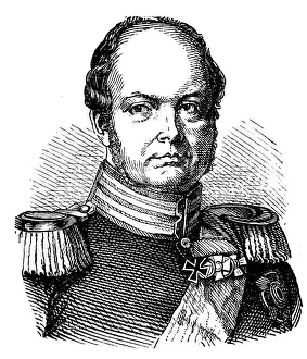
Frederick William IV (1795-1861), Prussian kingAntique illustration of a Frederick William IV (1795-1861), Prussian king
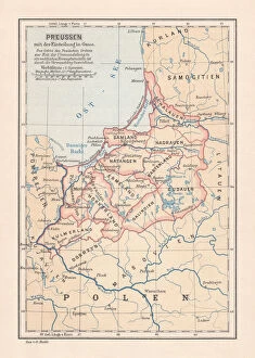
PrussiaAntique illustration of a East-West West Prussia
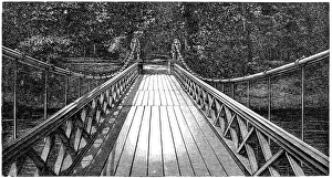
Bridge of Four LionsAntique illustration engraving of German Empire Kingdom Prussia Brandenburg Province Berlin: Tiergarten: Bridge of Four Lions
Map of Berlin 1893Illustration of a Map of Berlin 1893
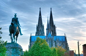
Cologne Cathedral and Equestrian statue of Prussian Kings Kaiser Wilhelm IICologne Cathedral (KAolner Dom) is a Roman Catholic Cathedral in Cologne, Germany. Equestrian statue of Prussian Kings Kaiser Wilhelm II (by Sculptor Louis Tuaillon 1910)