mail_outline sales@mediastorehouse.com
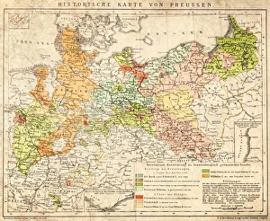
Prussia historical mapIllustration of a Prussia historical development map
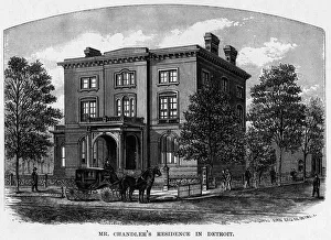
Home Of Zachariah ChandlerEngraving depicting the Detroit home of Zachariah Chandler (1813-1879), who was Mayor of Detroit between 1851 and 1852, and U.S. Senator from the state of Michigan, circa 1850
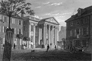
First Bank Of The United StatesEngraving by Fenner Sears & Co. shows pedestrians on the street outside the First Bank of the United States which was Alexander Hamiltons brainchild
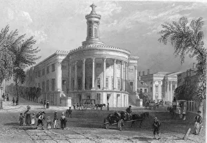
The Philadelphia Stock ExchangeEngraving by William Henry Bartlett shows pedestrian and horsecart traffic on the street in front of the Merchants Exchange Building, home of the Philadelphia Stock Exchange
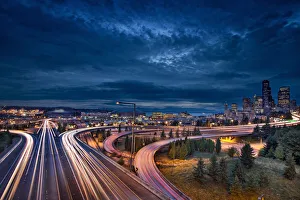
Seattle City Lights and Light Trails at Blue HourSeattle Washington Freeway Traffic Light Trails with City Skyline at Evening Blue Hour
Corbis CollectionFine Art Storehouse Corbis Collection
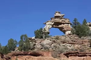
Eagle Gate Arch, Kanab, Utah, USA, America
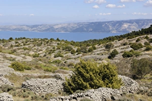
Lavender fields protected with stone walls, Hvar Island, Croatia, Europe
Cottontail rabbit (Sylvilagus), leveret, with ticks on its mouth, Chicago, Illinois, United States of America, USA
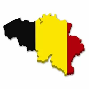
Outline and flag of Belgium, 3D
Outline and flag of Romania, 3D
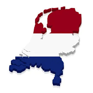
Outline and flag of the Netherlands, 3D
Outline and flag of South Africa, 3D
Outline and flag of Barbados, 3D
Shape and national flag of Croatia, 3D computer graphics
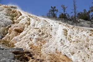
Mammoth Hot Spring Terraces, Yellowstone National Park, Wyoming, USA
Flag of Barbados
Flag of El Salvador
Flag of Japan
Flag of Vatican City
Flag of Paraguay
Flag of the Organisation of Islamic Cooperation, OIC
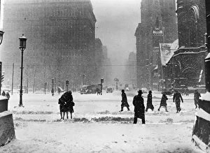
Winter street sceneUNITED STATES - CIRCA 1940s: Winter street scene in Philadelphia, pedestrians and cars at road intersection, snow falling. (Photo by H. Armstrong Roberts/Retrofile/Getty Images)
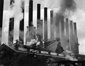
Factory smokestacksUNITED STATES - CIRCA 1930s: Steel industry, factory smokestacks, Conshohocken, Pennsylvania. (Photo by H. Armstrong Roberts/Retrofile/Getty Images)
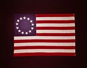
Colonial US flagUNITED STATES - CIRCA 1950s: 1776 Colonial US flag, showing 13 stars. (Photo by H. Armstrong Roberts/Retrofile/Getty Images)
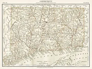
Connecticut map 1884Encyclopedia Britannica 9th Edition New York Charles Scribners and Sons 1884 Vol VI
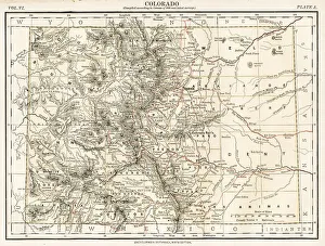
Colorado map 1884Encyclopedia Britannica 9th Edition New York Charles Scribners and Sons 1884 Vol VI
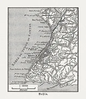
Salvador and surrounding, Bahia, Brazil, wood engraving, published in 1897Map of Salvador and surrounding, Bahia, Brazil. Wood engraving, published in 1897
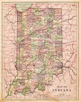
Map of Indiana USA 1881Harpers School Geography, New York, Harpers and Brothers, 1881
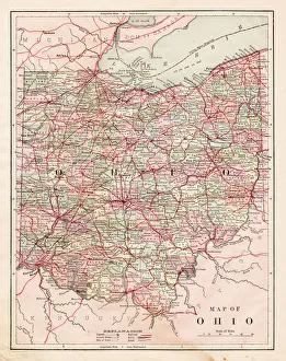
Map of the Ohio state USA 1881Harpers School Geography, New York, Harpers and Brothers, 1881
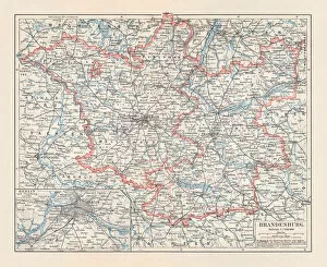
Brandenburg in Germany, mainland, province, and Berlin, lithograph, published 1897The state of Brandenburg in Germany, mainland, province, and Berlin. Lithograph, published in 1897
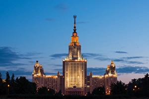
Moscow State UniversityMoscow, Russia
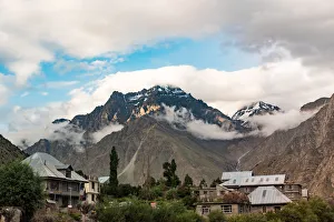
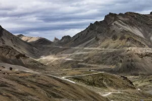
Beautiful scenics of Jispa village and tourist resort with mountain, Himachal Pradesh, IndiaBeautiful view of Himachal Pradesh along Manali - khoksar - sissu - keylong - jispa to leh ladakh with leh manali Highway in summer
Himalaya range in summer in jispa Himachal Pradesh indiaBeautiful view of Himachal Pradesh along Manali - khoksar - sissu - keylong - jispa to leh ladakh with leh manali Highway in summer
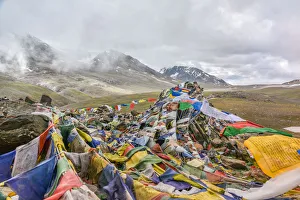
Prayer flag at Lachung la pass on Leh-Manali Highway, indiaLachung la pass is a mountain pass along the Leha'Manali Highway. This is one of the easier 16, 000 ft (4, 880 m) passes.the hikers face breathlessness during climb
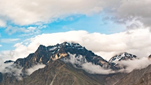
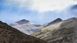
dramatic landscape sunlight on snow capped mountain peak on the way to leh ladakh, jammu and kashmir, indiaBeautiful view on the way from Himachal Pradesh along JISPA-KHARNAK-DEBRING-HEMIS to jammu region leh ladakh manali Highway in summer
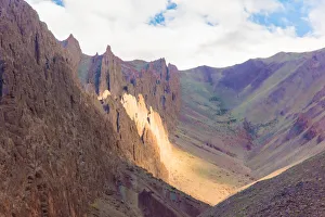
Scenic view of arid climate colorful Sand stone mountain on the way to leh city, jammu and kashmir, indiaBeautiful view on the way from Himachal Pradesh along JISPA-KHARNAK-DEBRING-HEMIS to jammu region leh ladakh manali Highway in summer
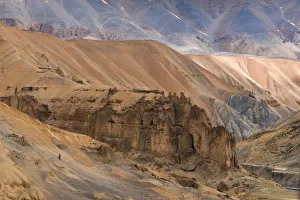
Scenic view of arid climate Sand stone mountain on the way to leh city, jammu and kashmir, indiaview on the way from Himachal Pradesh along JISPA-KHARNAK-DEBRING-HEMIS to jammu region leh ladakh manali Highway in summer
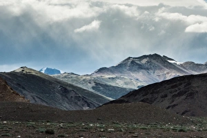
Scenic view mountain pass with sunlight dramatic sky on Leh manali road way from jispa himachal pradesh to leh ladakhBeautiful view of Himachal Pradesh along JISPA-KHARNAK-DEBRING-HEMIS to leh ladakh with leh manali Highway in summer
Leh-Manali Highway, a mountain pass road zigzag curve from jispa himachal pradesh to leh ladakh, indiaBeautiful view of Himachal Pradesh along JISPA-KHARNAK-DEBRING-HEMIS to leh ladakh with leh manali Highway in summer
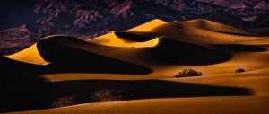
Death Valley Sand Dunes in Last LightMesquite sand dunes of death valley. Curves and patterns captured and contrasted in the fleeting light. Death Valley National Park is located primarily in the Southern California Desert
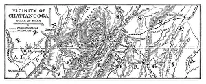
Vicinity of Chattanooga - 1886 scanned engraving
Map of Kentucky and Tennessee - 1886 scanned engraving
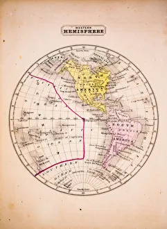
Western Hemisphere 1852 Map
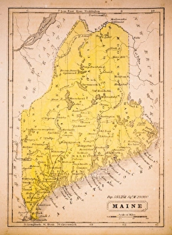
Maine 1852 Map
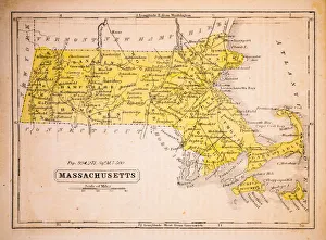
Massachusetts 1852 Map
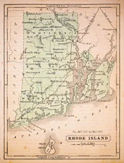
Rhode Island 1852 Map
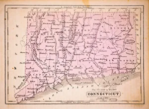
Connecticut 1852 Map