mail_outline sales@mediastorehouse.com
350 items
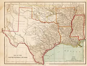
Map of USA South Central states 1877The Eclectic Elementary Geography by Wilson & Hinkle / Cincinnati -New York 1881
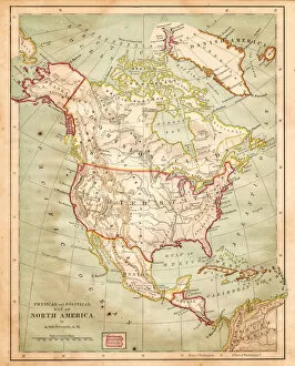
Map of North America 1877The Eclectic Elementary Geography by Wilson & Hinkle / Cincinnati -New York 1881
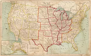
Map of United states 1881The Eclectic Elementary Geography by Wilson & Hinkle / Cincinnati -New York 1881
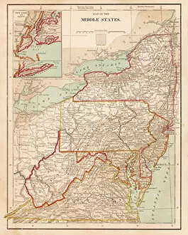
Map of USA New England 1877 middle states 1877The Eclectic Elementary Geography by Wilson & Hinkle / Cincinnati -New York 1881
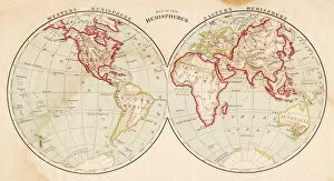
Map of the world in hemispheres 1877The Eclectic Elementary Geography by Wilson & Hinkle / Cincinnati -New York 1881
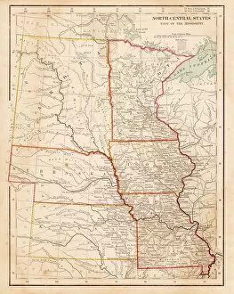
Map of USA North Central States 1877The Eclectic Elementary Geography by Wilson & Hinkle / Cincinnati -New York 1881
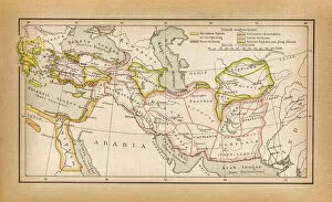
Countries of Diadochi ( from Greek: ????????, Diadokhoi, successors ) were the rival generalsIllustration of a Countries of Diadochi ( from Greek: ????????, Diadokhoi, " successors" ) were the rival generals, families
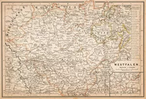
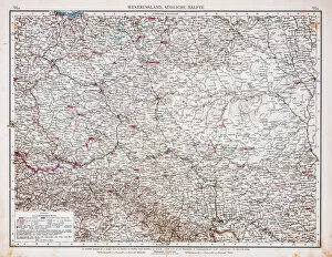
Map of Westphalia, a former province of northwestern GermanyIllustration of Westphalia, a former province of northwestern Germany
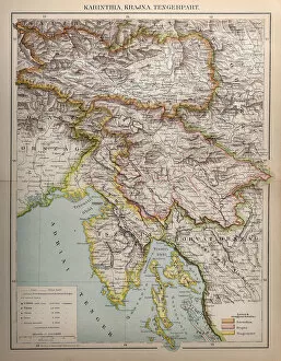
Carinthia, state of Austria from 1895Illustration of a Carinthia, state of Austria from 1895
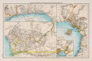
Map of West African colonies 1896Andres Allgemeiner Handatlas - Bielefeld und Leipzig 1896
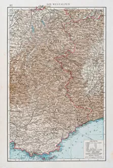
Map of the West Alps 1896Andres Allgemeiner Handatlas - Bielefeld und Leipzig 1896
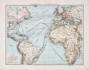
Map of traffic on the atlantic ocean 1896Andres Allgemeiner Handatlas - Bielefeld und Leipzig 1896
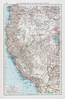
Map of USA pacific states 1896Andres Allgemeiner Handatlas - Bielefeld und Leipzig 1896
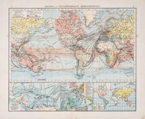
Map of world traffic map and currents 1896Andres Allgemeiner Handatlas - Bielefeld und Leipzig 1896
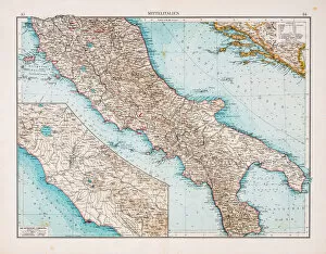
Map of Center Italy 1896Andres Allgemeiner Handatlas - Bielefeld und Leipzig 1896
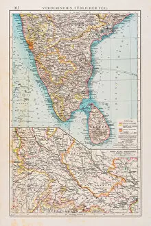
Map of southern India 1896Andres Allgemeiner Handatlas - Bielefeld und Leipzig 1896
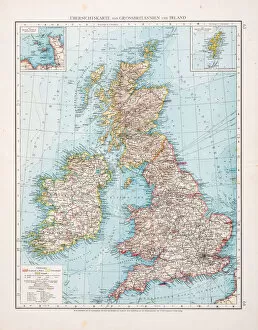
Map of Great Britain and Ireland 1896Andres Allgemeiner Handatlas - Bielefeld und Leipzig 1896
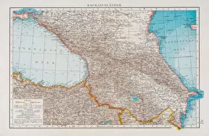
Map of the Caucasus lands 1896Andres Allgemeiner Handatlas - Bielefeld und Leipzig 1896
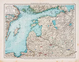
Map of West Russia and Baltic sea 1896Andres Allgemeiner Handatlas - Bielefeld und Leipzig 1896
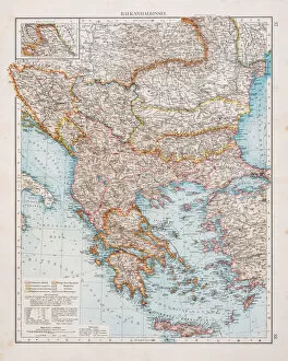
Map of the Blkan peninsula 1896Andres Allgemeiner Handatlas - Bielefeld und Leipzig 1896
East China map 1896Andres Allgemeiner Handatlas - Bielefeld und Leipzig 1896
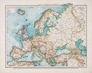
Map of Political Europe 1896Andres Allgemeiner Handatlas - Bielefeld und Leipzig 1896
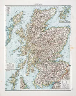
Map of Scotland 1896Andres Allgemeiner Handatlas - Bielefeld und Leipzig 1896
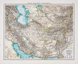
Map of Persian and Afghanistan 1896Andres Allgemeiner Handatlas - Bielefeld und Leipzig 1896
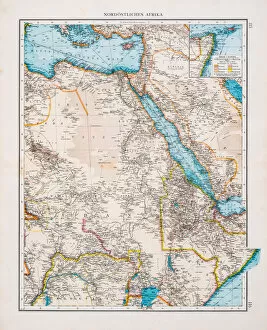
Map of North east Africa 1896Andres Allgemeiner Handatlas - Bielefeld und Leipzig 1896
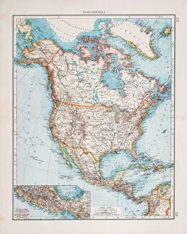
Map of North America 1896Andres Allgemeiner Handatlas - Bielefeld und Leipzig 1896
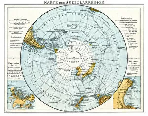
Map of South Polar region 1896Andres Allgemeiner Handatlas - Bielefeld und Leipzig 1896
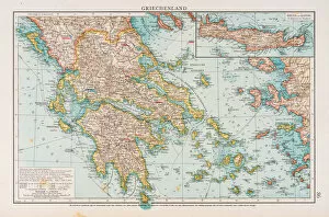
Map of Greece 1896Andres Allgemeiner Handatlas - Bielefeld und Leipzig 1896
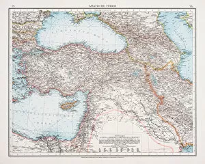
Map of Turkey 1896Andres Allgemeiner Handatlas - Bielefeld und Leipzig 1896
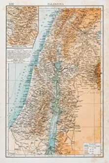
Map of Palestine 1896Andres Allgemeiner Handatlas - Bielefeld und Leipzig 1896
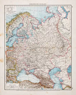
Map of european Russia 1896Andres Allgemeiner Handatlas - Bielefeld und Leipzig 1896
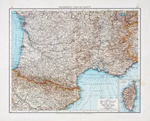
Map of France 1896Andres Allgemeiner Handatlas - Bielefeld und Leipzig 1896
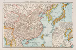
Map of China and Japan 1896Andres Allgemeiner Handatlas - Bielefeld und Leipzig 1896
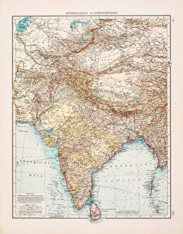
Map of India and Central Asia 1896Andres Allgemeiner Handatlas - Bielefeld und Leipzig 1896
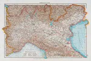
Map of North Italy 1896Andres Allgemeiner Handatlas - Bielefeld und Leipzig 1896
Map of Scandinavia 1896Andres Allgemeiner Handatlas - Bielefeld und Leipzig 1896
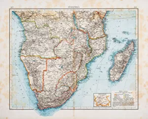
Map of Africa 1896Andres Allgemeiner Handatlas - Bielefeld und Leipzig 1896
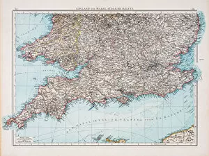
Map of England and Wales 1896Andres Allgemeiner Handatlas - Bielefeld und Leipzig 1896
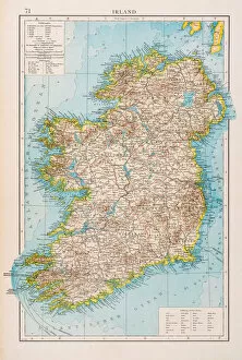
Map of Ireland 1896Andres Allgemeiner Handatlas - Bielefeld und Leipzig 1896
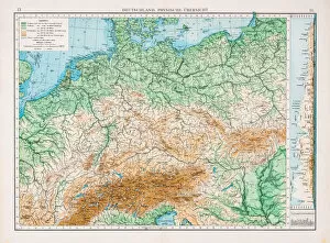
Map of Germany 1896Andres Allgemeiner Handatlas - Bielefeld und Leipzig 1896
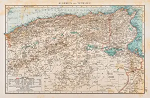
Map of Tunisia and Algeria 1896Andres Allgemeiner Handatlas - Bielefeld und Leipzig 1896
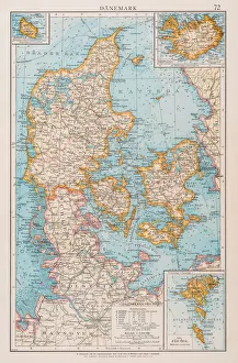
Map of Denmark 1896Andres Allgemeiner Handatlas - Bielefeld und Leipzig 1896
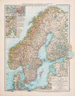
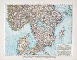
Map of Sweden and Norway 1896Andres Allgemeiner Handatlas - Bielefeld und Leipzig 1896
Map of west russia 1896Andres Allgemeiner Handatlas - Bielefeld und Leipzig 1896
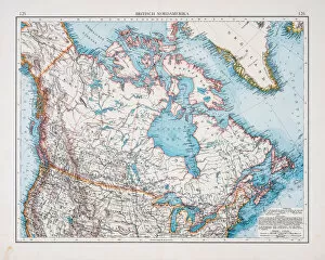
Map of British america1896Andres Allgemeiner Handatlas - Bielefeld und Leipzig 1896
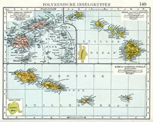
Polynesian islands map 1896Andres Allgemeiner Handatlas - Bielefeld und Leipzig 1896
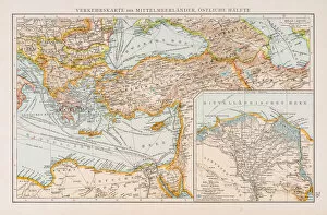
Map of traffic in the Mediterranean sea 1896Andres Allgemeiner Handatlas - Bielefeld und Leipzig 1896
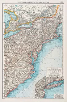
Map of north states USA 1896Andres Allgemeiner Handatlas - Bielefeld und Leipzig 1896