mail_outline sales@mediastorehouse.com
350 items
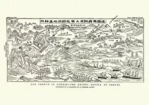
Plan of the Battle of Son Tay, 1883Vintage engraving of Plan of the Battle of S?n Tay, French forces attacking the Black Flag Arm, Tonkin (northern Vietnam). The Graphic, 1884
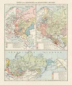
Historical development of the Russian Empire (15th-19th century), lithograph, 1897Map of the historical development of the Russian Empire, top, left: 15th - 17th century. Top, right and bottom: 17th - 19th century. Lithograph, published in 1897
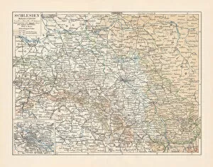
Map of Silesia, former German Empire, today Poland, lithograph, 1897Topographic map of Silesia, former territories of the German Empire, today Poland. Lithograph, published in 1897
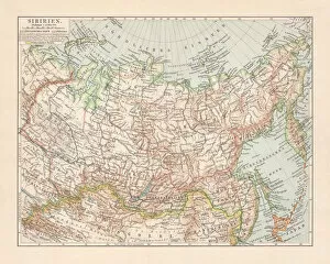
Topographic map of Siberia, Russia, lithograph, published in 1897Topographic map of Siberia, Russia. Lithograph, published in 1897
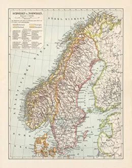
Typographic map of Sweden and Norway, lithograph, published in 1897Typographic map of Sweden and Norway. Lithograph, published in 1897
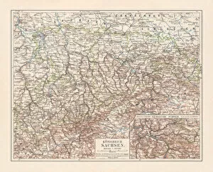
Topographic map of the Kingdom of Saxony (Germany), lithograph, 1897Topographic map of the Kingdom of Saxony (Germany) and the adjacent former areas of the Sudeten Germans in northern Bohemia. Lithograph, published in 1897
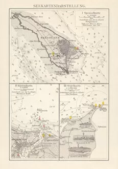
Excerpts of nautical charts, lithograph, published in 1897Excerpts of nautical charts: I) Helgoland (Germany); II) Stettiner Haff (Szczecin Lagoon, Germany/Poland); III) North Sea. Lithograph, published in 1897
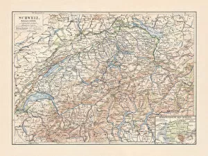
Map of Switzerland and the different language areas, lithograph, 1897Topographic map of Switzerland with a separate map of the different language areas. Lithograph, published in 1897
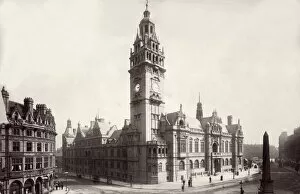
Sheffield Town HallThe Town Hall of Sheffield, Yorkshire, designed by Edward Mountfield. (Photo by Francis Frith/Getty Images)
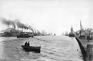
River Liffeycirca 1890: Boats moored along Dublins River Liffey from the North Wall. (Photo by Francis Frith/Getty Images)
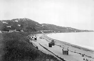
Killiney Headcirca 1885: The beach at Killiney Head overlooking Dublin Bay, Irelands largest enclosed harbour. (Photo by Francis Frith/Getty Images)
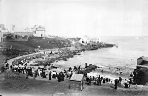
Portrushcirca 1885: Ladies Bathing Place in Portrush, a seaside resort in County Antrim. (Photo by Francis Frith/Getty Images)
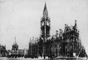
Town Hallcirca 1890: Manchester Town Hall in Albert Square, Manchester. Designed by Alfred Waterhouse, the neo-Gothic building was completed in 1887. (Photo by Francis Frith/Getty Images)
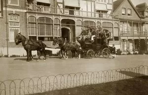
Stage Coachcirca 1890: Passengers travelling on the Woollacombe coach. (Photo by Francis Frith/Getty Images)
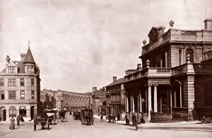
Street In Norwichcirca 1895: The Post Office (right) and Prince of Wales Road in Norwich. (Photo by Francis Frith/Getty Images)
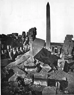
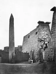
Karnak Obeliskcirca 1858: An obelisk standing above the ruins of the smaller court of a temple at El-Karnak, Eygpt. (Photo by Francis Frith/Getty Images)
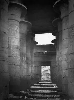
Karnak Templecirca 1858: The first area of the Great Temple at El-Karnak, Eygpt. (Photo by Francis Frith/Getty Images)
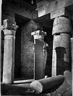
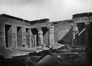
Thebes Templecirca 1858: Pillars and hieroglyphics in the northern corridor of a temple at Thebes, Eygpt. (Photo by Francis Frith/Getty Images)
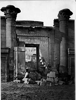
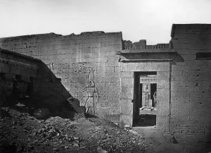
Karnak Gatewaycirca 1858: Hieroglyphics decorate the ruined gateway to the small temple at Karnak, Eygpt. (Photo by Francis Frith/Getty Images)
Memnoniumcirca 1858: The Great Hall of Memnon, one of the ancient Egyptian ruins in Thebes. (Photo by Francis Frith/Getty Images)
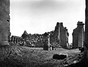
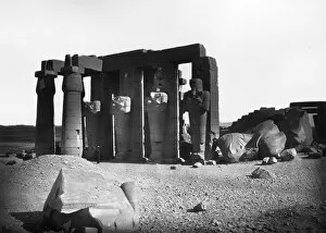
Ramses Ruinscirca 1858: Fallen pillars litter the interior of the Grand Temple of Amon or Ammon at El-Karnak in Thebes, built by Pharaoh Ramses II. Every inch of the walls is decorated with hieroglyphics
Temple Of Ammoncirca 1858: The entrance to the Great Temple of Amon or Ammon at El-Karnak in Thebes, built by Ramses II. Two crowned heads of the Pharaoh and a granite obelisk guard the gateway
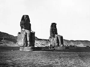
Colossi Of Memnoncirca 1858: The Colossi of Memnon, two giant statues of an ancient king situated in the plain of Thebes (modern Luxor and El-Karnak)
Temple Of Amoncirca 1858: The hieroglyphic-covered walls of the Temple of Amon or Ammon at El-Karnak in Thebes. The central figure represents Pharaoh Ramses II, who dedicated the temple to the local sungod
Fallen Colossuscirca 1858: The south-east colonnade of the second court of the Memnonium, an ancient Egyptian temple in Thebes (modern Luxor and El-Karnak). Beside it on the ground lies a colossus, or giant statue
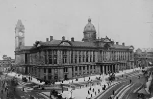
Birminghamcirca 1900: The council offices in Birmingham. (Photo by Francis Frith/Getty Images)
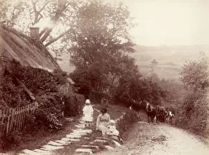
Life In WhitbyA woman and two children playing by the roadside in Whitby, circa 1880. (Photo by Frank Meadow Sutcliffe/Hulton Archive/Getty Images)
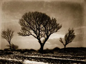
Three TreesAn albumen print of three trees silhouetted against a stormy sky in a field around the area of Whitby and Eskdale. (Photo by Frank Meadow Sutcliffe/Getty Images)
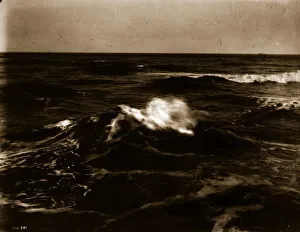
Crest Of A WaveAn albumen print of a wave breaking in an atmospheric seascape from the series Views Around Whitby And Eskdale, North Yorkshire. (Photo by Frank Meadow Sutcliffe/Getty Images)
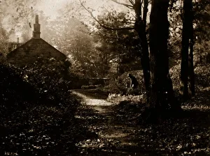
Rural GladeAn albumen print of a man tending his cottage garden in an idyllic wooded glade. Original Artwork: From a series Views Around Whitby And Eskdale, North Yorkshire
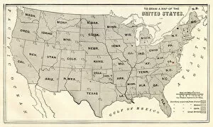
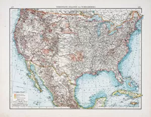
Map of USA 1889Comprehensive Geography by James Monteith - American Book Company 1882, 1889
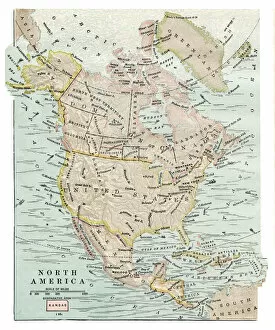
Map of North America 1889Comprehensive Geography by James Monteith - American Book Company 1882, 1889
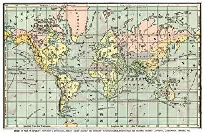
Map of world 1889Comprehensive Geography by James Monteith - American Book Company 1882, 1889
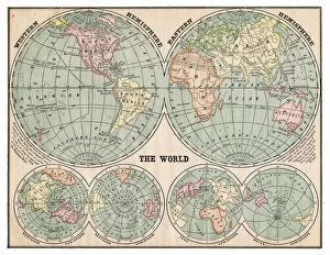
Map of the world 1889Comprehensive Geography by James Monteith - American Book Company 1882, 1889
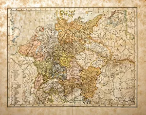
Germany until the Thirty Years War (1493-1618)Illustration of a Germany until the Thirty Years War (1493-1618)
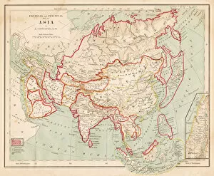
Map of Europe of 1877The Eclectic Elementary Geography by Wilson & Hinkle / Cincinnati -New York 1881
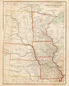
Map of USA North Central States 1877The Eclectic Elementary Geography by Wilson & Hinkle / Cincinnati -New York 1881
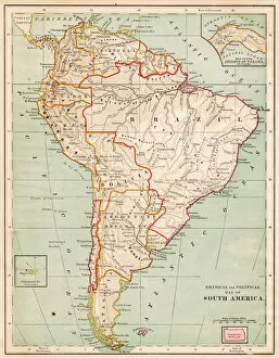
Map of South America 1877The Eclectic Elementary Geography by Wilson & Hinkle / Cincinnati -New York 1881
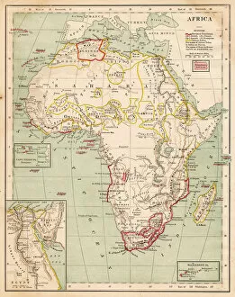
Map of Africa 1877The Eclectic Elementary Geography by Wilson & Hinkle / Cincinnati -New York 1881
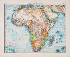
Map of Africa 1896Andres Allgemeiner Handatlas - Bielefeld und Leipzig 1896
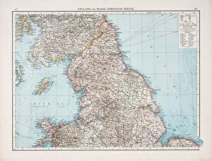
Map of England and Wales 1896Andres Allgemeiner Handatlas - Bielefeld und Leipzig 1896
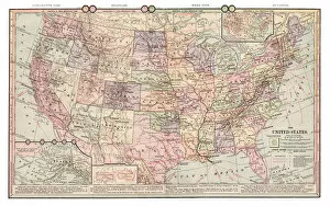
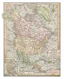
Map of North America 1896Andres Allgemeiner Handatlas - Bielefeld und Leipzig 1896
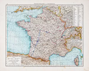
Map of France 1896Andres Allgemeiner Handatlas - Bielefeld und Leipzig 1896
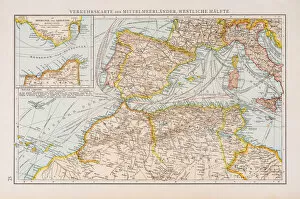
Map of traffic in the Mediterranean sea 1896Andres Allgemeiner Handatlas - Bielefeld und Leipzig 1896
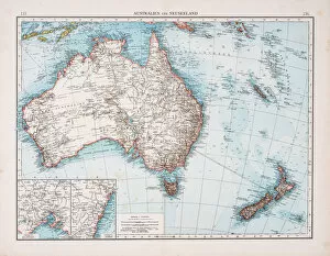
Map of 1896Andres Allgemeiner Handatlas - Bielefeld und Leipzig 1896
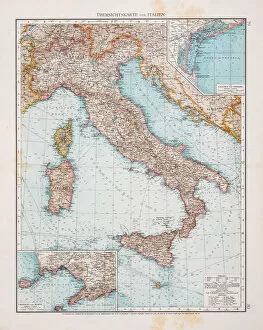
Map of Italy 1896Andres Allgemeiner Handatlas - Bielefeld und Leipzig 1896