mail_outline sales@mediastorehouse.com
350 items
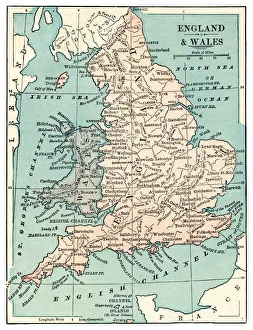
Map of England and Wales 1889Comprehensive Geography by James Monteith - American Book Company 1882, 1889
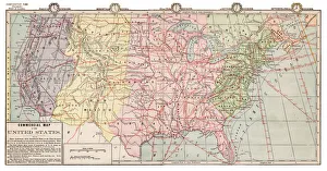
Map of USA 1889Comprehensive Geography by James Monteith - American Book Company 1882, 1889
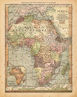
Map of Africa 1889Comprehensive Geography by James Monteith - American Book Company 1882, 1889
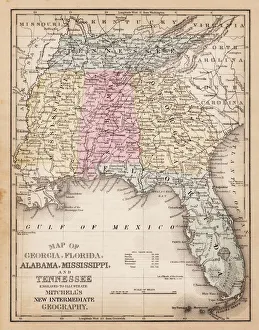
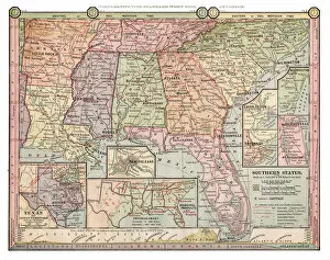
Map of USA Southern states 1881A System of Modern Geography designed for the use of schools and academies by Augustus Mitchell - Published by T. H. Butler / Philadelphia 1881
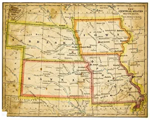
Map of USA Central states 1883The Eclectic Elementary Geography by Van Antwerp, Bragg & C0 / Cincinnati -New York 1883
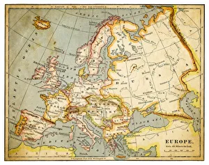
Map of Europe 1883The Eclectic Elementary Geography by Van Antwerp, Bragg & C0 / Cincinnati -New York 1883
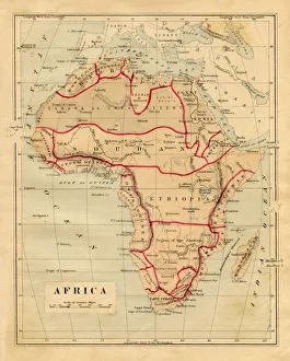
Map of Africa 1876Maurys Geographical Series - The Word we live in by M.F. Maury LLD - New York and Baltimore 1876
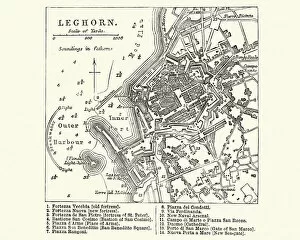
Map of Livorno (Leghorn), Tuscany, Italy, 19th CenturyVintage engraving of Map of Livorno (Leghorn), Tuscany, Italy, 19th Century
Map of India 1896Andres Allgemeiner Handatlas - Bielefeld und Leipzig 1896
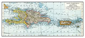
Haiti Puerto Rico map 1896Andres Allgemeiner Handatlas - Bielefeld und Leipzig 1896
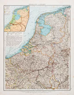
Map of Holland and Belgium 1896Andres Allgemeiner Handatlas - Bielefeld und Leipzig 1896
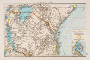
German East Africa map 1896Andres Allgemeiner Handatlas - Bielefeld und Leipzig 1896
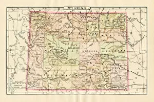
Map of Wyoming 1894Johnsons Universal Cyclopedia - Volume VIII New York - A. J. Johnson Company 1894
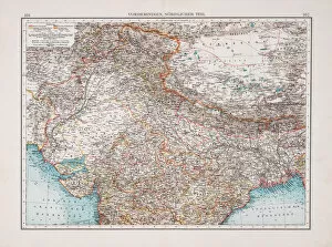
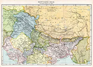
Map of Northern India 1894Johnsons Universal Cyclopedia - Volume IV New York - A. J. Johnson Company 1894
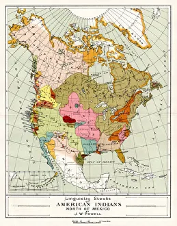
Map of American Indians North of Mexico 1894Johnsons Universal Cyclopedia - Volume IV New York - A. J. Johnson Company 1894
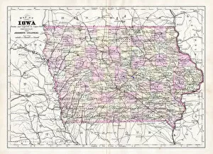
Map of Iowa USA 1894Johnsons Universal Cyclopedia - Volume IV New York - A. J. Johnson Company 1894
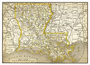
Map of Louisiana 1893New Pocket Atlas / Rand, McNally & Co -1893
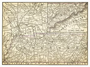
Map of Tennessee 1893New Pocket Atlas / Rand, McNally & Co -1893
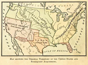
Map of the original USA territory 1881Appletons American Standard Geographies - New York 1881 - d. Appleton and Company
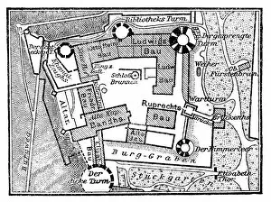
Floor plan of the castle to HeidelbergIllustration of a Floor plan of the castle to Heidelberg
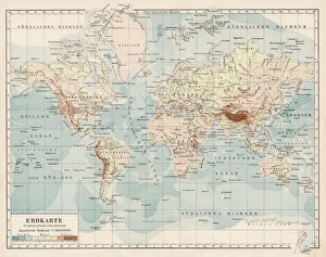
Map of the World 1900Meyers hand-Atlas Leipzig und Wien Verlag des Bibliographischen Instituts 1900
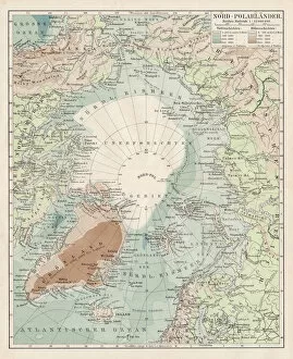
Map of North Pole 1900Meyers hand-Atlas Leipzig und Wien Verlag des Bibliographischen Instituts 1900
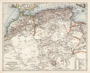
Map of Algeria, Morocco, Tunisia, 1900Meyers hand-Atlas Leipzig und Wien Verlag des Bibliographischen Instituts 1900
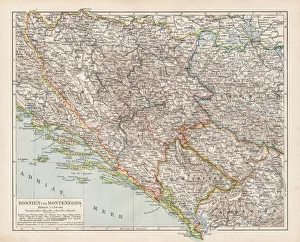
Map of Bosnia and Montenegro 1900Meyers hand-Atlas Leipzig und Wien Verlag des Bibliographischen Instituts 1900
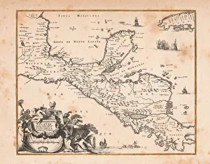
Antique map of Honduras Yucatan and Mexico 1671Map of Honduras Yucatan and Mexico Original edition from my own archives Source: America New World Empires 1671
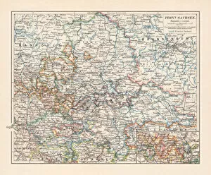
Map of the Province of Saxony, Germany (1816-1945), lithograph, 1897Topographic map of the Province of Saxony (Saxony-Anhalt, Germany), formerly province of the Kingdom of Prussia and later the Free State of Prussia from 1816 until 1945. Lithograph, published in 1897
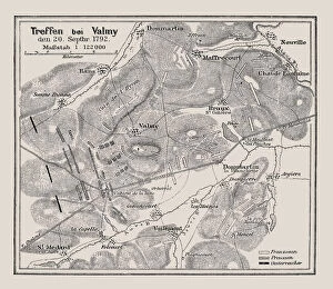
Map of Battle at Valmy 20. 9. 1792Illustration of a Map of Battle at Valmy 20.9.1792
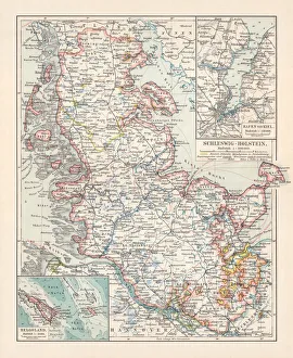
Topographic map of Schleswig-Holstein, German Empire, lithograph, published in 1897Topographic map of Schleswig-Holstein in the German Reich with the former border to Denmark after the German-Danish War (Second Schleswig War) in 1864, existing until 1920
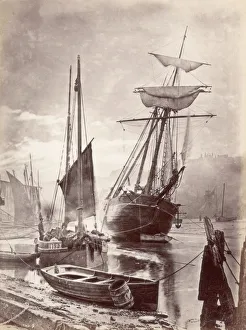
Whitbycirca 1880: The tide out in the harbour at Whitby, with boats moored up. (Photo by Frank Meadow Sutcliffe/Getty Images)
The MudlarksMudlarks, children who beachcomb for waste materials to resell, on Tate Hill Sands, Whitby, North Yorkshire. (Photo by Frank Meadow Sutcliffe/Getty Images)
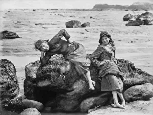
LimpetsTwo girls on the rocks by the sea. (Photo by Frank Meadow Sutcliffe/Getty Images)
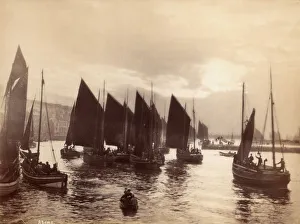
Fishing Boatscirca 1880: Small fishing boats about to set sail from Whitby harbour. (Photo by Frank Meadow Sutcliffe/Getty Images)
Pocket watchAntique pocket watch. Vintage etching circa late 19th century
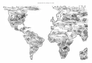
Map Distribution of animal in the world 1892Frye Grammar School Geography - 1892
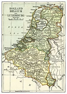
Map of Hollan and Belgium 1889Comprehensive Geography by James Monteith - American Book Company 1882, 1889
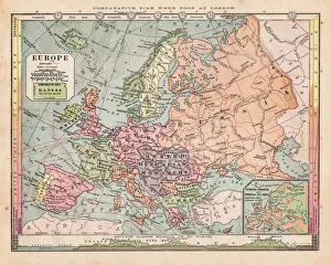
Map of Europe 18811889Comprehensive Geography by James Monteith - American Book Company 1882, 1889
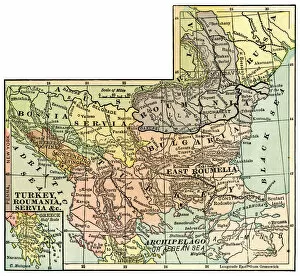
Map of Turkey and Rumania 1889Comprehensive Geography by James Monteith - American Book Company 1882, 1889
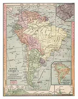
Map of South America 1889Comprehensive Geography by James Monteith - American Book Company 1882, 1889
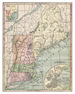
Map of New England states 1889Comprehensive Geography by James Monteith - American Book Company 1882, 1889
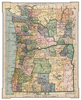
Map of Washington and Oregon 1889Comprehensive Geography by James Monteith - American Book Company 1882, 1889
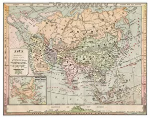
Map of Asia 1889Comprehensive Geography by James Monteith - American Book Company 1882, 1889
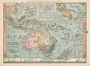
Map of Australasia 1889Comprehensive Geography by James Monteith - American Book Company 1882, 1889
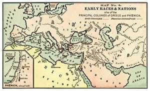
Map of early races and nations 1889Comprehensive Geography by James Monteith - American Book Company 1882, 1889
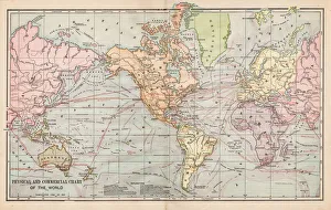
Map of the world 1889Comprehensive Geography by James Monteith - American Book Company 1882, 1889
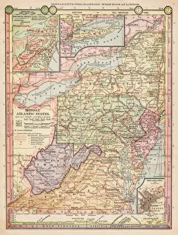
Map of middle atlantic states 1889Comprehensive Geography by James Monteith - American Book Company 1882, 1889
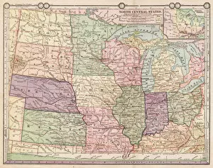
Map of North Central states1889Comprehensive Geography by James Monteith - American Book Company 1882, 1889
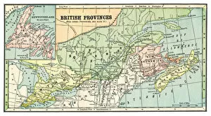
Map of British provinces Canada 1889Comprehensive Geography by James Monteith - American Book Company 1882, 1889
Map of Southern states1889Comprehensive Geography by James Monteith - American Book Company 1882, 1889