mail_outline sales@mediastorehouse.com
350 items
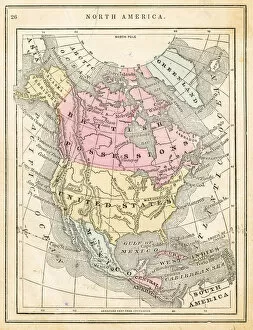
Map of North America 1871Colton and Fitchs Introductory School Geography - New York: Sheldon and Company 1871
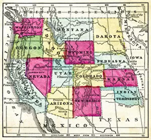
Map of USa western pacific states 1871Colton and Fitchs Introductory School Geography - New York: Sheldon and Company 1871
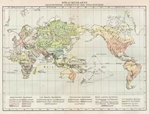
Map of the idioms of the world 1894Der Menfch Vol 2 by Johannes Ranke - Leipzig 1894
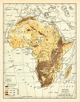
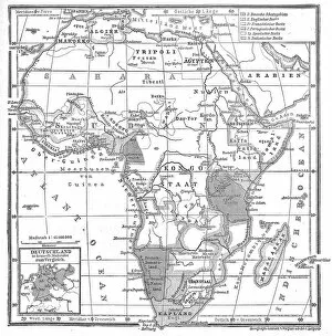
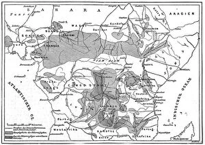
Physical map of Africa 1895The Rand-McNally Grammar School Geography 1895 - Chicago & New York
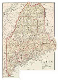
Map of Maine 1877Warrens Common School Geography 1877
General map of the European colonies in AfricaIllustration from 19th century
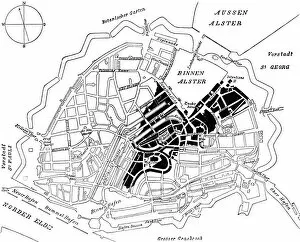
City map of Hamburg in 1842Illustration from 19th century
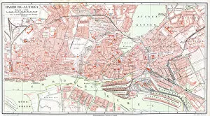
Map of Hamburg - AltonaIllustration of a Map of Hamburg - Altona
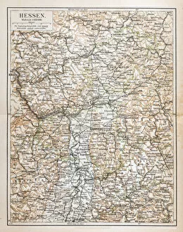
Hesse, a state in western Germany; capital, Wiesbaden. German name HessenIllustration of a Hesse, a state in western Germany; capital, Wiesbaden. German name Hessen
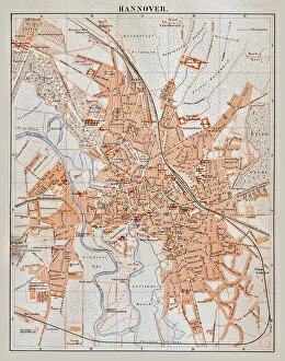
Map of HannoverIllustration of a Map of Hannover
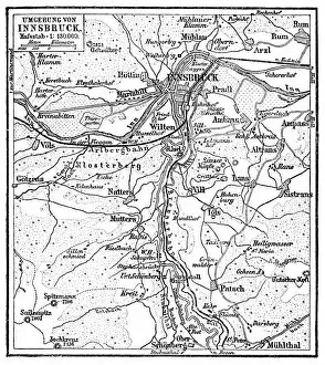
Map of the surroundings of InnsbruckIllustration of a Map of the surroundings of Innsbruck
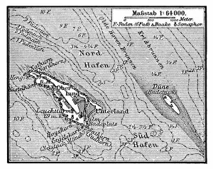
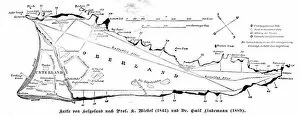
Map of Heligoland is a small German archipelago in the North SeaIllustration of a Map of Heligoland is a small German archipelago in the North Sea
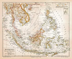
Hindi and Malay archipelagoIllustration of a Hindi and Malay archipelago
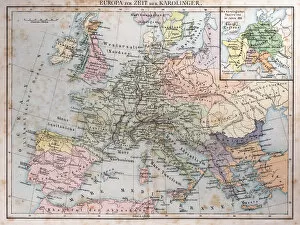
Europe at the time of the CarolingiansIllustration of a Europe at the time of the Carolingians
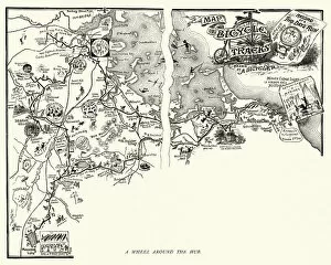
Map of a victorian cycle route around Boston, surrounding areaVintage engraving of map of a victorian cycle route around Boston and the surrounding area, 19th Century
Map of the island and city of Corfu, woodcut, 1897Map of the island and city of Corfu. Wood engraving, published in 1897
The territories of the African slave tradeIllustration from 19th century
Map of Island HelgolandIllustration from 19th century
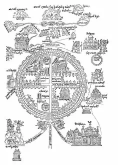
Jerusalem at the time of the Crusadesillustration of Jerusalem at the time of the Crusades
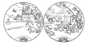
The two earth hemispheres after the Behaims globeIllustration of The two earth hemispheres after the Behaims globe
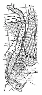
Map of Niagara Falls - Scanned 1899 Engraving
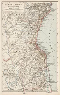
Map of South Brazil 1900Meyers hand-Atlas Leipzig und Wien Verlag des Bibliographischen Instituts 1900
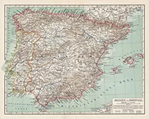
Map of 1900Meyers hand-Atlas Leipzig und Wien Verlag des Bibliographischen Instituts 1900
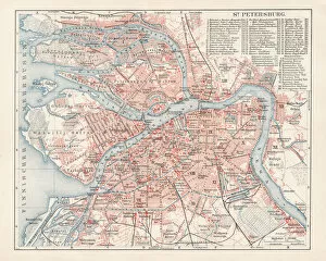
Map of St. Petersburg 1900Meyers hand-Atlas Leipzig und Wien Verlag des Bibliographischen Instituts 1900
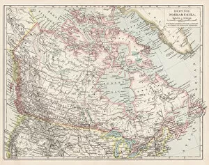
Map of British Canada 1900Meyers hand-Atlas Leipzig und Wien Verlag des Bibliographischen Instituts 1900
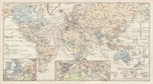
Map of World Traffic 1900Meyers hand-Atlas Leipzig und Wien Verlag des Bibliographischen Instituts 1900
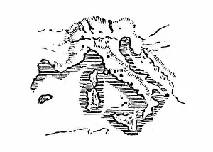
Antique engraving illustration: Italy
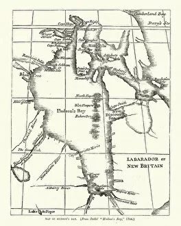
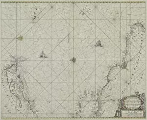
Map of Hudsons Bay, 18th CenturyVintage engraving of Map of Hudsons Bay, 18th Century
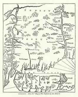
Map of Connecticut, USA, after john Seller, 17th CenturyVintage engraving of Map of Connecticut, USA, after john Seller, 17th Century
Map of the New NetherlandsVintage engraving of Map of the New Netherlands
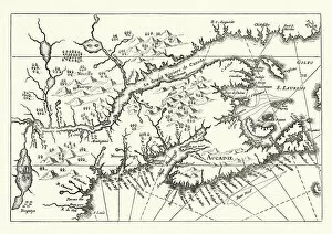
Map of Canada and Nova Scotia, 17th CenturyVintage engraving of Map of Canada and Nova Scotia, 17th Century
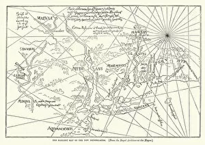
Antique map of Virginia United States 1671Antique map of Virginia United States Original edition from my own archives Source: America New World Empires 1671
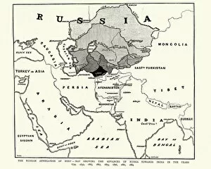
Map showing the Russian annexation of Merv, 1884Vintage engraving of Map showing the Russian annexation of Merv. The Graphic, 1884
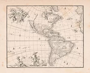
Antique world map with South and North America in the centerWorld map with South and North America in the center Original edition from my own archives Source: America New World Empires 1671
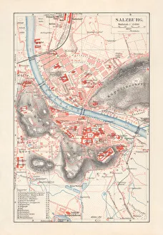
City map of Salzburg, Austria, lithograph, published in 1897City map of Salzburg, Austria. Lithograph, published in 1897
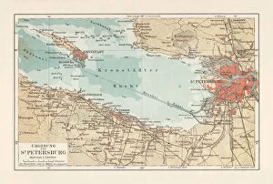
Historical map of Saint Petersburg and surroundings, Russia, lithograph, 1897Historical map of Saint Petersburg and surroundings, Russia. Lithograph, published in 1897
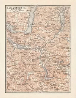
Map of Styria (Salzkammergut) in Austria, lithograph, published in 1897Map of Styria (Salzkammergut), federal state in Austria. Lithograph, published in 1897
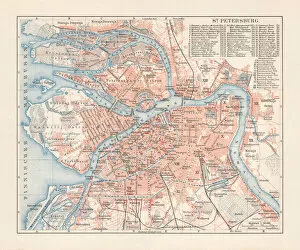
Historical city map of Saint Petersburg, Russia, lithograph, published 1897Historical city map of Saint Petersburg, Russia. Lithograph, published in 1897
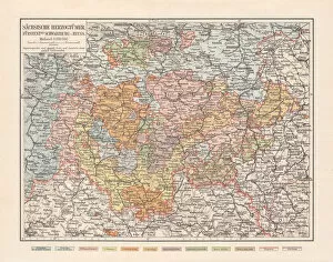
Saxon duchies, principalities Schwarzburg and Reuss (Germany), lithograph, 1897Topographic map of Saxon duchies, principalities Schwarzburg and Reuss (Germany). Lithograph, published in 1897
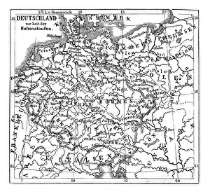
Germany at the time of the Staufer, also known as the House of Staufen, or of HohenstaufenIllustration of Germany at the time of the Staufer, also known as the House of Staufen, or of Hohenstaufen, were a dynasty of German kings (1138-1254) during the Middle Ages
Map of nautical battle with Russian navy1813, antiquity, archival, battle, cartography, geographical, geograph, Battle Maps and Plans, 87723369
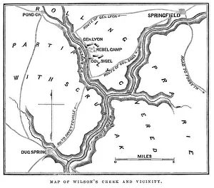
Battle of Wilsons Creek" Vintage engraving from 1863 of a map of the Battle of Wilsons Creek. The Battle of Wilsons Creek, also known as the Battle of Oak Hills, was fought on August 10, 1861, near Springfield
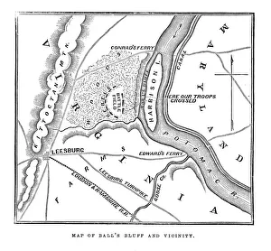
Map of Balls Bluff" Vintage engraving from 1863 of a map of Balls Bluff at the time of the American Civil War. The Battle of Balls Bluff, also known as the Battle of Harrisons Island or the Battle of Leesburg
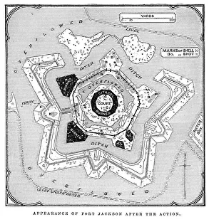
Fort Jackson, Louisiana" Vintage engraving from 1863 of a map of Fort Jackson, Louisiana. Fort Jackson was the site of the Battle of Forts Jackson and St
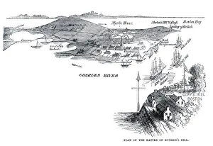
Battle of Bunker Hill" Vintage engraving from 1861 showing the Plan of the Battle of Bunker Hill. The Battle of Bunker Hill took place on June 17, 1775, mostly on and around Breeds Hill
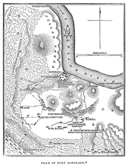
Battle of Fort Donelson" Vintage engraving from 1863 of a map of the Battle of Fort Donelson which was fought from February 11 to February 16, 1862, in the Western Theater of the American Civil War
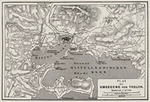
Plan of the surrounding of ToulonIllustration of a Plan of the surrounding of Toulon
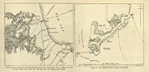
Map of the First Battle of Teb, and Suakim, 1884Vintage engraving of Map of the First Battle of Teb, and Suakim, 1884, 19th Century. The Graphic 1884