mail_outline sales@mediastorehouse.com
3,678 items
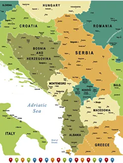
Map of Central Balkan RegionHigh detailed map of Central Balkan Region with national borders and navigation icons
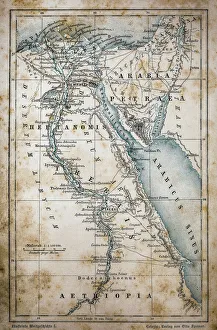
Map of EgyptIllustration of a Map of Egypt
Cluj Napoca, romania mapIllustration of a Cluj Napoca, romania map
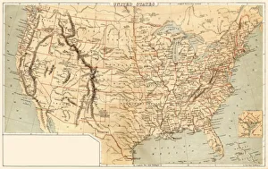
Map of United States 1869Cornells Grammars-School Geography - S.S. Cornell - New York D. Appleton and Company 1869
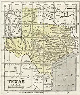
Map of Texas 1855System of Geography for the use of schools by Sidney E. Morse - Published by Harper & Brothers - New York 1855
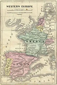
France Spain Portugal map 1856Colton and Fitchs Modern School Geography by George W. Fitch - New York 1856
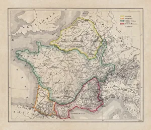
Gaul in the time of Julius Caesar, published in 1867Gaul in the time of Roman politican Gaius Iulius Caesar (100 - 44 BC). Steel engraving with hand-colored borderlines and Latin legend, published in 1867
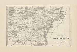
Map of Northeast United States, published in 1882Map of the Northeast United States of America. Wood engraving, published in 1882
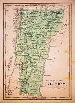
Vermont 1852 Map
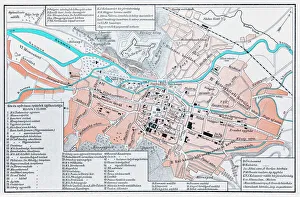
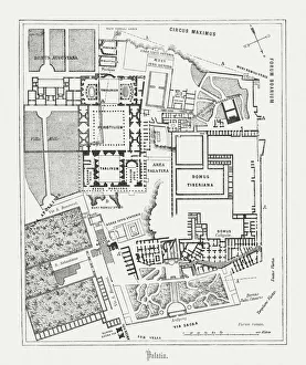
Floor plan of Palatine Hill in Rome, published in 1878Floor plan of the archaeological remains of the Palatine Hill in Rome. The Palatine Hill (Latin: Mons Palatinus, Italian: Monte Palatino)
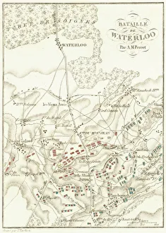
Battle Of WaterlooA plan of the Battle of Waterloo in present-day Belgium during the Napoleonic Wars, 18th June 1815. Here an Anglo-Allied army under the command of the Duke of Wellington defeated the Imperial French
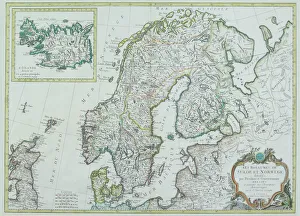
Map of Scandinavia
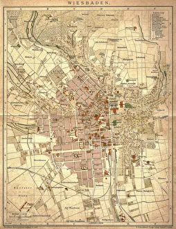
Wiesbaden, germanyAntique illustration of a Wiesbaden, Germany from 1898
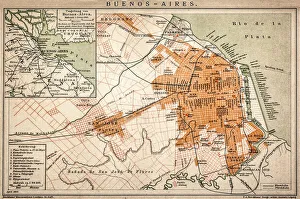
Buenos Aires mapAntique engraving map of Buenos Aires
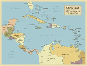
A vintage Central America Political MapCentral America is the thin section of land that links the North American continent with the South American continent. Geographically part of North America, it is made up of seven small
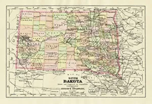
Map of South Dakota 1894Johnsons Universal Cyclopedia - Volume IV New York - A. J. Johnson Company 1894
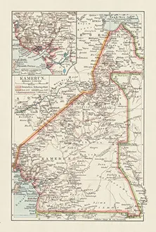
Topographic map of Cameroon, lithograph, published in 1897Topographic map of Cameroon, during the German colonial era at the end of the 19th century. Lithograph, published in 1897
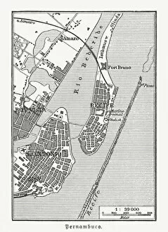
Historical city map of Recife, Pernambuco, Brazil, wood engraving, published 1897Historical city map of Recife, Pernambuco, Brazil. Wood engraving, published in 1897
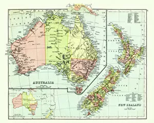
Antique map of Australia, New Zealand, 1897, late 19th CenturyVintage engraving of a Antique map of Australia, New Zealand, 1897, late 19th Century
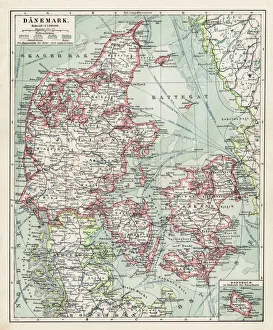
Map of Denmark 1900Meyers hand-Atlas Leipzig und Wien Verlag des Bibliographischen Instituts 1900
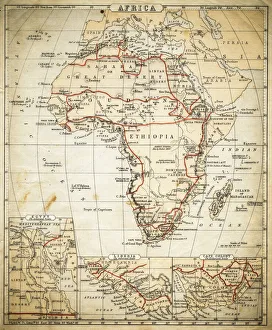
Africa map of 1869Cornells Grammar School Geography By S.S. Cornell - New York 1869
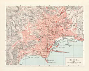
City map of Naples (Italian: Napoli), Italy, lithograph, published 1897City map of Naples (Italian: Napoli), Campania, Italy. Lithograph, published in 1897
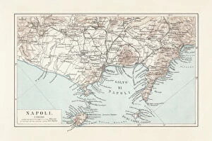
Map of Naples and surrounding, Campania, Italy, lithograph, published 1897Topographic map of Naples (Italian: Napoli) and surrounding, Campania, Italy. Lithograph, published in 1897
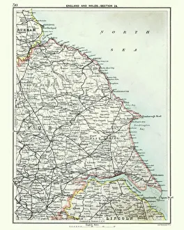
Antique map, North and East Yorkshire 19th CenturyVintage engraving of a Antique map, North and East Yorkshire 19th Century
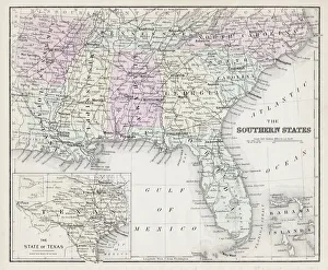
Map of Southern States USA 1877Warrens Common School Geography 1877
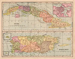
Cuba and Puerto Rico map 1898
Bosnia and Montenegro map 1893Illustration of a Bosnia and Montenegro map 1893
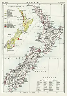
New Zealand map 1884Encyclopedia Britannica 9th Edition New York Charles Scribners and Sonsl 1884 Vol XVII
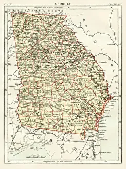
Georgia map 1884Encyclopedia Britannica 9th Edition New York Charles Scribners and Sonsl 1884 Vol X
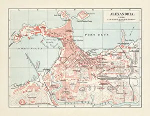
City map of Alexandria, Egypt, lithograph, published in 1897City map of Alexandria, Egypt. Lithograph, published in 1897
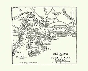
Map of Kingston and Port Royal, Jamaica, 19th CenturyVintage engraving of a Map of Kingston and Port Royal, Jamaica, 19th Century
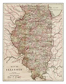
Map of Illinois 1889Indiana Educational Series The Complete Geography - Indianapolis 1889
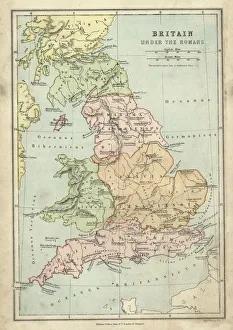
Antique map of Britain under the Ancient Romans
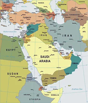
Map of Middle East - illustrationColored Map of Middle East Asia with Country Names and Capital Cities
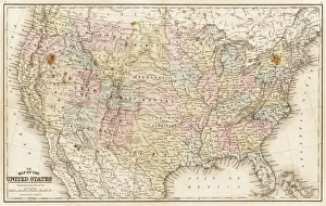
Map of United States 1867Mitchells Modern Atlas - Published by E.H. Buttler & Co - Philadelphia 1867
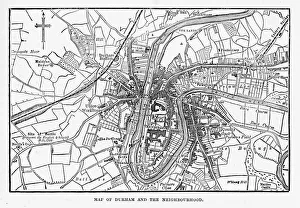
Map of the City of Durham, England Victorian Engraving, 1840Very Rare, Beautifully Illustrated Antique Engraving of Map of the City of Durham, England Victorian Engraving, 1840. Source: Original edition from my own archives
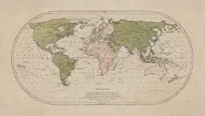
World map by Mathieu Albert Lotter, Augsburg, 1778World map from 1778. Original hand-colored copper engraving by Matthieu Albert Lotter (1741 - 1810, Augsburg) with route of James Cooks First Circumnavigation (1770), through Tahiti
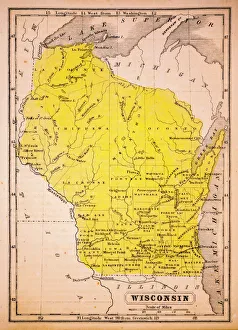
Wisconsin 1852 Map
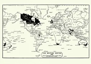
Map of the British Empire in 1837. At its height, the British Empire was the largest empire in history and, for over a century, was the foremost global power
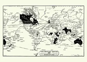
Map of the British Empire in 1897. At its height, the British Empire was the largest empire in history and, for over a century, was the foremost global power
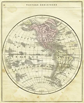
Western Hemisphere map 1856Colton and Fitchs Modern School Geography by George W. Fitch - New York 1856
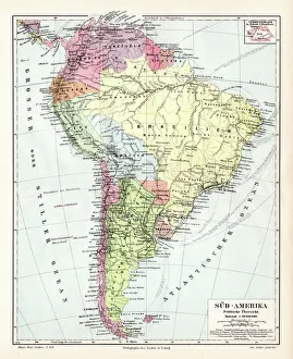
South America political map 1895Meyers Konversations-Lexikon. Ein Nachschlagewerk des allgemeinen Wissens, 5th edition 17 volumes Bibliographisches Institut - Leipzig 1895-1897
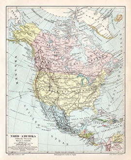
North America political map 1895Meyers Konversations-Lexikon. Ein Nachschlagewerk des allgemeinen Wissens, 5th edition 17 volumes Bibliographisches Institut - Leipzig 1895-1897
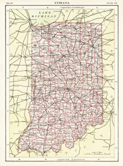
Indiana USA map 1881Encyclopedia Britannica 9th Edition Vol XII Philadelphia j.M. Stoddart & Co 1881
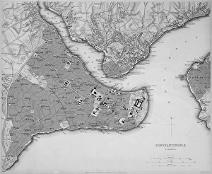
Antique map of Constantinople, present day Istanbul
Antique map of the Middle East by Halma
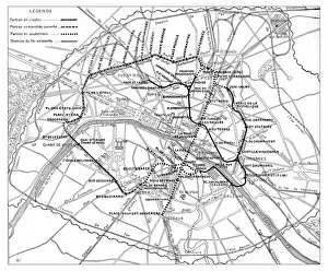
Antique engraving illustration: Paris Subway Metro map
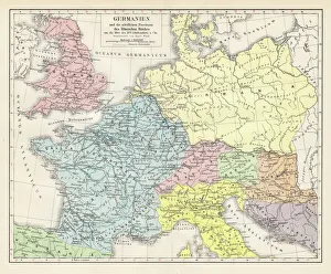
Germany and the northern provinces of the roman empire map 1895Encyclopedia Britannica 9th Edition Vol I New York, Samuel Hall 1878