mail_outline sales@mediastorehouse.com
3,678 items
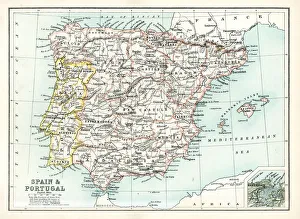
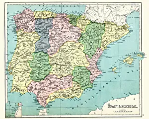
Antique map of Spain and Portugal from 1891 with a detail of Santander
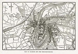
Map of the City of Durham, England Victorian Engraving, 1840Very Rare, Beautifully Illustrated Antique Engraving of Map of the City of Durham, England Victorian Engraving, 1840. Source: Original edition from my own archives
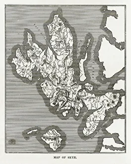
Map of the Isle of Skye, Scotland Victorian Engraving, 1840Very Rare, Beautifully Illustrated Antique Engraving of Map of the Isle of Skye, Scotland Victorian Engraving, 1840. Source: Original edition from my own archives
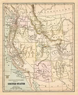
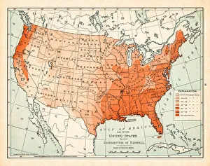
United States map 1881Coltons Common School Geography 1881 New York Sheldon and Co
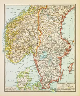
Map of Sweden and Norway 1897Map of Sweden and Norway
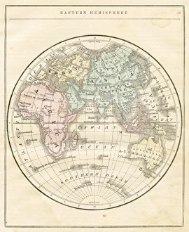
Eastern Hemisphere map 1856Colton and Fitchs Modern School Geography by George W. Fitch - New York 1856
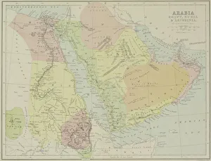
Antique map of Arabia with Egypt, Nubia, and Abyssinia
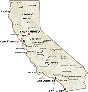
map of californiaVector map of California. Version Adobe illustrator 10 with editable text on hidden layer is attached. Each color is placed on a single layer
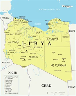
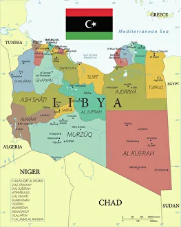
Reference Map of LibyaLibya is an African nation situated in North Africa, along the Mediterranean Sea. Libya shares borders with Egypt, Sudan, Chad, Niger, Algeria, and Tunisia
Reference Map of NigeriaNigeria is located in western Africa. Nigeria is bordered by the Gulf of Guinea, Benin to the west, Niger to the north, and Chad and Cameroon to the east
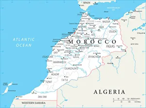
Map of MoroccoMorocco is a country in the western Maghreb region of North Africa. Morocco is bordered by the Atlantic Ocean in west, by the Mediterranean Sea in north
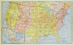
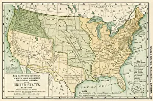
1883 United States Map
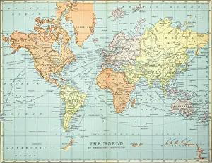
Old map of the World Map, Published 1894Antique Illustration. Copyright has expired on this artwork. From my own archives, digitally restored
Reference Map of Libya with KeysLibya is an African nation situated in North Africa, along the Mediterranean Sea. Libya shares borders with Egypt, Sudan, Chad, Niger, Algeria, and Tunisia
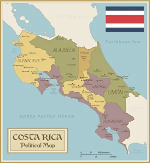
Political Map of Costa Rica with FlagCosta Rica is located in Central America. Costa Rica is bordered by the Pacific Ocean, the Caribbean Sea, Nicaragua to the north, and Panama to the south
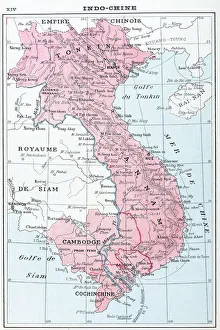
Antique map of Vietnam, Laos, Cambodia and Ta'hailandAntique map of Vietnam, Laos, Cambodia and TÔǽhailand
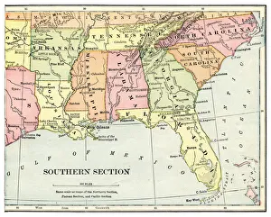
Map of USA southern states 1897Natural Elementary Geography by Redway and Hinman - NY/Cincinnati/Chicago 1897
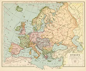
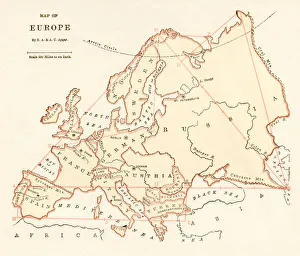
Map of Europe 1899Maurys Geographical Series Manual of Geography - New York 1899
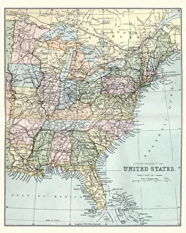
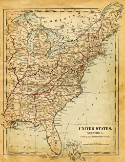
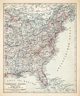
Map of the Eastern United States of America, 19th CenturyVintage engraving of a Map of the Eastern United States of America, late 19th Century
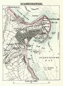
Map of Scarborough" Vintage map from 1880 of Scarborough, a town on the North Sea coast of North Yorkshire, England.++Inspector: Info about source material uploaded as property release++"
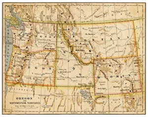
Map of Oregon and northwestern territories 1883The Eclectic Elementary Geography by Van Antwerp, Bragg & C0 / Cincinnati -New York 1883
Map of USA - East of Mississippi river 1876Maurys Geographical Series - The Word we live in by M.F. Maury LLD - New York and Baltimore 1876
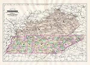
Map of Tennessee 1894Johnsons Universal Cyclopedia - Volume VIII New York - A. J. Johnson Company 1894
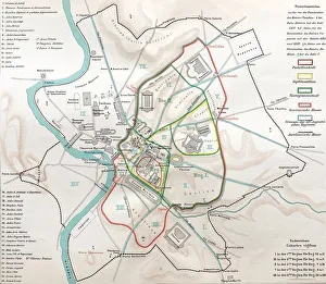
Ancient rome, regions map of RomeIllustration from 19th century
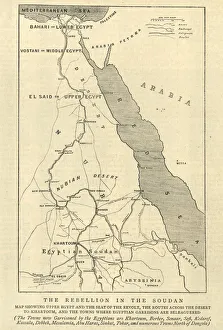
Mahdist War, Map of the rebellion in Sudan, 1884Vintage engraving of Mahdist War, Map of the rebellion in Sudan, 1884
Antique map of Spain and Portugal, 1897, late 19th CenturyVintage engraving of a Antique map of Spain and Portugal, 1897, late 19th Century
Map of Thailand and Vietnam 1900Meyers hand-Atlas Leipzig und Wien Verlag des Bibliographischen Instituts 1900
Map of USA Eastern States 1900Meyers hand-Atlas Leipzig und Wien Verlag des Bibliographischen Instituts 1900
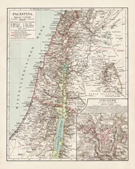
Map of Palestine 1900Meyers hand-Atlas Leipzig und Wien Verlag des Bibliographischen Instituts 1900
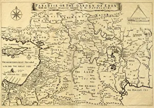
Middle East Ancient Map, Garden of Eden, 1675This may appear to be a straightforward map of the Middle East. However, closer inspection will reveal some extraordinary details, a number of descriptions on the map refer to stories from the Bible
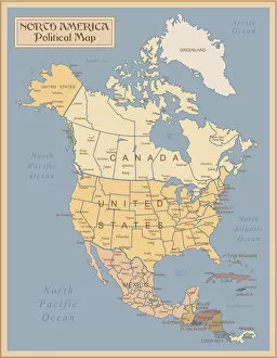
Vintage Map of North AmericaNorth America - Retro Map
Map of United States 1895The Rand-McNally Grammar School Geography 1895 - Chicago & New York
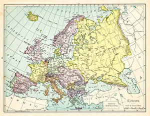
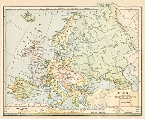
Map of Europe 1895The Rand-McNally Grammar School Geography 1895 - Chicago & New York
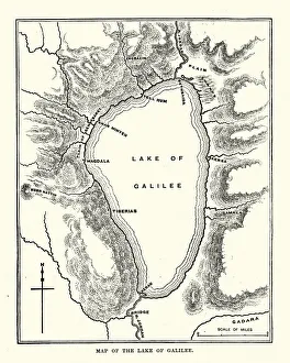
Map of the Sea of GalileeVintage engraving of a Map of the Sea of Galilee, 19th Century
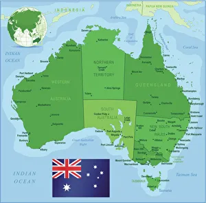
Map of Australia with states, cities and flagHighly detailed vector map of Australia with states, capitals and big cities
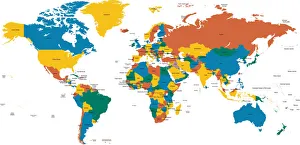
Hight detailed divided and labeled world map
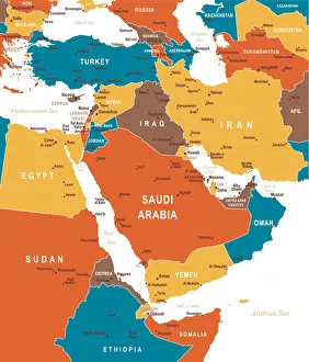
Colored Map of Middle EastMap of Middle East Asia - illustration
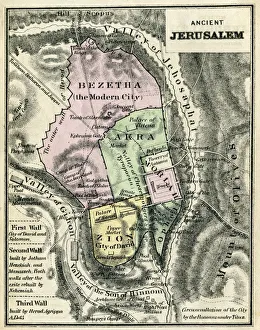
Map Of Ancient JerusalemEngraving From 1873 Featuring A Map Of Ancient Jerusalem
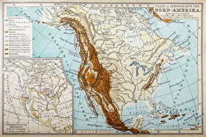
River and mountains map of North AmericaIllustration of a River and mountains map of North America
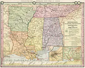
Map of Tennessee, Alabama, Louisiana states 1886Barnes Complete Geography by James Monteith - A.S. Barnes and Co. 1886
Map of USA 1898Map from the Complete Handy Atlas of the World - 1898
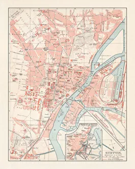
City map of Stettin, Germany (today Szczecin, Poland), lithograph, 1897Historical city map of Stettin, Germany (today Szczecin, Poland). Lithograph, published in 1897
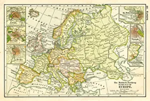
Map of Europe 1875Elementary Geography Course by William Swinton - New York 1875
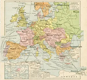
Europe map 1898Map from the Complete Handy Atlas of the World - 1898
Map of Europe 1888Butlers Elementary Geography by Jacques W. Redway - Philadelphia 1888
Europe map 1887Map from La Premiere Annee de Geographie par P. Foncin - Paris 1887
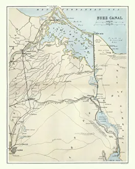
Antique map of Suez Canal, Egypt, 1880s, 19th CenturyVintage engraving of Antique map of Suez Canal, Egypt, 1880s, 19th Century. The Suez Canal is a sea-level waterway in Egypt, connecting the Mediterranean Sea to the Red Sea through the Isthmus of Suez
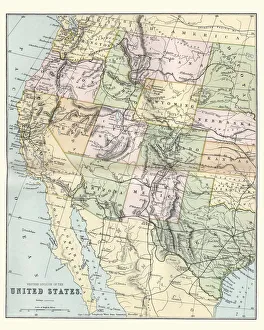
Map of the Western United States of America, 19th CenturyVintage engraving of a Map of the Western United States of America, 19th Century