mail_outline sales@mediastorehouse.com
3,749 Metal Prints
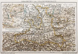
Salzburg and Lake DistrictAntique illustration of a Salzburg and Lake District
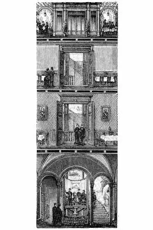
Elevator in Grand Restaurant BerlinAntique illustration of a Elevator in Grand Restaurant Berlin
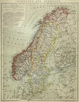
Sweden and NorwayAntique map of Sweden and Norway
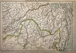
Siberia map, the Amur regionIllustration of a Siberia map, the Amur region
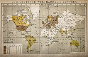
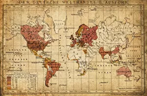
The German World Trade Import
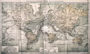
Overview map world traffic
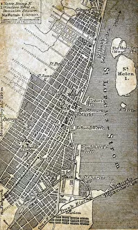
Montreal mapAntique illustration of Montreal map
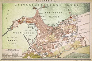
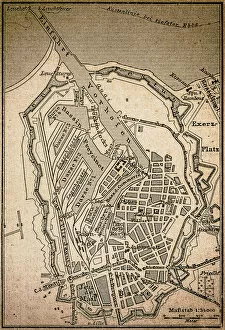
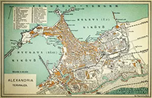
Alexandria mapAntique illustration of a Mediterranean Sea
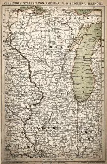
United States of America, Wisconsin, IllinoisAntique illustration of United States of America, Wisconsin, Illinois map
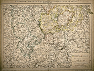
Westphalia, Hesse-nassau and Grand Duchy of Hesse Rhine ProvinceWestphalia, Hesse-Nassau and Grand Duchy of Hesse Rhine Province
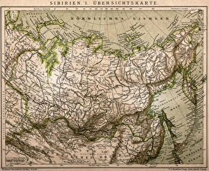
Siberia outline mapAntique illustration of Siberia outline map
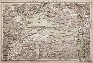
Lake LucerneAntique map of LAKE LUCERNE
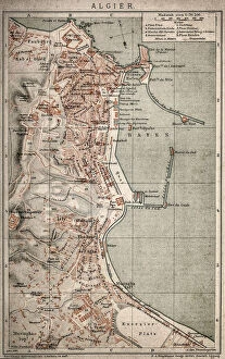
Algiers mapAntique illustration of a Algiers map
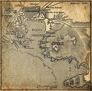
Cartagena, SpainAntique illustration of a Cartagena, Spain map
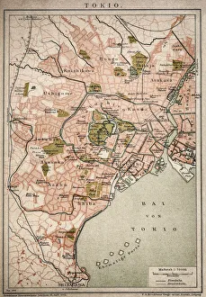
Vintage map of Tokyo
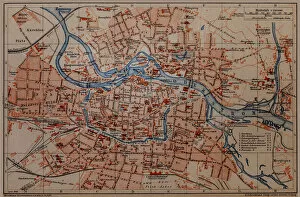
Wroclaw City map
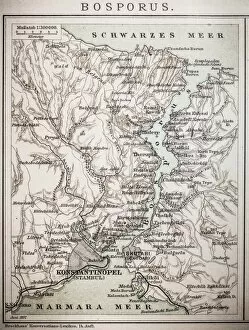
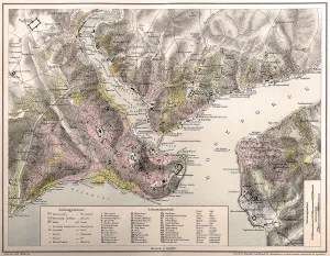
Bosporus mapAntique illustration map of Bosporus
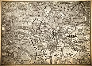
KasselAntique illustration of a Kassel map
Map of Korea, ChinaAntique illustration of a Map of Korea, China
German world trade export map 1898Illustration engraving of the German world trade export map from 1898
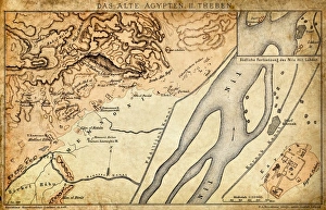
Ancient Egypt Map - Thebes
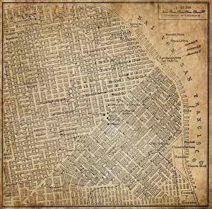
San Francisco, California, USAAntique illustration of a San Francisco, California, USA
Silesia. PolandAntique illustration of a Silesia. Poland
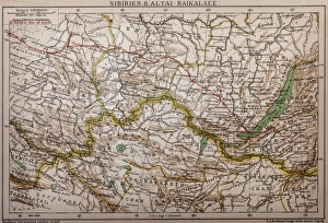
Siberia - lake of Baikal mapAntique illustration map of Siberia - lake of Baikal
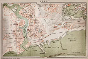
Brest, France mapAntique illustration of a Brest, France map
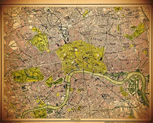
Historic map of LondonAntique illustration map map/plan of the inner city of London from 1898
Dunkirk mapAntique engraving illustration of a Dunkirk map
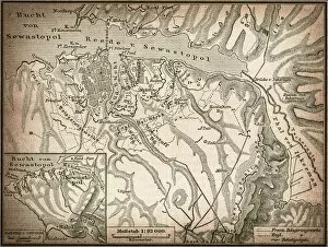
Sevastopol or SebastopolAntique illustration map of a Sevastopol or Sebastopol
Map of contantinopleAntique illustration map of contantinople
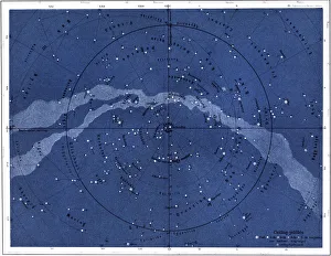
The northern skyIllustration of the northern sky
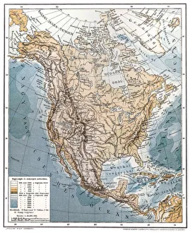
North AmericaAntique illustration of a North America
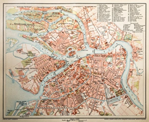
St. PetersburgAntique illustration of a St. Petersburg
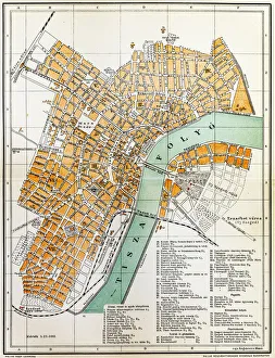
Szeged mapAntique illustration of a Szeged map
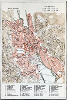
Sopron mapAntique map of Sopron city
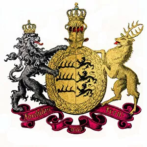
Kingdom of Wurttemberg, GermanyIllustration of Kingdom of Wurttemberg, Germany
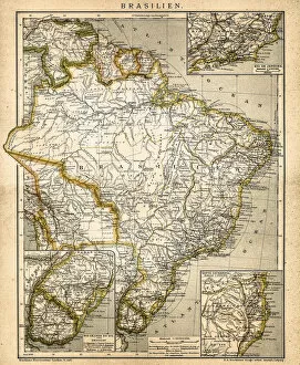
South America mapAntique illustration of a South America map
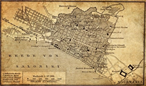
City map of Thessaloniki, GreeceIllustration of a city map of Thessaloniki, Greece
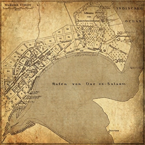
Dar es Salaam, TanzaniaAntique illustration of a Dar es Salaam, Tanzania
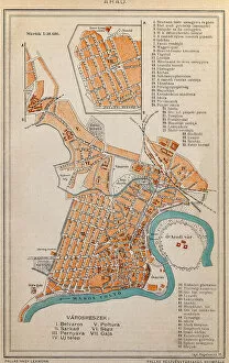
Arad City MapIllustration of a Arad City Map
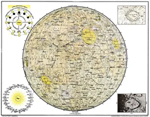
Lunar MapAntique illustration of a Lunar Map
Alexandria mapIllustration of a Alexandria map
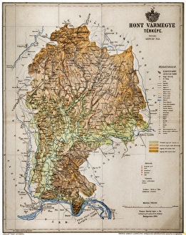
Hont CountyHont, Honthum, Honth was an administrative county (comitatus) of the Kingdom of Hungary and then shortly of Czechoslovakia
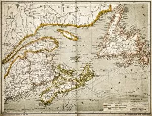
Eastern Canada and NewfoundlandIllustration of a Eastern Canada and Newfoundland
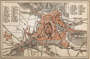
Map of EgerAntique illustration engraving map of Eger
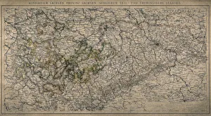
Kingdom of Saxony, province of Saxony (southern part) and Thuringian states
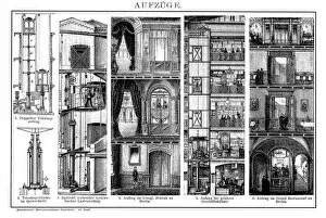
ElevatorsAntique illustration engraving of various elevators
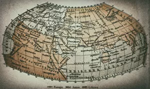
Earth map according to Claudius PtolemaeusAntique illustration of a earth map according to Claudius Ptolemaeus
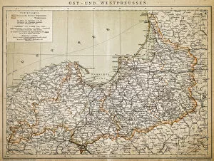
PrussiaAntique illustration of a East-West West Prussia