Home > Map > Historical Maps
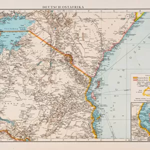
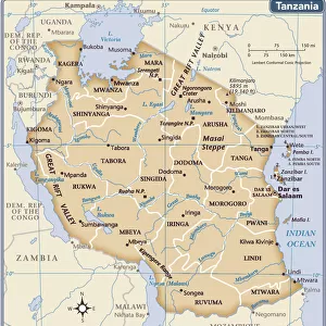
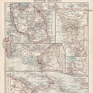
Map of formerly German colony East Africa, lithograph, published 1897

![]()
Wall Art and Photo Gifts from Fine Art Storehouse
Map of formerly German colony East Africa, lithograph, published 1897
Map of the formerly German colony East Africa between 1885 and 1918, (present-day Burundi, Rwanda, and the mainland part of Tanzania). Lithograph, published in 1897
Media ID 14756162
© This content is subject to copyright
20th Century African Culture Colonial Colonialism Colony East Africa German Culture Indian Ocean Kenya Kilimanjaro Mount Rwanda Tanzania Topographic Map Topography Zanzibar
FEATURES IN THESE COLLECTIONS
> Map
> Historical Maps
> Map
MADE IN THE UK
Safe Shipping with 30 Day Money Back Guarantee
FREE PERSONALISATION*
We are proud to offer a range of customisation features including Personalised Captions, Color Filters and Picture Zoom Tools
SECURE PAYMENTS
We happily accept a wide range of payment options so you can pay for the things you need in the way that is most convenient for you
* Options may vary by product and licensing agreement. Zoomed Pictures can be adjusted in the Basket.